Sinaloa, officially the Estado Libre y Soberano de Sinaloa, is one of the 31 states which, along with Mexico City, compose the Federal Entities of Mexico. It is divided into 18 municipalities, and its capital city is Culiacán Rosales.

Culiacán, officially Culiacán Rosales, is a city in northwestern Mexico, the capital and largest city of both Culiacán Municipality and the state of Sinaloa. The city was founded on 29 September 1531 by the Spanish conquerors Lázaro de Cebreros and Nuño Beltrán de Guzmán under the name "Villa de San Miguel", referring to its patron saint, Michael the Archangel.
Federal Highway 40, also called the Carretera Interoceánica, is a road beginning at Reynosa, Tamaulipas, just west of the Port of Brownsville, Texas, and ending at Fed. 15 in Villa Unión, Sinaloa, near Mazatlán and the Pacific coast. It is called Interoceanic as, once finished, the cities of Matamoros, Tamaulipas, on the Gulf of Mexico and Mazatlán on the Pacific Ocean will be linked.

Federal Highway 15 is Mexico 15 International Highway or Mexico-Nogales Highway, is a primary north–south highway, and is a free part of the federal highways corridors of Mexico. The highway begins in the north at the Mexico–United States border at the Nogales Port of Entry in Nogales, Sonora, and terminates to the south in Mexico City.
Federal Highway 2 is a free part of the Mexican federal highway corridors that runs along the U.S. border. The highway is in two separate improved segments, starting in the west at Tijuana, Baja California, on the Pacific coast and ending in the east in Matamoros, Tamaulipas, on the Gulf of Mexico. Fed. 2 passes through the border states of Baja California, Sonora, Chihuahua, Coahuila, Nuevo Leon and Tamaulipas. It has a total length of 1,987 kilometres (1,235 mi); 1,343 kilometres (835 mi) in the west and 644 kilometres (400 mi) in the east.
Federal Highway 54 Fed. 54 is a free (libre) part of the federal highways corridors and connects Ciudad Mier, Tamaulipas, to Colima City.

Carretera Federal 85D is the designation for toll highways (autopistas) paralleling Federal Highway 85. Two roads are designated Highway 85D, one from Nuevo Laredo, Tamaulipas, to Monterrey, Nuevo León, known as Autopista Monterrey–Nuevo Laredo, and the other from Pachuca, Hidalgo, to Mexico City, known as Autopista Pachuca–Ciudad de México. Both toll routes run parallel to their free alternative, Federal Highway 85. Highway 85D has wider lanes offers a more direct route and is continuously being repaired and repaved unlike the free route.
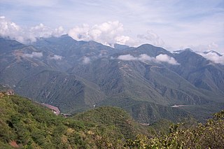
Federal Highway 24 is a free part of the federal highways corridors. Fed. 24 is intended to cross the Sierra Madre Occidental from the area of Hidalgo del Parral, Chihuahua, on the east, to the area of Culiacán, Sinaloa, on the west. A limited central section of about 40 to 50 km is not yet completed or graded. This section lies between the villages of Los Frailes, Durango, on the east, and Soyatita, Sinaloa, on the west. Travel is possible through this area, where the road is not yet completed, on unimproved roads using high clearance two-wheel drive vehicles. The two unconnected segments that extend through Los Frailes and Soyatita are graded, but each segment is unpaved for about the last 75 km. The central gap in the highway is in the rugged mountains of the Sierra Madre Occidental. This uncompleted and unpaved portion of the road is not well signed, there are many intersections with other unimproved roads, and it is easy to get lost off the intended route of the highway. As noted later, getting lost may not be a safe proposition. Further, the unfinished segment on the west is at about 820 meters elevation at Soyatita. Just outside Los Frailes, the road coming from the east is at 2,750 meters elevation. The traveler crossing this gap will have to negotiate this dramatic change in elevation traveling a good deal of the way on unimproved dirt roads. Travel times in this central section can be quite slow.
Federal Highway 43D is a toll highway connecting the cities of Morelia, Michoacán and Salamanca, Guanajuato. It is operated by Autopista Morelia-Salamanca, S.A. de C.V. (CAMSSA), and the toll is 93 pesos to travel its 107.95-kilometre (67.08 mi) length.
Federal Highway 95D is a toll highway connecting Mexico City to Acapulco, Guerrero. Highway 95D is among the most important toll roads in the country, serving as a backbone for traffic out of Mexico City toward Morelos and tourist destinations in Guerrero.
Federal Highway 200D is the toll highways paralleling Fed. 200, and has two separate improved segments of designated roadway. Fed200D in Colima funnels traffic from Manzanillo toward Fed. 110 to the city of Colima; the segment in Guerrero serves as a bypass of Tecpan.
Federal Highway 90D is a toll highway between Zapotlanejo and Guadalajara, Jalisco. The road is operated by Red de Carreteras de Occidente, which charges cars 70 pesos to travel Highway 90D. RCO operates the segments of Mexican Federal Highway 15D and Mexican Federal Highway 80D that connect into the road.
Federal Highway 150D is a toll highway connecting Mexico City to Veracruz City via Puebla City and Córdoba. It serves as one of the backbones of Mexico's toll road system. The road is primarily operated by Caminos y Puentes Federales, which charges cars 520 pesos to travel Highway 150D, with one segment in the Puebla metropolitan area built and maintained by OHL and PINFRA.
Federal Highway 15D is the name for toll highways paralleling Federal Highway 15. The toll segments of Highway 15D include some of the most significant highways in the country along the Nogales-Mexico City corridor. The highway is the southern terminus of the CANAMEX Corridor, a trade corridor that stretches from Mexico north across the United States to the Canadian province of Alberta.
Federal Highway 2D is a part of the federal highways corridors, and is the designation for toll highways paralleling Mexican Federal Highway 2. Seven road segments are designated Highway 2D, all but one in the state of Baja California, providing a toll highway stretching from Tijuana in the west to around Mexicali in the east; one in Sonora, between Santa Ana and Altar; and another between the cities of Matamoros and Reynosa in Tamaulipas.
Federal Highway 40D is the designation for toll highways paralleling Mexican Federal Highway 40. Highway 40D connects Mazatlán, Sinaloa to Reynosa, Tamaulipas. It forms most of the highway corridor between Mazatlán and Matamoros, Tamaulipas, one of 14 major highway corridors in the country.
Federal Highway 45D is a toll road alternative to the paralleling Fed. 45. Eleven separate tolled segments exist of Fed. 45D between Querétaro City and Villa Ahumada in Chihuahua, between Chihuahua City and Ciudad Juárez.
Federal Highway 57D (Fed. 57D) is a tolled (cuota) part of the federal highways corridor of the paralleling Fed. 57. Eight separate tolled segments exist of Fed. 57D between Mexico City and Allende, Coahuila; a ninth is part-federal and part-state.
The 2023 Sinaloa unrest began on January 5, 2023, following the arrest of Ovidio Guzmán, son of jailed drug lord Joaquín 'El Chapo' Guzmán, sparking a wave of violence in the state of Sinaloa. In retaliation for the arrest of Ovidio Guzmán, cartel members blocked highways with burning vehicles and began attacks against the armed forces. The Culiacán International Airport was closed after gunfire was opened on two planes. On January 13, the Mexican Secretary of the Interior Adán Augusto López Hernández declared that "order has been reestablished" in Sinaloa.
