
McKinley County is a county in the northwestern section of the U.S. state of New Mexico. As of the 2010 census, the population was 71,492. Its county seat is Gallup. The county was created in 1901 and named for President William McKinley.

Window Rock is a small city that serves as the seat of government and capital of the Navajo Nation, the largest territory of a sovereign Native American nation in North America. It lies within the boundaries of the St. Michaels Chapter, adjacent to the Arizona and New Mexico state line. Window Rock hosts the Navajo Nation governmental campus which contains the Navajo Nation Council, Navajo Nation Supreme Court, the offices of the Navajo Nation President and Vice President, and many Navajo government buildings.

Gallup is a city in McKinley County, New Mexico, United States, with a population of 21,678 as of the 2010 census. A substantial percentage of its population is Native American, with residents from the Navajo, Hopi, and Zuni tribes. Gallup is the county seat of McKinley County and the most populous city between Flagstaff and Albuquerque, along the historic U.S. Route 66.

U.S. Route 160 (US 160) is a 1,465 mile (2,358 km) long east–west United States highway in the Midwestern and Western United States. The western terminus of the route is at US 89 five miles (8 km) west of Tuba City, Arizona. The eastern terminus is at US 67 and Missouri 158 southwest of Poplar Bluff, Missouri.
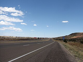
U.S. Route 491 (US 491) is a north–south U.S. Highway serving the Four Corners region of the United States. One of the newest designations in the U.S. Highway System, it was created in 2003 as a renumbering of U.S. Route 666 (US 666). With the 666 designation, this road was nicknamed the "Devil's Highway" because of the significance of number 666 to many Christian denominations, which is believed by some that 666 is the Number of the Beast. This Satanic connotation, combined with a high fatality rate along the New Mexico portion, convinced some people the highway was cursed. The problem was compounded by persistent sign theft. These factors led to two efforts to renumber the highway, first by officials in Arizona, later in New Mexico. There have been safety improvement projects in recent years, and fatality rates have subsequently decreased.

U.S. Route 191 is a spur of U.S. Route 91 that has two branches. The southern branch runs for 1,465 miles (2,358 km) from Douglas, Arizona on the Mexican border to the southern part of Yellowstone National Park. The northern branch runs for 440 miles (710 km) from the northern part of Yellowstone National Park to Loring, Montana, at the Canada–US border. Unnumbered roads within Yellowstone National Park connect the two branches. The highway passes through the states of Arizona, Utah, Wyoming, and Montana.
State Road 80 (NM 80) is 32.416-mile (52.168 km) long north–south state road in southwestern New Mexico, between the Arizona state line near Rodeo and Interstate 10 at Road Forks. Lying entirely within Hidalgo County, New Mexico, it is the only section of the old US 80 in New Mexico which still retains its number. The route was re-designated NM 80 in 1989. This is the reason why NM 80 has an even number designation despite the highway being north/south. From the south, AZ 80 acts as a continuation of NM 80 into Arizona.
Interstate 10 (I-10) in the US state of New Mexico is a 164.264-mile (264.357 km) long route of the United States Interstate Highway System. I-10 traverses southern New Mexico through Hidalgo, Grant, Luna, and Doña Ana counties. The Interstate travels west–east from the Arizona state line to the interchange with I-25 in Las Cruces, and then travels north–south to the Texas state line. US Route 80 in New Mexico (US 80) was replaced by Interstate 10.

State Route 264 is a state highway in northeastern Arizona, that run from a junction with US 160 near Tuba City to the New Mexico state line at Window Rock, where the highway continues as New Mexico State Road 264.

State Road 597 (NM 597) is a 0.447-mile-long (719 m) state highway located entirely on the Navajo Nation in San Juan County, New Mexico, United States. The highway serves to link U.S. Route 160 (US 160) to the Four Corners Monument. The highway is the second shortest highway in New Mexico; the shortest is NM 446 at 0.250 miles (402 m).
Interstate 40 (I-40), a major east–west route of the Interstate Highway System, runs east–west through Albuquerque in the U.S. state of New Mexico. It is the direct replacement for the historic U.S. Highway 66 (US 66).

The Trail of the Ancients is a New Mexico Scenic Byway to prehistoric archaeological and geological sites of northwestern New Mexico. It provides insight into the lives of the Ancestral Puebloans and the Navajo, Ute, and Apache peoples. Geological features include canyons, volcanic rock features, and sandstone buttes. Several of the sites are scenic and wilderness areas with recreational opportunities.
Interstate business routes are roads connecting a central or commercial district of a city or town with an Interstate bypass. These roads typically follow along local streets often along a former U.S. route or state highway that had been replaced by an Interstate. Interstate business route reassurance markers are signed as either loops or spurs using a green shield shaped and numbered like the shield of the parent Interstate highway.
U.S. Route 64 (US 64) runs from the Four Corners area in Arizona to the east coast of North Carolina. In New Mexico the highway starts from the Arizona state line in Bechlabito to the Oklahoma state line northeast of Clayton.
State Road 57 (NM 57) is a state highway in the US state of New Mexico. Its total length is approximately 27.6 miles (44.4 km). NM 57's southern terminus is at the San Juan–McKinley county line where it continues south as Navajo Route 14, and NM 57's northern terminus is at U.S. Route 550 (US 550) northwest of Nageezi.
State Road 134 (NM 134) is a 22.47-mile-long (36.16 km) state highway in the US state of New Mexico. NM 134's southern terminus is at Navajo 12 near McKinley, and the northern terminus is in Sheep Springs at U.S. Route 491 (US 491).
State Road 602 (NM 602) is a 30.727-mile-long (49.450 km) state highway in the US state of New Mexico. NM 602's southern terminus is at NM 53 east of Black Rock, and the northern terminus is at Interstate 40 (I-40) and U.S. Route 491 (US 491) in Gallup.
State Road 608 (NM 608) is a 1.969-mile-long (3.169 km) state highway in the US state of New Mexico. NM 608's southern terminus is at NM 609 in Gallup, and the northern terminus is at U.S. Route 491 (US 491) north of Gallup.
State Road 609 (NM 609) is an approximately 2.3-mile-long (3.7 km) state highway in the US state of New Mexico. NM 609's western terminus is at U.S. Route 491 (US 491) in Gallup, and the eastern terminus is at NM 118 and Historic U.S. Route 66 in Gallup.


