Business routes of Interstate 10

Last updated

Business Loop 10.svg

Interstate 10 Business

Location
Country United States
Highway system

Interstate business routes are roads connecting a central or commercial district of a city or town with an Interstate bypass. These roads typically follow along local streets often along a former US route or state highway that had been replaced by an Interstate. Interstate business route reassurance markers are signed as either loops or spurs using a green shield shaped and numbered like the shield of the parent Interstate highway.

Contents

Along Interstate 10 (I-10), business routes are found in the four westernmost states through which I-10 passes: California, Arizona, New Mexico, and the far western region of Texas beyond the Pecos River. Although I-10 is a transcontinental highway, none of the states to the east along the Interstate have yet to designate I-10 business routes.

Some states regard Interstate business routes as fully integrated within their state highway system while other states consider them to be either local roads to be maintained by county or municipal authorities or a hybrid of state and local control.

Although the public may differentiate between different business routes by the number of the parent route and the location of the route, there is no uniform naming convention. Each state highway department internally uses its own designations to identify segments within its jurisdiction.

California

Interstate business routes in California are assigned by the California Department of Transportation (Caltrans), but are not maintained by Caltrans unless they overlay other routes of the state highway system. Local authorities may request route assignment from the Caltrans Transportation System Information Program, and all requests require approval of the executive committee of the American Association of State Highway and Transportation Officials (AASHTO). [1]

Blythe business loop

Business Loop 10 (CA).svg

Interstate 10 Business

Location Blythe, California
Length7.9 mi [2]  (12.7 km)

Interstate 10 Business is a business loop of I-10 at Blythe in Riverside County. The route begins at I-10 exit 236 and goes to the north along Neighbours Boulevard. The route turns to the east along Hobsonway through town, then crosses underneath I-10 just before the Colorado River at the Arizona state line and emerges from the underpass as Riviera Drive where the route reconnects with I-10 at exit 243. The business loop has major intersections with US Route 95 (US 95) and California State Route 78 (SR 78). [2]

The route was formerly designated as part of US 60/US 70 except along Neighbours Blvd. The eastern part of the route also conveyed US 95. [3]

Major intersections

The entire route is in Blythe, Riverside County.

mi [2] kmDestinationsNotes
0.000.00I-10 (1961).svgCalifornia 78.svg I-10 (Christopher Columbus Transcontinental Highway) / SR 78 (Neighbours Boulevard south)Western terminus; I-10 exit 236; highway continues as SR 78 (Neighbours Blvd.)
5.38.5US 95 (1961 cutout).svgTo plate blue 1961.svg
I-10 (1961).svg
US 95 (Intake Boulevard) to I-10
7.912.7I-10 (1961).svgUS 95 (1961 cutout).svg I-10  / US 95 Eastern terminus; I-10 west exit 242, east exit 243; road continues west as Donlon Street
1.000 mi = 1.609 km; 1.000 km = 0.621 mi
  •        Route transition

Arizona

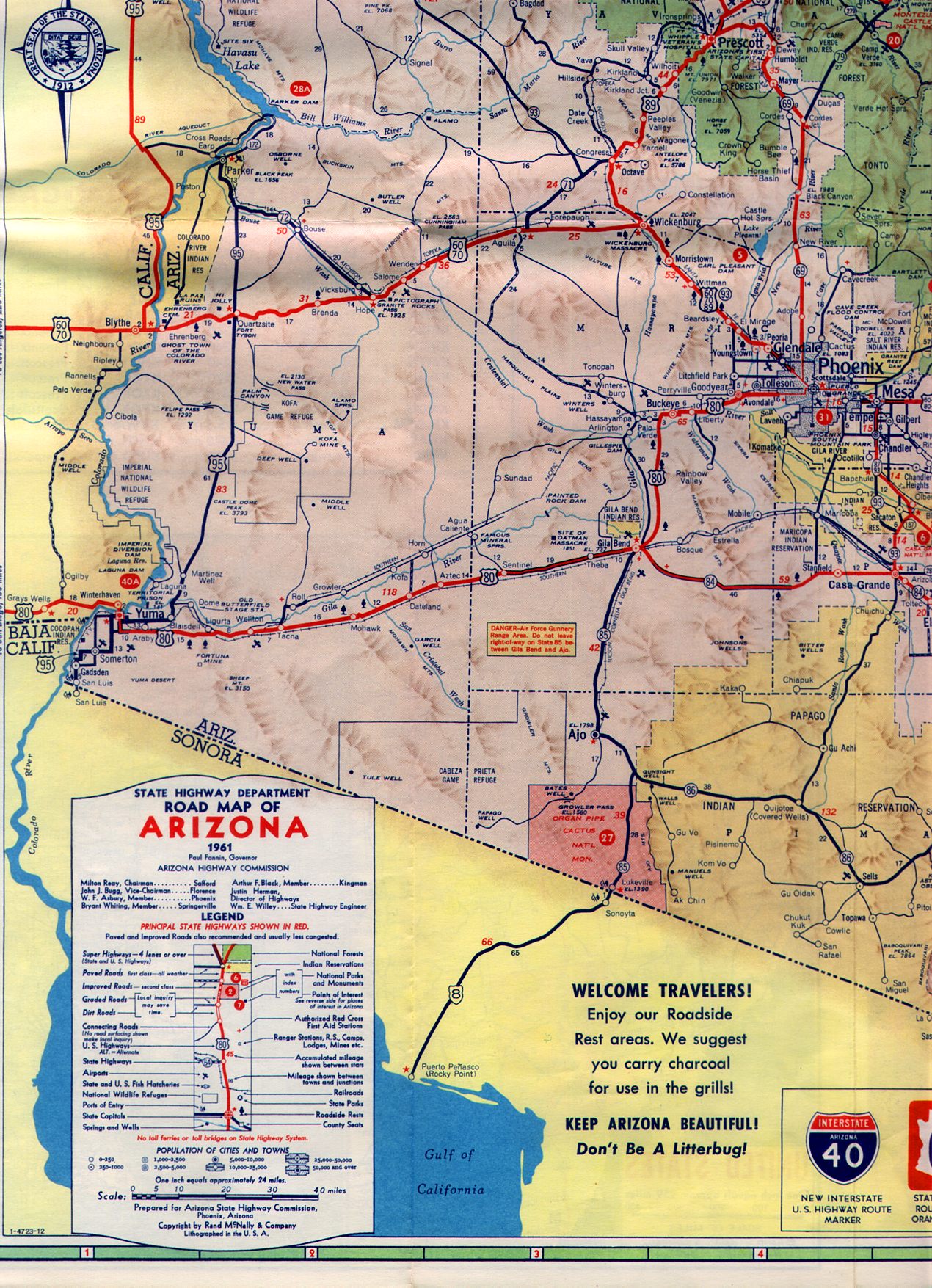
The business loops within Arizona are maintained by the Arizona Department of Transportation (ADOT) and by municipal authorities. I-10 has five business loops within the state including one in La Paz County, the westernmost in Arizona through which I-10 passes, and four in Cochise County, the easternmost. ADOT identifies Interstate business loops as State Business Routes followed by the number of the parent Interstate. Therefore, all I-10 business loops in Arizona carry the unsigned designation of Arizona State Route 10 Business (or State Business Route 10). Individual loops along an Interstate are designated by adding parenthetical numbers that increase eastward and northward. Gaps in numbering represent removal of former routes or potential expansion. Many of the business loops are sections of highways which preceded I-10, such as US 60, US 70, US 80 and Arizona State Route 86 (SR 86).

Quartzsite business loop

Business Loop 10.svg

Interstate 10 Business

State Business Route 10 (1)
Location Quartzsite, Arizona
Length2.94 mi [4] :532 (4.73 km)
Existed1991–present [4] :532
Business routes of Interstate 10
A map of the Quartzsite business loop. The route is highlighted in red.

State Business Route 10 (1) (also known as SR 10 Bus.) is a business loop of I-10 at Quartzsite in La Paz County operated since 1991. The 2.9-mile (4.7 km) route, which follows along the local streets Quartzsite Boulevard, Main Street, and Riggles Avenue, begins at exit 17 of I-10 and US 95 west of town and ends at exit 24 of I-10 east of town. Between its termini, the route has a major intersection with SR 95 where it ends a concurrency with US 95. [5] :407

The route was originally designated along part of US 60 and US 70. [6]

Major intersections

The entire route is in Quartzsite, La Paz County.

mi [5] :407kmDestinationsNotes
17.4528.08Dome Rock Road / Kuehn StreetWestern terminus
17.53–
17.61
28.21–
28.34
North plate.svg
US 95.svg
I-10.svg US 95 north / I-10  Phoenix, Los Angeles, California
West end of US 95 overlap; I-10 exit 17
18.9630.51South plate.svg
US 95.svg
North plate.svg
Arizona 95.svg
US 95 south (Central Boulevard south) / SR 95 north (Central Boulevard north) Yuma, Parker
East end of US 95 overlap; southern terminus of SR 95
20.07–
20.15
32.30–
32.43
I-10.svg I-10  Phoenix, Los Angeles, California I-10 exit 19
20.4232.86Kuehn Street / Dome Rock RoadEastern terminus
1.000 mi = 1.609 km; 1.000 km = 0.621 mi

Phoenix business loop

Business Loop 10.svg

Interstate 10 Business

Location Phoenix, Arizona
Existed????–c. 1990 [7]

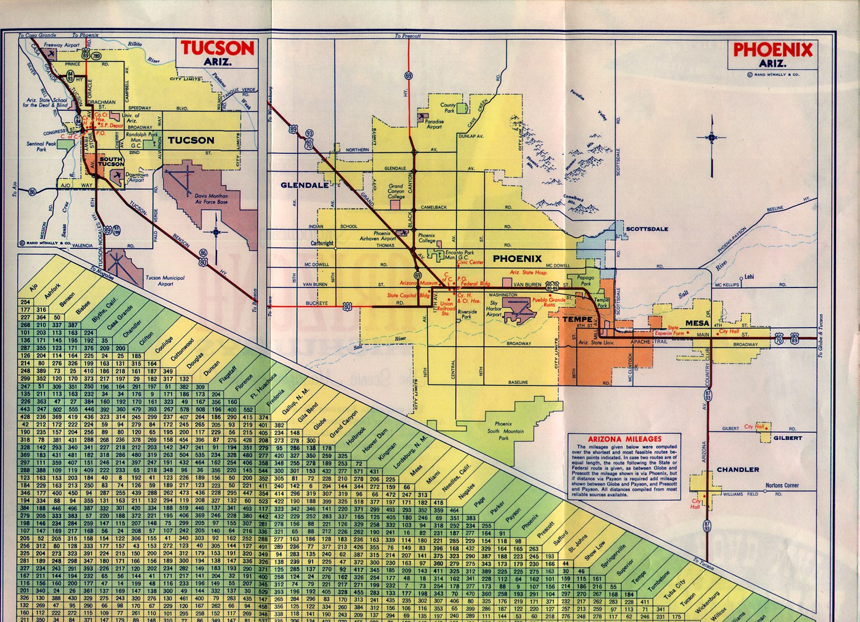
State Business Route 10 (Phoenix) (also known as SR 10 Bus.) was a business loop of I-10 at Phoenix, in Maricopa County, decommissioned circa 1990. Prior to the completion of I-10 through Phoenix, this business loop connected the eastern and western segments of the Interstate on a route through Downtown Phoenix.

Prior to its decommissioning, the route began at I-10 exit 142 (27th Avenue), heading south before turning east at Van Buren Street. At the five-legged intersection with Grand Avenue and 7th Avenue, I-10 BL began a concurrency with US 60 and US 89. This concurrency ended as I-10 BL turned right at 44th Street, heading south again before terminating at I-10 exit 153 (48th Street). [7]

The 44th Street leg of the Phoenix I-10 BL has since been replaced by part of the Hohokam Expressway (SR 143).

Major intersections

Major highway intersections as listed shortly before I-10 BL was decommissioned in 1990. The entire route was in Maricopa County.

LocationmikmDestinationsNotes
Phoenix 0.000.00West plate blue.svg
I-10.svg
I-10 west (Papago Freeway) Los Angeles
Western terminus; road continued north as 27th Avenue
I-17.svg I-17 (Black Canyon Freeway)
South plate.svg
Arizona 85.svg
SR 85 south (17th Avenue)
West end of overlap with SR 85; former US 80 west
West plate.svg
US 60.svg
North plate.svg
US 89.svg
North plate.svg
Arizona 93.svg
End plate.svg
Arizona 85.svg
US 60 west / US 89 north / SR 93 north (Grand Avenue) / SR 85 ends / 7th Avenue
East end of overlap with SR 85; northern terminus of SR 85; west end of overlap with US 60 / US 89; southern terminus of SR 93; former US 70 west
East plate.svg
US 60.svg
South plate.svg
US 89.svg
US 60 east / US 89 south (Van Buren Street)
East end of overlap with US 60 / US 89; former US 70  / US 80 east
PhoenixTempe lineI-10.svg I-10 (Maricopa Freeway) Tucson Eastern terminus; road continued south as 48th Street
1.000 mi = 1.609 km; 1.000 km = 0.621 mi

Tucson business loop

Business Loop 10.svg

Interstate 10 Business

State Business Route 10 (2)
Location Tucson, Arizona
Length5.75 mi [8] :50 (9.25 km)
Existed1972–2001 [9] [10]
Business routes of Interstate 10
A map of the Tucson business loop. The route is highlighted in red.

State Business Route 10 (2) (also known as SR 10 Bus.) was a business loop of I-10 at Tucson in Pima County operated between 1972 and 2001. The 5.8-mile (9.3 km) route followed Tucson–Benson Highway through the south end of Tucson, starting at exit 262 in town and ended at exit 267 east of town. Between its termini, the route made a quick jog down Irvington Road near Tucson Boulevard to stay on Benson Highway and used a small section of Valencia Road at the end of Benson Highway to access exit 267. [8] :49

The route was formerly designated as part of US 80 and SR 86. [11] Maintenance of the route was transferred to the city of Tucson upon decommissioning. [12]

Major intersections

The entire route was in Pima County.

Locationmi [8] :49kmDestinationsNotes
Tucson 247.60398.47East plate blue.svg
I-10.svg
I-10 east
Western terminus; eastbound exit only; no access to I-10 from I-10 BL; no access from I-10 west to I-10BL
247.95399.04Park Avenue to I-10.svg I-10  Casa Grande Access to I-10 via Park Avenue and north frontage road; access to I-10 BL from I-10 west was at this exit
253.35407.73I-10.svg I-10  Benson Eastern terminus; road continued as Valencia Road
1.000 mi = 1.609 km; 1.000 km = 0.621 mi

Benson business loop

Business Loop 10.svg

Interstate 10 Business

State Business Route 10 (3)
Location Benson, Arizona
Length3.51 mi [4] :533 (5.65 km)
Existed1974–present [13]
Business routes of Interstate 10
A map of the Benson business loop. The route is highlighted in red.
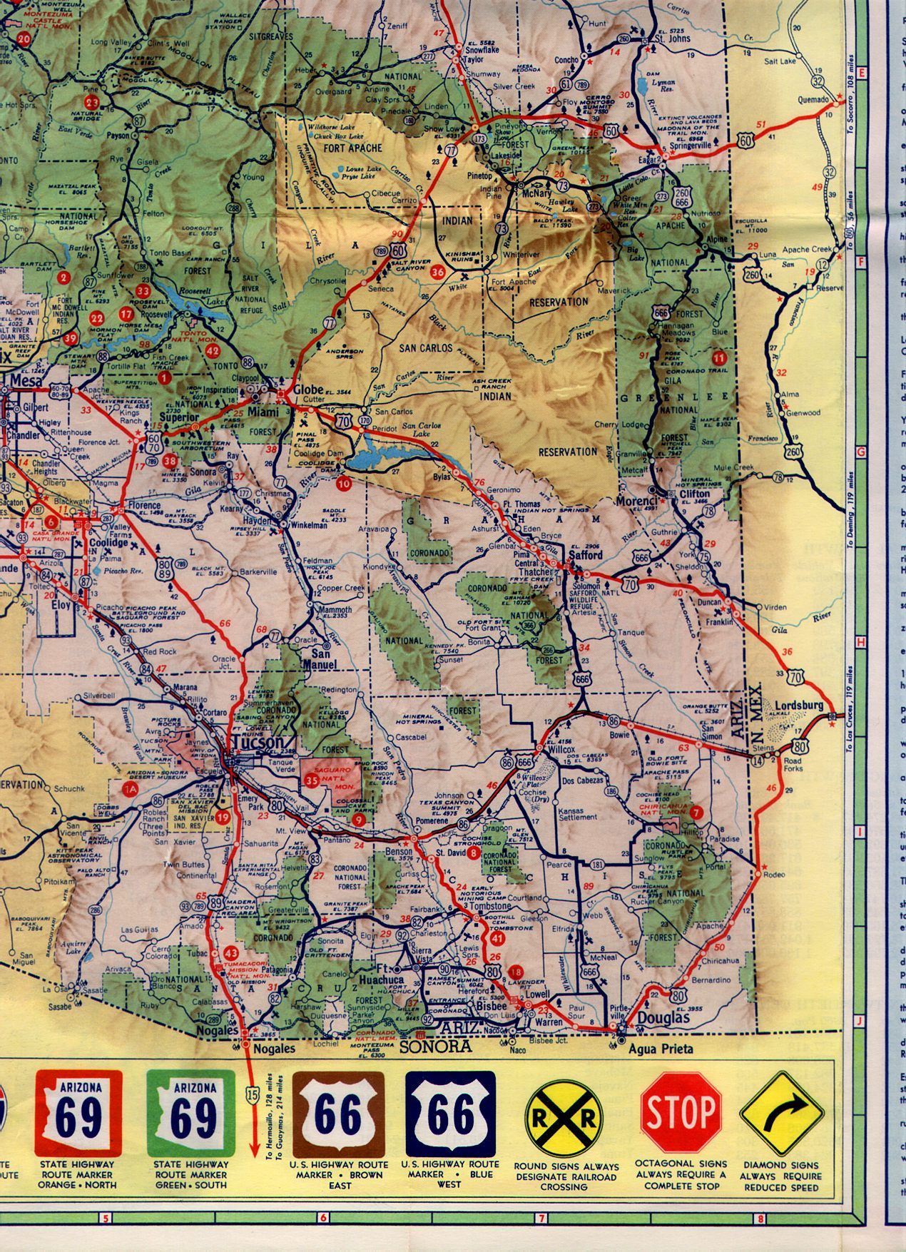
State Business Route 10 (3) (also known as SR 10 Bus.) is a business loop of I-10 at Benson in Cochise County operated since 1974. The 3.5-mile (5.6 km) route follows along Benson's Fourth Street beginning at exit 303 of I-10 west of town and ends at exit 306 of I-10 east of town. Between its termini, the route has a major intersection with SR 80. [5] :408 The western part of the business loop from I-10 to SR 80 is signed as part of Historic US 80. [14]

The route was originally designated along part of SR 86 while US 80 was conveyed over a portion of the present business route, west of present day SR 80. [15]

Major intersections

The entire route is in Cochise County.

Locationmi [5] :408kmDestinations [16] [8] Notes
303.77488.87I-10.svgBegin plate brown.svg
US 80 (AZ historic).svg
I-10  / Historic US 80 begins Tucson
Western terminus; western end of Historic US 80 concurrency; I-10 west exit 303; no access to I-10 BL from I-10 west; western terminus of Historic US 80
Benson 304.80490.53Airport Sign.svg Ocotillo AvenueFormer BL 10 Spur west; serves Benson Municipal Airport
305.79492.12East plate.svg
Arizona 80.svg
SR 80 east (Historic US 80 east) Tombstone, Bisbee, Douglas
Interchange; western terminus of SR 80; eastern end of Historic US 80 concurrency
306.92493.94I-10.svg I-10  Tucson, El Paso Eastern terminus; road continues north as Pomerene Road
1.000 mi = 1.609 km; 1.000 km = 0.621 mi

Benson business spur

Business Spur 10.svg

Interstate 10 Business Spur

State Route 10 Spur
Location Benson
Length0.55 mi [8] :53 (890 m)
Existed1969–1999 [17] [18]
Business routes of Interstate 10
A map of the Benson business spur. The route is highlighted in red.

State Route 10 Spur (also known as SR 10 Spur) was a business spur of I-10 at Benson in Cochise County operated from 1969 to 1999. The 0.6-mile (1.0 km) route followed Ocotillo Road south from I-10 before ending at 4th Street (I-10 BL) west of downtown Benson. [8] :53

Maintenance of the route was transferred to the city of Benson upon decommissioning. [18]

Major intersections

The entire route was in Benson, Cochise County.

mi [8] :53kmDestinationsNotes
304.93490.74I-10.svg I-10  / North Ocotillo Avenue Tucson, El Paso Western terminus; I-10 Exit 304; road continues north as Ocotillo Avenue
305.48491.62Business Loop 10.svgTo plate.svg
East plate.svg
Arizona 80.svg
BL 10 (4th Street) to SR 80 east / South Ocotillo Avenue
Eastern terminus; road continues south as Ocotillo Avenue
1.000 mi = 1.609 km; 1.000 km = 0.621 mi

Willcox business loop

Business Loop 10.svg

Interstate 10 Business

State Business Route 10 (4)
Location Willcox, Arizona
Length8.33 mi [4] :536 (13.41 km)
Existed1986–present [4] :536
Business routes of Interstate 10
A map of the Willcox business loop. The route is highlighted in red.

State Business Route 10 (4) (also known as SR 10 Bus.) is a business loop of I-10 at Willcox in Cochise County operated since 1986. The 8.3-mile (13.4 km) route, following along Willcox's Haskell Avenue, begins at exit 336 of I-10 west of town and ends at exit 344 of I-10 east of town. Between its termini, the route has a brief concurrency with SR 186. [5] :410

The route was formerly designated as part of US 666 and SR 86. [19]

Major intersections

The entire route is in Cochise County.

Locationmi [5] :410kmDestinationsNotes
336.39–
336.70
541.37–
541.87
I-10.svgUS 191.svg I-10  / US 191  El Paso, Safford, Tucson, Douglas Western terminus; I-10 exit 336
Willcox 340.10547.34South plate.svg
Arizona 186.svg
SR 186 south (Maley Street) Dos Cabezas
Begin overlay with SR 186
340.81548.48North plate.svg
Arizona 186.svg
SR 186 north (Rex Allen Drive)
End overlay with SR 186
344.66554.68I-10.svgUS 191.svg I-10  / US 191  Tucson, El Paso, Safford Eastern terminus; I-10 exit 344
1.000 mi = 1.609 km; 1.000 km = 0.621 mi

Bowie business loop

Business Loop 10.svg

Interstate 10 Business

State Business Route 10 (5)
Location Bowie, Arizona
Length4.41 mi [4] :537 (7.10 km)
Existed1980–present [4] :537
Business routes of Interstate 10
A map of the Bowie business loop. The route is highlighted in red.

State Business Route 10 (5) (also known as SR 10 Bus.) is a business loop of I-10 at Bowie in Cochise County operated since 1980. The 4.4-mile (7.1 km) route along Sixth Street in Bowie begins at exit 362 of I-10 west of town and ends at exit 366 of I-10 east of town. Between its termini, the route has no major intersections. [5] :411

The route was formerly designated as part of SR 86. [20]

Major intersections

The entire route is in Cochise County.

Locationmi [5] :411kmDestinationsNotes
362.41–
363.01
583.24–
584.21
I-10.svg I-10  Tucson, El Paso Western terminus; I-10 exit 362
366.42–
366.91
589.70–
590.48
I-10.svg I-10  El Paso, Tucson Eastern terminus; I-10 exit 366
1.000 mi = 1.609 km; 1.000 km = 0.621 mi

San Simon business loop

Business Loop 10.svg

Interstate 10 Business

State Business Route 10 (6)
Location San Simon, Arizona
Length3.90 mi [4] :538–539 (6.28 km)
Existed1961–present [4] :539
Business routes of Interstate 10
A map of the San Simon business loop. The route is highlighted in red.

State Business Route 10 (6) (also known as SR 10 Bus.) is a business loop of I-10 at San Simon in Cochise County operated since 1961. The 3.9-mile (6.3 km) route follows San Simon's Sixth Street beginning at exit 378 of I-10 west of town and ending at exit 382 of I-10 east of town. Between its termini, the route has no major intersections. [5] :412–413

The route was formerly designated as part of SR 86. [21]

Major intersections

The entire route is in Cochise County.

Locationmi [5] :412–413kmDestinationsNotes
San Simon 378.64–
379.15
609.36–
610.18
I-10.svg I-10  Tucson, El Paso Western terminus; I-10 exit 378
382.13–
382.48
614.98–
615.54
I-10.svg I-10  El Paso, Tucson Eastern terminus; I-10 exit 382
1.000 mi = 1.609 km; 1.000 km = 0.621 mi


New Mexico

All of the business loops within New Mexico are maintained by the New Mexico Department of Transportation (NMDOT). In New Mexico, Interstate business routes are named independently of their parent Interstate's designation with business loops of I-25 numbered between 10–19, those of I-10 between 20–29, and those of I-40 between 30–39. New Mexico business loop numbers ascend eastward and northward with gaps in numbering to allow for future designations. Within New Mexico, I-10 currently has business routes in Lordsburg and Deming.

Lordsburg business loop

Business Loop 10.svg

Business Loop 21

Location Lordsburg, New Mexico
Length4.370 mi [22]  (7.033 km)

Business Loop 21 is a business loop of Interstate 10 at Lordsburg in Hidalgo County. The 4.4-mile (7.1 km) route, which follows the city's Motel Drive, begins at exit 20 of I-10 west of town and ends at exit 24 of I-10 and US 70 east of town. [23] Between its termini, the route has major intersections with US 70 and New Mexico State Road 494 (NM 494). [24] :4

The route was originally designated as part of US 80 while a portion of the business route also conveyed US 70. [25]

Major intersections

The entire route is in Lordsburg, Hidalgo County.

mi [24] :4kmDestinationsNotes
0.0000.000I-10.svg I-10  Deming, Tucson Western terminus; I-10 west exit 20, east exit 20B
2.0673.327West plate.svg
US 70.svg
To plate.svg
New Mexico 90.svg
US 70 west to NM 90  Silver City, Duncan, Globe
Interchange; west end of overlap with US 70
2.1353.436East Bound Trucks (NM 494 south)Northern terminus of NM 494
4.3707.033I-10.svgUS 70.svg I-10  / US 70  Deming, Lordsburg Eastern terminus; east end of overlap with US 70
1.000 mi = 1.609 km; 1.000 km = 0.621 mi

Deming business loop

Business Loop 10.svg

Business Loop 22

Location Deming, New Mexico
Length4.458 mi [22]  (7.174 km)

Business Loop 22 is a business loop of I-10 at Deming in Luna County. The 4.5-mile (7.2 km) route begins at exit 81 of I-10 and US 70 west of town and follows Pine Street and Motel Drive to exit 85 of I-10, US 70, and US 180 east of town. [26] Between its termini, the route has major intersections with US 180, NM 418, and NM 549. [24] :5

The route was originally designated as part of US 70 and US 80 while a portion of the business route also conveyed US 180. [27]

Major intersections

The entire route is in Deming, Luna County.

mi [24] :5kmDestinationsNotes
0.0000.000I-10.svg I-10 (US 70) Lordsburg, Las Cruces Western terminus; I-10 exit 81
0.6100.982New Mexico 497.svgHospital sign.svg NM 497 (Eighth Street) – City ParkServes Mimbres Memorial Hospital
1.2301.979South plate.svg
New Mexico 11.svg
NM 11 south (Gold Avenue) Columbus, Palomas Mex.
3.7356.011East plate.svg
New Mexico 549.svg
NM 549 east
Former US 70/US 80 east
4.4587.174I-10.svg I-10 (US 70  / US 180) Lordsburg, Las Cruces Eastern terminus; I-10 exit 85
1.000 mi = 1.609 km; 1.000 km = 0.621 mi

Texas

All of the business loops within Texas are maintained by the Texas Department of Transportation (TxDOT). I-10 has four business loops in the state, each located in the far western Trans-Pecos region. Along I-10, TxDOT identifies each business route as Business Interstate 10 followed by an alphabetic suffix. Along Texas Interstates, the alphabetic suffixes on business route names ascend eastward and northward. There are gaps in the alphabetic values to allow for future system expansion. The alphabetic naming suffixes are included as small letters on the bottom of reassurance shields.

Sierra Blanca business loop

Business Interstate 10-C (TX).svg

Business Interstate 10-C

Location Sierra Blanca, Texas
Length2.747 mi [28]  (4.421 km)
Existed1990–present [28]

Business Interstate 10-C or Bus. I-10-C is a business loop of I-10 at Sierra Blanca in Hudspeth County commissioned in 1991. The 2.7-mile (4.3 km) route follows El Paso Street beginning at exit 105 on I-10 west of town and ending at exit 108 on I-10 east of town. [29] The route has one major intersection with Ranch to Market Road 1111 (RM 1111) to Cornudas and Dell City. [30]

The road was originally designated as part of US 80. After October 15, 1965, the road was designated Texas State Highway Loop 416, although it was signed as a business route of US 80. This became the present Business I-10 designation on June 21, 1990. [31]

Major intersections

The entire route is in Sierra Blanca, Hudspeth County.

mi [29] kmDestinationsNotes
0.00.0I-10.svg I-10  Fort Hancock, El Paso Western terminus
1.52.4Texas RM 1111.svg RM 1111 (Archie Ave.) Cornudas, Dell City
2.74.3I-10.svg I-10  Allamoore, Van Horn Eastern terminus
1.000 mi = 1.609 km; 1.000 km = 0.621 mi

Van Horn business loop

Business Interstate 10-D (TX).svg

Business Interstate 10-D

Location Van Horn, Texas
Length2.881 mi [32]  (4.637 km)
Existed1990–present [32]
Bus. I-10-D in Van Horn Van horn texas.jpg
Bus. I-10-D in Van Horn

Business Interstate 10-D or Bus. I-10-D is a business loop of I-10 at Van Horn in Culberson County commissioned in 1991. The 2.9-mile (4.7 km) route, which follows along Ross Drive and Broadway Boulevard in Van Horn, begins at exit 138 on I-10 west of town and ends at exit 140B on I-10 east of town. [33] The road has major intersections with US 90 and Texas State Highway 54 (SH 54). [34]

The road was originally designated as part of US 80. On November 25, 1975, the road was designated Texas State Highway Loop 519, although it was signed as a business route of US 80. [35]

Major intersections

The entire route is in Van Horn, Culberson County.

mi [33] kmDestinationsNotes
0.00.0I-10.svg I-10  Sierra Blanca, El Paso Western terminus
2.03.2US 90.svgSouth plate.svg
Texas 54.svg
US 90  / SH 54 south (Van Horn Dr.) Valentine
Begin overlay with SH 54; western terminus of US 90
2.13.4North plate.svg
Texas 54.svg
SH 54 north (La Caverna St.) Pine Springs
End overlay with SH 54
2.94.7I-10.svg I-10  Kent, San Antonio Eastern terminus
1.000 mi = 1.609 km; 1.000 km = 0.621 mi

Balmorhea business loop

Business Interstate 10-F (TX).svg

Business Interstate 10-F

Location Balmorhea, Texas
Length2.000 mi [36]  (3.219 km)
Existed1991–present [36]

Business Interstate 10-F or Bus. I-10-F is a business loop of I-10 at Balmorhea in Reeves County commissioned in 1992. The route begins at exit 206 on I-10 and Farm to Market Road 2903 (FM 2903, Fort Worth Street) north of town and ends at exit 209 on I-10 and SH 17 (Main Street) east of the small community of Brogado. Although TxDOT certifies the length of the road as 2.0 miles (3.2 km), that length does not include a portion of the route concurrent with SH 17. This section brings the total length of the road to 4.6 miles (7.4 km). [37] The junction where the road merges with SH 17 is the only major intersection between the road's termini. [38]

The portion of Bus. I-10-F concurrent with SH 17 was formerly part of US 290 with the remainder formerly a southern extension of FM 2903. [36]

Major intersections

The entire route is in Reeves County.

Locationmi [37] kmDestinationsNotes
0.00.0I-10.svgTexas FM 2903.svg I-10  / FM 2903  Kent, El Paso, Toyah Western terminus
Balmorhea 1.93.1South plate.svg
Texas 17.svg
SH 17 south (Main St.) Toyahvale, Fort Davis
Begin overlay with SH 17
4.67.4I-10.svgTexas 17.svg I-10  / SH 17  Fort Stockton, San Antonio, Saragosa, Pecos Eastern terminus, end overlay with SH 17
1.000 mi = 1.609 km; 1.000 km = 0.621 mi

Fort Stockton business loop

Business Interstate 10-G (TX).svg

Business Interstate 10-G

Location Fort Stockton, Texas
Length1.398 mi [39]  (2.250 km)
Existed1991–present [39]

Business Interstate 10-G or Bus. I-10-G is a business loop of I-10 at Fort Stockton in Pecos County commissioned in 1992. The route, following the city's Dickinson Boulevard, begins at exit 256 on I-10 and US 67 west of town and ends at exit 261 on I-10, US 67, and US 385 east of town. Although TxDOT certifies the length of the road as 1.4 miles (2.3 km), that length does not include a portion of the route concurrent with other highways. These sections brings the total length of the road to 4.4 miles (7.1 km). [40] Between its termini, the route has major intersections with US 285, US 385, SH 18, and FM 1053. [41]

Bus. I-10-G was formerly designated as part of US 290. [39]

Major intersections

The entire route is in Fort Stockton, Pecos County.

mi [40] kmDestinationsNotes
0.00.0I-10.svgUS 67.svg I-10  / US 67  Balmorhea, El Paso, Alpine Western terminus
1.52.4North plate.svg
US 285.svg
US 285 north Pecos
Begin overlay with US 285
2.23.5Texas 18.svg SH 18 (N. Front St.) Monahans
2.43.9South plate.svg
US 385.svg
US 385 south (N. Jackson St.) Marathon
Begin overlay with US 385
2.54.0Texas FM 1053.svg FM 1053 (N. Main St.) Imperial
2.94.7South plate.svg
US 285.svg
US 285 south (N. Alamo St.) Sanderson
End overlay with US 285
4.47.1I-10.svgUS 67.svgNorth plate.svg
US 385.svg
I-10  / US 67  / US 385 north Bakersfield, San Antonio, McCamey
Eastern terminus, end overlay with US 385
1.000 mi = 1.609 km; 1.000 km = 0.621 mi

See also

Blank shield.svg  U.S. Roadsportal

Related Research Articles

<span class="mw-page-title-main">Interstate 17</span> Interstate Highway in central Arizona

Interstate 17 (I-17) is a north–south Interstate Highway entirely within the US state of Arizona. I-17's southern terminus lies in Phoenix, at I-10, and its northern terminus is in Flagstaff, at Milton Road north of I-40.

<span class="mw-page-title-main">Interstate 19</span> Interstate Highway in southern Arizona

Interstate 19 (I-19) is a north–south Interstate Highway located entirely within the US state of Arizona. I-19 travels from Nogales, roughly 90 meters (300 ft) from the Mexican border, to Tucson, at I-10. The highway also travels through the cities of Rio Rico, Green Valley, and Sahuarita.

<span class="mw-page-title-main">Arizona State Route 80</span> State highway in Arizona, United States

State Route 80 is a roughly arc-shaped highway lying in southeastern Arizona that, with New Mexico's State Road 80, is a relic of the old U.S. Route 80, now truncated from San Diego to Dallas. This segment of old US 80 was not closely paralleled by Interstate 10, which lies to its north and instead supplants the old and more direct State Route 86.

<span class="mw-page-title-main">Arizona State Route 85</span> State highway in Arizona, United States

State Route 85 is a 128.86-mile-long (207.38 km) state highway in the U.S. state of Arizona. The highway runs from the United States–Mexico border near Lukeville to the north ending at Interstate 10 (I-10) in Buckeye. The highway also intersects I-8 in Gila Bend and serves as a connector between I-8 and I-10 and for travelers between Phoenix and Yuma as well as San Diego. SR 85 between I-10 and I-8, as well as I-8 between SR 85 and I-10 in Casa Grande, is touted as a bypass of the Phoenix area for long-distance travelers on I-10.

<span class="mw-page-title-main">U.S. Route 191</span> Numbered Highway in the United States

U.S. Route 191 is a spur of U.S. Route 91 that has two branches. The southern branch runs for 1,102 miles (1,773 km) from Douglas, Arizona on the Mexican border to the southern part of Yellowstone National Park. The northern branch runs for 442 miles (711 km) from the northern part of Yellowstone National Park to Loring, Montana, at the Canada–US border. Unnumbered roads within Yellowstone National Park connect the two branches. The highway passes through the states of Arizona, Utah, Wyoming, and Montana.

<span class="mw-page-title-main">Arizona State Route 84</span> State highway in Arizona, United States

State Route 84, also known as SR 84, is a 41-mile (66 km) east–west highway in south-central Arizona, with its western terminus at Exit 151 of Interstate 8 and its eastern signed terminus at its junction with State Route 387 and State Route 287 in Casa Grande. An unsigned section, which is mostly maintained by local governments, runs from the SR 287 and SR 387 junction southeast through Arizola and Eloy. East of Eloy, SR 84 is concurrent with the beginning 0.87 miles (1.40 km) of State Route 87 just north of Interstate 10 near Picacho.

<span class="mw-page-title-main">Arizona State Route 86</span> State highway in Arizona, United States

State Route 86 is a state highway in southern Arizona that stretches from its junction with State Route 85 in Why east to its junction at 16th Avenue east of Interstate 19 in Tucson. It formerly went east to the New Mexico border near Lordsburg, but this eastern segment has been superseded by Interstate 10. SR 86 is the primary east–west highway through the Tohono O'odham Nation.

<span class="mw-page-title-main">Arizona State Route 186</span> State highway in Arizona, United States

State Route 186 is a highway in Cochise County, Arizona that runs from its junction with Interstate 10 in Willcox to its junction with SR 181 west of the Chiricahua National Monument. It is a northwest–southeast diagonal route.

<span class="mw-page-title-main">U.S. Route 60 in Arizona</span> Section of U.S. Highway in Arizona, United States

U.S. Route 60 (US 60) is an east–west United States Highway within Arizona. The highway runs for 369 miles (594 km) from a junction with Interstate 10 near Quartzsite to the New Mexico State Line near Springerville. As it crosses the state, US 60 overlaps at various points: I-17, I-10, SR 77, SR 260, US 191, and US 180. Between Wickenburg and Phoenix, the route is known as Grand Avenue. From Tempe to Apache Junction, it is known as the Superstition Freeway.

<span class="mw-page-title-main">U.S. Route 191 in Arizona</span> Section of U.S. Highway in Arizona, United States

U.S. Route 191 (US 191) is a north–south United States Highway within Arizona. The highway runs for 517 miles (832 km), the longest of any numbered highway in Arizona, from State Route 80 near Douglas to the Utah state line near Mexican Water. As it crosses the state, US 191 overlaps at various points: I-10, US 70, US 180, US 60, SR 61, I-40, SR 264, and US 160. Previously the route was designated as US 666 and SR 63.

<span class="mw-page-title-main">U.S. Route 93 in Arizona</span> Highway in Arizona

U.S. Route 93 in the state of Arizona is a United States Numbered Highway that begins in Wickenburg and heads north to the Nevada state line at the Mike O'Callaghan–Pat Tillman Memorial Bridge.

<span class="mw-page-title-main">U.S. Route 95 in Arizona</span> Highway in Arizona

U.S. Route 95 (US 95) is a major U.S. Highway in the American state of Arizona. Starting at the Mexican border in San Luis, US 95 acts as the main highway north through Gadsden, Somerton and Yuma before arriving in Quartzsite. Between Quartzsite and the California border on the Colorado River in Ehrenberg, US 95 runs entirely concurrent with I-10. Part of US 95 between San Luis and Yuma is maintained by local governments instead of the Arizona Department of Transportation, which maintains the remainder of the route.

<span class="mw-page-title-main">Business routes of Interstate 35</span>

Interstate business routes are roads connecting a central or commercial district of a city or town with an Interstate bypass. These roads typically follow along local streets often along a former U.S. Route or state highway that had been replaced by an Interstate. Interstate business route reassurance markers are signed as either loops or spurs using a green shield shaped sign and numbered like the shield of the parent Interstate highway.

<span class="mw-page-title-main">Business routes of Interstate 20 in Texas</span>

All of the business loops within Texas are maintained by the Texas Department of Transportation (TxDOT). Interstate 20 (I-20) has 15 business loops in the state, all located in western Texas. Along I-20, TxDOT identifies each business route as Business Interstate 20 followed by an alphabetic suffix. Along Texas Interstates, the alphabetic suffixes on business route names ascend eastward and northward. There are gaps in the alphabetic values to allow for future system expansion. The alphabetic naming suffixes are included as small letters on the bottom of route shields.

<span class="mw-page-title-main">Business routes of Interstate 25</span> Route system

Interstate business routes are roads connecting a central or commercial district of a city or town with an Interstate bypass. These roads typically follow along local streets often along a former U.S. Route or state highway that had been replaced by an Interstate. Interstate business route reassurance markers are signed as either loops or spurs using a green shield shaped sign and numbered like the shield of the parent Interstate highway.

<span class="mw-page-title-main">Business routes of Interstate 75</span>

Business routes of Interstate 75 exist in three states. Georgia has three existing Interstate 75 (I-75) business routes and one other that was deleted. Ohio has three business routes for I-75. Nine other I-75 business routes also exist, or have existed, in Michigan, and a 10th has been proposed.

<span class="mw-page-title-main">Business routes of Interstate 8</span>

There are five business routes of Interstate 8 (I-8).

<span class="mw-page-title-main">Business routes of Interstate 40</span> Highway system

Interstate business routes are roads connecting a central or commercial district of a city or town with an Interstate bypass. These roads typically follow along local streets often along a former U.S. Route or state highway that had been replaced by an Interstate. Interstate business route reassurance markers are signed as either loops or spurs using a green shield shaped and numbered like the shield of the parent Interstate highway.

<span class="mw-page-title-main">Business routes of Interstate 45</span>

All of the business loops are maintained by the Texas Department of Transportation (TxDOT). Interstate 45 (I-45) has four business loops in the state, all located in northern Texas. Along I-45, TxDOT identifies each business route as Business Interstate 45 followed by an alphabetic suffix. Along Texas Interstates, the alphabetic suffixes on business route names ascend eastward and northward. There are gaps in the alphabetic values to allow for future system expansion. The alphabetic naming suffixes are included as small letters on the bottom of route shields.

References

  1. Division of Design (May 7, 2012). "Highway Design Manual, Chapter 20, Index 21.2" (PDF). California Department of Transportation. p. 3. Retrieved September 9, 2014.
  2. 1 2 3 Google (September 6, 2014). "Overview of I-10 Bus., Blythe, CA" (Map). Google Maps . Google. Retrieved September 6, 2014.
  3. "Southeastern California" (Map). California Official Highway Map (PDF). Cartography by H.M. Gousha. California State Department of Public Works. 1966. Retrieved September 8, 2014.
  4. 1 2 3 4 5 6 7 8 9 Staff (December 31, 2012). "2012 State Highway System Log" (PDF). Arizona Department of Transportation, Multimodal Planning Division, Roadway Inventory Management Section. Retrieved September 3, 2014.
  5. 1 2 3 4 5 6 7 8 9 10 Staff (December 31, 2008). "2008 State Highway System Log" (PDF). Arizona Department of Transportation, Multimodal Planning Division, Data Bureau. Retrieved September 3, 2014.
  6. State Highway Department Road Map of Arizona (PDF) (Map). 1"=24 mi. Cartography by Rand McNally & Company. Arizona Highway Commission. 1961. p. 3. § F2. Retrieved September 7, 2014.
  7. 1 2 "Interstate-Guide: Business Route 10". AARoads' Interstate Guide. interstate-guide.com. October 21, 2013. Retrieved May 8, 2015. Alan Hamilton
  8. 1 2 3 4 5 6 7 Arizona Department of Transportation (1998). "1998 State Highway System Log" (PDF). Phoenix: Arizona Department of Transportation. Retrieved October 18, 2018.
  9. Staff. "ADOT Right-of-Way Resolution 1972-P-082". Arizona Department of Transportation. Retrieved October 18, 2018.
  10. Staff. "ADOT Right-of-Way Resolution 2001-8-A-060". Arizona Department of Transportation. Retrieved October 18, 2018.
  11. State Highway Department Road Map of Arizona (JPG) (Map). Cartography by Rand McNally & Company. Arizona Highway Commission. 1961. p. 5. Tucson inset. Retrieved October 18, 2018.
  12. Staff. "ADOT Right-of-Way Resolution 2001-8-A-060". Arizona Department of Transportation. Retrieved October 18, 2018.
  13. Arizona Department of Transportation. "ADOT Right-of-Way Resolution 1974-P-060". Arizona Department of Transportation. Retrieved October 18, 2018.
  14. "Historic Arizona U.S. Route 80 Designation". Tucson Historic Preservation Foundation. August 2017. Retrieved August 23, 2018.
  15. State Highway Department Road Map of Arizona (PDF) (Map). 1"=24 mi. Cartography by Rand McNally & Company. Arizona Highway Commission. 1961. p. 4. § I6. Retrieved September 7, 2014.
  16. Arizona State Transportation Board Meeting Agenda (PDF) (Report). Show Low, Arizona: Arizona State Transportation Board. July 20, 2018. pp. 310 to 339. Retrieved June 16, 2019.
  17. Staff. "ADOT Right-of-Way Resolution 1969-P-063". Arizona Department of Transportation. Retrieved June 19, 2019.
  18. 1 2 Staff. "ADOT Right-of-Way Resolution 1999-11-A-053". Arizona Department of Transportation. Retrieved June 19, 2019.
  19. State Highway Department Road Map of Arizona (PDF) (Map). 1"=24 mi. Cartography by Rand McNally & Company. Arizona Highway Commission. 1961. p. 4. § I7. Retrieved September 7, 2014.
  20. State Highway Department Road Map of Arizona (PDF) (Map). 1"=24 mi. Cartography by Rand McNally & Company. Arizona Highway Commission. 1961. p. 4. § H7. Retrieved September 7, 2014.
  21. State Highway Department Road Map of Arizona (PDF) (Map). 1"=24 mi. Cartography by Rand McNally & Company. Arizona Highway Commission. 1961. p. 4. § I8. Retrieved September 7, 2014.
  22. 1 2 Staff (March 16, 2010). "Posted RouteLegal Description; Business Loops" (PDF). New Mexico Department of Transportation, Data Management Bureau. p. 3. Retrieved September 3, 2014.
  23. Google (September 3, 2014). "Overview of Loop 21" (Map). Google Maps. Google. Retrieved September 3, 2014.
  24. 1 2 3 4 Staff (March 27, 2014). "TIMS Road Segments by Posted Route/Point with AADT Info; BL, I, ICR, IX-Routes" (PDF). New Mexico Department of Transportation, Data Management Bureau. Archived from the original (PDF) on September 3, 2014. Retrieved September 3, 2014.
  25. Official Road Map of New Mexico (PDF) (Map). Cartography by Rand McNally & Co. New Mexico State Highway Department. 1973. § J1. Archived from the original (PDF) on September 7, 2014. Retrieved September 7, 2014.
  26. Google (September 3, 2014). "Overview of Loop 22" (Map). Google Maps. Google. Retrieved September 3, 2014.
  27. Official Road Map of New Mexico (PDF) (Map). New Mexico State Highway Department. 1967. § J3. Archived from the original (PDF) on September 7, 2014. Retrieved September 7, 2014.
  28. 1 2 Transportation Planning and Programming Division (n.d.). "Business Interstate Highway No. 10-C". Highway Designation Files. Texas Department of Transportation. Retrieved December 25, 2022.
  29. 1 2 Google (September 6, 2014). "Overview of Bus.I-10-C" (Map). Google Maps. Google. Retrieved September 6, 2014.
  30. Transportation Planning and Programming Division (2018). Texas County Mapbook (PDF) (Map) (2018 ed.). 1:72,224. Texas Department of Transportation. p. 1237. Retrieved July 14, 2021.
  31. Transportation Planning and Programming Division (n.d.). "State Highway Loop No. 416". Highway Designation Files. Texas Department of Transportation. Retrieved September 7, 2014.
  32. 1 2 Transportation Planning and Programming Division (n.d.). "Business Interstate Highway No. 10-D". Highway Designation Files. Texas Department of Transportation. Retrieved December 25, 2022.
  33. 1 2 Google (September 6, 2014). "Overview of Bus. I-10-D" (Map). Google Maps. Google. Retrieved September 6, 2014.
  34. Transportation Planning and Programming Division (2018). Texas County Mapbook (PDF) (Map) (2018 ed.). 1:72,224. Texas Department of Transportation. p. 1294. Retrieved July 14, 2021.
  35. Transportation Planning and Programming Division (n.d.). "State Highway Loop No. 519". Highway Designation Files. Texas Department of Transportation. Retrieved September 7, 2014.
  36. 1 2 3 Transportation Planning and Programming Division (n.d.). "Business Interstate Highway No. 10-F". Highway Designation Files. Texas Department of Transportation. Retrieved December 25, 2022.
  37. 1 2 Google (September 6, 2014). "Overview of Bus.I-10-F" (Map). Google Maps. Google. Retrieved September 6, 2014.
  38. Transportation Planning and Programming Division (2018). Texas County Mapbook (PDF) (Map) (2018 ed.). 1:72,224. Texas Department of Transportation. p. 1299. Retrieved July 14, 2021.
  39. 1 2 3 Transportation Planning and Programming Division (n.d.). "Business Interstate Highway No. 10-G". Highway Designation Files. Texas Department of Transportation. Retrieved December 25, 2022.
  40. 1 2 Google (September 6, 2014). "Overview of Bus.I-10-G" (Map). Google Maps. Google. Retrieved September 6, 2014.
  41. Transportation Planning and Programming Division (2018). Texas County Mapbook (PDF) (Map) (2018 ed.). 1:72,224. Texas Department of Transportation. p. 1358. Retrieved July 14, 2021.