Dell City, Texas

Last updated

Dell City, Texas
Dell City sign TX.jpg
Sign indicating the city limits
TXMap-doton-DellCity.PNG
Location of Dell City, Texas
Hudspeth County DellCity.svg
Coordinates: 31°56′7″N105°12′1″W / 31.93528°N 105.20028°W / 31.93528; -105.20028
Country United States
State Texas
County Hudspeth
Area
[1]
  Total1.67 sq mi (4.32 km2)
  Land1.67 sq mi (4.32 km2)
  Water0.00 sq mi (0.00 km2)
Elevation
3,701 ft (1,128 m)
Population
 (2010)
  Total365
  Estimate 
(2019) [2]
526
  Density315.54/sq mi (121.85/km2)
Time zone UTC-7 (Mountain (MST))
  Summer (DST) UTC-6 (MDT)
ZIP code
79837
Area code 915
FIPS code 48-19708 [3]
GNIS feature ID1355897 [4]
Website www.dellcity.com

Dell City is a city in Hudspeth County, Texas, United States. The population was 365 at the time of the 2010 census, [5] down from 413 at the time of the 2000 census. It is near the former location of Paulville, a failed Ron Paul-inspired Libertarian cooperative and planned community.

Contents

The city was incorporated in 1948, [6] shortly after the discovery of an underground water supply by oil prospectors, which attracted farmers to the area. Its name is a reference to the nursery rhyme "The Farmer in the Dell." [7] [ unreliable source? ]

History

Dell City was established in 1948, [8] as an aquifer had been found in the area. Settlers came from other areas of Texas and New Mexico. [9] It developed into being a farming town. The community had about 500 people in the 1950s. [10]

In 2012, Jeanne Catsoulis of The New York Times described Dell City as "a borderline ghost town". [11] In 2014, there were 336 people, according to the United States Census Bureau, with 50 being the average age. In 2016, Jessica Onsurez wrote that residents in the town, which had a decline in the number of businesses, are divided over whether the town is "dying", in her words, or whether it will rebound. Residents rejected proposals to establish a prison and a manufacturing plant. [10]

Geography

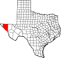
Dell City is located in northeastern Hudspeth County at 31°56′7″N105°12′1″W / 31.93528°N 105.20028°W / 31.93528; -105.20028 (31.935324, –105.200298), [12] in West Texas. It is 13 miles (21 km) north of U.S. Routes 62 and 180, and 4 miles (6 km) south of the New Mexico state line. The Guadalupe Mountains are visible to the east.

According to the United States Census Bureau, the city has a total area of 1.7 square miles (4.3 km2), all land. [5]

It is approximately 90 miles (140 km) from El Paso, which is west of Dell City. [13] Carlsbad, New Mexico, to the northeast, is 90 miles (140 km) away. [14]

It is about 20 miles (32 km) west of the Guadalupe Mountains National Park. Texas Highways states that it is about 45 minutes' travel time away. [9]

Economy

As of 2019, the major sectors were farming and ranching. [13] There were multiple farms owned by families and two cotton gins that provided employment. By 2016, the number of farms had declined. [10] By 2019, several alfalfa growing operations were established and several persons from the Mesilla Valley and the area around Hatch, New Mexico began growing chile peppers on leased land around Dell City. [9]

In 1979, there were three grocery stores and four bars. [10] By 1989, there was only one grocery and general store, Dell City Mercantile, which had burned down in a fire that year. There were also three bars, two gas stations, two restaurants, a hardware store, and a video rental business. [14] In 2016, the city had one grocery store, Two T's Grocery, in a former bar. Additionally as of that year there was one restaurant, Spanish Angel Cafe. [10]

As of 1989, no barber shops were in Dell City, nor were there any in the rest of Hudspeth County. [14]

By 2019, a business owner began operating an Airbnb from several previously disused buildings. [9]

Healthcare

In 1989, there was one doctor who had office hours on Wednesdays in Dell City, but otherwise townfolk had to travel to El Paso to get medical appointments. As of 1989, the closest hospital was in El Paso. [14]

Townscape

There are no traffic lights in town. Several of the buildings are in an adobe style. As it was established in the 20th century, it lacks prior architecture found in other small towns in Texas. [9]

Education

Dell City School Dell City ISD school.jpg
Dell City School

The area is served by the Dell City Independent School District. [15] The district has just one school, covering grades kindergarten through 12. In 1949, a teacher from Sierra Blanca Independent School District was sent to Dell City on request by Dell City residents, and another teacher, Grace Grebing, took over the role in 1950; she became the first superintendent of Dell City ISD. [8]

The district operates Grace Grebing Public Library, which also serves as a community library for Dell City. [16] It was named after a longtime teacher. [8]

Hudspeth County is within the official service area of El Paso Community College. [17]

Demographics

Historical population
CensusPop.Note
1970 383
1980 49529.2%
1990 56914.9%
2000 413−27.4%
2010 365−11.6%
2020 245−32.9%
U.S. Decennial Census [18]

2020 census

Dell City racial composition [19]
(NH = Non-Hispanic) [lower-alpha 1]
RaceNumberPercentage
White (NH)8434.29%
Black or African American (NH)10.41%
Native American or Alaska Native (NH)41.63%
Mixed/Multi-Racial (NH)72.86%
Hispanic or Latino 14960.82%
Total245

As of the 2020 United States census, there were 245 people, 83 households, and 30 families residing in the city.

2000 census

As of the census [3] of 2000, 413 people, 155 households, and 119 families resided in the city. The population density was 250.1 inhabitants per square mile (96.6/km2). The 226 housing units averaged 136.9 per square mile (52.9/km2). The racial makeup of the city was 61.50% White, 1.45% African American, 1.94% Native American, 0.24% Asian, 32.69% from other races, and 2.18% from two or more races. Hispanic or Latinos of any race were 69.25% of the population.

Of the 155 households, 36.8% had children under the age of 18 living with them, 63.9% were married couples living together, 11.6% had a female householder with no husband present, and 22.6% were not families. About 20.6% of all households were made up of individuals, and 7.7% had someone living alone who was 65 years of age or older. The average household size was 2.66 and the average family size was 3.11.

In the city, the population was distributed as 30.5% under the age of 18, 6.3% from 18 to 24, 21.8% from 25 to 44, 28.1% from 45 to 64, and 13.3% who were 65 years of age or older. The median age was 37 years. For every 100 females, there were 105.5 males. For every 100 females age 18 and over, there were 95.2 males.

The median income for a household in the city was $19,602, and for a family was $21,667. Males had a median income of $24,135 versus $18,571 for females. The per capita income for the city was $9,580. About 26.4% of families and 29.4% of the population were below the poverty line, including 33.1% of those under age 18 and 38.6% of those age 65 or over.

Climate

Climate data for Dell City, Texas
MonthJanFebMarAprMayJunJulAugSepOctNovDecYear
Record high °F (°C)81
(27)
87
(31)
93
(34)
101
(38)
108
(42)
115
(46)
112
(44)
108
(42)
105
(41)
101
(38)
90
(32)
79
(26)
115
(46)
Mean daily maximum °F (°C)60.0
(15.6)
64.8
(18.2)
72.7
(22.6)
80.8
(27.1)
89.4
(31.9)
97.6
(36.4)
97.3
(36.3)
94.9
(34.9)
88.8
(31.6)
80.5
(26.9)
68.4
(20.2)
59.3
(15.2)
79.5
(26.4)
Mean daily minimum °F (°C)25.4
(−3.7)
30.0
(−1.1)
35.6
(2.0)
42.9
(6.1)
52.6
(11.4)
60.9
(16.1)
64.8
(18.2)
63.5
(17.5)
56.2
(13.4)
44.4
(6.9)
32.2
(0.1)
25.6
(−3.6)
44.5
(6.9)
Record low °F (°C)3
(−16)
−9
(−23)
11
(−12)
20
(−7)
32
(0)
44
(7)
53
(12)
50
(10)
34
(1)
21
(−6)
9
(−13)
−5
(−21)
−9
(−23)
Average precipitation inches (mm)0.43
(11)
0.59
(15)
0.28
(7.1)
0.27
(6.9)
0.89
(23)
0.94
(24)
1.48
(38)
1.89
(48)
1.74
(44)
0.99
(25)
0.54
(14)
0.52
(13)
10.55
(268)
Source: The Western Regional Climate Center [21]

Media

The Dell Valley Review began publication in Dell City in 1956. It became known as the Hudspeth County Herald in 1964. [22] Its offices are now in Odessa. The publication maintains a mailing address PO Box in Fort Hancock. [23] The full name is Hudspeth County Herald and Dell Valley Review. In 2012 the newspaper had one employee, who served as the editor. [24]

In culture

The filmmaker Josh Carter, beginning in 2002, assisted the creation of four films created by natives of Dell City, and he spliced them into a single work called Tales from Dell City, Texas, released in 2012. Catsoulis wrote that the film "immortalizes a dusty slice of vanishing Americana, delivering a parched ode to hard work, endurance and desert dreams." [11]

Notable people

Related Research Articles

<span class="mw-page-title-main">Hudspeth County, Texas</span> County in Texas, United States

Hudspeth County is a county located in the U.S. state of Texas. As of the 2020 census, the population was 3,202. Its county seat is Sierra Blanca, and the largest community is Fort Hancock. The county is named for Claude Benton Hudspeth, a state senator and United States Representative from El Paso. It is northeast of the Mexico–U.S. border.

<span class="mw-page-title-main">El Paso County, Texas</span> County in Texas, United States

El Paso County is the westernmost county in the U.S. state of Texas. As of the 2020 census, the population was 865,657, making it the ninth-most populous county in the state of Texas. Its seat is the city of El Paso, the sixth-most populous city in Texas and the 22nd-most populous city in the United States. The county was created in 1850 and later organized in 1871.

<span class="mw-page-title-main">Otero County, New Mexico</span> County in New Mexico, United States

Otero County is a county located in the U.S. state of New Mexico. As of the 2020 census, the population was 67,839. Its county seat is Alamogordo. Its southern boundary is the Texas state line. It is named for Miguel Antonio Otero, the territorial governor when the county was created.

<span class="mw-page-title-main">Converse, Texas</span> City in Texas, United States

Converse is a city in Bexar County, Texas, United States, 15 miles (24 km) northeast of downtown San Antonio. As of the 2020 census, it had a population of 27,466. It is part of the San Antonio Metropolitan Statistical Area.

<span class="mw-page-title-main">Liverpool, Texas</span> City in Texas, United States

Liverpool is a city in Brazoria County, Texas, United States, named after the city of Liverpool in England. It is located along the Union Pacific Railroad and County Road 171, northeast of Angleton and south of Alvin. The population was 482 at the 2010 census.

<span class="mw-page-title-main">Baird, Texas</span> City in Texas, United States

Baird is a city and the county seat of Callahan County, Texas, United States. Its population was 1,496 at the 2010 census. The city is named after Matthew Baird, the owner and director of the Texas and Pacific Railway. The railway depot is now operated as the visitor center and a transportation museum.

<span class="mw-page-title-main">Dimmitt, Texas</span> City in Texas, United States

Dimmitt is a city and county seat in Castro County, Texas, United States. Its population was 4,393 at the 2010 census.

<span class="mw-page-title-main">Anthony, Texas</span> Town in Texas, United States

Anthony is an incorporated town in El Paso County, Texas, United States. The population was 5,011 at the 2010 census. As of July 1, 2018, the population estimate for the town from the U.S. Census was 5,655. It is the first town encountered in Texas when traveling southbound on Interstate 10 from New Mexico.

<span class="mw-page-title-main">Socorro, Texas</span> City in Texas, United States

Socorro is a city in El Paso County, Texas, United States. It is located on the north bank of the Rio Grande southeast of El Paso, and on the border of Mexico. El Paso adjoins it on the west and the smaller city of San Elizario on the southeast; small unincorporated areas of El Paso County separate it from the nearby municipalities of Horizon City to the north and Clint to the east. As of the 2020 census, the city population was 34,306. By the 2010 census, the number had grown to 32,013. As of July 1, 2019, the population estimate for the city from the U.S. Census was 34,370. It is part of the El Paso Metropolitan Statistical Area. The city is El Paso County's second-largest municipality, after El Paso. It has a council-manager type of government with five city council members. Socorro is the 93rd-largest community in Texas.

<span class="mw-page-title-main">Tornillo, Texas</span> Census-designated place in Texas, United States

Tornillo is a census-designated place (CDP) and border town in El Paso County, Texas, United States. The population was 1,568 at the 2010 census. It is part of the El Paso Metropolitan Statistical Area. The Tornillo and Guadalupe, Chihuahua, area is connected by the Tornillo–Guadalupe International Bridge.

<span class="mw-page-title-main">Vinton, Texas</span> Village in Texas, United States

Vinton is a village in El Paso County, Texas, United States. The population was 1,971 at the 2010 census. It is part of the El Paso Metropolitan Statistical Area.

<span class="mw-page-title-main">Memphis, Texas</span> City in Texas, United States

Memphis is a city and the county seat of Hall County, Texas, United States. As of the 2010 census, the population was 2,290.

<span class="mw-page-title-main">Fort Hancock, Texas</span> Census-designated place in Texas, United States

Fort Hancock is an unincorporated community and census-designated place (CDP) in Hudspeth County, Texas, United States. Its population was 1,213 at the 2020: DEC Redistricting Data.

<span class="mw-page-title-main">Sierra Blanca, Texas</span> County Seat & Unincorporated community in Texas, United States

Sierra Blanca is an unincorporated area in Hudspeth County, Texas, United States. It is also the county seat of the county and the namesake of a census-designated place (CDP) in which it is located. The town is part of the Trans-Pecos region of far West Texas, is located northeast of the Mexican border and is within the Mountain Time Zone. As of the 2010 census, its population was 553.

<span class="mw-page-title-main">Brackettville, Texas</span> City in Texas, United States

Brackettville is a city in Kinney County, Texas, United States. The population was 1,688 at the 2010 census, down from 1,876 at the 2000 census. It is the county seat of Kinney County.

<span class="mw-page-title-main">Hallettsville, Texas</span> City in Texas, United States

Hallettsville is a city in Lavaca County, Texas, United States. Its population was 2,731 at the 2020 census. It is the county seat of Lavaca County. Hallettsville also has a sizable German-Texan population, as the town founders were mainly German and Czech immigrants.

<span class="mw-page-title-main">Dell City Independent School District</span> School district in Texas

Dell City Independent School District (DCISD) is a public school district based in Dell City, Texas (USA). The district operates Dell City School, which covers grades Kindergarten through 12 and serves students in northern Hudspeth County. Dell City School is classified as a 1A school by the UIL. In 2016, the school was rated "Improvement Required" by the Texas Education Agency. In addition to northern Hudspeth County, it also serves areas of southeast Otero County, New Mexico as part of an inter-district agreement with Alamogordo Public Schools due to the area's lack of proximity to the Alamogordo district's schools.

<span class="mw-page-title-main">Sierra Blanca Independent School District</span> School district in Sierra Blanca, Texas

Sierra Blanca Independent School District is a public school district based in the community of Sierra Blanca, Texas (USA).

The El Paso Metropolitan Statistical Area, as defined by the United States Census Bureau, is an area consisting of two counties – El Paso and Hudspeth – in far West Texas, anchored by the city of El Paso. As of the 2020 United States Census, the MSA had a population of 868,859. The El Paso MSA forms part of the larger El Paso–Las Cruces combined statistical area, with a total population of 1,088,420 as of the 2020 United States Census.

<span class="mw-page-title-main">Acala, Texas</span> Ghost Town in Texas, United States

Acala is a ghost town in Hudspeth County, Texas, United States, located 34 miles northwest of Sierra Blanca and 54 miles southeast of El Paso, with a current population of approximately 25. Acala is located on Highway 20. Acala was named for acala cotton, a type of cotton produced in Mexico.

References

  1. "2019 U.S. Gazetteer Files". United States Census Bureau. Retrieved August 7, 2020.
  2. "Population and Housing Unit Estimates". United States Census Bureau. May 24, 2020. Retrieved May 27, 2020.
  3. 1 2 "U.S. Census website". United States Census Bureau . Retrieved January 31, 2008.
  4. "US Board on Geographic Names". United States Geological Survey. October 25, 2007. Retrieved January 31, 2008.
  5. 1 2 "Geographic Identifiers: 2010 Census Summary File 1 (G001): Dell City city, Texas". American Factfinder. U.S. Census Bureau. Archived from the original on February 13, 2020. Retrieved March 19, 2018.
  6. "N". Texas Tech University Southwest Collection/Special Collections Library. Retrieved September 15, 2012.
  7. "Dell City Texas". Texas Escapes. Retrieved September 15, 2012.
  8. 1 2 3 "Grace Grebing: A Leader and Her Legacy" (PDF). Dell City Independent School District. February 2021. Retrieved April 16, 2021. - HTML preview
  9. 1 2 3 4 5 Patoski, Joe Nick (October 31, 2019). "My Hometown: A New Frontier of the Old West in Dell City". Texas Highways . Texas Department of Transportation . Retrieved April 19, 2021.
  10. 1 2 3 4 5 Onsurez, Jessica (March 5, 2016). "Dell City changing as population drops". El Paso Times . Carlsbad Current-Argus . Retrieved April 17, 2021. - Alternate link - Alternate version: "Dell City, Texas: Ghost town in the making? (with Mark R. Lambie)
  11. 1 2 Catsoulis, Jeanne (May 18, 2012). "Down and Out in West Texas". The New York Times . Retrieved April 19, 2021.
  12. "US Gazetteer files: 2010, 2000, and 1990". United States Census Bureau. February 12, 2011. Retrieved April 23, 2011.
  13. 1 2 Falk, Mallory (January 19, 2019). "For Rural School Districts, Filling Key Teaching Positions Can Be A Challenge". KUT 90.5 . Retrieved April 16, 2021.
  14. 1 2 3 4 Belkin, Lisa (October 11, 1989). "Dell City Journal; After Fire, A Town's Strength Is Tested". The New York Times . Retrieved July 28, 2021.
  15. "SCHOOL DISTRICT REFERENCE MAP (2010 CENSUS): Hudspeth County, TX" (PDF). U.S. Census Bureau . Retrieved April 16, 2021.
  16. "Grace Grebing Public Library". Dell City ISD. Retrieved April 16, 2021.
  17. Texas Education Code, Section 130.178, "El Paso County Community College District Service Area".
  18. "Census of Population and Housing". Census.gov. Retrieved June 4, 2015.
  19. "Explore Census Data". data.census.gov. Retrieved May 19, 2022.
  20. "About the Hispanic Population and its Origin". www.census.gov. Retrieved May 18, 2022.
  21. "Seasonal Temperature and Precipitation Information". Western Regional Climate Center. Retrieved April 1, 2013.
  22. "Hudspeth County Area Newspaper Collection". University of North Texas . Retrieved April 19, 2021.
  23. "Hudspeth County Herald". Texas Press Association . Retrieved April 19, 2021. Mailing Address: PO Box 128, Fort Hancock, TX 79839 Street Address: 1009 S Crane Ave, Odessa, TX 79763
  24. "About Hudspeth County Herald". Hudspeth County Herald. August 25, 2012. Archived from the original on August 25, 2012. Retrieved April 19, 2021.
  1. Note: the US Census treats Hispanic/Latino as an ethnic category. This table excludes Latinos from the racial categories and assigns them to a separate category. Hispanics/Latinos can be of any race. [20]