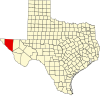
Hudspeth County is a county located in the U.S. state of Texas. As of the 2020 census, the population was 3,202. Its county seat is Sierra Blanca, and the largest community is Fort Hancock. The county is named for Claude Benton Hudspeth, a state senator and United States Representative from El Paso. It is northeast of the Mexico–U.S. border.

Fort Bliss is a United States Army post in New Mexico and Texas, with its headquarters in El Paso, Texas. Named in honor of LTC William Bliss (1815–1853), a mathematics professor who was the son-in-law of President Zachary Taylor, Ft. Bliss has an area of about 1,700 square miles (4,400 km2); it is the largest installation in FORSCOM and second-largest in the Army overall. The portion of the post located in El Paso County, Texas, is a census-designated place with a population of 8,591 as of the time of the 2010 census. Fort Bliss provides the largest contiguous tract of restricted airspace in the Continental United States, used for missile and artillery training and testing, and at 992,000 acres boasts the largest maneuver area. The garrison's land area is accounted at 1.12 million acres, ranging to the boundaries of the Lincoln National Forest and White Sands Missile Range in New Mexico. Fort Bliss also includes the Castner Range National Monument.

Fort Stockton is a city in and the county seat of Pecos County, Texas, United States. It is located on Interstate 10, future Interstate 14, U.S. Highways 67, 285, and 385, and the Santa Fe Railroad, 329 mi (529 km) northwest of San Antonio and 240 mi (390 km) southeast of El Paso. Its population was 8,466 at the 2020 census.
The New Mexico campaign was a military operation of the trans-Mississippi theater of the American Civil War from February to April 1862 in which Confederate Brigadier General Henry Hopkins Sibley invaded the northern New Mexico Territory in an attempt to gain control of the Southwest, including the gold fields of Colorado and the ports of California. Historians regard this campaign as the most ambitious Confederate attempt to establish control of the American West and to open an additional theater in the war. It was an important campaign in the war's Trans-Mississippi Theater, and one of the major events in the history of the New Mexico Territory in the American Civil War.
The Battle of Devil's Backbone, also known as the Action at Devil's Backbone, was a military engagement in the Trans-Mississippi Theater of the American Civil War. Devil's Backbone is a ridge in the Ouachita Mountains approximately 4 miles (6.4 km) southwest of Greenwood, Arkansas. The battle was fought on September 1, 1863, in Sebastian County, Arkansas. The Union victory ensured the safety of the Fort Smith garrison until the end of the war.

The First Battle of Newtonia was fought on September 30, 1862, between Confederate soldiers commanded by Colonel Douglas H. Cooper and a Union column commanded by Brigadier General Frederick Salomon near Newtonia, Missouri, during the American Civil War. Cooper's force had moved into southwestern Missouri, and encamped near the town of Newtonia. The Confederate column was composed mostly of cavalry led by Colonel Joseph O. Shelby and a brigade of Native Americans. A Union force commanded by Brigadier General James G. Blunt moved to intercept Cooper's force. Blunt's advance force, led by Salomon, reached the vicinity of Newtonia on September 29, and attacked Cooper's position on September 30. A Union probing force commanded by Colonel Edward Lynde was driven out of Newtonia by Cooper's forces on the morning of the 30th.

Fort Davis National Historic Site is a United States National Historic Site located in the unincorporated community of Fort Davis, Jeff Davis County, Texas. Located within the Davis Mountains of West Texas, the historic site was established in 1961 to protect one of the best remaining examples of a United States Army fort in the southwestern United States.

California's involvement in the American Civil War included sending gold east to support the war effort, recruiting volunteer combat units to replace regular U.S. Army units sent east, in the area west of the Rocky Mountains, maintaining and building numerous camps and fortifications, suppressing secessionist activity and securing the New Mexico Territory against the Confederacy. The State of California did not send its units east, but many citizens traveled east and joined the Union Army there, some of whom became famous.

The Pacific coast theater of the American Civil War consists of major military operations in the United States on the Pacific Ocean and in the states and Territories west of the Continental Divide. The theater was encompassed by the Department of the Pacific that included the states of California, Oregon, and Nevada, the territories of Washington, Utah, and later Idaho.

The California Column was a force of Union volunteers sent to Arizona and New Mexico during the American Civil War. The command marched over 900 miles (1,400 km) from California through Arizona and New Mexico Territory to the Rio Grande and as far east as El Paso, Texas, between April and August 1862.
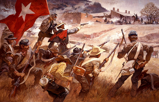
The Forts of Texas include a number of historical and operational military installations. For over 200 years, various groups fought over access to or control over the region that is now Texas. Possession of the region was claimed and disputed by the European powers of Spain and France, and the continental countries of Mexico, the United States, the Republic of Texas, and the Confederate States of America. Ownership of specific lands was claimed and disputed by different ethnic groups, including numerous Native American tribes, Mexican residents, Anglo- and African-American settlers, and European immigrants. Access to and control of resources were claimed and disputed by various economic groups, including indigenous hunter/gatherers, farmers, herders, ranchers, colonists, settlers, buffalo hunters, traders, bandits, smugglers, pirates, and revolutionaries. Over the centuries, claims and disputes were enforced by Native American warriors, Spanish conquistadors, French cavaliers, Texas Rangers, local militias, and uniformed regular army regiments of Spain, Mexico, Texas, the United States, and the Confederacy.

The Fort McKavett State Historic Site is a former United States Army installation located in Menard County, Texas. The fort was first established in 1852 as part of a line of forts in Texas intended to protect migrants traveling to California. The fort was deemed unnecessary and abandoned in 1859 and was occupied by settlers. From 1861 to 1863, during the American Civil War, the fort became an outpost of Confederate forces on the Texas frontier until they left for other theaters of the war. When the US Army returned to Texas in the later 1860s, the fort was reoccupied and rebuilt, and became a base for the "Buffalo Soldier", or all-African American, 24th Infantry and 9th Cavalry Regiments.
The Company A, Arizona Rangers was a cavalry formation of the Confederate States Army during the American Civil War.

Fort Clark was a frontier fort located just off U.S. Route 90 near Brackettville, in Kinney County, Texas, United States. It later became the headquarters for the 2nd Cavalry Division. The Fort Clark Historic District was added to the National Register of Historic Places on December 6, 1979. The Commanding Officer's Quarters at Fort Clark were designated a Recorded Texas Historic Landmark in 1988. The Fort Clark Guardhouse became a Recorded Texas Historic Landmark in 1962. The Fort Clark Officers' Row Quarters were designated a Recorded Texas Historic Landmark in 1991.

The El Paso–Las Cruces, Texas–New Mexico, combined statistical area consists of two counties in western Texas and one in southern New Mexico. This CSA was defined as part of the United States Office of Management and Budget's 2013 delineations for metropolitan, micropolitan, and combined statistical areas.< As of the 2023 United States Census Estimate, the El Paso-Las Cruces CSA had a population of 1,098,541 making it the 56th largest combined statistical area in the United States. The statistical area consists of the metropolitan areas of El Paso, Texas and Las Cruces, New Mexico. This CSA has a GDP of about $33 billion and would rank 58th nationally among all CSA or metro areas. The total land area of the El Paso–Las Cruces combined statistical area is 9,402 sq. mi.
Birchville, or Smith Ranch, now a ghost town, was located in what is now Hudspeth County, Texas, United States. Birchville was a settlement on the San Antonio-El Paso Road in what was El Paso County. Birchville lay 35 miles northwest of the First Camp on Rio Grande and 24.8 miles southeast of San Elizario, according to the table of distances for the San Antonio-San Diego Mail Line in the Texas Almanac of 1857. Later used as a station on the Butterfield Overland Mail, the distances to the station for that line were given as 241⁄2 miles from San Elizario, 33 miles from Fort Quitman.

1st Texas Field Battery or Edgar's Company was an artillery battery from Texas that served in the Confederate States Army during the American Civil War. The artillery company formed in November 1860, but was not formally taken into Confederate service until April 1861. The unit participated in the disarming and surrender of United States soldiers and property in Texas in early 1861. The battery marched to Arkansas where in 1862 it joined the infantry division known as Walker's Greyhounds. The battery fought at Milliken's Bend and Richmond (La.), shelled a Federal river transport, and campaigned in south Louisiana in late 1863. The 1st Texas Battery was captured at Henderson's Hill in March 1864. The soldiers were later exchanged, and the unit disbanded in 1865 at the end of the conflict.

The 2nd Louisiana Cavalry Regiment was a unit of mounted volunteers recruited in Louisiana that fought in the Confederate States Army during the American Civil War. Breazeale's Cavalry Battalion was formed in July 1862 and was augmented by five additional companies in September 1862 to form a regiment. It served for the entire war west of the Mississippi River in the Trans-Mississippi Department. The regiment fought at Georgia Landing, Fort Bisland, Irish Bend, and Brashear City in 1863 and Henderson's Hill and Mansfield in 1864. Afterward, the regiment fought in minor skirmishes before the Trans-Mississippi's final surrender on 26 May 1865.

The Battle of McGuire's Store was fought at McGuire, Arkansas, near Elkins, between Union forces led by Brigadier General Francis J. Herron and Confederate forces under Colonel Jesse L. Cravens during the American Civil War. The skirmish was the result of an attempt by Union Brigadier General John Schofield to trap a body of Confederate cavalry reported to be at McGuire's Store. In the event, the operation failed when Herron's column took the wrong road and approached from the west instead of the north. Herron's well-equipped troops attacked Cravens' poorly armed and demoralized Texas cavalrymen and drove them off. This minor clash and other events caused Confederate Major General Thomas C. Hindman to suspend his intended advance to recover northwestern Arkansas and withdraw to the Arkansas River. Ironically, most of Schofield's soldiers also retreated to Missouri after the fight. Though the clash was minor, it marked one pulse of the ebb and flow of the war in northwest Arkansas.