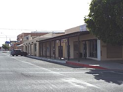
Founded in 1908, the town was named after Ely Parker, the first Native American commissioner for the U.S. government. The original town site of Parker was surveyed and laid out in 1909 by Earl H. Parker, a railroad location engineer for the Arizona & California Railway. The town officially incorporated in 1948 and became the county seat for the newly created La Paz County on January 1, 1983.
Camp Colorado and Parkers Landing
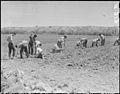
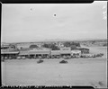
The town's name and origin began when a post office called Parker was established January 6, 1871, at Parker's Landing and the site of the Parker Indian Agency, named for Ely Parker, on the Colorado River Indian Reservation, four miles downriver from the site of the railroad bridge of the modern town, to serve the Indian agency.[4][5][6]:118 What became Parkers Landing was established on the river as the place to land and pick up cargo and personnel for the Indian Agency and the U. S. Army detachment that was stationed there at Camp Colorado from 1864 to 1869, during the first years of the Reservation. Camp Colorado was abandoned after sparks from the departing steamboat Cocopah rapidly burned down the brush huts of the officers of the garrison, and endangered its barracks and storehouses. [7]:66,n.61[8]
According to the United States Census Bureau, the town has a total area of 22.0 square miles (57km2), of which 22.0 square miles (57km2) is land and 0.05% is water.
According to Census Bureau maps, the town is divided into two non-contiguous sections; the northern section consists of the original town and is located in the Colorado River Indian reservation and the southern section consists of a larger, roughly rectangular section of largely undeveloped territory. The undeveloped territory consist of extensive unpaved roads. Of the few that are paved, Mohave Road is the most utilized between the town and the territory. The same road can be taken 15.5 miles south to the town of Poston, which is noted for its relocation camps for Japanese Americans during World War II.
Climate
Parker has an arid climate classification, which is characterized by extremely hot summers and warm winters.
Wintertime highs in Parker are generally in the upper 60s to lower 70s. Lows during the winter are between 40 and 50°F (4.4 and 10.0°C) with an occasional morning dipping below 32°F (0°C). The all-time lowest recorded temperature in Parker occurred on December 31, 1911, when temperatures bottomed out at 9°F (−12.8°C); however, snow has been recorded only once when 3.0 inches (0.08m) fell on one day in December 1932,[10] and no maximum below 32°F (0°C) has ever been observed.[11]
Summers in Parker can be dangerously hot, with highs in June, July, August, and September remaining in the 100 to 110°F (37.8 to 43.3°C) range, days over 115°F (46.1°C) or even 120°F (48.9°C) are not rare.
April and May both average 90 to 100°F (32.2 to 37.8°C) daytime highs. Even the month of October has an average high of 90.0°F (32.2°C). The all-time highest recorded temperature in Parker was 127°F (52.8°C), which occurred on July 7, 1905. This was, at the time, the all-time record high temperature in Arizona history until Lake Havasu City reached 128°F (53.3°C) on June 29, 1994.
Rainfall is uniformly scanty throughout the year in Parker, with no month averaging more than three days with measurable rainfall. The monsoon storms that provide much of the rain in southern and eastern parts of Arizona seldom effect Parker. The wettest month since records began in 1893 was September 1939, when a rare decaying hurricane produced a total of 8.85 inches (224.8mm) including a record daily total of 3.41 inches (86.6mm) on the fifth day of that month. The wettest calendar year has been 1992 with 13.59 inches (345.2mm) – though from July 1992 to June 1993 the figure was slightly higher still at 13.74 inches (349.0mm) – and the driest 1956 with 0.34 inches (8.6mm).[10]
Climate data for Parker, Arizona, 1991–2020 normals, extremes 1893–present
As of the census[18] in 2000, there were 3,140 people, 1,064 households, and 791 families residing in the town. The population density was 142.8 inhabitants per square mile (55.1/km2). There were 1,157 housing units at an average density of 52.6 per square mile (20.3/km2). The racial makeup of the town was 62.0% White, 1.9% Black or African American, 23.1% Native American, 0.9% Asian, 0.2% Pacific Islander, 7.5% from other races, and 4.5% from two or more races. 29.8% of the population were Hispanic or Latino of any race.
There were 1,064 households, out of which 41.5% had children under the age of 18 living with them, 51.6% were married couples living together, 15.6% had a female householder with no husband present, and 25.6% were non-families. 20.6% of all households were made up of individuals, and 8.4% had someone living alone who was 65 years of age or older. The average household size was 2.93 and the average family size was 3.38.
In the town, the population was spread out, with 32.8% under the age of 18, 9.6% from 18 to 24, 25.4% from 25 to 44, 22.8% from 45 to 64, and 9.4% who were 65 years of age or older. The median age was 32 years. For every 100 females, there were 93.9 males. For every 100 females age 18 and over, there were 88.4 males.
The median income for a household in the town was $34,625, and the median income for a family was $37,663. Males had a median income of $26,542 versus $21,006 for females. The per capita income for the town was $15,016. About 10.6% of families and 14.7% of the population were below the poverty line, including 18.2% of those under age 18 and 13.9% of those age 65 or over.
Transportation
Arizona State Route 95 runs through Parker, entering the town from the northeast as Rio Vista Highway then turning south in the intersection with California Avenue. To the north of the intersection with California Avenue is the State Route 95 truck spur, which leads to the Colorado River bridge and the eastern terminus of California State Route 62 in Earp.
The Arizona & California Railroad is headquartered in Parker, after replacing the Santa Fe Railway in 1991 as the owner and operator of the railroad line through the town. It crosses over the Colorado River on a five-span truss bridge near the road bridge to Earp.
La Paz County Health Department operates La Paz County Transit, an on-demand bus service.[19]
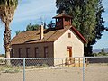
The Old Parker Jail was built in 1914 and located in Pop Harvey City Park. It was listed on the National Register of Historic Places on April 3, 1975, Reference #75000369.
The Old Presbyterian Church a.k.a. Mojave Indian Presbyterian Mission Church, located on the South West corner of 2nd Ave., was built in 1917. It was listed in the National Register of Historic Places on June 3, 1971, Reference #71000122.
This page is based on this Wikipedia article Text is available under the CC BY-SA 4.0 license; additional terms may apply. Images, videos and audio are available under their respective licenses.