
 The Old Parker Jail viewed from a different angle
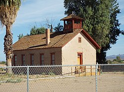 The Old Presbyterian Church a.k.a. Mojave Indian Presbyterian Mission Church
 The Old Presbyterian Church as viewed from a different angle
 The Old Presbyterian Church School
 Old Parker High School
 The Arizona and California Railroad Bridge a.k.a. “The Colorado River Bridge”
 The Trestle of the Arizona and California Railroad Bridge
 The Arizona and California Railroad Station
 The Arizona and California Railroad Station viewed from a different angle
 The Arizona and California Railroad Station Storage-Depot
 Town of Parker railroad car
 The Parker Dam as viewed from Arizona
 The Parker Dam as viewed from California
List of historic properties in Parker, Arizona | |
|---|---|
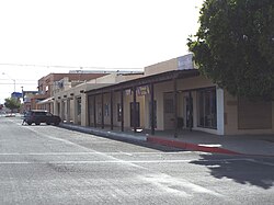 Downtown historic Parker | |
 Location of Parker in La Paz County, Arizona. |
| Part of a series of the |
| Cities, towns and CDPs in Arizona with lists and images of historic properties, forts, cemeteries or historic districts |
|---|
 |
This is a list, which includes a photographic gallery, of some of the remaining structures and monuments, of historic significance in Parker, a town in La Paz County, Arizona. Parker is the county seat of La Paz County, Arizona, United States, [1] on the Colorado River in Parker Valley.


