Brief history
The area surrounding the Bradshaw Mountains was inhabited by the Hohokams, a Native American tribe, and later by their descendants the Yavapai before the arrival and settlement of the people of Anglo European descent from the east coast of the United States.
Joe Mayer (birth name: Joseph Hoffmayer) was a native of Olean, New York, who like so many other American easterners moved to the west coast in search of gold. He changed his surname to "Mayer" and went to Silver City, New Mexico where he met Sarah Belle Wilbur, his future wife. [1] [2] [3]
He then moved to Globe, Arizona and there he married Sarah and spent a year mining. By 1882, Mayer was mining in the Tip Top Mine in Central Arizona. In one occasion he had to go to the City of Prescott and decided to take a short cut from the Black Canyon Trail. During his trip, he made a stop at the “Big Bug Stage Station,” a stage stop on the Black Canyon Stage Line. The station was located on the outskirts of Big Bug Creek. Mayer was impressed with the area and he purchased the “Big Bug Stage Station” for $1,200 in gold. Mayer then moved there with his wife Sarah and children. [1] [2] [3]
Miners would often stop at the Mayer's place to rest and to patronize the store which he had built. In 1882, Joe Mayer officially founded the town which bears his name. In 1884, his wife Sarah became the first postmistress of Mayer. Tragedy struck the town of Mayer in 1890, when heavy rain caused a dam nearby to fail causing a flood which wiped out all of the structures in the town. [1] [2] [3]
Mayer began to rebuild the town and in 1897, he built a two-story hotel which he named the "Mayer Hotel". He offered the "right of way' to the Southern Pacific Railroad if they established a rail line in Mayer. The railroad began servicing the town of Mayer in 1898. Mayer established a brickyard and in 1902, he used his bricks to build a business block, now known as the "Mayer Business Block" across the street from the Mayer Hotel. The block included a saloon with a dance floor, a barber and bath shop, a Mercantile shop and a general store. [1] [2] [3]
On November 28, 1909, Joe Mayor heard a noise outside his house and believing that there was an animal or thief, he took his rifle and ran outside. He tripped as he ran and accidentally shot himself. The wounds which he received were fatal and he died soon after. [1] [2] [3]
This page is based on this
Wikipedia article Text is available under the
CC BY-SA 4.0 license; additional terms may apply.
Images, videos and audio are available under their respective licenses.

 The Mayer Hotel.
 Close-up of the Mayer Hotel.
 The Central Hotel.
 Prescott and Eastern Railroad Depot.
 Pioneer House.
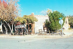
 General Market Store.
 Different view of the General Market Store.
 The Mayer Saloon and the Mayer Dance Floor.
 The Barber Shop and Bath House.
 Mayer Mercantile.
 The original Mayer Post Office.
 Mayer Apartment #1 once a brothel.
 Mayer Apartment #2.
 Mayer Red Brick Schoolhouse.
 Rear view of the Mayer Red Brick Schoolhouse.
 Mayer Smokestack.
 The Smelter ruins.
 The Mayer Bank building.
 Mine-cart which was used in the Bradshaw Mountains in the 1890s.
 Abandoned mine-cart.
 1940 Ford Howard Cooper Fire Truck which once serviced Mayer.


