Eagar Townsite Historic District

Last updated
Eagar Townsite Historic District
Eagar, Arizona 45 N Main St.JPG
"Grapevine Hall" building at 45 N. Main Street
USA Arizona location map.svg
Red pog.svg
Usa edcp location map.svg
Red pog.svg
Location Eagar, Arizona
Coordinates 34°6′29″N109°17′30″W / 34.10806°N 109.29167°W / 34.10806; -109.29167
Area54 acres (22 ha)
Architectural styleNational Folk, Bungalow, Spanish Colonial Revival
NRHP reference No. 93000625 [1]
Added to NRHPJuly 23, 1993

Eagar Townsite Historic District is a section of the town of Eagar, Arizona which has been designated a National Historic Place. Sitting on roughly 54 acres, the site contains 37 structures, 21 of which have historical significance. The period of significance is from 1886, the year the townsite was founded, through 1942, which represents the significant period of development of the town. The site was added to the Register on July 23, 1993.

Contents

History

William La Sueur house, at 287 N. Main Street Eagar, Arizona 287 N Main St.JPG
William La Sueur house, at 287 N. Main Street

The Church of Jesus Christ of Latter-day Saints leaders in Salt Lake City consolidated the Omer and Amity wards into the Union Ward in 1886, the ward was centered on the newly formed townsite of Eagar. The town had been founded by three brothers: John T., William, and Joel Eagar. The Eager brothers had come to the Round Valley area along the Little Colorado in 1879, settling near Springerville in 1882. By 1885 they had relocated further south to the land which would become Eagar. [2] The original townsite was divided as per the Mormon City of Zion concept. That concept was for every square mile was broken up into ten-acre square blocks separated by streets of 132 foot widths. The blocks were then further divided into half-acre lots, each 66 feet wide, creating 20 lots, ten on a side. While Eagar followed the general concept, the blocks and streets were slightly smaller, approximately 500 foot square and 90 foot wide, respectively. An irrigation system was developed, utilizing water from the Little Colorado River by way of the "Big Ditch" canal. [3] The irrigation system is one of the most extensive of any Mormon community in Arizona. [4] In approximately 1890 the oldest structure still extant in the historic district, the Harry Colter house was built at 22 West 2nd Avenue. [5]

During the 1900s, three more of the contributing structures to the historic site were constructed: the William La Sueur House at 287 North Main Street, a folk house at 36 West Central Avenue, and a barn at 236 North Main Street were constructed. [6]

In 1910, Eagar was the third most populous town in Apache County, with 397 citizens in the 1910 census. Through most of the 1910s, through the end of World War I, the town prospered and grew, with an economy based on timber, cattle, sheep, and wool. The economy went into a slump with the collapse of commodity prices at the end of the World War, but the town had grown to 635 people by the 1920 census. In 1916 the Grapevine social hall, one of the contributing buildings to the present historic site, was constructed. [7] Initially it was used for various social and community functions, such as dances, plays, benefits, and even served as a school classroom. When the township's high school opened, it became their basketball court in the 1920s. It was also the first electrically building in Eagar in 1927. [8] In addition to the Grapevine structure, the 1910s also saw the construction of two other contributing buildings, both folk houses; one at 286 North Eagar Street and the other at 81 North Eagar Street. [9]

Ten of the contributing properties of the historic district were built during the 1920s: seven bungalow-style houses, a folk house, a commercial building and a barn. [10] The barn was part of the Joe Udall homestead, which consisted of an adobe house and the barn, which at the time was the largest barn in the town. [11] The last three contributing buildings were all constructed around 1930. They were pueblo revival style house located at 266 North Main Street, a pueblo revival style duplex which sits at 28 North Main Street, and the Spanish colonial revival style house located at 60 East Central Avenue. [12]

Description of site

EagerTownsiteHistoricDistrictMap EagerTownsiteHistoricDistrictMap.jpg
EagerTownsiteHistoricDistrictMap

The historic site consists of two discontiguous sections, separated by a city block. The northern section is irregularly shaped, stretching from northern side of Second Avenue to the northern side of Third Avenue, from Eagar street to Harless Street. The southern section is smaller, and also irregularly shaped, lying between First and Central Avenues, and from Eagar Street to just beyond Main Street. [13] Both sections sit within the 1+12-mile by 1/4 mile area of the original townsite. While areas outside the historic district have seen significant development and alterations, within the two sections of the historic district much of the original historic character of the structures has been retained. [14]

The block between the two sections of the historic site used to be filled with historic residences and the original Latter-Day Saints church. All have been demolished, and the blocks now contain the modern LDS church (east of Main Street), and a recent motel (west of Main). [15]

Most of the historic structures lie on either Main Street (nine) or Eagar Street (seven), with the five on either Second or Central Avenues. [16] The most northern building is a bungalow style house sitting at 313 North Main Street, while the southernmost structure is the Udall Barn. The Grapevine Hall sits on Main Street in the southern section of the site, while the Harry Colter and Leseur homes are located on Main Street in the northern section. The Leseur home is unusual in Eagar in that it is constructed of red brick, and in the Georgian Revival style. [17]

Historic structures and markers

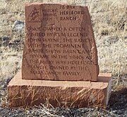
The town of Eagar has various structures and locations which the town's historic society consider historical. These are identified with a marker which resemble a tombstone. Among them are those which have the markers description and which are pictured and listed here. [18]

See also

Related Research Articles

<span class="mw-page-title-main">Eagar, Arizona</span> Town in Apache County, Arizona

Eagar is a town in Apache County, Arizona, United States. As of the 2010 census, the population of the town was 4,885.

<span class="mw-page-title-main">Phantom Ranch</span> Historic Grand Canyon lodging

Phantom Ranch is a lodge inside Grand Canyon National Park in Arizona. It sits at the bottom of Grand Canyon, on the east side of Bright Angel Creek, a little over half a mile north of the Creek's confluence with the Colorado River. Opened in 1922, Phantom Ranch is a member of Historic Hotels of America, the official program of the National Trust for Historic Preservation.

<span class="mw-page-title-main">General Artemas Ward House</span> Historic house in Massachusetts, United States

The General Artemas Ward House is a historic house at 786 Main Street in Shrewsbury, Massachusetts. Commonly known as the "Artemas Ward House", it was the lifelong home of Artemas Ward, American Major General in the American Revolutionary War and a Congressman from Massachusetts. The house is listed on the National Register of Historic Places.

<span class="mw-page-title-main">Lookout Studio</span> United States historic place

Lookout Studio, known also as The Lookout, is a stone building located on the South Rim of the Grand Canyon, within Grand Canyon National Park in Arizona. It is part of the Grand Canyon Village Historic District, and is part of the Mary Jane Colter Buildings National Historic Landmark. It currently operates as a gift shop and observation station for visitors, with telescopes on its outdoor terrace. Lookout Studio was constructed by the Santa Fe Railway in 1914 and was established as a photography studio to compete with Kolb Studio. It is one of six buildings at the Grand Canyon that were designed by architect Mary Colter, along with Bright Angel Lodge, Hermit's Rest, Hopi House, Phantom Ranch, and Desert View Watchtower. Lookout Studio employs her signature rustic style of using jagged native rocks to imitate indigenous structures of the region and to blend in with the environment.
<span class="mw-page-title-main">Snyder, New York</span> Hamlet in New York, United States

Snyder is a hamlet within the town of Amherst in Erie County, New York, that is part of the Buffalo–Niagara Falls metropolitan area. The hamlet was established in 1837. It was named for Michael Snyder, its first postmaster, who also operated a store at the corner of Harlem Road, which is also known as New York State Route 240, and Main Street, which is also known as New York State Route 5. The hamlet blossomed due to retail activity demand created along the Main Street transportation route between Buffalo and points to the east in the 19th and early 20th century.

<span class="mw-page-title-main">Desert View Watchtower</span> United States historic place

Desert View Watchtower, also known as the Indian Watchtower at Desert View, is a 70-foot (21 m)-high stone building located on the South Rim of the Grand Canyon within Grand Canyon National Park in Arizona, United States. The tower is located at Desert View, more than 20 miles (32 km) to the east of the main developed area at Grand Canyon Village, toward the east entrance to the park. The four-story structure, completed in 1932, was designed by American architect Mary Colter, an employee of the Fred Harvey Company who also created and designed many other buildings in the Grand Canyon vicinity including Hermit's Rest and the Lookout Studio. The interior contains murals by Fred Kabotie.
<span class="mw-page-title-main">Lorado Taft Midway Studios</span> United States historic place

The Lorado Taft Midway Studios are a historic artist studio complex at South Ingleside Avenue and East 60th Street, on the campus of the University of Chicago on the South Side of Chicago. The architecturally haphazard structure, originating as two converted barns and a Victorian house, was used from 1906 to 1929 as the studio of Lorado Taft (1860-1936), one of the most influential sculptors of the period. A National Historic Landmark, it now houses the university's visual arts department.
<span class="mw-page-title-main">Hopi House</span> United States historic place

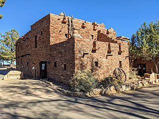
Hopi House is located on the South Rim of the Grand Canyon, within Grand Canyon National Park in the U.S. state of Arizona. Built in 1904 as concessioner facilities at the South Rim were being developed, it is the first of eight projects at the Grand Canyon that were designed by architect Mary Colter, along with Bright Angel Lodge, Hermit's Rest, Lookout Studio, Phantom Ranch, Desert View Watchtower, Colter Hall and Victor Hall,. Hopi House was built by the Fred Harvey Company as a market for Native American crafts, made by artisans on the site. The Hopi, as the historic inhabitants of the area, were chosen as the featured artisans, and the building was designed to closely resemble a traditional Hopi pueblo. Hopi House opened on January 1, 1905, two weeks before the El Tovar Hotel, located just to the west, was opened.

<span class="mw-page-title-main">Summerseat (Morrisville, Pennsylvania)</span> Historic house in Pennsylvania, United States

Summerseat, also known as the George Clymer House and Thomas Barclay House, is a historic house museum at Hillcrest and Legion Avenues in Morrisville, Bucks County, Pennsylvania. Built about 1765, it is the only house known to have been owned by two signers of the United States Declaration of Independence, Founding Fathers George Clymer and Robert Morris, and as a headquarters of General George Washington during the American Revolutionary War. The house is now managed by the Morrisville Historical Society, which offers tours. It was designated a National Historic Landmark in 1965.

<span class="mw-page-title-main">AMK Ranch</span> United States historic place

The AMK Ranch is a former personal retreat on the eastern shore of Jackson Lake in Grand Teton National Park. Also known as the Merymare, Lonetree and Mae-Lou Ranch, it was a former homestead, expanded beginning in the 1920s by William Louis Johnson, then further developed in the 1930s by Alfred Berol (Berolzheimer). Johnson built a lodge, barn and boathouse in 1927, while Berol added a larger lodge, new boathouse, and cabins, all in the rustic style.
<span class="mw-page-title-main">Iowa State Fairgrounds</span> United States historic place

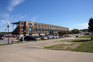
The Iowa State Fairgrounds is located on the east side of Des Moines, Iowa. It annually hosts the Iowa State Fair in late summer. The state fair was begun in Iowa in 1854 and the current fairgrounds were established in 1886. The fairgrounds were listed as a historic district on the National Register of Historic Places in 1987 as the Iowa State Fair and Exposition Grounds.

<span class="mw-page-title-main">Worland Ranch</span> Historic house in Wyoming, United States

The Worland Ranch is a historic district that includes the farmstead established in 1900 by C.F. "Dad" Worland near his namesake town of Worland, Wyoming, United States. The site was in fact the original townsite, with the Worland post office located on the grounds. The present town developed just to the east on the broad flatlands east of the Bighorn River. The original townsite is commemorated by an inscribed stone marker.

<span class="mw-page-title-main">Wientjes Barn and Ranch Yard</span> United States historic place

The Wientjes Barn and Ranch Yard are a historic farm property in rural Campbell County, South Dakota. It consists of a barn and ranch yard located amid other farm buildings near the junction of 299th Avenue and 117th Street, west-southwest of Mound City. The barn, built in 1909, is a large wood-frame structure with a gambrel roof and integral shed extensions on the long sides, bringing the structure to a shape that is 64 feet (20 m) square. The yard is divided into several sections, with corrals south and west of the barn, with a calf shed measuring 50 by 25 feet where the two corrals meet. The barn was built by Claus Wientjes, a Dutch immigrant, and is a high quality example of the increasingly rare rural South Dakota barn.

The Broad View Ranch Historic District is a nationally recognized agricultural historic district located northwest of Sheldon, Iowa, United States. It was listed on the National Register of Historic Places in 1994. At the time of its nomination it contained 19 resources, which included nine contributing buildings, one contributing site, four contributing structures, and two non-contributing structures.

<span class="mw-page-title-main">Colter Ranch Historic District</span> Historic district in Arizona, United States

The Colter Ranch Historic District consists of twelve buildings in a rural setting near Eagar, Arizona. The site is located in the Amity Valley, which itself is part of Round Valley ; the Little Colorado River runs along the one side of the district. Most of the buildings date from between 1904 and 1930, the period during which Fred Colter resided on the residence.

<span class="mw-page-title-main">Eagar School</span> USA NRHP building

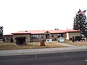
The Eagar School is a one-story building consisting of six rooms located in Eagar, Arizona. It was originally built in 1930, with a large addition added in 1951. During the 1980s it was no longer used as a schoolhouse, becoming the town hall of Eagar, and would later become the town's police station.
References

  1. "National Register Information System". National Register of Historic Places . National Park Service. July 9, 2010.
  2. "National Register of Historic Places Registration Form: Eagar Townsite Historic District". U.S. National Park Service. June 8, 1993. pp. 8:7–8. Archived from the original on October 17, 2017. Retrieved October 17, 2017.
  3. National Park Service 1993, p. 8:8.
  4. National Park Service 1993, p. 8:9.
  5. National Park Service 1993, p. 7:4.
  6. National Park Service 1993, p. 7:4.
  7. National Park Service 1993, p. 7:4.
  8. National Park Service 1993, p. 8:10.
  9. National Park Service 1993, p. 7:4.
  10. National Park Service 1993, p. 7:4–5.
  11. National Park Service 1993, p. 8:10.
  12. National Park Service 1993, p. 7:2.
  13. National Park Service 1993, p. 11:18.
  14. National Park Service 1993, p. 8:10.
  15. National Park Service 1993, p. 7:2.
  16. National Park Service 1993, p. 7:4–5.
  17. National Park Service 1993, p. 7:2.
  18. Historical Markers Data Base
  19. The Pistols, Plows and Petticoats Historic Driving Tour Brochure.