Joe Mayer

Last updated • 5 min readFrom Wikipedia, The Free Encyclopedia
Joe Mayer
Joe Mayer c. 1900.jpg
Joe Mayer c. 1900
Founder of Mayer, Arizona
Born
Joseph Hoffmayer

1846
DiedNovember 27, 1909
Nationality American
OccupationProspector, businessman

Joseph Mayer (1846 – November 27, 1909) was an American businessman, gold prospector and pioneer who founded the town of Mayer, Arizona.

Contents

Early years

Mayer (birth name: Joseph Hoffmayer) was born in Olean, New York, to French immigrants. He didn't get along with his strict father and believed that his family favored his brother "Gus" over him. Therefore, he ran away from home when he was a teenager. He worked in various places including a cigar store and a cracker factory. After living on his own for several months he became interested in joining the troupe of a wild west circus which was performing in his town. [1] [2] [3]

Mayer was assigned to do various chores in the circus and he visited many western towns. Eventually, he did what so many other American easterners were doing at the time and moved to the west coast in search of gold. He changed his surname to "Mayer" because he did not want his family in New York to find him and went to Silver City, New Mexico. There he met Sarah Belle Wilbur. [4] [5] [6]

Big Bug Stage Station

Marker which indicates the location of "Big Bug Station" Mayer-(B)-Historic Mayer Business Block marker.jpg
Marker which indicates the location of "Big Bug Station"

He and Sarah moved to Globe, Arizona, where they were married. Mayer and Sarah had four children. The children were named Mary Bell (1878–1964), Martha Gertrude (1881–1967), Wilbur Joseph (1882–1955) and Winifred Lucille (1892–1983). He spent a year mining in Globe; however by 1881, Mayer moved and began mining in the Tip Top Mine by Cottonwood Creek in Central Arizona. There he opened a restaurant and a store. Although he was successful as a businessman, his businesses were affected by the decline of the mine and the decline of the mining camp which depended on it. On one occasion he had to go to the city of Prescott and decided to take a short cut from the Black Canyon Trail. During his trip, he made a stop at the “Big Bug Stage Station”, a stage stop on the Black Canyon Stage Line. The station was located on the outskirts of Big Bug Creek. Mayer was impressed with the area and he purchased the “Big Bug Stage Station” for $1,200 in gold. Mayer then moved there with his wife Sarah and children. [4] [5] [6]

Mayer, Arizona

Mayer-Mayer Hotel-1871-1.jpg
The Mayer Hotel.
Mayer-Prescott and Eastern Railroad Depot-1898-2.jpg
Prescott and Eastern Railroad Depot.
Mayer-(B)-Historic Mayer Business Block-1902.jpg
Historic Mayer Business Block

The Big Bug Stage Station was located in an area which was surrounded by the Bradshaw Mountains. The area was once inhabited by the Hohokams, a Native American tribe, and later by their descendants the Yavapai. This was before the arrival and settlement of the area by the people of Anglo European descent from the east coast of the United States. [1] [2] [3]

The Black Canyon trail from Prescott to Phoenix was dangerous and many travelers were robbed of their belongings and sometimes murdered either by the Yavapai or the thieves who roamed the area. Miners would often stop at the Mayers' place to rest and to patronize the store which he had built. In 1882, Mayer officially founded the town which bears his name. In 1884, his wife Sarah became the first postmistress of the town [7] and in 1889, one of the largest and finest deposits of onyx was discovered in the town of Mayer. [1] [2] [3]

Tragedy struck the town of Mayer in 1890, when heavy rain caused a nearby dam called the "Walnut Dam" to fail causing a flood which wiped out all of the structures in the town. [4] [5] [6] Mayer began to rebuild the town and in 1897, he built a two-story, 23-room hotel which he named the "Mayer Hotel". [1] [2] [3]

Mayer also raised cattle and sheep. He realized that the establishment of a railroad line in the town would benefit his ranch and the mine near it. He offered the "right of way" to the Southern Pacific Railroad with the condition that they establish a rail line that ran through the town. The railroad company agreed and began servicing the town of Mayer in 1898. [note 1] Mayer established a brickyard and in 1902, he used his bricks to build a business block, now known as the "Mayer Business Block", across the street from the Mayer Hotel. The block included a saloon with a dance floor, a barber and bath shop, a mercantile shop and a general store. [4] [5] [6]

Later years

Mayer provided the money needed to finance the building of two schools. He had one school built within the town and the second one two miles out from the town for the miners' children. [1] [2] [3]

Not all of his ventures were successful. One of his failures was the "Indian Souvenir Toothpick Company". He planned to produce toothpicks from cacti with a new chemical process. However, the cost of removing barbed skin of cactus needles, by the patented chemical process, to make them suitable for toothpicks was too high. Finally, the toothpick company closed because it could not compete with the companies that made standard wooden toothpicks. [1] [2] [3]

Mayer learned from a family friend that his mother was in ill-health and that she was dying. He was told by the friend that she wanted to see him before she died. He was also informed that his father and his older brother Gus were dead. Mayer was able to visit his mother and brother Anthony in New York shortly before she died. [8]

On November 28, 1909, Mayer heard a noise outside his house and, believing that there was an animal or thief, he took his rifle and ran outside. He tripped as he ran and accidentally shot himself. The wounds which he received were fatal and he died soon after. [4] [5] [6] His funeral was held in the Sacred Heart Church of Prescott. Mayer was buried in Mountain View Cemetery located at 1051 Willow Creek Rd. in Prescott. [1] [2] [3]

Further reading

See also

Arizona pioneers

Notes

  1. The historic depot was built in 1898 in Mayer, Arizona. The building was purchased by a private citizen who had it hauled to a hill in Phoenix. The owner turned it into part of his home. It is located at 1711 N. 18th Place.

Related Research Articles

<span class="mw-page-title-main">Scouting in Arizona</span> Aspect of Scouting and Arizona history

Scouting in Arizona has a long history, from the 1910s to the present day, serving thousands of youth in programs that suit the environment in which they live.

<span class="mw-page-title-main">Ash Fork, Arizona</span> CDP in Yavapai County, Arizona

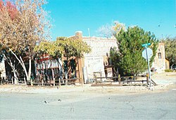
Ash Fork is a census-designated place in Yavapai County, Arizona, United States. Its population was 396 at the 2010 U.S. Census, down from 457 in 2000.

<span class="mw-page-title-main">Dewey–Humboldt, Arizona</span> Town in Yavapai County, Arizona

Dewey–Humboldt is a town in Yavapai County, Arizona, United States. The population of the town was 3,894 according to the 2010 census. The Dewey–Humboldt area was a census-designated place (CDP) at the 2000 census, at which time its population was 6,295.

<span class="mw-page-title-main">Prescott, Arizona</span> City in Arizona, United States

Prescott is a city in Yavapai County, Arizona, United States. According to the 2020 Census, the city's population was 45,827. The city is the county seat of Yavapai County. In 1864, Prescott was designated as the capital of the Arizona Territory, replacing the temporary capital of Fort Whipple. The Territorial Capital was moved to Tucson in 1867. Prescott again became the Territorial Capital in 1877, until Phoenix became the capital in 1889.

<span class="mw-page-title-main">Prescott Valley, Arizona</span> Town in Yavapai County, Arizona

Prescott Valley is a town located in Yavapai County, Arizona, United States, approximately 8 miles (13 km) east of Prescott, which it has surpassed in population. Prescott Valley was the seventh fastest-growing place among all cities and towns in Arizona between 1990 and 2000, with a current population in 2019 of about 46,515 residents.

<span class="mw-page-title-main">Jack Swilling</span> American pioneer in the Arizona Territory (1830–1878)

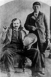
John W. "Jack" Swilling was an early pioneer in the Arizona Territory. He is commonly credited as one of the original founders of the city of Phoenix, Arizona. Swilling also played an important role in the opening of the central Arizona highlands to white settlement. His discoveries resulted in a gold rush to the region, and this in turn led to the establishment of Arizona's first territorial capital at the mining town of Prescott.

<span class="mw-page-title-main">Cleator, Arizona</span> Ghost town in Yavapai County, Arizona

Cleator, formerly Turkey Creek or Turkey, is a near ghost town and small community in Yavapai County, Arizona, in the Southwestern United States.

<span class="mw-page-title-main">Drake, Arizona</span> Unincorporated community in the state of Arizona, United States

Drake was an unincorporated community on the Verde River in Yavapai County, Arizona, United States, and a station on the Burlington Northern and Santa Fe Railway. Drake is also the junction and western terminus of the Verde Canyon Railroad. Drake is the site of the old Hell Canyon Bridge, formerly used by US Route 89, and now on the National Register of Historic Places.

<span class="mw-page-title-main">Big Bug, Arizona</span> Ghost town in Yavapai County, Arizona

Big Bug is a ghost town in Yavapai County, Arizona, United States. The former settlement is located twelve miles southeast of Prescott and was established in 1862.

<span class="mw-page-title-main">Stoneman Military Trail</span> Supply road in Yapavai & Maricopa Counties, Arizona, 1870–1890

The Stoneman Road, an important supply road between Fort McDowell and Fort Whipple in Prescott between 1870 and 1890. It was an important conduit for the shipping of supplies from Fort Whipple in Prescott to Fort McDowell on what is today the Yavapai Reservation near Fountain Hills.

<span class="mw-page-title-main">Stanton, Arizona</span> Populated place in Yavapai County, Arizona

Stanton is a populated place in Yavapai County, Arizona, United States that is now used as an RV park. The town was originally a stagecoach stop known as Antelope Station, and was later renamed "Stanton" after the businessman and crook Chuck Stanton, who took over the town in the 1870s. Stanton is located approximately twenty miles north of Wickenburg, at the base of Rich Hill, near the ghost towns of Octave and Weaver.

<span class="mw-page-title-main">George U. Young</span> American businessman, Arizona mining promoter (1867–1926)

George Ulysses Young was an American businessman and politician. Active initially in journalism, he redirected his business interests to the expansion of railroads and the promotion of mining. Politically he served as Secretary of Arizona Territory and as Mayor of Phoenix.

<span class="mw-page-title-main">Gillett, Arizona</span> Ghost town in Yavapai County, Arizona

Gillett, Arizona, is a ghost town in Yavapai County, Arizona, United States. It has an estimated elevation of 1,362 feet (415 m) above sea level. Historically, it was a stagecoach station, and then a settlement formed around an ore mill serving the Tip Top Mine, on the Agua Fria River in Yavapai County in what was then Arizona Territory. It was named for the mining developer of the Tip Top Mine, Dan B. Gillett and is spelled incorrectly as Gillette on U. S. Topographic Maps and elsewhere.

<span class="mw-page-title-main">Highland Park, Yavapai County, Arizona</span> Populated place in Arizona, United States

Highland Pines is a populated place in Township 14N, Range 3W Gila and Salt River Meridian, situated near Prescott and within the Prescott National Forest, in Yavapai County, Arizona, United States. Highland Park is the unofficial map reference for the locality. Highland Pines is the promotional name associated with the Highland Park areas several subdivisions. In the Arizona Territorial era up to 1912, and Statehood until around the late 1920s, this particular area of land acted as a cattle ranch with a mining history, lies within the Thumb Butte Mining District, which appears to be initially platted by the Arizona Corporation Highland Pine Properties Inc. beginning in the late 1950s.

<span class="mw-page-title-main">Fort Tyson</span> Historic site in La Paz County, Arizona

Fort Tyson was a privately owned fort built in 1856 by Charles Tyson in the area which is now called Quartzsite, Arizona. He built the fort to protect the local miners and water supply from the raids of the Yavapai (Mohave-Apache), a Native-American tribe. The area in which Fort Tyson was located has been known as Fort Tyson, Tyson’s Well and is now called the town of Quartzsite because of the large amount of quartz found in its surrounding areas.

References

  1. 1 2 3 4 5 6 7 "Joe Mayer and His Town"; by Winifred L. Thorpe; Journal of Arizona History; Vol. 19 #2, Summer, 1978, pp. 131–168.
  2. 1 2 3 4 5 6 7 "French Runaway in Arizona"; By Sharlot Hall Museum Archives: Vertical file-Biography-Mayer, Joseph.
  3. 1 2 3 4 5 6 7 "Builders of Yavapai: Something About the Man Who Recognized the Big Possibilities in Store for Mayer" Yavapai Magazine; March 1918, p. 3.
  4. 1 2 3 4 5 An Illustrated History of Mayer: Stagecoaches, Mining, Ranching and the Railroad; By: Nancy Burgess; ISBN   978-0786462872
  5. 1 2 3 4 5 "Mayer, Arizona - Ghost Towns of Arizona and Surrounding States". ghosttownaz.info. Retrieved 2017-11-19.
  6. 1 2 3 4 5 "Humboldt (Val Verde) – Arizona Ghost Town". ghosttowns.com. Retrieved 2017-11-19.
  7. "National Register of Historic Places Registration For". NPS.gov. Retrieved January 19, 2018.
  8. "stagecoach". stagecoach. Retrieved January 19, 2018.