Cimarron, New Mexico

Last updated

Cimarron, New Mexico
Cimarron Art Gallery Cimarron, NM.JPG
Downtown Cimarron
Colfax County New Mexico Incorporated and Unincorporated areas Cimarron Highlighted.svg
Location of Cimarron, New Mexico
Cimarron-nm-map.png
U.S. Census map
Usa edcp location map.svg
Red pog.svg
Cimarron, New Mexico
Location in the United States
Coordinates: 36°30′34″N104°54′56″W / 36.50944°N 104.91556°W / 36.50944; -104.91556
Country United States
State New Mexico
County Colfax
Area
[1]
  Total2.12 sq mi (5.48 km2)
  Land2.12 sq mi (5.48 km2)
  Water0.00 sq mi (0.00 km2)
Elevation
6,430 ft (1,960 m)
Population
 (2020) [2]
  Total792
  Density374.11/sq mi (144.42/km2)
Time zone UTC-7 (Mountain (MST))
  Summer (DST) UTC-6 (MDT)
ZIP code
87714
Area code 575
FIPS code 35-15440
GNIS feature ID0887606
Website villageofcimarron.net

Cimarron is a village in Colfax County, New Mexico, United States, which sits on the eastern slopes of the Sangre de Cristo Mountains. The population was 792 at the 2020 census, making it the fourth most populous municipality in Colfax County. [3]

Contents

Cimarron sits on the Cimarron River, a tributary of the 900 mile-long Canadian River, whose headwaters are at the Eagle Nest Dam, with the main part of town lying along U.S. Route 64. The village is surrounded on all sides by numerous ranches, including Philmont Scout Ranch, [4] an extensive "high-adventure base" operated by the Boy Scouts of America. Philmont is located just four miles south of Cimarron. Other ranches also include the Chase Ranch (famous for its heart-shaped brand and allegedly the Marlboro Man's place of origin), Ted Turner's Vermejo Park Ranch, [5] the CS Ranch, [6] the Express UU Bar Ranch [7] (formerly the property of Waite Phillips), and the Clearview Ranch of the western singer/songwriter R.W. Hampton, as well as numerous other small ranches. The Elliott Barker State Wildlife Area, the Valle Vidal unit of the Carson National Forest, and Cimarron Canyon State Park., [8] [9] are also located within the Cimarron area. 17 miles and 28 miles to the northeast is Dawson, New Mexico, a ghost town with a population of over 9,000 near the early 20th century, and the Raton Municipal Airport, respectively.

The village is a pioneer of the four-day school week (MondayThursday), which it originally implemented in the early 1970s, during a time of rising fuel and utility prices. [10] Cimarron is home to the 1979 New Mexico High School Boys Basketball State Championship team. [11]

History

Brooks Mercantile Building, c. 1909. Brooks Mercantile Building 1909 Cimarron, NM.JPG
Brooks Mercantile Building, c. 1909.

Cimarron is located on the land of what became known as the 1,700,000 acres (6,900 km2) Maxwell Land Grant. In 1842, Lucien B. Maxwell, a fur trapper, came to the Beaubien-Miranda Ranch in northern New Mexico and courted and married Luz Beaubien, one of the owner's six daughters. He eventually inherited the ranch and built a mansion in 1858 on the future town site.

Maxwell built the Aztec Mill in 1864. It is preserved as the Old Mill Museum, operated by the Cimarron Historical Society. The museum's collection includes working mill parts; Native American tools, weapons and pottery; Maxwell Land Grant paperwork and documents; and other materials.

Cimarron was officially chartered in 1859 and was named for the Spanish word used to describe a mustang, meaning "wild" or "unbroken". Cimarron was the county seat of Colfax County beginning in 1872, when it replaced Elizabethtown. At that time, Cimarron was a stage stop on the Mountain Branch of the Santa Fe Trail. In 1881, the county seat was moved to Springer, a town on the Atchison, Topeka and Santa Fe Railway. It was during this time that Lucien Maxwell, due to rising tensions, sold the Maxwell Land Grant to a group of investors, with the resultant Colfax County War in which more than two hundred people were killed.

In 1905, the St. Louis, Rocky Mountain, and Pacific Railway Co. laid tracks from Raton to Ute Park, with the intent to haul coal between Raton and Cimarron. Passengers used the daily train service, as well as ranchers who moved agricultural animals. During World War II, the tracks were removed, with the steel to be recycled to help with the shortage during the war effort.

Soon after the tracks were laid through town, tracks were also laid 22 miles up Ponil Canyon by the Cimarron and Northwestern Railway Company, to haul timber from the surrounding mountains, which were loaded with douglas fir and ponderosa pine. The railroad company delivered its timber to the Continental Tie and Lumber Company, located in Cimarron, NM, who made railroad ties and timber supports for nearby coal mines.

Cimarron continues to thrive, in part due to its proximity to Philmont Scout Ranch, as well as summer tourism.

As a tribute to many dedicated crew members, the USS Cimarron's key artifacts were donated to Cimarron, since it is the closest village to the Cimarron River Basin's Headwaters. The ship's bell now stands in front of the village's high school, Cimarron High School.
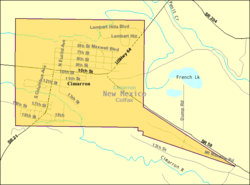
Geography

Cimarron is located in west-central Colfax County at 36°30′34″N104°54′56″W / 36.50944°N 104.91556°W / 36.50944; -104.91556 (36.509467, -104.915496), [12] on the north bank of the Cimarron River, where it emerges from the Cimarron Range of the Sangre de Cristo Mountains. U.S. Route 64 passes through the village, leading west up the Cimarron Canyon 23 miles (37 km) to Eagle Nest and northeast 40 miles (64 km) to Raton, the Colfax County seat. New Mexico State Road 58 leads east from Cimarron 19 miles (31 km) to Interstate 25, north of Springer.

West of Cimarron is the Palisades Sill, with high cliffs surrounding a modest flow of the Cimarron River.

Climate

Cimarron has a borderline cool semi-arid climate (Köppen BSk) closely bordering on a subtropical highland climate, with summers featuring cool nights and warm days with frequent thunderstorms, and cold winters with occasional heavy snowfall. The lowest temperature recorded in the town was −35 °F (−37 °C). [13]

Climate data for CIMARRON 4 SW, NM (1991–2020 normals, extremes 1904–present)
MonthJanFebMarAprMayJunJulAugSepOctNovDecYear
Record high °F (°C)81
(27)
76
(24)
81
(27)
84
(29)
92
(33)
98
(37)
101
(38)
100
(38)
98
(37)
88
(31)
81
(27)
75
(24)
101
(38)
Mean daily maximum °F (°C)47.6
(8.7)
50.4
(10.2)
58.2
(14.6)
65.0
(18.3)
73.2
(22.9)
82.5
(28.1)
84.3
(29.1)
81.8
(27.7)
77.2
(25.1)
68.1
(20.1)
56.3
(13.5)
47.6
(8.7)
66.0
(18.9)
Mean daily minimum °F (°C)18.1
(−7.7)
19.5
(−6.9)
25.8
(−3.4)
31.8
(−0.1)
40.3
(4.6)
48.6
(9.2)
52.8
(11.6)
51.7
(10.9)
44.7
(7.1)
34.4
(1.3)
24.3
(−4.3)
17.4
(−8.1)
34.1
(1.2)
Record low °F (°C)−32
(−36)
−24
(−31)
−17
(−27)
−2
(−19)
17
(−8)
25
(−4)
40
(4)
36
(2)
16
(−9)
−5
(−21)
−18
(−28)
−17
(−27)
−32
(−36)
Average precipitation inches (mm)0.66
(17)
0.57
(14)
0.95
(24)
1.51
(38)
1.70
(43)
1.74
(44)
3.03
(77)
3.11
(79)
1.75
(44)
1.22
(31)
0.57
(14)
0.43
(11)
17.24
(438)
Average snowfall inches (cm)7.0
(18)
7.1
(18)
7.0
(18)
5.0
(13)
0.5
(1.3)
0.0
(0.0)
0.0
(0.0)
0.0
(0.0)
0.0
(0.0)
2.1
(5.3)
5.1
(13)
6.2
(16)
40.0
(102)
Average precipitation days (≥ 0.01 in)2.83.24.44.56.16.911.011.56.84.12.42.566.2
Average snowy days (≥ 0.1 in)1.92.62.41.30.20.00.00.00.00.41.31.811.9
Source: NOAA [14] [15]

Demographics

Historical population
CensusPop.Note
1880 290
1910 791
1920 481−39.2%
1930 69845.1%
1940 7446.6%
1950 85514.9%
1960 99716.6%
1970 927−7.0%
1980 888−4.2%
1990 774−12.8%
2000 91718.5%
2010 1,02111.3%
2020 792−22.4%
U.S. Decennial Census [16] [2]

According to the United States Census Bureau, the village of Cimarron has a total area of 2.0 square miles (5.2 km2), all land. [3]

Old Aztec Mill in Cimarron Old Aztec Museum in Cimarron, NM IMG 0537.JPG
Old Aztec Mill in Cimarron
St. James Hotel St. James Hotel.jpg
St. James Hotel

As of the census [17] of 2010, there were 1021 people, 382 households, and 255 families residing in the village. The population density was 479.5 inhabitants per square mile (185.1/km2). There were 449 housing units at an average density of 234.8 per square mile (90.7/km2). The racial makeup of the village was 77.54% White, 0.11% African American, 1.09% Native American, 0.11% Asian, 17.23% from other races, and 3.93% from two or more races. Hispanic or Latino of any race were 58.89% of the population.

There were 382 households, out of which 34.0% had children under the age of 18 living with them, 49.2% were married couples living together, 8.1% had a female householder with no husband present, and 33.0% were non-families. 29.1% of all households were made up of individuals, and 13.6% had someone living alone who was 65 years of age or older. The average household size was 2.40 and the average family size was 2.89.

In the village, the population was spread out, with 27.0% under the age of 18, 7.6% from 18 to 24, 25.1% from 25 to 44, 24.1% from 45 to 64, and 16.1% who were 65 years of age or older. The median age was 40 years. For every 100 females, there were 106.5 males. For every 100 females age 18 and over, there were 102.7 males.

The median income for a household in the village was $27,875, and the median income for a family was $30,677. Males had a median income of $26,125 versus $19,792 for females. The per capita income for the village was $14,248. About 9.1% of families and 12.5% of the population were below the poverty line, including 16.1% of those under age 18 and 8.6% of those age 65 or over.

Education

The school district is Cimarron Municipal Schools. [18]

Tourism

Notable people

See also

Related Research Articles

<span class="mw-page-title-main">Colfax County, New Mexico</span> County in New Mexico, United States

Colfax County is a county in the U.S. state of New Mexico. As of the 2020 census, the population was 12,387. Its county seat is Raton. It is south from the Colorado state line. This county was named for Schuyler Colfax (1823–1885), seventeenth Vice President of the United States under U.S. President Ulysses S. Grant.

<span class="mw-page-title-main">Angel Fire, New Mexico</span> Village in New Mexico, United States

Angel Fire is a village in Colfax County, New Mexico, United States. The population was 1,216 at the 2010 census. It is a popular ski resort destination, with over 500 acres (2.0 km2) of slopes. Angel Fire and nearby communities experience cold winter temperatures and mild temperatures in the summer.

<span class="mw-page-title-main">Eagle Nest, New Mexico</span> Village in New Mexico, United States

Eagle Nest is a village in Colfax County, New Mexico. The population was 290 at the time of the 2010 census. Located along the Enchanted Circle Scenic Byway, Eagle Nest is a small summer-home and resort destination. Originally named Therma, the village was renamed Eagle Nest in the 1930s. The town is located in the Sangre de Cristo Mountains in northern New Mexico near the Colorado border.

<span class="mw-page-title-main">Maxwell, New Mexico</span> Village in New Mexico, United States

Maxwell is a village in Colfax County, New Mexico, United States. The population was 254 at the 2010 census, down from 274 in 2000. Maxwell was established in 1879 as a railroad town on the Atchison, Topeka and Santa Fe Railway. It was named in honor of Lucien Maxwell, who provided the land for the original townsite from his Maxwell Land Grant.

<span class="mw-page-title-main">Raton, New Mexico</span> City in New Mexico, United States

Raton is a city and the county seat of Colfax County in northeastern New Mexico. The city is located just south of Raton Pass. The city is also located about 6.5 miles south of the New Mexico–Colorado border and 85 miles west of Texas.

<span class="mw-page-title-main">Springer, New Mexico</span> Town in New Mexico, United States

Springer is a town in Colfax County, New Mexico, United States. Its population was 1,047 at the 2010 census.

<span class="mw-page-title-main">Folsom, New Mexico</span> Village in Union County, New Mexico, United States

Folsom is a village in Union County, New Mexico, United States. Its population was 56 at the 2010 census, down from 75 in 2000. The town was named after Frances Folsom, the fiancée of President Grover Cleveland.

<span class="mw-page-title-main">Philmont Scout Ranch</span> Large ranch for youth high adventure in New Mexico, US

Philmont Scout Ranch is a ranch located in Colfax County, New Mexico, near the village of Cimarron; it covers 140,177 acres (56,728 ha) of wilderness in the Sangre de Cristo Mountains on the east side of the Cimarron Range of the Rocky Mountains. Donated by oil baron Waite Phillips, the ranch is owned and operated by the Boy Scouts of America. It is a National High Adventure Base where crews of Scouts and Venturers take part in backpacking treks and other outdoor activities. By land area, it is one of the largest youth camps in the world. During the 2019 season, between June 8 and August 22, an estimated 24,000 Scouts and adult leaders backpacked through the Ranch's extensive backcountry. That same year 1,302 staff were responsible for the Ranch's summer operations.

<span class="mw-page-title-main">Kenton, Oklahoma</span> Town in Oklahoma, United States

Kenton is a town in Cimarron County, Oklahoma, United States. As of the 2020 census, the community had 31 residents.

<span class="mw-page-title-main">Baldy Mountain (Colfax County, New Mexico)</span> Mountain peak in New Mexico, US

Baldy Mountain, Baldy Peak, Mount Baldy, or Old Baldy is the highest peak in the Cimarron Range, a subrange of the Sangre de Cristo Mountains of New Mexico. It is located in Colfax County, about 6 miles (10 km) northeast of Eagle Nest. It rises abruptly, with 3,640 feet (1,110 m) of vertical relief, from the Moreno Valley to the west and has a total elevation of 12,441 feet (3,792 m).

<span class="mw-page-title-main">Lucien Maxwell</span>

Lucien Bonaparte Maxwell was a mountain man, rancher, scout, and farmer who at one point owned more than 1,700,000 acres (6,900 km2). Along with Thomas Catron and Ted Turner, Maxwell was one of the largest private landowners in United States history. In 1959, he was inducted into the Hall of Great Westerners of the National Cowboy & Western Heritage Museum.

<span class="mw-page-title-main">Maxwell Land Grant</span>

The Maxwell Land Grant, also known as the Beaubien-Miranda Land Grant, was a 1,714,765-acre (6,939.41 km2) Mexican land grant in Colfax County, New Mexico, and part of adjoining Las Animas County, Colorado. This 1841 land grant was one of the largest contiguous private landholdings in the history of the United States. The New Mexico communities of Cimarron, Dawson, Elizabethtown, Baldy Town, Maxwell, Miami, Raton, Rayado, Springer, Ute Park and Vermejo Park came to be located within the grant, as well as numerous places that are now ghost towns.

<span class="mw-page-title-main">Rayado, New Mexico</span> Place in New Mexico, United States

Rayado or Reyado was the first permanent settlement in Colfax County, New Mexico, United States and an important stop on the Santa Fe Trail. The name Rayado derives from the Spanish term for "streaked", perhaps in reference to the lot lines marked out by Lucien Maxwell.

New Mexico State Road 21, is a 34.447-mile-long (55.437 km) state highway located entirely in Colfax County in the U.S. state of New Mexico. The road starts in the center of the town of Cimarron at U.S. Route 64 and runs southward then east to an intersection with unsigned I-25 Business and the western termini of US 56 and US 412 in Springer.

State Road 204 (NM 204) is a 10.882-mile-long (17.513 km) gravel state highway in the US state of New Mexico. NM 204's southern terminus at U.S. Route 64 (US 64) just north of Cimarron, and it the northern terminus at the gate at the southern end of Ponil Campsite on the grounds of the Philmont Scout Ranch in Colfax County. This campsite was formerly the Ranch headquarters, from its inception in 1938 until shortly after its 1941 expansion, when it was moved to its present location south of Cimarron. The road is primarily used by Philmont busses transporting Scouts into and out of the Ranch's North Country at Six Mile Gate and the Ponil Turnaround. The Highway was never paved because the old owner of philmont was afraid people would speed down the Highway and hit their cattle.

Philmont Scout Ranch is located in the Sangre de Cristo Mountains of the Rocky Mountains of New Mexico. Philmont is about 12 miles (19 km) across at its widest point, and about 30 miles (48 km) long. The southern part of the ranch is mostly grasslands/prairie, while the north is rocky and rugged, but a small part of the eastern area is prairie.

Chase Ranch Cimarron, New Mexico was founded in 1867 by Manly and Theresa Chase. As pioneers, from Wisconsin by way of Colorado, they crossed the Raton Pass in a covered wagon and establish a new home in New Mexico. Manly Chase purchased the land from Lucien Maxwell, part of the Maxwell Land Grant. The ranch is near the Ponil Creek, a mile north of the Cimarron River, not far from the Santa Fe Trail. The Ranch included the old Kit Carson homestead. Before the arrival of pioneers, the land was populated by Apaches and Ute people. Manly provided the local Native Americans with beef, creating peaceful coexistence.

<span class="mw-page-title-main">2015 Philmont Scout Ranch flash flood</span> Natural disaster

On the morning of June 27, 2015, heavy rain occurred in a great portion of the Scouting reserve Philmont Scout Ranch, which is near Cimarron, New Mexico, United States, causing a flash flood. The flood also affected some other nearby areas in Colfax County that morning, including highways and small towns around Philmont. One youth Scout, Alden Brock, who was situated in a campsite within the staff camp Indian Writings, drowned while being swept away by the flood. The flood also had a significant impact on many individual crews and treks and significantly damaged some campsites. The 2015 flash flood is the largest documented flood in the history of Philmont, and is the only flood at Philmont that has ever caused the death of a person.

<span class="mw-page-title-main">Ute Park Fire</span> Wildfire in New Mexico, United States

The Ute Park Fire was a wildfire one mile east of Ute Park, New Mexico in the United States. The fire started on May 31, 2018. The cause remains under investigation. The fire burned a total of 36,740 acres (149 km2) and was contained on June 19, 2018. It threatened the communities of Cimarron and Ute Park, with mandatory evacuations in place from June 1 2, respectively, until June 8th: when both were lifted. The fire destroyed 14 buildings and threatened over 750 structures.

<span class="mw-page-title-main">Cimarron Range, New Mexico</span> Mountain range in New Mexico, US

The Cimarron Range is a mountain range located mainly in Colfax County of northeastern New Mexico, United States. The range forms the eastern margin of the Southern Rocky Mountains in north-central New Mexico to the west of Cimarron, New Mexico. The range is about forty-seven miles (76 km) long and forty-four miles (71 km) wide and is bounded by the Moreno Valley to the west, the Great Plains to the east, the Raton Basin to the north, and Ocate Mesa to the south. The highest point is Baldy Mountain, 12,441 feet (3,792 m)

References

  1. "ArcGIS REST Services Directory". United States Census Bureau. Retrieved October 12, 2022.
  2. 1 2 "Census Population API". United States Census Bureau. Retrieved October 12, 2022.
  3. 1 2 "Geographic Identifiers: 2010 Demographic Profile Data (G001): Cimarron village, New Mexico". U.S. Census Bureau, American Factfinder. Archived from the original on February 12, 2020. Retrieved October 22, 2014.
  4. Philmont Scout Ranch
  5. VPR invite
  6. CS Cattle Co. - Welcome!
  7. Express UU Bar Ranches
  8. Coalition for the Valle Vidal - New Mexico - an Endangered American Treasure Archived 2008-06-27 at the Wayback Machine
  9. Carson National Forest - Welcome
  10. Schools eye four-day week to cut fuel costs | Lifestyle | Living | Reuters
  11. "1979 Boys Bracket". New Mexico Prep Basketball (Historical). Retrieved May 23, 2017.
  12. "US Gazetteer files: 2010, 2000, and 1990". United States Census Bureau. February 12, 2011. Retrieved April 23, 2011.
  13. "CIMARRON 4 SW, NEW MEXICO - Climate Summary".
  14. "NOWData - NOAA Online Weather Data". National Oceanic and Atmospheric Administration . Retrieved March 21, 2022.
  15. "Monthly Normals 1991-2020". National Oceanic and Atmospheric Administration . Retrieved March 21, 2022.
  16. "Census of Population and Housing". Census.gov. Retrieved June 4, 2015.
  17. "U.S. Census website". United States Census Bureau . Retrieved January 31, 2008.
  18. "2020 CENSUS - SCHOOL DISTRICT REFERENCE MAP: Colfax County, NM" (PDF). U.S. Census Bureau . Retrieved September 5, 2022.