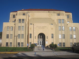
Colfax County is a county in the U.S. state of New Mexico. As of the 2020 census, the population was 12,387. Its county seat is Raton. It is south from the Colorado state line. This county was named for Schuyler Colfax (1823–1885), seventeenth Vice President of the United States under U.S. President Ulysses S. Grant.

Cimarron is a village in Colfax County, New Mexico, United States, which sits on the eastern slopes of the Sangre de Cristo Mountains. The population was 1,021 at the 2010 census, making it the fourth most populous municipality in Colfax County.

Springer is a town in Colfax County, New Mexico, United States. Its population was 1,047 at the 2010 census.

Philmont Scout Ranch is a ranch located in Colfax County, New Mexico, near the village of Cimarron; it covers 140,177 acres (56,728 ha) of wilderness in the Sangre de Cristo Mountains on the east side of the Cimarron Range of the Rocky Mountains. Donated by oil baron Waite Phillips, the ranch is owned and operated by the Boy Scouts of America. It is a National High Adventure Base where crews of Scouts and Venturers take part in backpacking treks and other outdoor activities. By land area, it is one of the largest youth camps in the world. During the 2019 season, between June 8 and August 22, an estimated 24,000 Scouts and adult leaders backpacked through the Ranch's extensive backcountry. That same year 1,302 staff were responsible for the Ranch's summer operations.

Robert A. Clay Allison also known as Clay Allison was a cattle rancher, cattle broker, and sometimes gunfighter of the American Old West. He fought for the Confederacy in the Civil War. Allison had a reputation for violence, having survived several one-on-one knife and gunfights, as well as being implicated in a number of vigilante jail break-ins and lynchings. A drunken Allison once rode his horse through town nearly naked—wearing only his gunbelt. Later most reports stated that he was not only dangerous to others but himself, accidentally shooting himself in the foot.

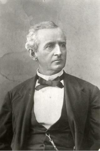
Stephen Benton Elkins was an American industrialist and politician. He served as the Secretary of War between 1891 and 1893. He served in the United States Congress as a Delegate from the Territory of New Mexico and a Senator from West Virginia.

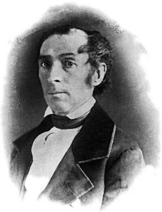
Samuel Beach Axtell was an American jurist and politician. He is noted for serving as chief justice of the New Mexico Territorial Supreme Court, territorial Governor of Utah and New Mexico, and a two-term Congressman from California.

Dawson is a ghost town in Colfax County, New Mexico, United States. Dawson was the site of two separate coal mining disasters in 1913 and 1923. Dawson is located approximately 17 miles northeast of Cimarron.

The Taos Revolt was a populist insurrection in January 1847 by Hispano and Pueblo allies against the United States' occupation of present-day northern New Mexico during the Mexican–American War. Provisional governor Charles Bent and several other Americans were killed by the rebels. In two short campaigns, United States troops and militia crushed the rebellion of the Hispano and Pueblo people. The New Mexicans, seeking better representation, regrouped and fought three more engagements, but after being defeated, they abandoned open warfare. Hatred of New Mexicans for the occupying American army combined with the oft-exercised rebelliousness of Taos residents against authority imposed on them from elsewhere were causes of the revolt. In the aftermath of the revolt the Americans executed at least 28 rebels. The Treaty of Guadalupe Hidalgo in 1850 guaranteed the property rights of New Mexico's Hispanic and American Indian residents.

The St. James Hotel, located in historic downtown Cimarron, New Mexico, is a historic hotel, restaurant and bar. Today, guests can stay at the historic hotel, in either the historic section or in a modern addition. The hotel is in the National Register of Historic Places and is part of the Cimarron Historic District.
Elizabethtown is an unincorporated community in Colfax County, New Mexico, United States. It is located just off New Mexico State Road 38, between the communities of Eagle Nest and Red River. Elizabethtown is just east of the Carson National Forest. The community is a former mining town, and lies northeast of Scully Mountain, and west of Baldy Mountain.

Jesus Gil Abreu was an American rancher and pioneer who owned a New Mexico ranch that now comprises Philmont Scout Ranch.

Lucien Bonaparte Maxwell was a mountain man, rancher, scout, and farmer who at one point owned more than 1,700,000 acres (6,900 km2). Along with Thomas Catron and Ted Turner, Maxwell was one of the largest private landowners in United States history. In 1959, he was inducted into the Hall of Great Westerners of the National Cowboy & Western Heritage Museum.

The Maxwell Land Grant, also known as the Beaubien-Miranda Land Grant, was a 1,714,765-acre (6,939.41 km2) Mexican land grant in Colfax County, New Mexico, and part of adjoining Las Animas County, Colorado. This 1841 land grant was one of the largest contiguous private landholdings in the history of the United States. The New Mexico communities of Cimarron, Dawson, Elizabethtown, Baldy Town, Maxwell, Miami, Raton, Rayado, Springer, Ute Park and Vermejo Park came to be located within the grant, as well as numerous places that are now ghost towns.

Charles H. Beaubien, also known as Alexis Beaubien, Don Carlos Beaubien and Charles Trotier, was a Canadian-born American fur trader who was one of two investors who owned 2,700,000 acres (11,000 km2) of northeastern New Mexico and southeastern Colorado in the Beaubien-Miranda and Sangre de Cristo Land Grants. He served for a time on the New Mexico Territorial Supreme Court.

Rayado or Reyado was the first permanent settlement in Colfax County, New Mexico, United States and an important stop on the Santa Fe Trail. The name Rayado derives from the Spanish term for "streaked", perhaps in reference to the lot lines marked out by Lucien Maxwell.

The Clifton House was an important overnight stage stop on the Mountain Branch of the Santa Fe Trail. It was located in Colfax County, New Mexico about six miles south of Raton, New Mexico, on the Canadian River. The site is located at mile marker 344 of U.S. Route 64, just off of exit 446 on Interstate 25.

The Eagle Nest Dam is a dam just east of the town of Eagle Nest, New Mexico on U.S. Route 64. The dam, on private property, is on the Cimarron River, and is responsible for Eagle Nest Lake.

Land grants in New Mexico and Colorado were awarded to individuals and communities by the Spanish and Mexican governments to encourage settlement and expansion of the Territorio de Nuevo Mexico, which included southern Colorado. Land grants by the Spanish and Mexicans between 1692 and 1846 numbered 291 in New Mexico, four partly in New Mexico and partly in Colorado, and three in Colorado. The land area of grants totaled tens of thousands of square miles. "The two major types of land grants were private grants made to individuals, and communal grants made to groups of people for the purpose of establishing settlements. Communal land grants were also made to Pueblos for the lands they inhabited." The majority of the land area within grants was designated as common land for residents. Common land was mostly used for grazing cattle and sheep. Smaller acreages within the grants were devoted to irrigation agriculture and home sites. The principal objectives of the land grants were to encourage the foundation of new communities and to expand the settled area on the frontiers of New Mexico for defense from Indian raids.
Pete Burleson was a cattle drover and rancher, western lawman, farmer and pioneer in the New Mexico Territory and State of New Mexico. He drove cattle from Texas as part of the 1870's I. W. Lacy - L. G. Coleman cattle drive, settling in northeast New Mexico as a cattle rancher near Cimarron. He was elected sheriff of Colfax County (1877–1871), serving in this capacity during the bloodiest part of the Colfax County War (1873–1888). In his tenure as sheriff and as a resident of Cimarron, he was close friends with several notorious cowboys including Clay Allison and David John (Davy) Crockett. Burleson was also a deputy sheriff in Colfax County and Lincoln County for seven different sheriffs, his last appointment coming at age 63. Western writers Eugene Manlove Rhodes and Emerson Hough both included characters in their novels and short stories based on Burleson.


