
Taos is a town in Taos County in the north-central region of New Mexico in the Sangre de Cristo Mountains. Initially founded in 1615, it was intermittently occupied until its formal establishment in 1795 by Nuevo México Governor Fernando Chacón to act as fortified plaza and trading outpost for the neighboring Native American Taos Pueblo and Hispano communities, including Ranchos de Taos, Cañon, Taos Canyon, Ranchitos, El Prado, and Arroyo Seco. The town was incorporated in 1934. As of the 2010 census, its population was 5,716.
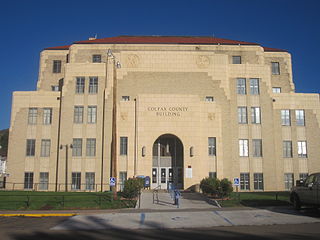
Colfax County is a county in the U.S. state of New Mexico. As of the 2010 census, the population was 13,750. Its county seat is Raton. It is south from the Colorado state line. This county was named for Schuyler Colfax (1823–1885), seventeenth Vice President of the United States under U.S. President Ulysses S. Grant.

Angel Fire is a village in Colfax County, New Mexico, United States. The population was 1,216 at the 2010 census. It is a popular ski resort destination, with over 500 acres (2.0 km2) of slopes. Angel Fire and nearby communities experience cold winter temperatures and mild temperatures in the summer.

Cimarron is a village in Colfax County, New Mexico, United States, which sits on the eastern slopes of the Sangre de Cristo Mountains. The population was 1,021 at the 2010 census, making it the fourth most populous municipality in Colfax County.

Eagle Nest is a village in Colfax County, New Mexico. The population was 290 at the time of the 2010 census. Located along the Enchanted Circle Scenic Byway, Eagle Nest is a small summer-home and resort destination. Originally named Therma, the village was renamed Eagle Nest in the 1930s. The town is located in the Sangre de Cristo Mountains in northern New Mexico near the Colorado border.

Questa is a village in Taos County, New Mexico, United States. The population was 1,770 at the 2010 census. The village has trails into the Rio Grande Gorge, trout fishing, and mountain lakes with trails that access the Sangre de Cristo Mountains that overlook the area. Questa is on the Enchanted Circle Scenic Byway, near the confluence of the Rio Grande and the Red River. The "Gateway to the Rio Grande del Norte Monument", its visitors can drive to an overlook of the Red River meeting the Rio Grande in the depth of the gorge. The Carson National Forest parallels Questa to the east. The Columbine Hondo Wilderness and Latir Peak Wildness are in the Carson National Forest close to Questa.

Red River is a resort town in Taos County, New Mexico, located in the Sangre de Cristo Mountains. The population was 477 at the 2010 census. Red River is located along the Enchanted Circle Scenic Byway, and is 36 miles (58 km) from Taos.

The Cimarron River, flowing entirely in New Mexico, was also known as La Flecha or Semarone. Its headwaters are Moreno, Sixmile, and Cieneguilla creeks in the Sangre de Cristo Mountains, which feed into Eagle Nest Dam. From the dam, it runs for 60 miles (97 km) to below the city of Springer, New Mexico in the Taylor Springs area, where it flows into the Canadian River, the southwesternmost major tributary flowing into the Mississippi River via the Arkansas River sub-basin.
Gallup-McKinley County Schools (GMCS) is a school district based in Gallup, New Mexico which serves students from Gallup and surrounding areas of McKinley County.
Elizabethtown is an unincorporated community in Colfax County, New Mexico, United States. It is located just off New Mexico State Road 38, between the communities of Eagle Nest and Red River. Elizabethtown is just east of the Carson National Forest. The community is a former mining town, and lies northeast of Scully Mountain, and west of Baldy Mountain.
Music from Angel Fire, (MFAF) is the first chamber music festival in New Mexico designed to serve the artistic needs of rural northern New Mexico communities. This touring summer chamber music festival currently produces 15 outstanding concerts in Angel Fire, Taos, Raton, and Las Vegas, NM mid-August through the day before Labor Day. The Festival's mission is to bring to these communities the highest standard of artistic excellence in the classical chamber music repertoire presented by world class artists with emerging and established careers. Music from Angel Fire concerts are broadcast by American Public Media, Performance Today, throughout the United States.

The Eagle Nest Dam is a dam just east of the town of Eagle Nest, New Mexico on U.S. Route 64. The dam, on private property, is on the Cimarron River, and is responsible for Eagle Nest Lake.
Weed is a hamlet and a census-designated place in Otero County, New Mexico, United States. It lies alongside New Mexico State Road 24 on the southeastern slopes of the Sacramento Mountains at an elevation of 7,047 ft. It has had a Post Office since 1885. As of the 2010 census, its population was 63.

Mount Phillips, formerly called Clear Creek Mountain was renamed in 1960 in honor of the then living Waite Phillips, who donated the area to the Boy Scouts of America. It is located in Colfax County about 11 miles (18 km) south of Baldy Mountain in the Cimarron Range, a subrange of the Sangre de Cristo Mountains of New Mexico.
The Alamagordo Municipal School District No. 1, also the Alamogordo Public School District or Alamogordo Public Schools (APS), is a school district that serves the communities of Alamogordo, High Rolls, Holloman Air Force Base, Mountain Park, and La Luz and portions of unincorporated Otero County in the state of New Mexico.

The Enchanted Circle Scenic Byway is a New Mexico Scenic Byway and National Forest Scenic Byway located in Northern New Mexico. It begins and ends in Taos, New Mexico.
Ramah Middle/High School is a public secondary school in unincorporated McKinley County, New Mexico, near the Ramah census-designated place and with a Ramah postal address. It is a part of Gallup-McKinley County Schools.
Santa Rosa Consolidated School District, also known as Santa Rosa Consolidated Schools (SRCS), is a school district headquartered in Santa Rosa, New Mexico.
Questa Independent School District, also known as Questa Independent Schools, is a school district headquartered in Questa, New Mexico. It has two district-operated schools: Alta Vista Elementary & Intermediate School and Questa Junior/Senior High School. There is an affiliated charter school, Roots & Wings Charter School, in Lama.