Springer, New Mexico

Last updated

Springer, New Mexico
Downtown Springer, NM IMG 0546.JPG
Downtown Springer (2008)
Colfax County New Mexico Incorporated and Unincorporated areas Springer Highlighted.svg
Location within Colfax County and New Mexico
Coordinates: 36°21′50″N104°35′37″W / 36.36389°N 104.59361°W / 36.36389; -104.59361
Country United States
State New Mexico
County Colfax
Area
[1]
  Total2.26 sq mi (5.84 km2)
  Land2.20 sq mi (5.71 km2)
  Water0.05 sq mi (0.13 km2)
Elevation
5,797 ft (1,767 m)
Population
 (2020) [2]
  Total931
  Density422.41/sq mi (163.09/km2)
Time zone UTC-7 (Mountain (MST))
  Summer (DST) UTC-6 (MDT)
ZIP codes
87729, 87747
Area code 575
FIPS code 35-74800
GNIS feature ID0895273

Springer is a town in Colfax County, New Mexico, United States. Its population was 1,047 at the 2010 census. [3]

Contents

History

Former Colfax County Courthouse is now a historical museum Former courthouse in Springer, NM IMG 0543.JPG
Former Colfax County Courthouse is now a historical museum

In 1877, William T Thornton, representing the Maxwell Land Grant and Railway Company commissioned Melvin Whitson Mills to "sell, locate, survey, map and plat, and lay out town site, no exceeding three hundred and twenty acres". Judge Mills selected a location along the Cimarron called Las Garzas and laid out the townsite and graded the streets. The Maxwell Land Grand and Railway Company conveyed the deed to Mills on 31 March 1880. The deed bequeathed the town Maxwell, but by 1883 according to the deed for the Mills Mansion, it was named Springer after two brothers: Charles Springer, a rancher near Cimarron and brother Frank, a lawyer and official of the Maxwell Land Grant Company [4] .

The town was the county seat of Colfax County from 18821897 and keeps the former Courthouse as a museum. The location was chosen due to anticipation of the Atchison, Topeka and Santa Fe Railway coming and as it was halfway between the Mountain Branch and Cimarron Cutoff of the Santa Fe Trail.

The Springer Correctional Center, operated by the New Mexico Corrections Department, is located 2 miles (3 km) northwest of Springer. The correctional center is one of New Mexico's oldest detention facilities, having begun operation in 1909 as the New Mexico Boys' School. [5]

Geography

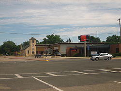
Springer is located in southern Colfax County at 36°21′50″N104°35′37″W / 36.36389°N 104.59361°W / 36.36389; -104.59361 (36.363976, -104.593491). [6] It is in the valley of the Cimarron River, 6 miles (10 km) west of where that river flows into the Canadian River.

Interstate 25 passes along the west side of the town, with access from exits 412 and 414. I-25 leads north 40 miles (64 km) to Raton, the county seat, and southwest 68 miles (109 km) to Las Vegas. The western terminus of U.S. Routes 56 and 412 is in the center of Springer. The two routes together lead 82 miles (132 km) east to Clayton.

According to the United States Census Bureau, Springer has a total area of 1.5 square miles (3.8 km2), all land. [3]

Demographics

Historical population
CensusPop.Note
1910 550
1920 91566.4%
1930 9574.6%
1940 1,31437.3%
1950 1,55818.6%
1960 1,5640.4%
1970 1,5740.6%
1980 1,6575.3%
1990 1,262−23.8%
2000 1,2851.8%
2010 1,047−18.5%
2020 931−11.1%
U.S. Decennial Census [7] [2]

As of the census [8] of 2000, there were 1,285 people, 520 households, and 372 families residing in the town. The population density was 876.6 inhabitants per square mile (338.5/km2). There were 605 housing units at an average density of 412.7 per square mile (159.3/km2). The racial makeup of the town was 79.46% White, 1.09% Native American, 14.94% from other races, and 4.51% from two or more races. Hispanic or Latino of any race were 69.96% of the population.

There were 520 households, out of which 33.1% had children under the age of 18 living with them, 51.2% were married couples living together, 14.2% had a female householder with no husband present, and 28.3% were non-families. 26.5% of all households were made up of individuals, and 13.3% had someone living alone who was 65 years of age or older. The average household size was 2.41 and the average family size was 2.86.

In the town, the population was spread out, with 25.9% under the age of 18, 5.2% from 18 to 24, 25.1% from 25 to 44, 22.3% from 45 to 64, and 21.5% who were 65 years of age or older. The median age was 40 years. For every 100 females, there were 98.0 males. For every 100 females age 18 and over, there were 92.7 males.

The median income for a household in the town was $27,850, and the median income for a family was $34,563. Males had a median income of $24,479 versus $19,000 for females. The per capita income for the town was $14,606. About 14.9% of families and 16.6% of the population were below the poverty line, including 28.0% of those under age 18 and 8.9% of those age 65 or over.

Notable people

Related Research Articles

<span class="mw-page-title-main">Harper County, Oklahoma</span> County in Oklahoma, United States

Harper County is a county located in the U.S. state of Oklahoma. As of the 2020 census, the population was 3,272, making it the third-least populous county in Oklahoma. The county seat is Buffalo. It was created in 1907 from the northwestern part of Woodward County, and named for Oscar Green Harper, who was clerk of the Oklahoma Constitutional Convention.

<span class="mw-page-title-main">Cimarron County, Oklahoma</span> County in Oklahoma, United States

Cimarron County is the westernmost county in the U.S. state of Oklahoma. Its county seat is Boise City. As of the 2020 census, its population was 2,296, making it the least-populous county in Oklahoma; and indeed, throughout most of its history, it has had both the smallest population and the lowest population density of any county in Oklahoma. Located in the Oklahoma Panhandle, Cimarron County contains the only community in the state (Kenton) that observes the Mountain Time Zone. Black Mesa, the highest point in the state, is in the northwest corner of the county. The Cimarron County community of Regnier has the distinction of being the driest spot in Oklahoma ranked by lowest annual average precipitation, at just 15.62 inches; at the same time, Boise City is the snowiest location in Oklahoma ranked by highest annual average snowfall, at 31.6 inches.

<span class="mw-page-title-main">Union County, New Mexico</span> County in New Mexico, United States

Union County is the northeasternmost county in the U.S. state of New Mexico. As of the 2020 census, the population was 4,079, making it the fourth-least populous county in New Mexico. Its county seat is Clayton. The county was formed in 1894. Union County borders Colorado to the north, and Oklahoma and Texas to the east.

<span class="mw-page-title-main">Colfax County, New Mexico</span> County in New Mexico, United States

Colfax County is a county in the U.S. state of New Mexico. As of the 2020 census, the population was 12,387. Its county seat is Raton. It is south from the Colorado state line. This county was named for Schuyler Colfax (1823–1885), seventeenth Vice President of the United States under U.S. President Ulysses S. Grant.

<span class="mw-page-title-main">Mojave Ranch Estates, Arizona</span> CDP in Mohave County, Arizona

Mojave Ranch Estates is an unincorporated community and census-designated place (CDP) in Mohave County, Arizona, United States. The population was 53 as of the 2020 census.

<span class="mw-page-title-main">Colfax, Indiana</span> Town in Indiana, United States

Colfax is a town in Perry Township, Clinton County, Indiana, United States. The population was 691 at the 2010 census. The town was originally known as Midway since it was a half-way point on the IC&L Railroad between Chicago & Louisville. Railways intersected North/South & East/West making Colfax a popular transfer destination. The town was renamed to honor Vice President Schuyler Colfax in 1857.

<span class="mw-page-title-main">Dexter, New Mexico</span> Town in New Mexico, United States

Dexter is a town in Chaves County, New Mexico. The population was 1,266 at the time of the 2010 census.

<span class="mw-page-title-main">Angel Fire, New Mexico</span> Village in New Mexico, United States

Angel Fire is a village in Colfax County, New Mexico, United States. The population was 1,216 at the 2010 census. It is a popular ski resort destination, with over 500 acres (2.0 km2) of slopes. Angel Fire and nearby communities experience cold winter temperatures and mild temperatures in the summer.

<span class="mw-page-title-main">Cimarron, New Mexico</span> Village in New Mexico, United States

Cimarron is a village in Colfax County, New Mexico, United States, which sits on the eastern slopes of the Sangre de Cristo Mountains. The population was 792 at the 2020 census, making it the fourth most populous municipality in Colfax County.

<span class="mw-page-title-main">Eagle Nest, New Mexico</span> Village in New Mexico, United States

Eagle Nest is a village in Colfax County, New Mexico. The population was 290 at the time of the 2010 census. Located along the Enchanted Circle Scenic Byway, Eagle Nest is a small summer-home and resort destination. Originally named Therma, the village was renamed Eagle Nest in the 1930s. The town is located in the Sangre de Cristo Mountains in northern New Mexico near the Colorado border.

<span class="mw-page-title-main">Maxwell, New Mexico</span> Village in New Mexico, United States

Maxwell is a village in Colfax County, New Mexico, United States. The population was 254 at the 2010 census, down from 274 in 2000. Maxwell was established in 1879 as a railroad town on the Atchison, Topeka and Santa Fe Railway. It was named in honor of Lucien Maxwell, who provided the land for the original townsite from his Maxwell Land Grant.

<span class="mw-page-title-main">Raton, New Mexico</span> City in New Mexico, United States

Raton is a city and the county seat of Colfax County in northeastern New Mexico. The city is located just south of Raton Pass. The city is also located about 6.5 miles south of the New Mexico–Colorado border and 85 miles west of Texas.

<span class="mw-page-title-main">Fort Sumner, New Mexico</span> Village and county seat in De Baca County, New Mexico, United States

Fort Sumner is a village in and the county seat of De Baca County, New Mexico, United States. The population was 1,031 at the 2010 U.S. Census, down from the figure of 1,249 recorded in 2000. Fort Sumner is the spring and fall home of the Columbia Scientific Balloon Facility, and is home to the burial site of famed outlaw of the American West, Billy the Kid, who was shot and killed there in 1881.

<span class="mw-page-title-main">Clayton, New Mexico</span> Town in New Mexico, United States

Clayton is a town and county seat of Union County, New Mexico, United States. As of the 2010 census, the city population was 2,980.

<span class="mw-page-title-main">Victory, Saratoga County, New York</span> Village in New York, United States

Victory is a village in Saratoga County, New York, United States. The population was 605 at the 2010 census. The village is located in the northeastern part of the town of Saratoga, southwest of and bordering the village of Schuylerville. Victory is one of the smallest villages in New York.

<span class="mw-page-title-main">West Siloam Springs, Oklahoma</span> Town in Oklahoma, United States

West Siloam Springs is a town in Delaware County, Oklahoma, United States. The population was 1,000 at the 2020 census, an 18.2 percent increase from the figure of 846 recorded in 2010. A bedroom community for Siloam Springs, Arkansas, it is notable for its Cherokee casino, and is the closest town to Natural Falls State Park.

<span class="mw-page-title-main">Cimarron City, Oklahoma</span> Town in Oklahoma, United States

Cimarron City is a town in Logan County, Oklahoma, United States. The population was 150 at the 2010 census, a 39.4 percent gain over the figure of 110 in 2000. It is part of the Oklahoma City Metropolitan Statistical Area. Cimarron City is a combination bedroom and retirement community.

<span class="mw-page-title-main">Woodbury, Pennsylvania</span> Borough in Pennsylvania, United States

Woodbury is a borough in Bedford County, Pennsylvania, United States. The population was 286 at the 2020 census.

<span class="mw-page-title-main">Mill Village, Pennsylvania</span> Borough in Pennsylvania, United States

Mill Village is a borough in Erie County, Pennsylvania, United States. The population was 394 at the 2020 census, down from 412 during the 2010 census. It is part of the Erie Metropolitan Statistical Area.

<span class="mw-page-title-main">Colfax, Washington</span> City in Washington, United States

Colfax is a city and the county seat of Whitman County, Washington, United States. The population was 2,805 at the 2010 census. The population is estimated at 2,911 per the State of Washington Office of Financial Management in 2018 making Colfax the second largest city in Whitman County behind Pullman. It is situated amidst wheat-covered hills in a valley at the confluence of the north and south forks of the Palouse River. U.S. Route 195, which forms the town's main street, intersects with State Route 26 at the north end of town; in the past, Colfax also lay at the junction of three major railway lines. It is part of the Pullman–Moscow combined statistical area. It was named after Schuyler Colfax, the vice president from 1869–73.

References

  1. "ArcGIS REST Services Directory". United States Census Bureau. Retrieved October 12, 2022.
  2. 1 2 "Census Population API". United States Census Bureau. Retrieved October 12, 2022.
  3. 1 2 "Geographic Identifiers: 2010 Demographic Profile Data (G001): Springer town, New Mexico". U.S. Census Bureau, American Factfinder. Archived from the original on February 12, 2020. Retrieved October 22, 2014.
  4. Pearce, T.M.,editor, New Mexico Place Names, A Geographical Dictionary, University of New Mexico Press 1965. ISBN   0-8263-0082-0
  5. "Springer Correctional Center, Springer". New Mexico Corrections Department. Retrieved December 25, 2011.
  6. "US Gazetteer files: 2010, 2000, and 1990". United States Census Bureau. February 12, 2011. Retrieved April 23, 2011.
  7. "Census of Population and Housing". Census.gov. Retrieved June 4, 2015.
  8. "U.S. Census website". United States Census Bureau . Retrieved January 31, 2008.