Fort Grant, Arizona

Last updated
Fort Grant
Aravaipa Canyon, Arizona
Fortgrant 4.jpg
Fort Grant, c. 1885
Coordinates 32°37′26.1″N109°56′41.7″W / 32.623917°N 109.944917°W / 32.623917; -109.944917
Type Army fortification
Site information
Controlled byFlag of Arizona.svg  Arizona
ConditionRepurposed as a state prison
Site history
Built1872
Built byFlag of the United States.svg  United States
In use1860–1905
Battles/wars Apache Wars
Garrison information
Occupants Flag of the United States (1896-1908).svg United States Army

Fort Grant is a state prison and a former United States Army fortification in the U.S. state of Arizona. Fort Grant is located on the southwestern slope of Mount Graham in what is now Graham County. The post is named for Ulysses S. Grant, the 18th President of the United States. [1]

Contents

History

Plan of Fort Grant Fort Grant, Arizona - DPLA - 1410a00582f31258ac6b03ed828d5b6a.jpg
Plan of Fort Grant
The officers' quarters at Fort Grant Fortgrant3.jpg
The officers' quarters at Fort Grant

Fort Grant began its life in August 1860 in the Arizona Territory as an Old West outpost named Fort Breckinridge, at the junction of Aravaipa Creek and the San Pedro River. Fort Breckinridge was destroyed and the site was abandoned in 1861, following removal of the Union garrison at the start of the American Civil War.

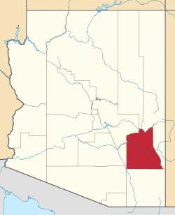
The site of Fort Breckinridge was reoccupied as Fort Stanford, or Camp Stanford, from 1862 to 1865 by troops of the California Column. When the U.S. Army proper finally reoccupied the site, it was renamed Camp Grant between 1865 and 1872. In 1872, after the Camp Grant Massacre, the United States Army post at "old" Camp Grant (at the confluence of Aravaipa Creek and the San Pedro River) was relocated to the southwestern slope of Mount Graham in what is now Graham County. The new fort was strategically placed so as to protect settlers who were constantly harassed by Apache warriors. It played a prominent role in the Apache Wars of the 1880s.

Henry McCarty, better known as "Billy the Kid", reportedly settled in the vicinity of Fort Grant in 1876, working as a ranch hand and tending sheep nearby. In 1877, McCarty killed a local blacksmith at a saloon and gambling house that is now called the Bonita Store, located a few miles from Fort Grant. McCarty was taken into custody at the Fort Grant stockade, but escaped to the New Mexico Territory before he could be tried. Fort Grant was also the departure point for the pay wagons carrying currency during the Wham Paymaster robbery of 1889.

Edgar Rice Burroughs was stationed at Fort Grant in 1896 as an enlisted man after failing the entrance exam for the United States Military Academy at West Point. He was discharged in 1897 after being diagnosed with a heart condition that made him ineligible for a commission. The fort was repurposed in 1900 as a staging point for soldiers going to the Philippines to fight in the Philippine–American War.

Fort Grant was abandoned by the Army in 1905, which transferred all troops to Fort Huachuca and left the fort unoccupied except for a caretaker. In 1912, Arizona gained statehood, and the fort was occupied by the State Industrial School for Wayward Boys and Girls, which modernized most of the buildings. [2] [3]

In 1968, the state of Arizona officially assigned the site to the Department of Corrections, and in 1973 Fort Grant became a state prison for male convicts. In 1997, the prison became a unit of an Arizona State Prison complex headquartered in Safford. The main road to and from Fort Grant is Arizona State Route 266. There is an abandoned general-aviation airport, Angel Field, immediately south of the prison.

Fort Grant Historical Museum

The Fort Grant Historical Museum was once located in the lobby of the administration building, outside the prison grounds. The museum featured artifacts and photos about the fort's military history up through its history as a state reformatory and later as a state prison. [4]

Fort Grant no longer has a visitor area or museum. Visitors are not allowed on prison property unless it is to visit an incarcerated inmate. The administration building has been closed and has no known plans to reopen.[ citation needed ]

Climate

According to the Köppen Climate Classification system, Fort Grant has a semi-arid climate, abbreviated "BSk" on climate maps. [5]

See also

Related Research Articles

<span class="mw-page-title-main">Graham County, Arizona</span> County in Arizona, United States

Graham County is a county in the southeastern part of the U.S. state of Arizona. As of the 2020 census, the population was 38,533, making it the third-least populous county in Arizona. The county seat is Safford.

<span class="mw-page-title-main">Safford, Arizona</span> City in Arizona, United States

Safford is a city in Graham County, Arizona, United States. According to the 2020 Census, the population of the city is 10,129. The city is the county seat of Graham County.

<span class="mw-page-title-main">Camp Verde, Arizona</span> Town in Yavapai County, Arizona

Camp Verde is a town in Yavapai County, Arizona, United States. As of the 2010 census, the population of the town is 10,873.

Arizona State Prison Complex – Safford is one of 13 prison facilities operated by the Arizona Department of Corrections (ADC). ASPC-Safford is located in Safford, Graham County, Arizona, 173 miles southeast from the state capital of Phoenix, Arizona.

<span class="mw-page-title-main">Western Apache people</span> Native American ethnic group

The Western Apache are a subgroup of the Apache Native American people, who live primarily in east central Arizona, in the United States and north of Mexico in the states of Sonora and Chihuahua. Most live within reservations. The Fort Apache Indian Reservation, San Carlos Apache Indian Reservation, Yavapai-Apache Nation, Tonto Apache, and the Fort McDowell Yavapai Nation are home to the majority of Western Apache and are the bases of their federally recognized tribes. In addition, there are numerous bands. The Western Apache bands call themselves Ndee (Indé). Because of dialectical differences, the Pinaleño/Pinal and Arivaipa/Aravaipa bands of the San Carlos Apache pronounce the word as Innee or Nnēē:.

<span class="mw-page-title-main">Apache Pass</span> Landform in Cochise County, Arizona

Apache Pass, also known by its earlier Spanish name Puerto del Dado, is a historic mountain pass in the U.S. state of Arizona between the Dos Cabezas Mountains and Chiricahua Mountains at an elevation of 5,110 feet (1,560 m). It is approximately 20 miles (32 km) east-southeast of Willcox, Arizona, in Cochise County.

<span class="mw-page-title-main">Camp Grant massacre</span> Part of the Apache Wars

The Camp Grant massacre, on April 30, 1871, was an attack on Pinal and Aravaipa Apaches who surrendered to the United States Army at Camp Grant, Arizona, along the San Pedro River. The massacre led to a series of battles and campaigns fought between the Americans, the Apache, and their Yavapai allies, which continued into 1875, the most notable being General George Crook's Tonto Basin Campaign of 1872 and 1873.

<span class="mw-page-title-main">Fort Yuma</span> US Army fort (1851–1853) in California near Yuma, Arizona

Fort Yuma was a fort in California located in Imperial County, across the Colorado River from Yuma, Arizona. It was Established in 1848. It served as a stop on the Butterfield Overland Mail route from 1858 until 1861. The fort was retired from active military service on May 16, 1883, and transferred to the Department of the Interior. The Fort Yuma Indian School and the Saint Thomas Yuma Indian Mission now occupy the site. It is one of the "associated sites" listed as Yuma Crossing and Associated Sites on the National Register of Historic Places in the Yuma Crossing National Heritage Area. In addition, it is registered as California Historical Landmark #806.

<span class="mw-page-title-main">San Pedro River (Arizona)</span> River in northern Sonora, Mexico, and southern Arizona, USA

The San Pedro River is a northward-flowing stream originating about 10 miles (16 km) south of the international border south of Sierra Vista, Arizona, in Cananea Municipality, Sonora, Mexico. The river starts at the confluence of other streams just east of Sauceda, Cananea. Within Arizona, the river flows 140 miles (230 km) north through Cochise County, Pima County, Graham County, and Pinal County to its confluence with the Gila River, at Winkelman, Arizona. It is the last major, undammed desert river in the American Southwest, and it is of major ecological importance as it hosts two-thirds of the avian diversity in the United States, including 100 species of breeding birds and almost 300 species of migrating birds.

<span class="mw-page-title-main">Fort Thomas, Arizona</span> CDP in Graham County, Arizona

Fort Thomas is a census-designated place in Graham County, Arizona, United States. Its population was 319 as of the 2020 census. The community has an elementary school and a high school. It is part of the Safford Micropolitan Statistical Area. Fort Thomas has a ZIP code of 85536.

<span class="mw-page-title-main">Presidio San Ignacio de Tubac</span> Historic former fort in southern Arizona

The Presidio of San Ignacio de Túbac or Fort Tubac was a Spanish built fortress. The fortification was established by the Spanish Army in 1752 at the site of present-day Tubac, Arizona. Its ruins are preserved in the Tubac Presidio State Historic Park.

<span class="mw-page-title-main">Traditional Arizona</span> Aspect of state history

Prior to the adoption of its name for a U.S. state, Arizona was traditionally defined as the region south of the Gila River to the present-day Mexican border, and between the Colorado River and the Rio Grande. It encompasses present-day Southern Arizona and the New Mexico Bootheel plus adjacent parts of Southwestern New Mexico. This area was transferred from Mexico to the United States in the Gadsden Purchase of 1853. Mining and ranching were the primary occupations of traditional Arizona's inhabitants, though growing citrus fruits had long been occurring in Tucson.

<span class="mw-page-title-main">Royal Emerson Whitman</span> United States Army officer (1833–1913)

Colonel Royal Emerson Whitman, was an American army officer who served in the Civil War, Reconstruction and the Indian wars, best known for his association with the 1871 Camp Grant massacre. He was the father of noted orthopedic surgeon Royal Whitman.

<span class="mw-page-title-main">Presidio San Agustín del Tucsón</span> Remains of an 18th-century Spanish fort in Tucson, Arizona

Presidio San Agustín del Tucsón was a presidio located within Tucson, Arizona, United States. The original fortress was built by Spanish soldiers during the 18th century and was the founding structure of what became the city of Tucson. After the American arrival in 1846, the original walls were dismantled, with the last section torn down in 1918. A reconstruction of the northeast corner of the fort was completed in 2007 following an archaeological excavation that located the fort's northeast tower.

<span class="mw-page-title-main">Fort McDowell, Arizona</span> Unincorporated community in the state of Arizona, United States

Fort McDowell is an unincorporated community in Maricopa County, Arizona, United States. Fort McDowell is 23 miles northeast of Phoenix. Fort McDowell has a post office with ZIP code 85264.

<span class="mw-page-title-main">Aravaipa Creek</span> Creek in Graham County, Arizona

Aravaipa Creek is a drainage between three mountain ranges in southwest Graham County, Arizona – the Galiuro Mountains, the Santa Teresa Mountains and the Pinaleno Mountains. These mountains are part of the high altitude Madrean Sky Islands located in southern Arizona and New Mexico in the United States, and northern Sonora and Chihuahua states in Mexico.

<span class="mw-page-title-main">Yavapai Wars</span> Part of the Apache Wars

The Yavapai Wars, or the Tonto Wars, were a series of armed conflicts between the Yavapai and Tonto tribes against the United States in the Arizona Territory. The period began no later than 1861, with the arrival of American settlers on Yavapai and Tonto land. At the time, the Yavapai were considered a band of the Western Apache people due to their close relationship with tribes such as the Tonto and Pinal. The war culminated with the Yavapai's removal from the Camp Verde Reservation to San Carlos on February 27, 1875, an event now known as Exodus Day.

<span class="mw-page-title-main">Camp Grant, Arizona</span> Military post in the Arizona Territory (1860–72)

Camp Grant was the name used from 1866 to 1872 for the United States military post at the confluence of the San Pedro River and Aravaipa Creek in the Arizona Territory. It is near the site of the Camp Grant massacre.

Camp Goodwin, and Fort Goodwin, a historical locale, at an elevation of 2648 feet, located in Graham County, Arizona.

Aravaipa, formerly Dunlap, a former populated place, on Arizona Gulch, a tributary of Deer Creek, tributary to Aravaipa Creek north of Klondyke in Graham County, Arizona. Aravaipa lies at an elevation of 4596 feet.

References

  1. Gannett, Henry (1905). The Origin of Certain Place Names in the United States. Govt. Print. Off. pp.  141.
  2. "Fort Grant History". Arizona Department of Corrections. Archived from the original on October 13, 2011. Retrieved December 8, 2011.
  3. A pictorial tour of the Arizona State Industrial School for Boys at Fort Grant, Arizona. Print Shop. 1949.
  4. "Museum/Heritage Resources". Graham County Chamber of Commerce. Archived from the original on 16 July 2013. Retrieved 1 December 2013.
  5. Climate Summary for Fort Grant, Arizona

32°37′22″N109°56′45″W / 32.62278°N 109.94583°W / 32.62278; -109.94583