Pima, Arizona

Last updated

Pima, Arizona
Pima-Building-Pima Historic Block.jpg
Downtown Pima
Flag of Pima, Arizona.svg
Motto: 
"Pioneers of the Valley" [1]
Graham County Arizona Incorporated and Unincorporated areas Pima Highlighted 0455560.svg
Location of Pima in Graham County, Arizona.
Usa edcp location map.svg
Red pog.svg
Pima, Arizona
Location in the United States
Coordinates: 32°52′32″N109°50′05″W / 32.87556°N 109.83472°W / 32.87556; -109.83472
Country United States
State Arizona
County Graham
Area
[2]
  Total7.36 sq mi (19.05 km2)
  Land7.30 sq mi (18.90 km2)
  Water0.06 sq mi (0.16 km2)
Elevation
[3]
2,881 ft (878 m)
Population
 (2020)
  Total2,847
  Density390.21/sq mi (150.67/km2)
Time zone UTC-7 (MST (no DST))
ZIP codes
85535, 85543
Area code 928
FIPS code 04-55560
GNIS feature ID2413130 [3]
Website www.pimatown.az.gov

Pima is a town in Graham County, Arizona, United States. As of the 2010 census, the population of the town was 2,387, [4] up from 1,989 in 2000. The estimated population in 2018 was 2,512. [5] Pima is part of the Safford Micropolitan Statistical Area.

Contents

Despite its name, it is not located in nearby Pima County.

History

Pima was settled by Mormon settlers in 1879. It was originally named "Smithville". The first settlers had been living in Forrest Dale, but then were told they had to leave because the location was on Indian land. Unlike other Mormon settlements of the era, Smithville was not planned by the leaders of the church. [6]

Joseph K. Rogers was the first branch president at Pima, being appointed to this office before any of the settlers arrived. [7] The branch was organized into a ward in 1880. [8] In 1930 the ward had 666 members. Pima had a population of 980, and a total of 1,260 people resided within the boundaries of the Pima ward. [9] In 1990 Pima had 1,725 residents.

In 1882 Jesse N. Smith predicted that a Mormon temple would one day be built in Pima. [10] The Gila Valley Arizona Temple is currently at a site between Pima and Thatcher in Central, Arizona, [11] within the boundaries of the Pima Arizona Stake of the Church.

Geography

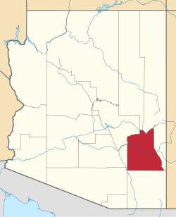
Pima is located in central Graham County in the valley of the Gila River. U.S. Route 70 passes through the town, leading southeast 8 miles (13 km) to Safford, the county seat, and northwest 68 miles (109 km) to Globe.

According to the United States Census Bureau, the town has a total area of 5.9 square miles (15.4 km2), of which 0.04 square miles (0.1 km2), or 0.76%, is water. [4]

Demographics

Historical population
CensusPop.Note
1890 750
1900 521−30.5%
1910 500−4.0%
1920 5153.0%
1930 98090.3%
1940 867−11.5%
1950 824−5.0%
1960 806−2.2%
1970 1,18446.9%
1980 1,59935.1%
1990 1,7257.9%
2000 1,98915.3%
2010 2,38720.0%
2020 2,84719.3%
U.S. Decennial Census [12]

As of the census [13] of 2000, there were 1,989 people, 663 households, and 521 families residing in the town. The population density was 787.0 inhabitants per square mile (303.9/km2). There were 735 housing units at an average density of 290.8 per square mile (112.3/km2). The racial makeup of the town was 87.0% White, 0.2% Black or African American, 0.8% Native American, 0.1% Asian, 9.9% from other races, and 2.1% from two or more races. 20.1% of the population were Hispanic or Latino of any race.

There were 663 households, out of which 42.5% had children under the age of 18 living with them, 63.3% were married couples living together, 10.6% had a female householder with no husband present, and 21.4% were non-families. 18.4% of all households were made up of individuals, and 10.3% had someone living alone who was 65 years of age or older. The average household size was 3.00 and the average family size was 3.43.

In the town, the population was spread out, with 34.3% under the age of 18, 9.8% from 18 to 24, 23.4% from 25 to 44, 18.3% from 45 to 64, and 14.2% who were 65 years of age or older. The median age was 30 years. For every 100 females, there were 97.3 males. For every 100 females age 18 and over, there were 89.8 males.

The median income for a household in the town was $30,985, and the median income for a family was $34,900. Males had a median income of $31,765 versus $21,042 for females. The per capita income for the town was $12,896. About 15.0% of families and 19.4% of the population were below the poverty line, including 25.3% of those under age 18 and 15.6% of those age 65 or over.

Transportation

San Carlos Apache Nnee Bich'o Nii Transit provides transportation from Pima to the San Carlos Apache Indian Reservation, Safford and Globe. [14]

See also

Related Research Articles

<span class="mw-page-title-main">Graham County, Arizona</span> County in Arizona, United States

Graham County is a county in the southeastern part of the U.S. state of Arizona. As of the 2020 census, the population was 38,533, making it the third-least populous county in Arizona. The county seat is Safford.

<span class="mw-page-title-main">Pima County, Arizona</span> County in Arizona, United States

Pima County is a county in the south central region of the U.S. state of Arizona. As of the 2020 census, the population was 1,043,433, making it Arizona's second-most populous county. The county seat is Tucson, where most of the population is centered. The county is named after the Pima Native Americans, also known as Tohono O'odham, who are indigenous to this area.

<span class="mw-page-title-main">Pinal County, Arizona</span> County in Arizona, United States

Pinal County is a county in the central part of the U.S. state of Arizona. According to the 2020 census, the population of the county was 425,264, making it Arizona's third-most populous county. The county seat is Florence. The county was founded in 1875.

<span class="mw-page-title-main">Eagar, Arizona</span> Town in Apache County, Arizona

Eagar is a town in Apache County, Arizona, United States. As of the 2010 census, the population of the town was 4,885.

<span class="mw-page-title-main">Globe, Arizona</span> City in Arizona, United States

Globe is a city in Gila County, Arizona, United States. As of the 2020 census, the population of the city was 7,249. The city is the county seat of Gila County. Globe was founded c. 1875 as a mining camp. Mining, tourism, government and retirees are most important in the present-day Globe economy.

<span class="mw-page-title-main">Peridot, Arizona</span> CDP in Arizona, US

Peridot is an unincorporated community and census-designated place (CDP) in Gila and Graham counties in the U.S. state of Arizona. The population was 1,350 at the 2010 census.

<span class="mw-page-title-main">Pine, Arizona</span> CDP in Gila County, Arizona

Pine is an unincorporated community and census-designated place (CDP) in Gila County, Arizona, United States. The population was 1,953 at the 2020 census. Pine was established by four Mormon families in 1879.

<span class="mw-page-title-main">San Carlos, Arizona</span> CDP in Gila County, Arizona

San Carlos is a census-designated place (CDP) in Gila County, Arizona, United States. The population was 4,038 at the 2010 census, up from 3,716 in 2000.

<span class="mw-page-title-main">Safford, Arizona</span> City in Arizona, United States

Safford is a city in Graham County, Arizona, United States. According to the 2020 Census, the population of the city is 10,129. The city is the county seat of Graham County.

<span class="mw-page-title-main">Thatcher, Arizona</span> Town in Graham County, Arizona

Thatcher is a town in Graham County, Arizona, United States. According to the 2010 Census, the population of the town is 4,865. It is part of the Safford Micropolitan Statistical Area.

<span class="mw-page-title-main">Duncan, Arizona</span> Town in Greenlee County, Arizona

Duncan is a town in Greenlee County, Arizona, United States. As of the 2010 census, the population of the town was 696. In 2018 the estimated population was 789.

<span class="mw-page-title-main">Gila Bend, Arizona</span> Town in Maricopa County, Arizona

Gila Bend, founded in 1872, is a town in Maricopa County, Arizona, United States. The town is named for an approximately 90-degree bend in the Gila River, which is near the community's current location. As of the 2020 census, the population of the town was 1,892.

<span class="mw-page-title-main">Sacaton, Arizona</span> CDP in Pinal County, Arizona

Sacaton is a census-designated place (CDP) in Pinal County, Arizona, United States. The population was 3,254 at the 2020 census. It is the capital of the Gila River Indian Community.

<span class="mw-page-title-main">Ammon, Idaho</span> City in Idaho, United States

Ammon is a suburb city in Bonneville County, Idaho, United States. As of the 2010 US Census, the population of Ammon was 13,816. By the 2020 census, Ammon's population had grown to 17,694. It lies directly to the east of Idaho Falls and to the west of the Ammon foothills, and is the second most populous city in the Idaho Falls metropolitan area.

<span class="mw-page-title-main">Dayton, Idaho</span> City in Idaho, United States

Dayton is a city in Franklin County, Idaho, United States. The population was 463 at the 2010 census. It is part of the Logan, Utah-Idaho Metropolitan Statistical Area.

<span class="mw-page-title-main">Clarkston, Utah</span> Town in the state of Utah, United States

Clarkston is a town in Cache County, Utah, United States. The population was 666 at the 2010 census. It is included in the Logan, Utah-Idaho Metropolitan Statistical Area. The community celebration is held in June each year and is known as The Pony Express Days.

<span class="mw-page-title-main">Mendon, Utah</span> City in Utah, United States

Mendon is a city in Cache County, Utah, United States. The population was 1,282 at the 2010 census. It is included in the Logan, Utah-Idaho Metropolitan Statistical Area.

<span class="mw-page-title-main">Meadow, Utah</span> Town in the state of Utah, United States

Meadow is a town in Millard County, Utah, United States. The population was 254 at the 2000 census. Originally called Meadow Creek, the town is located about eight miles south of Fillmore.

<span class="mw-page-title-main">Gila River Valley</span> Valley in Arizona, United States of America

The Gila River Valley is a multi-sectioned valley of the Gila River, located primarily in Arizona. The Gila River forms in western New Mexico and flows west across southeastern, south-central, and southwestern Arizona; it changes directions as it progresses across the state, and defines specific areas and valleys. The central portion of the river flows through the southern Phoenix valley region, and the final sections in southwestern Arizona form smaller, irrigated valleys, such as Dome Valley, Mohawk Valley, and Hyder Valley.

<span class="mw-page-title-main">Central, Arizona</span> CDP in Graham County, Arizona

Central is a census-designated place in Graham County, Arizona, United States. Its population was 758 as of the 2020 census. It is part of the Safford micropolitan area.

References

  1. "Town of Pima: Pioneers of the Valley". Town of Pima. Retrieved November 8, 2016.
  2. "2020 U.S. Gazetteer Files". United States Census Bureau. Retrieved October 29, 2021.
  3. 1 2 U.S. Geological Survey Geographic Names Information System: Pima, Arizona
  4. 1 2 "Geographic Identifiers: 2010 Demographic Profile Data (G001): Pima town, Arizona". U.S. Census Bureau, American Factfinder. Retrieved November 8, 2016.[ dead link ]
  5. "Population and Housing Unit Estimates" . Retrieved June 4, 2019.
  6. McClintock, James H. (1921). Mormon Settlement in Arizona. Phoenix, Arizona: Office of the Arizona State Historian. pp.  244–246. Retrieved April 20, 2009.
  7. Jenson, Andrew. Encyclopedic History of the Church of Jesus Christ of Latter-day Saints (Salt Lake City: Deseret Book, 1941) p. 654
  8. Jenson. Encyclopedic History. p. 654.
  9. Jenson. Encyclopedic History. p. 654
  10. McClintock (1921), p. 223.
  11. Adair, Jill (February 16, 2009). "Ground broken for Gila Valley temple". Church News. Retrieved April 8, 2009.
  12. "Census of Population and Housing". Census.gov. Retrieved June 4, 2016.
  13. "U.S. Census website". United States Census Bureau . Retrieved January 31, 2008.
  14. "Globe/Safford Route". Nnee Bich'o Nii Transit. Retrieved January 27, 2020.