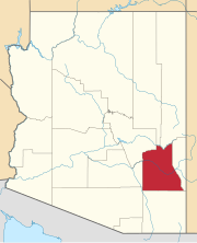
Allentown, is a populated place located in Apache County, Arizona, United States. It has an estimated elevation of 6,145 feet (1,873 m) above sea level.
Artesia is a populated place situated in Graham County, Arizona, United States.
Ashurst is a populated place situated in Graham County, Arizona, United States, and appears on the Eden U.S. Geological Survey Map.

Beardsley is a populated place situated within the Sun City West CDP in Maricopa County, Arizona, United States. It has an estimated elevation of 1,263 feet (385 m) above sea level, and was named for William H. Beardsley, an irrigation pioneer who began an irrigation project at this location in 1888.
Buena Vista is a populated place situated in Graham County, Arizona, United States.
Calva is a populated place situated in Graham County, Arizona, United States.
Crookton is a place situated in Yavapai County, Arizona, United States. It has an estimated elevation of 5,699 feet (1,737 m) above sea level. Crookton is a point on the railroad named in honor of General George Crook.
Breezy Pine is a populated place situated in Yavapai County, Arizona, United States. It has an estimated elevation of 5,945 feet (1,812 m) above sea level.
Whispering Pines is a census-designated place (CDP) in Gila County, Arizona, United States. It is one of two locations in Arizona with this name, the other being a populated place in Greenlee County. The population was 148 at the 2010 United States Census.
Entro, also known as Entro Siding and P and E Junction, was a rail junction in Yavapai County, Arizona, United States. It has an estimated elevation of 5,141 feet (1,567 m) above sea level. It was the point at which the Prescott and Eastern Railroad met the Santa Fe, Prescott and Phoenix Railway, eventually part of the Atchison, Topeka and Santa Fe Railway. In 1917 it had a population of 15. The lines were eventually abandoned.
Glenbar is a populated place situated in Graham County, Arizona, United States.
Indian Hot Springs, also known as Holladay Hot Springs, is a populated place situated in Graham County, Arizona, United States.
Indian Pine is a populated place situated in Navajo County, Arizona, United States. It has an estimated elevation of 7,175 feet (2,187 m) above sea level.
Itak is a populated place situated in Pima County, Arizona, United States. Itak means "point of mountain" in the O'odham language. European settlers had referred to this place as Rocky Point at least through the early part of the twentieth century. On September 8, 1939, the Office of Indian Affairs petitioned the USGS to officially recognize the name of the location as Itak, as that was the name preferred by the local residents, and was more historical. On April 10, 1941, the Board on Geographic Names rendered its decision, officially naming the place Itak. It has an estimated elevation of 2,297 feet (700 m) above sea level.
Jackrabbit was an early 20th century mining community in Pinal County, Arizona, USA, just north of the border of Pima County. It has an estimated elevation of 1,542 feet (470 m) above sea level.
Lone Star is a populated place situated in Graham County, Arizona, United States. The community is located eight miles north of Solomonville and was named after the nearby mine and mountain.
Pine Springs is a populated place situated in Apache County, Arizona, United States.
Sanchez is a populated place situated in Graham County, Arizona, United States. It has an estimated elevation of 3,061 feet (933 m) above sea level.
Santa Cruz is a populated place situated in Pima County, Arizona, United States. It has an estimated elevation of 2,812 feet (857 m) above sea level. It is one of two locations in Arizona with this name, the other being the census-designated place in Pinal County.
Wheatfields is a populated place situated in Apache County, Arizona, United States, right along the border with New Mexico. It has an estimated elevation of 7,287 feet (2,221 m) above sea level. It is one of two places in Arizona with this name, the other being a CDP in Gila County. In 1909, the US Government set up an irrigation project to assist the Navajo residents. It is a chapter of the Navajo Nation.


