Aripine is a populated place situated in Navajo County, Arizona, United States. It has an estimated elevation of 6,427 feet (1,959 m) above sea level.
Artesia is a populated place situated in Graham County, Arizona, United States.
Ashurst is a populated place situated in Graham County, Arizona, United States, and appears on the Eden U.S. Geological Survey Map.

Baby Rocks is a populated place situated in Navajo County, Arizona, United States, and appears on the Baby Rocks U.S. Geological Survey Map. It has an estimated elevation of 5,236 feet (1,596 m) above sea level.
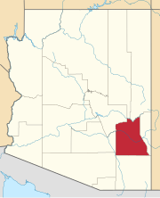
Buena Vista is a populated place situated in Graham County, Arizona, United States.
Buenos Aires, also known as Buena Ayres or Buenos Ayres, is a populated place situated in Pima County, Arizona. It has an estimated elevation of 3,045 feet (928 m) above sea level. Buenos Aires is located on the Tohono Oʼodham Indian Reservation. The settlement once had its own school district, which has since become part of the Baboquivari Unified School District.
Calva is a populated place situated in Graham County, Arizona, United States.
Forepaugh is a populated place situated in Maricopa County, Arizona, United States. It has an estimated elevation of 2,303 feet (702 m) above sea level. It is located along the Arizona and California Railroad.
Glenbar is a populated place situated in Graham County, Arizona, United States.
Hooper is a populated place situated in Yavapai County, Arizona, United States. It was begun as a mining camp, originally called Foresight, which was a misspelling of Foresythe, having been named after the Foresythe family, one of whom, John Foresythe, served as postmaster. It has an estimated elevation of 5,331 feet (1,625 m) above sea level.
Humbug, also known as Humburg, is a populated place situated in Yavapai County, Arizona, United States. Named after Humbug Creek, it has an estimated elevation of 2,461 feet (750 m) above sea level.
Hunt is a populated place situated on the Little Colorado River at the mouth of Concho Creek in Apache County, Arizona, United States. It is named after Colonel James Hunt, who served at Fort Apache in the 1870s.
Indian Hot Springs, also known as Holladay Hot Springs, is a populated place situated in Graham County, Arizona, United States.
Johnson is a populated place situated in Cochise County, Arizona, United States, on the east side of the Little Dragoon Mountains.
Las Guijas is a populated place situated in Pima County, Arizona, United States. It has an estimated elevation of 3,451 feet (1,052 m) above sea level. The name, as with the nearby mountains of the same name, comes from 19th century Spanish miners referring to las guijas for "the rubble" as the placer gold they were working occurred in the gravels or conglomerates along the stream valleys and gulches draining the range.
Point of Pines is a populated place situated on the San Carlos Apache Indian Reservation in Graham County, Arizona, United States.

Salt River is a populated place situated in Maricopa County, Arizona, United States. It has an estimated elevation of 1,220 feet (370 m) above sea level. It is located on the Salt River Pima–Maricopa Indian Community.
Sanchez is a populated place situated in Graham County, Arizona, United States. It has an estimated elevation of 3,061 feet (933 m) above sea level.
San Pedro, also known as San Pedro Well and Viopoli or Viopuli is a populated place situated in Pima County, Arizona, United States.

Sombrero Butte is a populated place situated in Pinal County, Arizona, United States. The location takes its name from a nearby butte of the same name, so called because of its resemblance to a huge sombrero. It has an estimated elevation of 4,071 feet (1,241 m) above sea level.


