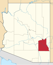
The 1940 United States Senate elections in Arizona took place on November 5, 1940. Incumbent Democratic U.S. Senator Henry F. Ashurst ran for reelection to a sixth term, but was defeated in the Democratic primary to challenger Ernest McFarland.

Apache is a ghost town in Cochise County, Arizona, United States. It has an estimated elevation of 4,383 feet (1,336 m) above sea level.
Aripine is a populated place situated in Navajo County, Arizona, United States. It has an estimated elevation of 6,427 feet (1,959 m) above sea level.
Arizola is a populated place situated in Pinal County, Arizona, United States. It has an estimated elevation of 1,437 feet (438 m) above sea level.
Ashurst is a populated place situated in Graham County, Arizona, United States, and appears on the Eden U.S. Geological Survey Map.
Aultman was a settlement now within the town of Camp Verde in Yavapai County, Arizona, United States. It has an estimated elevation of 3,281 feet (1,000 m) above sea level.

Aztec is a census designated place situated in Yuma County, Arizona, United States. It had a population of 47 as of the 2010 U.S. Census. As of July 2015, Aztec had an estimated population of 52. It has an estimated elevation of 509 feet (155 m) above sea level. It is located along Interstate 8 to the west of Tenmile Wash.
Buena Vista is a populated place situated in Graham County, Arizona, United States.
Calva is a populated place situated in Graham County, Arizona, United States.
Glenbar is a populated place situated in Graham County, Arizona, United States.
Not to be confused with the nearby Harquahala Mountains.
Humbug, also known as Humburg, is a populated place situated in Yavapai County, Arizona, United States. Named after Humbug Creek, it has an estimated elevation of 2,461 feet (750 m) above sea level.
Indian Hot Springs, also known as Holladay Hot Springs, is a populated place situated in Graham County, Arizona, United States.
Lone Star is a populated place situated in Graham County, Arizona, United States. The community is located eight miles north of Solomonville and was named after the nearby mine and mountain.

Mount Trumbull is a populated place situated in Mohave County, Arizona, United States. It has also been known as Bundyville. It has an estimated elevation of 5,331 feet (1,625 m) above sea level.
Point of Pines is a populated place situated on the San Carlos Apache Indian Reservation in Graham County, Arizona, United States.
Riordan was a populated place situated in Coconino County, Arizona, United States. It has an estimated elevation of 7,316 feet (2,230 m) above sea level.
Sanchez is a populated place situated in Graham County, Arizona, United States. It has an estimated elevation of 3,061 feet (933 m) above sea level.
Sunnyside is a populated place situated in the far west of Cochise County, Arizona, United States, located just north of the international border with Mexico. It has an estimated elevation of 5,814 feet (1,772 m) above sea level.

Youngberg is a populated place situated in Pinal County, Arizona, United States.


