Camp Goodwin

Last updated
Camp Goodwin (historical)
Locale
Nickname(s): Fort Goodwin
USA Arizona location map.svg
Red pog.svg
Camp Goodwin (historical)
Coordinates: 33°05′20″N110°03′29″W / 33.08889°N 110.05806°W / 33.08889; -110.05806 Coordinates: 33°05′20″N110°03′29″W / 33.08889°N 110.05806°W / 33.08889; -110.05806
Country United States
State Arizona
County Graham
Elevation 2,648 ft (807 m)
Time zone Mountain (MST) (UTC-7)
GNIS feature ID 23918 [1]

Camp Goodwin, and Fort Goodwin, a historical locale, at an elevation of 2648 feet, located in Graham County, Arizona. [1]

Locale is the geographic place at which there is or was human activity. It does not include populated places, mines, and dams. Locale indicates locations of present more dispersed, periodic or temporary human activity, such as a crossroad, a camp, a farm, a landing, a railroad siding, a ranch, a windmill or one of any of the various types of agricultural, communication, infrastructure or transport stations where human activities are carried out.

Graham County, Arizona County in the United States

Graham County is a county located in the southeastern part of the U.S. state of Arizona. As of the 2010 census, the population was 37,220, making it the third-least populous county in Arizona. The county seat is Safford.

Contents

History

Camp Goodwin, then Fort Goodwin, was constructed in June 1864 by the California Volunteers, of the Union Army in Arizona Territory for a base for prosecuting the 1861-1872 Apache War and protecting settlers in the Upper Gila River region. It was named for Arizona's first territorial governor, John N. Goodwin. The adobe buildings it was constructed with began to crumble in a few years due to poor construction. Additionally the camp was plagued by malaria from mosquitoes in the cienega fed by the nearby spring from which the fort obtained its water. Called Camp Goodwin again from 1866, the camp was abandoned by the Army in March, 1871 due to the illness caused by malaria.

Union Army Land force that fought for the Union during the American Civil War

During the American Civil War, the Union Army referred to the United States Army, the land force that fought to preserve the Union of the collective states. Also known as the Federal Army, it proved essential to the preservation of the United States of America as a working, viable republic.

Arizona Territory US 19th century-early 20th century territory

The Territory of Arizona was a territory of the United States that existed from February 24, 1863 until February 14, 1912, when the remaining extent of the territory was admitted to the Union as the state of Arizona. It was created from the western half of the New Mexico Territory during the American Civil War.

Apache Wars armed conflicts between indigenous peoples and white people in southwestern USA between 1849 and circa 1924

The Apache Wars were a series of armed conflicts between the United States Army and various Apache nations fought in the southwest between 1849 and 1886, though minor hostilities continued until as late as 1924. The United States inherited conflicts between American invaders and Apache groups when Mexico ceded territory after the Mexican–American War in 1846. These conflicts continued as new United States citizens came into traditional Apache lands to raise livestock, crops and to mine minerals.

The camp was subsequently used as a subagency of the San Carlos Apache Indian Reservation until about 1884. [2]

San Carlos Apache Indian Reservation Indian reservation

The San Carlos Apache Indian Reservation, in southeastern Arizona, United States, was established in 1872 as a reservation for the Chiricahua Apache tribe as well as surrounding Yavapai and Apache bands forcibly removed from their original homelands under a strategy devised by General George Crook of using an Apache to catch an Apache. Also known as "Hell's Forty Acres" under United States occupation because of deplorable health and environmental conditions, today's San Carlos Apaches successfully operate a Chamber of Commerce, the Apache Gold Casino, a Language Preservation program, a Culture Center, and a Tribal College.

Today the site is located on farmland not far from the ghost town of Geronimo. Nothing remains of the post, the only physical marker is a Bureau of Land Management survey marker which indicates the original site of its flagpole.

Geronimo, Arizona Populated place in Arizona, United States

Geronimo is a populated place located on Highway 70 between Bylas and Fort Thomas west of Safford in Graham County, Arizona. Geronimo lies at an elevation of 2,723 feet (830 m).

Bureau of Land Management agency within the United States Department of the Interior

The Bureau of Land Management (BLM) is an agency within the United States Department of the Interior that administers more than 247.3 million acres (1,001,000 km2) of public lands in the United States which constitutes one-eighth of the landmass of the country. President Harry S. Truman created the BLM in 1946 by combining two existing agencies: the General Land Office and the Grazing Service. The agency manages the federal government's nearly 700 million acres (2,800,000 km2) of subsurface mineral estate located beneath federal, state and private lands severed from their surface rights by the Homestead Act of 1862. Most BLM public lands are located in these 12 western states: Alaska, Arizona, California, Colorado, Idaho, Montana, Nevada, New Mexico, Oregon, Utah, Washington and Wyoming.

Related Research Articles

Fort Verde State Historic Park State historic park

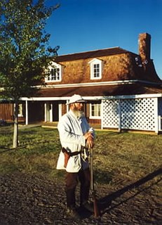
Fort Verde State Historic Park in the town of Camp Verde, Arizona is a small park that attempts to preserve parts of the Apache Wars-era fort as it appeared in the 1880s. The park was established in 1970 and was added to the National Register of Historic Places a year later.

Apache Pass

Apache Pass, also known by its earlier Spanish name Puerto del Dado, is a historic mountain pass in the U.S. state of Arizona between the Dos Cabezas Mountains and Chiricahua Mountains at an elevation of 5,110 feet (1,560 m). It is approximately 20 miles (32 km) east-southeast of Willcox, Arizona, in Cochise County.

Fort Apache Indian Reservation

The Fort Apache Indian Reservation is an Indian reservation in Arizona, United States, encompassing parts of Navajo, Gila, and Apache counties. It is home to the federally recognized White Mountain Apache Tribe of the Fort Apache Reservation, a Western Apache tribe. It has a land area of 2,627 square miles (6,800 km2) and a population of 12,429 people as of the 2000 census. The largest community is in Whiteriver.

Camp Grant massacre

The Camp Grant massacre, on April 30, 1871, was an attack on Pinal and Aravaipa Apaches who surrendered to the United States Army at Camp Grant, Arizona, along the San Pedro River. The massacre led to a series of battles and campaigns fought between the Americans, the Apache, and their Yavapai allies, which continued into 1875, the most notable being General George Crook's Tonto Basin Campaign of 1872 and 1873.

Fort Bowie historic fort in Arizona, USA

Fort Bowie was a 19th-century outpost of the United States Army located in southeastern Arizona near the present day town of Willcox, Arizona. The remaining buildings and site are now protected as Fort Bowie National Historic Site.

Fort Yuma

Fort Yuma was a fort in California located in Imperial County, across the Colorado River from Yuma, Arizona. It was on the Butterfield Overland Mail route from 1858 until 1861 and was abandoned May 16, 1883, and transferred to the Department of the Interior. The Fort Yuma Indian School and the Saint Thomas Yuma Indian Mission now occupy the site. It is one of the "associated sites" listed as Yuma Crossing and Associated Sites on the National Register of Historic Places in the Yuma Crossing National Heritage Area. In addition, it is registered as California Historical Landmark #806.

Fort Selden

Fort Selden was a United States Army post, occupying the area in what is now Radium Springs, New Mexico. The site was long a campground along the El Camino Real de Tierra Adentro. It was the site of a Confederate Army camp in 1861. The U. S. Army established Fort Selden in 1865 for the purpose of protecting westward settlers from Native American raids, the post fell into disrepair after the American Civil War. It was ultimately abandoned in 1891, due in large part to the decision to expand Fort Bliss and the lack of any expenditures for repair of the facility.

Mission San Cayetano de Calabazas place in Arizona listed on National Register of Historic Places

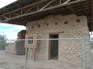
Mission San Cayetano de Calabazas, also known as Calabasas, is a Spanish Mission in the Sonoran Desert, located near present-day near Tumacácori, Arizona.

Fort Wayne was the name of two forts near the present-day border of northeastern Oklahoma and northwestern Arkansas.

Yavapai tribe

Yavapai are a Native American tribe in Arizona. Historically, the Yavapai – literally “people of the sun” – were divided into four geographical bands who identified as separate, independent peoples: the Ɖo:lkabaya, or Western Yavapai; the Yavbe', or Northwestern Yavapai; the Guwevkabaya, or Southeastern Yavapai; and the Wi:pukba, or Northeastern Yavapai - Verde Valley Yavapai.

Fort Grant, Arizona a state prison and a former United States Army fortification

Fort Grant, located in the U.S. state of Arizona, is a state prison and a former United States Army fortification. Fort Grant is located on the southwestern slope of Mount Graham in what is now Graham County. The post is named for Ulysses S. Grant, 18th President of the United States.

Fort Thomas, Arizona Census-designated place in Arizona, United States

Fort Thomas is a census-designated place in Graham County, Arizona, United States. Its population was 374 as of the 2010 census. The community has an elementary school and a high school. It is part of the Safford Micropolitan Statistical Area. Fort Thomas has a ZIP code of 85536.

Fort Lowell (Tucson, Arizona) US Army post active from 1873-1891 on the outskirts of Tucson, Arizona

Fort Lowell was a United States Army post active from 1873 to 1891 on the outskirts of Tucson, Arizona. Fort Lowell was the successor to Camp Lowell, an earlier Army installation. The Army chose a location just south of the confluence of the Tanque Verde and Pantano creeks, at the point where they form the Rillito River, due to the year-round supply of water during that period. The Hohokam natives had chosen the site centuries earlier, presumably for the same reason. To this day, shards of Hohokam pottery can still be found in the area. The Army claimed a military reservation that encompassed approximately eighty square miles and extended east toward the Rincon Mountains.

Fort McDowell, Arizona Unincorporated community in Arizona, United States

Fort McDowell is an unincorporated community in Maricopa County, Arizona, United States. Fort McDowell is 23 miles northeast of Phoenix, Arizona. Fort McDowell has a post office with ZIP code 85264.

The Presidio de Calabasas, also known as Fort Calabasas or Camp Calabasas, was a stone fortress built by Mexico in 1837 south of Tumacacori, Arizona. It was built on the land of the Grant of Manuel María Gándara, by Gándara to protect his lands near the Mission San Cayetano de Calabazas from the Apache.

Enoch Steen United States Army officer and western explorer

Enoch Steen was a United States military officer and western explorer. He joined the United States Army in 1832, serving at posts throughout the United States, including many remote locations in the west. During his military service, Steen explored parts of the western United States including large areas of southern New Mexico and southeastern Oregon. He served as the commander of several Union Army forts during the American Civil War. Today, there are landmarks in Oklahoma, Oregon, and New Mexico named in his honor; however, many of the place names are misspelled as Stein.

Camp Grant, Arizona

Camp Grant was the name used from 1866 to 1872 for the United States military post at the confluence of the San Pedro River and Aravaipa Creek in the Arizona Territory. It is near the site of the Camp Grant massacre.

Fort Tyson Fort in Arizona, United States

Fort Tyson was a privately owned fort built in 1856 by Charles Tyson in the area which is now called Quartzsite, Arizona. He built the fort to protect the local miners and water supply from the raids of the Yavapai (Mohave-Apache), a Native-American tribe. The area in which Fort Tyson was located has been known as Fort Tyson, Tyson’s Well and is now called the town of Quartzsite because of the large amount of quartz found in its surrounding areas.

References

  1. 1 2 "Camp Goodwin (historical)". Geographic Names Information System . United States Geological Survey.
  2. Granger, Byrd H. Arizona Place Names. Tucson, Arizona: University of Arizona Press, 1982, p. 127.