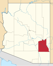
Artesia is a populated place situated in Graham County, Arizona, United States.
Ashurst is a populated place situated in Graham County, Arizona, United States, and appears on the Eden U.S. Geological Survey Map.
Buena Vista is a populated place situated in Graham County, Arizona, United States.
Calva is a populated place situated in Graham County, Arizona, United States.
Cedar Springs is a populated place situated in Navajo County, Arizona, United States. It has an estimated elevation of 6,279 feet (1,914 m) above sea level.

Cow Springs is a populated place situated in Coconino County, Arizona, United States. It has an estimated elevation of 5,863 feet (1,787 m) above sea level.
Frazier Wells, sometimes known as Frazier Well or Fraziers Well, is a populated place situated in Coconino County, Arizona, United States, located approximately 30 miles northeast of Peach Springs. It has an estimated elevation of 6,047 feet (1,843 m) above sea level.
Glenbar is a populated place situated in Graham County, Arizona, United States.
Hidden Springs is a populated place situated in Coconino County, Arizona, United States, located on U.S. 89 approximately 75 miles north of Flagstaff. It has an estimated elevation of 4,819 feet (1,469 m) above sea level. The San Juan Southern Paiute Tribe of Arizona is located there.

Indian Gardens is a populated place situated on the east side of Oak Creek Canyon, in Coconino County, Arizona, United States, north of Sedona. It has an estimated elevation of 4,603 feet (1,403 m) above sea level.
Indian Pine is a populated place situated in Navajo County, Arizona, United States. It has an estimated elevation of 7,175 feet (2,187 m) above sea level.
Lone Star is a populated place situated in Graham County, Arizona, United States. The community is located eight miles north of Solomonville and was named after the nearby mine and mountain.
Pan Tak is a populated place situated in Pima County, Arizona, United States. Throughout its existence, it has been known by a number of names, including Cajote Spring, Coyote, Coyote Indian Village, Coyote Spring, Coyote Village, Coyotes Spring, Ojo de los Coyotes, and Pantak. Pan Tak become the official name as a result of a Board on Geographic Names decision in 1941. The name comes from the O'odham, meaning "coyote sits". It has an estimated elevation of 3,412 feet (1,040 m) above sea level.
Point of Pines is a populated place situated on the San Carlos Apache Indian Reservation in Graham County, Arizona, United States.

Salt River is a populated place situated in Maricopa County, Arizona, United States. It has an estimated elevation of 1,220 feet (370 m) above sea level. It is located on the Salt River Pima–Maricopa Indian Community.
Sanchez is a populated place situated in Graham County, Arizona, United States. It has an estimated elevation of 3,061 feet (933 m) above sea level.
Sand Springs, also known as Dinnebito or Dinnebito Trading Post, is a populated place situated in Coconino County, Arizona, United States. It is one of two locations in Arizona with this name, the other being located in Apache County. It has an estimated elevation of 5,154 feet (1,571 m) above sea level.
Stan Shuatuk is a populated place situated in Pima County, Arizona, United States, just north of the international border with Mexico. Historically, it has also been known as Cervantis Well, La Moralita, Molinitos, Molinton, Molonitos, and Serventi Well. In 1941, the name officially became Stan Shuatuk through a decision by the Board on Geographic Names. The name request came through a request by the Bureau of Indian Affairs, who stated that Stan Shuatuk was "used and understood by the residents and Papagos in general." In O'odham, stan shuatuk means "hot water". It has an estimated elevation of 1,772 feet (540 m) above sea level.
Tanner Springs, historically also known as La Xara Springs and Ojo La Xara, is a populated place situated in Apache County, Arizona, United States. It has an estimated elevation of 5,787 feet (1,764 m) above sea level.
Willow Springs is a populated place situated in Coconino County, Arizona, United States. It has an estimated elevation of 4,823 feet (1,470 m) above sea level.


