
Emery County is a county in east-central Utah, United States. As of the 2020 United States Census, the population was 9,825. Its county seat is Castle Dale, and the largest city is Huntington.
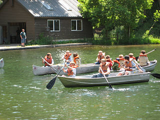
Scouting in Utah has a long history, from the 1910s to the present day, serving thousands of youth in programs that suit the environment in which they live.

Fredonia is a town in Coconino County, Arizona, United States. As of the 2010 census it had a population of 1,314. Fredonia is the gateway to the North Rim of the Grand Canyon.

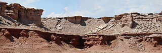
The Entrada Sandstone is a formation in the San Rafael Group found in the U.S. states of Wyoming, Colorado, northwest New Mexico, northeast Arizona, and southeast Utah. Part of the Colorado Plateau, this formation was deposited during the Jurassic Period sometime between 180 and 140 million years ago in various environments, including tidal mudflats, beaches, and sand dunes. The Middle Jurassic San Rafael Group was dominantly deposited as ergs in a desert environment around the shallow Sundance Sea.
Horseshoe Canyon may refer to:
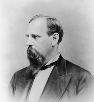
George W. Emery was the eleventh governor of Utah Territory. Emery was appointed by President Ulysses S. Grant for Supervisor of Internal Revenue for the confederate states from 1870 to 1874 and governor in 1875. After his term ended in 1880, the Utah Legislature named Emery County, Utah in honor of him.

Pediocactus bradyi subsp. winkleri, commonly known as Winkler's cactus or Winkler's pincushion cactus, is a small cactus endemic to the state of Utah in the United States. It is known only from Emery and Wayne Counties.

Emery Telcom is a telecommunications company, which provides phone service, DSL service, cable TV and cable internet to much of eastern and south eastern Utah. Emery Telcom was founded in 1950 as a cooperative in Orangeville, Utah. It joined a consortium with four other Utah independent telephone companies to form Western FiberNet.
The Curtis Formation is a geologic formation in Utah. It preserves fossils dating back to the Callovian age of the Jurassic period.
The following television stations broadcast on digital channel 28 in the United States:
The following low-power television stations broadcast on digital or analog channel 47 in the United States:
The following low-power television stations broadcast on digital or analog channel 45 in the United States:
The following low-power television stations broadcast on digital or analog channel 41 in the United States:
The following low-power television stations broadcast on digital or analog channel 35 in the United States:
The following low-power television stations broadcast on digital or analog channel 28 in the United States:
The following low-power television stations broadcast on digital or analog channel 27 in the United States:

The 2015–16 BYU Cougars men's basketball team represents Brigham Young University in the 2015–16 NCAA Division I men's basketball season. It is head coach Dave Rose's eleventh season at BYU and the Cougars fifth season in the West Coast Conference. The Cougars once again play their home games at the Marriott Center.


