Poston, Arizona

Last updated

Poston, Arizona
La Paz County Incorporated and Unincorporated areas Poston highlighted.svg
Location in La Paz County and the state of Arizona
USA Arizona location map.svg
Red pog.svg
Poston
Usa edcp location map.svg
Red pog.svg
Poston
Coordinates: 33°59′25″N114°24′4″W / 33.99028°N 114.40111°W / 33.99028; -114.40111
Country Flag of the United States (23px).png  United States
State Flag of Arizona.svg  Arizona
County La Paz
Area
[1]
  Total1.38 sq mi (3.56 km2)
  Land1.38 sq mi (3.56 km2)
  Water0.00 sq mi (0.00 km2)
Elevation
335 ft (102 m)
Population
 (2020)
  Total183
  Density133.09/sq mi (51.40/km2)
Time zone UTC-7 (MST (no DST))
ZIP code
85371
Area code 928
FIPS code 04-57170
GNIS feature ID 0009680

Poston is an unincorporated community and census-designated place (CDP) in La Paz County, Arizona, United States, in the Parker Valley. The population was 285 at the 2010 census, [2] down from 389 in 2000.

Contents

During World War II, Poston was the site of the Poston War Relocation Center, one of the United States' largest Japanese-American internment camps, where over 17,000 Japanese-Americans were held over a three-year period. The camp sites are now home to a monument dedicated to those interned there.

Memorial Monument at the Poston War Relocation Center Poston War Relocation Center Memorial Monument.jpg
Memorial Monument at the Poston War Relocation Center

Geography

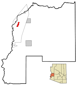
Poston is located in western La Paz County, in the Parker Valley at 33°59′25″N114°24′4″W / 33.99028°N 114.40111°W / 33.99028; -114.40111 (33.990348, -114.401052). [3] It is 3 miles (5 km) east of the Colorado River, which forms the state border with California. Mohave Road runs through the community, leading north 15 miles (24 km) to Parker and south 28 miles (45 km) to Ehrenberg. The community lies within the boundaries of the Colorado River Indian Reservation.

According to the United States Census Bureau, the Poston CDP has a total area of 1.4 square miles (3.6 km2), all land.

Demographics

Historical population
CensusPop.Note
2020 183
U.S. Decennial Census [4]

As of the census [5] of 2000, there were 389 people, 101 households, and 92 families residing in the CDP. The population density was 279.9 inhabitants per square mile (108.1/km2). There were 110 housing units at an average density of 79.1 per square mile (30.5/km2). The racial makeup of the CDP was 31% White, 1% Black or African American, 17% Native American, 48% from other races, and 3% from two or more races. 77% of the population were Hispanic or Latino of any race.

There were 101 households, out of which 66% had children under the age of 18 living with them, 66% were married couples living together, 16% had a female householder with no husband present, and 9% were non-families. 7% of all households were made up of individuals, and 2% had someone living alone who was 65 years of age or older. The average household size was 3.85 and the average family size was 3.92.

In the CDP, the population was spread out, with 42% under the age of 18, 11% from 18 to 24, 30% from 25 to 44, 13% from 45 to 64, and 4% who were 65 years of age or older. The median age was 23 years. For every 100 females, there were 110.3 males. For every 100 females age 18 and over, there were 107.3 males.

The median income for a household in the CDP was $17,625, and the median income for a family was $17,065. Males had a median income of $15,859 versus $13,125 for females. The per capita income for the CDP was $6,938. About 42% of families and 46% of the population were below the poverty line, including 55% of those under age 18 and 18% of those age 65 or over.

Related Research Articles

<span class="mw-page-title-main">La Paz County, Arizona</span> County in the United States

La Paz County is the 15th county in the U.S. state of Arizona, located in the western part of the state. As of the 2020 census, its population was 16,557, making it the second-least populous county in Arizona. The county seat is Parker. The name of the county is the Spanish word for "the peace", and is taken from the early settlement of La Paz along the Colorado River.

<span class="mw-page-title-main">Bluewater, Arizona</span> CDP in La Paz County, Arizona

Bluewater is a census-designated place (CDP) on the Colorado River Indian Reservation in La Paz County, Arizona, United States. The population was 725 at the 2010 census.

<span class="mw-page-title-main">Bouse, Arizona</span> CDP in La Paz County, Arizona

Bouse is a census-designated place (CDP) and ghost town in La Paz County, Arizona, United States. Founded in 1908 as a mining camp, the economy of Bouse is now based on tourism, agriculture, and retirees. The population was 996 at the 2010 census. It was originally named Brayton after the store owner John Brayton Martin.

<span class="mw-page-title-main">Cibola, Arizona</span> CDP in La Paz County, Arizona

Cibola is a census-designated place (CDP) in La Paz County, Arizona, United States. The population was 250 at the 2010 census, up from 172 in 2000. It is named for the famed city of gold of the same name.

<span class="mw-page-title-main">Parker Strip, Arizona</span> CDP in La Paz County, Arizona

Parker Strip is a census-designated place (CDP) in La Paz County, Arizona, United States. The population was 662 at the 2010 census.

<span class="mw-page-title-main">Harbour Heights, Florida</span> Census-designated place in Florida, United States

Harbour Heights is a census-designated place (CDP) in Charlotte County, Florida, United States. The population was 3,428 at the 2020 census. It is part of the Sarasota-Bradenton-Punta Gorda Combined Statistical Area.

<span class="mw-page-title-main">Wabasso Beach, Florida</span> CDP in Florida, United States

Wabasso Beach is a census-designated place (CDP) in Indian River County, Florida, United States. The population was 1,853 at the 2010 census, an increase of 72.4% since 2000. It is part of the Sebastian–Vero Beach Metropolitan Statistical Area.

<span class="mw-page-title-main">The Crossings, Florida</span> CDP in Florida

The Crossings is a census-designated place (CDP) and suburb of Miami in Miami-Dade County, Florida, United States. It is part of the Miami metropolitan area of South Florida. The CDP includes the neighborhoods of The Crossings, Devon Aire, and Calusa. The population was 23,276 at the 2020 census.

Pistakee Highlands is a census-designated place (CDP) in McHenry County, Illinois, United States. It consists primarily of an unincorporated area of McHenry County adjoining Pistakee Bay, within the McHenry post office, and is located just northeast of Johnsburg. Per the 2020 census, the population was 3,237.

<span class="mw-page-title-main">Willow Brook Estates, Illinois</span> Census-designated place in Illinois, United States

Willow Brook Estates is an unincorporated census-designated place in Will County, Illinois, United States. The population was 1,346 at the 2020 census. it is considered a far south suburb of Chicago.

<span class="mw-page-title-main">Garrison, Maryland</span> Census-designated place in Maryland, United States

Garrison is a census-designated place (CDP) in Baltimore County, Maryland, United States, adjacent to Owings Mills. It consists mainly of the McDonogh area and Valley Centre. The population was 8,823 at the 2010 census.

<span class="mw-page-title-main">Martin City, Montana</span> Unincorporated community in Montana, United States

Martin City is an unincorporated community and census-designated place (CDP) in Flathead County, Montana, United States. As of the 2010 census, it had a population of 500, up from 331 in 2000.

<span class="mw-page-title-main">Fortine, Montana</span> Census-designated place in Montana, United States

Fortine is a census-designated place (CDP) in Lincoln County, Montana, United States. The population was 206 at the 2021 census.

<span class="mw-page-title-main">Corvallis, Montana</span> Census-designated place in Montana, United States

Corvallis is a census-designated place (CDP) in Ravalli County, Montana, United States. The population was 1,125 at the 2020 census.

<span class="mw-page-title-main">McGill, Nevada</span> CDP in Nevada, United States

McGill is a census-designated place (CDP) in White Pine County, Nevada, United States. The population was 1,148 at the 2010 census.

<span class="mw-page-title-main">Dayton, Montana</span> Census-designated place in Montana, United States

Dayton is an unincorporated community and census-designated place (CDP) in Lake County, Montana, United States. The population was 84 at the 2010 census.

<span class="mw-page-title-main">Sheppton, Pennsylvania</span> CDP in Pennsylvania, United States

Sheppton is a census-designated place (CDP) in Schuylkill County, Pennsylvania, United States. The population was 239 at the 2000 census.

Parker is a census-designated place (CDP) in Greenville County, South Carolina, United States. The population was 11,431 at the 2010 census, up from 10,760 in 2000. It is part of the Greenville–Mauldin–Easley Metropolitan Statistical Area.

<span class="mw-page-title-main">Sherando, Virginia</span> CDP in Virginia, United States

Sherando is a census-designated place (CDP) in Augusta County, Virginia, United States. The population was 688 at the 2010 census. It is part of the Staunton–Waynesboro Micropolitan Statistical Area.

<span class="mw-page-title-main">Verlot, Washington</span> CDP in Washington, United States

Verlot is a census-designated place (CDP) in Snohomish County, Washington, United States. The population was 285 at the 2010 census.

References

  1. "2020 U.S. Gazetteer Files". United States Census Bureau. Retrieved October 29, 2021.
  2. "Geographic Identifiers: 2010 Census Summary File 1 (G001), Poston CDP, Arizona". American FactFinder. U.S. Census Bureau. Archived from the original on February 13, 2020. Retrieved August 19, 2019.
  3. "US Gazetteer files: 2010, 2000, and 1990". United States Census Bureau. February 12, 2011. Retrieved April 23, 2011.
  4. "Census of Population and Housing". Census.gov. Retrieved June 4, 2016.
  5. "U.S. Census website". United States Census Bureau . Retrieved January 31, 2008.