Related Research Articles

Quartzsite is a town in La Paz County, Arizona, United States. According to the 2010 census, the population was 3,677.
The U.S. Army Corps of Topographical Engineers was a branch of the United States Army authorized on 4 July 1838. It consisted only of officers who were handpicked from West Point and was used for mapping and the design and construction of federal civil works such as lighthouses and other coastal fortifications and navigational routes. Members included such officers as George Meade, John C. Frémont, Thomas J. Cram and Stephen Long. It was merged with the United States Army Corps of Engineers on 31 March 1863, at which point the Corps of Engineers also assumed the Lakes Survey for the Great Lakes. In the mid-19th century, Corps of Engineers' officers ran Lighthouse Districts in tandem with U.S. Naval officers.

Aubrey Landing, Aubrey City or Aubrey is a ghost town at the mouth of the Bill Williams River in southern Mohave County, Arizona, United States. The town was founded before 1865 and was abandoned sometime after 1886. Aubrey Landing was inundated when Lake Havasu was formed.
Robinson's Landing was a location in Baja California, Mexico. It lay on the west bank of the Colorado River northwest of the north tip of Montague Island in the Colorado River Delta, 10 miles above the mouth of the river on the Gulf of California. Named for David C. Robinson, it was the place where cargo was unloaded in the river from seagoing craft on to flatbottomed steamboats and carried up to Fort Yuma and points further north on the river from 1852 onward. Joseph C. Ives, described it as it was in 1858, in his 1861 Report upon the Colorado river of the West The river here was subject to a severe tidal bore that formed in the estuary about Montague Island and propagated upstream and could on occasion swamp barges, boats and ships. By 1865, a better location was found, ships offloaded their cargos on the east bank of the river at Port Isabel, Sonora, northeast of Montague Island. 17 miles from Robinson's landing and 57 miles below Port Famine.
Joseph Christmas Ives was an American soldier, botanist, and an explorer of the Colorado River in 1858.

Vallecito, in San Diego County, California is an oasis of cienegas and salt grass along Vallecito Creek and a former settlement on the edge of the Colorado Desert in the Vallecito Valley. Its Spanish name is translated as "little valley". Vallecito was located at the apex of the gap in the Carrizo Badlands created by Carrizo Creek and its wash in its lower reach, to which Vallecito Creek is a tributary. The springs of Vallecito, like many in the vicinity, are a product of the faults that run along the base of the Peninsular Ranges to the west.

Steamboats on the Colorado River operated from the river mouth at the Colorado River Delta on the Gulf of California in Mexico, up to the Virgin River on the Lower Colorado River Valley in the Southwestern United States from 1852 until 1909, when the construction of the Laguna Dam was completed. The shallow draft paddle steamers were found to be the most economical way to ship goods between the Pacific Ocean ports and settlements and mines along the lower river, putting in at landings in Sonora state, Baja California Territory, California state, Arizona Territory, New Mexico Territory, and Nevada state. They remained the primary means of transportation of freight until the advent of the more economical railroads began cutting away at their business from 1878 when the first line entered Arizona Territory.
Pedrick's was a steamboat landing, owned by John Pedrick, supplying wood to the steamboats on the lower Colorado River in Sonora, Mexico, from the mid 1850s to the late 1870s. After the 1854 Gadsden Purchase, Pedrick's was within New Mexico Territory and Arizona Territory after 1863. Pedrick's landing was located 24 miles above Ogden's Landing and 31 miles below Fort Yuma. Pedrick's lay along the east bank of the river just above what is now the Sonora – Arizona border in modern Yuma County, Arizona.
Ogden's Landing was a steamboat landing and woodyard, owned by former Colorado River ferry partner of George Alonzo Johnson, supplying wood to the steamboats on the lower Colorado River in Sonora, Mexico, from the mid 1854 to the late 1870s. Ogden's Landing was located 28 miles above Gridiron and 24 miles below Pedrick's in Sonora until 1856, when it became part of New Mexico Territory, until it became Arizona Territory in 1863. Ogden's Landing lay along the east bank of the river 19 miles below what is now the Sonora - Arizona border.
Gridiron was a steamboat landing and woodyard on the lower Colorado River in Sonora state of northwestern Mexico,.
Port Famine was a steamboat landing and woodyard, supplying wood to the steamboats on the lower Colorado River in Sonora, Mexico, from the 1854 to the late 1870s.
La Laguna was a gold mining town in New Mexico Territory, now Yuma County, Arizona. It was in existence for a short time from 1860 to 1862. The town was a steamboat landing 20 miles above Yuma, Arizona on the Colorado River. It had a few merchants and a ferry across the Colorado River that served placer miners in the vicinity. When the La Paz gold rush began, La Laguna began to decline and it was soon replaced by Castle Dome Landing, 15 miles to the north, following the discovery of gold in the Castle Dome Mountains. It remained for a time as the site of a store and a ranch, belonging to Jose Redondo, one of the first to mine gold at La Paz.
Explorer was a small, custom-made stern-wheel steamboat built for Second lieutenant Joseph Christmas Ives and used by him to carry the U. S. Army Corps of Topographical Engineers expedition to explore the Colorado River above Fort Yuma in 1858.
Bradshaw's Ferry was a ferry at the crossing point on the Colorado River, of the Bradshaw Trail at Olive City and later at Mineral City and Ehrenburg, between what was then San Diego County, California and Arizona County, New Mexico Territory. The ferry connected the Bradshaw Trail to the road to the gold placers of La Paz, the first big strike of the Colorado River Gold Rush. From 1863, the La Paz - Wikenburg Road connected the Bradshaw Trail to the new mining boom town settlements in the interior of Arizona Territory.

Fortification Rock, once a landmark hill on the Colorado River before it was inundated, now known as Rock Island, southernmost and tallest of the Boulder Islands in Lake Mead, Clark County, Nevada. It has an elevation of 1284 feet. Fortification Rock appears on the 1861 Geological Map No. 1; Rio Colorado of the West, explored by 1st Lieut. Joseph C. Ives, which shows Fortification Rock, Ives Camp #59 and the course of the Colorado River from its mouth on the Gulf of California to Las Vegas Wash and the location of its features and other expedition camps along the way.
Empire Flat was a steamboat landing at Empire Flat on the east shore of the Colorado River, within Parker Strip, Arizona, in La Paz County, Arizona.
George A. Johnson & Company was a partnership between three men who pioneered navigation on the Colorado River. Benjamin M. Hartshorne, George Alonzo Johnson and Alfred H. Wilcox. The George A. Johnson & Company was formed in the fall of 1852, and was reorganized as the Colorado Steam Navigation Company in 1869.
Norton's Landing or Norton's, was a steamboat landing on the Colorado River, in what was then Yuma County, Arizona Territory. Today it is in La Paz County, Arizona. Nortons Landing is 52 miles upriver from Yuma, Arizona 4 miles above Picacho, California and 18 miles below the Clip, Arizona landing. It lays on a rocky point of land next to the river at 215 feet of elevation just east of Red Cloud Wash and Black Rock Wash, where roads to the district mines in the mountains, met the Colorado River.
Desert Wells, originally Desert Station, a stagecoach station on the La Paz–Wikenburg Road in the 1870s, is a populated place in La Paz County, Arizona, United States. It lies at an elevation of 1,132 feet/ 345 meters and is located 4.7 miles west-southwest of Vicksburg on U.S. Route 60.
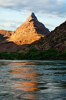
Diamond Peak is a 3,512-foot-elevation summit located in the western end of the Grand Canyon, on the Hualapai Indian Reservation in Mohave County of northwestern Arizona, United States. This double summit landmark is situated at the mouth of Peach Springs Canyon, where Diamond Creek meets the Colorado River. This peak is an erosional remnant composed of Cambrian Muav Limestone and Mississippian Redwall Limestone. Topographic relief is significant as Diamond Peak towers 2,200 feet above the Colorado River in one-half mile. According to the Köppen climate classification system, Diamond Peak is located in a desert climate zone.
References
- ↑ Richard E. Lingenfelter, Steamboats on the Colorado River, 1852–1916, University of Arizona Press, Tucson, 1978 Archived January 18, 2016, at the Wayback Machine
- ↑ Geological Map No. 1. Prepared by J.S. Newberry, M.D. Geologist to the Expedition. Explorations and Surveys. War Department. Map No. 1. Rio Colorado of the West, explored by 1st Lieut. Joseph C. Ives, Topl. Engrs. under the direction of the Office of Explorations and Surveys. A.A. Humphreys, Capt. Topl. Engrs. in Charge, by order of the Hon. John B. Floyd, Secretary of War. 1858. Drawn by Frhr. F.W.v. Egloffstein. Topographer to the Expedition. Topography by Frhr. F.W.v. Egloffstein. Ruling by Samuel Sartain. Lettering by F. Courtenay. from davidrumsey.com, accessed June 12, 2015.
Municipalities and communities of La Paz County, Arizona, United States | ||
|---|---|---|
| Towns |  | |
| CDPs | ||
| Populated places | ||
| Indian reservations | ||
| Ghost towns | ||