Related Research Articles

Contention City or Contention is a ghost mining town in Cochise County in the southeastern part of the U.S. state of Arizona. It was occupied from the early-1880s through the late-1880s in what was then known as the Arizona Territory. Only a few foundations now remain of this boomtown which was settled and abandoned with the rise and fall of silver mining in and around the area of Tombstone.
La Paz was a short-lived early gold mining town along on the western border of current-day La Paz County, Arizona. The town grew quickly after gold was discovered nearby in 1862. La Paz, Spanish for peace, was chosen as the name in recognition of the feast day for Our Lady of Peace. Originally located in the New Mexico Territory, the town became part of the Arizona Territory when President Abraham Lincoln established the new territory in 1863. In 1983 the newly-formed County of La Paz adopted the name, long after the town had become a ghost town.

The Castle Dome Mountains are a mountain range in Yuma County, Arizona, within the Kofa National Wildlife Refuge. Castle Dome Peak, the high point of the range, is a prominent butte and distinctive landmark. The peak is 3,776 feet (1,151 m) high, and is located at 33°05′04″N114°08′36″W. Castle Dome was named by American soldiers at old Fort Yuma in the 1880s. Early Spanish explorers called the same peak Cabeza de Gigante, "Giant's Head."

Castle Dome Landing, Arizona is a ghost town in the Castle Dome Mountains of Yuma County in the U.S. state of Arizona. It was first settled as a transport depot and mining camp around 1863 in what was then the Arizona Territory.
Mohave City is a ghost town in Mohave County in the northwestern part of the U.S. state of Arizona. Settled in the 1860s, in what was then the Arizona Territory, it was founded as a river landing and trading center for area miners and soldiers, and was named for Mohave County.
Aubrey Landing, Aubrey City or Aubrey is a ghost town at the mouth of the Bill Williams River in southern Mohave County, Arizona, United States. The town was founded before 1865 and was abandoned sometime after 1886. Aubrey Landing was inundated when Lake Havasu was formed.
Gila City is a ghost town in Yuma County in the U.S. state of Arizona. The town was settled in 1858 in what was then the New Mexico Territory.
Rioville, Nevada was a settlement founded by Latter-day Saints in what they thought was Utah Territory in 1869, now under Lake Mead and within Clark County, Nevada.

El Dorado Canyon is a canyon in southern Clark County, Nevada famed for its rich silver and gold mines. The canyon was named in 1857 by steamboat entrepreneur Captain George Alonzo Johnson when gold and silver was discovered here. It drains into the Colorado River at the former site of Nelson's Landing.

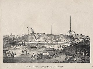
Steamboats on the Colorado River operated from the river mouth at the Colorado River Delta on the Gulf of California in Mexico, up to the Virgin River on the Lower Colorado River Valley in the Southwestern United States from 1852 until 1909, when the construction of the Laguna Dam was completed. The shallow draft paddle steamers were found to be the most economical way to ship goods between the Pacific Ocean ports and settlements and mines along the lower river, putting in at landings in Sonora state, Baja California Territory, California state, Arizona Territory, New Mexico Territory, and Nevada state. They remained the primary means of transportation of freight until the advent of the more economical railroads began cutting away at their business from 1878 when the first line entered Arizona Territory.
La Laguna was a gold mining town in New Mexico Territory, now Yuma County, Arizona. It was in existence for a short time from 1860 to 1862. The town was a steamboat landing 20 miles above Yuma, Arizona on the Colorado River. It had a few merchants and a ferry across the Colorado River that served placer miners in the vicinity. When the La Paz gold rush began, La Laguna began to decline and it was soon replaced by Castle Dome Landing, 15 miles to the north, following the discovery of gold in the Castle Dome Mountains. It remained for a time as the site of a store and a ranch, belonging to Jose Redondo, one of the first to mine gold at La Paz.
El Dorado City, which is now a ghost town, was a mining camp in the Colorado Mining District at the mouth of January Wash at its confluence with El Dorado Canyon. It was located about a mile down the canyon from Huse Spring, at an elevation of 2382 feet. Its site was located nearby to the south southeast of the Techatticup Mine the primary source of the ore its mill processed.
Colorado City is now a ghost town, in Clark County, Nevada, located under Lake Mohave at the mouth of El Dorado Canyon.
Lucky Jim Camp sometimes called Lucky Camp is a ghost town site in Clark County, Nevada. It was within New Mexico Territory when founded in 1862.
Eureka or Eureka Landing, is a former mining town and steamboat landing, now a ghost town, on the Arizona bank of the Colorado River in what is now La Paz County, Arizona. It was originally located in Yuma County, Arizona from 1863 through the 1870s.
Williamsport is a former mining town and present day ghost town, on the bank of the Colorado River in La Paz County, Arizona.
Colorado Mining District was primarily a silver and gold mining district organized in El Dorado Canyon, New Mexico Territory on the west shore of the Colorado River in what is now Clark County, Nevada. The Colorado District was part of Arizona Territory from 1863 to 1869. In 1869, the land of Arizona Territory north and west of the Colorado River east to the 114th meridian of longitude, including the Colorado District, was turned over to Nevada.
Empire Flat was a steamboat landing at Empire Flat on the east shore of the Colorado River, within Parker Strip, Arizona, in La Paz County, Arizona.
Norton's Landing or Norton's, was a steamboat landing on the Colorado River, in what was then Yuma County, Arizona Territory. Today it is in La Paz County, Arizona. Nortons Landing is 52 miles upriver from Yuma, Arizona 4 miles above Picacho, California and 18 miles below the Clip, Arizona landing. It lies on a rocky point of land next to the river at 215 feet of elevation just east of Red Cloud Wash and Black Rock Wash, where roads to the district mines in the mountains met the Colorado River.
References
- 1 2 U.S. Geological Survey Geographic Names Information System: Clip Mine
- 1 2 3 James E. Sherman, Barbara H. Sherman, Ghost Towns of Arizona, University of Oklahoma Press, 1969
- ↑ John and Lillian Theobald, Arizona Territory Post Offices & Postmasters, The Arizona Historical Foundation, Phoenix, 1961.
- ↑ U.S. Geological Survey Geographic Names Information System: Clip Mill
- ↑ Richard E. Lingenfelter, Steamboats on the Colorado River (PDF) Archived January 18, 2016, at the Wayback Machine , 1852–1916, University of Arizona Press, Tucson, 1978
