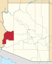
Plomosa, Arizona | |
|---|---|
| Coordinates: 33°38′03″N114°07′05″W / 33.63417°N 114.11806°W | |
| Country | United States |
| State | Arizona |
| County | La Paz |
| Elevation | 1,490 ft (450 m) |
| Time zone | UTC-7 (Mountain (MST)) |
| • Summer (DST) | UTC-7 (MST) |
| Area code | 928 |
| FIPS code | 04-56850 |
| GNIS feature ID | 24567 [1] |
Plomosa is a populated place situated in La Paz County, Arizona, United States. [2] The name is derived from the Spanish for "lead-colored", and also refers to the nearby Plomosa Mountains, which contain numerous lead-bearing mines.


