Three Points, Arizona

Last updated

Three Points, Arizona
CDP
Pima County Incorporated and Unincorporated areas Three Points highlighted.svg
Location in Pima County and the state of Arizona
Usa edcp location map.svg
Red pog.svg
Three Points, Arizona
Location in the United States
Coordinates: 32°2′55″N111°17′7″W / 32.04861°N 111.28528°W / 32.04861; -111.28528
Country United States
State Arizona
County Pima
Area
[1]
  Total46.62 sq mi (120.73 km2)
  Land46.62 sq mi (120.73 km2)
  Water0.00 sq mi (0.00 km2)
Elevation
2,543 ft (775 m)
Population
 (2020)
  Total5,184
  Density111.21/sq mi (42.94/km2)
Time zone UTC-7 (MST (no DST))
FIPS code 04-73700
GNIS feature ID0024652

Three Points is a census-designated place (CDP) in Pima County, Arizona, United States. The population was 5,581 at the 2010 census.

Contents

History

Three Points, also known as Robles Junction was founded in 1882. Bernabe S. Robles, who was born in 1857, in Baviácora, Sonora, Mexico. His family relocated to Tucson in 1864, where he grew up. After spending sometime in Florence, Arizona, he returned to Tucson and accepted a mail route to Gunsight, Arizona, near Ajo. It was during this time he located what is now called Robles Pass, near Cat (Back) Mountain, while searching for a shorter route to Gunsight. In 1882, he had his brother Jesús homesteaded 160 acres at what is now Robles Junction/Three Points. The brothers dug a well to set up a watering stop and stage station so Bernabe could water his horses along his mail route. He eventually gave up his mail route, and moved to the former watering stop/stage station, which at that point was called the Robles Ranch. He and his family ran the ranch for many years, even after the family had moved back to Tucson. Robles died in 1945. The old ranch house is now the Three Points/Robles Junction Community Center. [2]

Geography

Three Points is located at 32°2′55″N111°17′7″W / 32.04861°N 111.28528°W / 32.04861; -111.28528 (32.048652, -111.285174). [3]

According to the United States Census Bureau, the CDP has a total area of 44.5 square miles (115 km2), all land.

Demographics

Historical population
CensusPop.Note
2000 5,273
2010 5,5815.8%
2020 5,184−7.1%
U.S. Decennial Census [4]

As of the census [5] of 2000, there were 5,273 people, 1,772 households, and 1,304 families living in the CDP. The population density was 118.4 inhabitants per square mile (45.7/km2). There were 2,022 housing units at an average density of 45.4 per square mile (17.5/km2). The racial makeup of the CDP was 70.6% White or European American, 0.7% Black or African American, 2.5% Native American, 0.4% Asian, 0.1% Pacific Islander, 22.2% from other races, and 3.49% from two or more races. 40.8% of the population were Hispanic or Latino of any race.

There were 1,772 households, out of which 38.5% had children under the age of 18 living with them, 56.9% were married couples living together, 10.9% had a female householder with no husband present, and 26.4% were non-families. 19.8% of all households were made up of individuals, and 5.1% had someone living alone who was 65 years of age or older. The average household size was 2.98 and the average family size was 3.46.

In the CDP, the population was spread out, with 31.8% under the age of 18, 8.1% from 18 to 24, 29.0% from 25 to 44, 23.6% from 45 to 64, and 7.5% who were 65 years of age or older. The median age was 33 years. For every 100 females, there were 106.5 males. For every 100 females age 18 and over, there were 102.4 males.

The median income for a household in the CDP was $31,486, and the median income for a family was $35,229. Males had a median income of $28,642 versus $22,857 for females. The per capita income for the CDP was $13,088. About 18.0% of families and 22.1% of the population were below the poverty line, including 30.0% of those under age 18 and 12.8% of those age 65 or over.

Related Research Articles

<span class="mw-page-title-main">Gisela, Arizona</span> CDP in Gila County, Arizona

Gisela is an unincorporated community and census-designated place (CDP) in Gila County, Arizona, United States. The population was 570 at the 2010 census.

<span class="mw-page-title-main">Strawberry, Arizona</span> CDP in Gila County, Arizona

Strawberry is an unincorporated community and census-designated place (CDP) in Gila County, Arizona, United States. The population was 961 at the 2010 census.

<span class="mw-page-title-main">Swift Trail Junction, Arizona</span> CDP in Graham County, Arizona

Swift Trail Junction is a census-designated place (CDP) in Graham County, Arizona, United States. The population was 2,935 at the 2010 census, up from 2,195 in 2000. It is part of the Safford Micropolitan Statistical Area. It is situated at the junction of U.S. Route 191 and State Route 366. The Swift Trail Parkway is a scenic highway that winds through the Coronado National Forest and provides access to the higher elevations of the Pinaleño Mountains, also known as the Graham Mountains.

<span class="mw-page-title-main">Mojave Ranch Estates, Arizona</span> CDP in Mohave County, Arizona

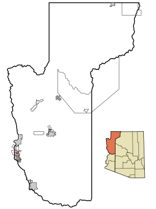
Mojave Ranch Estates is an unincorporated community and census-designated place (CDP) in Mohave County, Arizona, United States. The population was 53 as of the 2020 census.

<span class="mw-page-title-main">Avra Valley, Arizona</span> CDP in Pima County, Arizona

Avra Valley is a census-designated place (CDP) in Pima County, Arizona, United States. The population was 6,050 at the 2010 census, up from 5,038 in 2000.

<span class="mw-page-title-main">Casas Adobes, Arizona</span> CDP in Pima County, Arizona

Casas Adobes is an unincorporated community and census-designated place (CDP) located in the northern metropolitan area of Tucson, Arizona. The population was 66,795 at the 2010 census. Casas Adobes is situated south and southwest of the town of Oro Valley, and west of the community of Catalina Foothills.

<span class="mw-page-title-main">Catalina, Arizona</span> CDP in Pima County, Arizona

Catalina is a census-designated place (CDP) in Pima County, Arizona, United States. The population was 7,025 at the 2000 census. Catalina continues to experience increasing population growth, while attempting to maintain its rural character. Catalina remains an unincorporated community, with no plans for annexation into any nearby towns.

<span class="mw-page-title-main">Catalina Foothills, Arizona</span> CDP in Pima County, Arizona

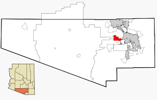
Catalina Foothills is an unincorporated community and census-designated place (CDP) located north of Tucson in Pima County, Arizona, United States. Situated in the southern foothills of the Santa Catalina Mountains, Catalina Foothills had a population of 50,796 at the 2010 census. Catalina Foothills is one of the most affluent communities in Arizona and in the U.S., with the 6th highest per capita income in Arizona, and the 14th highest per capita income in the U.S. of communities with a population of at least 50,000. The Catalina Foothills community includes some of Arizona's most expensive homes and land, and has the highest median property value. It also includes resorts, golf courses, and spas.

<span class="mw-page-title-main">Corona de Tucson, Arizona</span> CDP in Pima County, Arizona

Corona de Tucson is a census-designated place (CDP) in Pima County, Arizona, United States. The population was 9,240 at the 2020 census, an increase of 1036% from the 2000 population of 813.

<span class="mw-page-title-main">Flowing Wells, Arizona</span> CDP in Pima County, Arizona

Flowing Wells is a census-designated place (CDP) in Pima County, Arizona, United States. It is a suburb of Tucson. The population was 16,419 at the 2010 census.

<span class="mw-page-title-main">Picture Rocks, Arizona</span> CDP in Pima County, Arizona

Picture Rocks is a census-designated place (CDP) in Pima County, Arizona, United States, home of the Tucson artifacts. The population was 9,551 at the 2020 United States census.

<span class="mw-page-title-main">Tucson Estates, Arizona</span> CDP in Arizona, United States

Tucson Estates is a census-designated place (CDP) in Pima County, Arizona, United States. The population was 9,755 at the 2000 census.

<span class="mw-page-title-main">Vail, Arizona</span> CDP in Pima County, Arizona

Vail is a census-designated place (CDP) in Pima County, Arizona, United States. It is 24 miles (39 km) southeast of Tucson. The population was 10,208 at the 2010 census, up from 2484 in the 2000 census. The area is known for the nearby Colossal Cave, a large cave system, and the Rincon Mountains District of Saguaro National Park, a top tourism spot within Arizona.

<span class="mw-page-title-main">Dudleyville, Arizona</span> CDP in Pinal County, Arizona

Dudleyville is a census-designated place (CDP) in Pinal County, Arizona, United States. The population was 959 at the 2010 census.

<span class="mw-page-title-main">Oracle, Arizona</span> CDP in Pinal County, Arizona

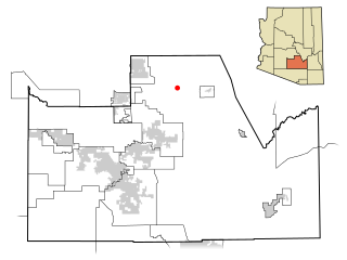
Oracle is a census-designated place (CDP) in Pinal County, Arizona, United States. The population was 3,686 at the 2010 Census, falling to 3,051 at the 2020 Census.

<span class="mw-page-title-main">Queen Valley, Arizona</span> CPD in Pinal County, Arizona

Queen Valley is a census-designated place (CDP) in north central Pinal County, Arizona, United States. The population was 820 at the 2000 census.

<span class="mw-page-title-main">Lake Montezuma, Arizona</span> CDP in Yavapai County, Arizona

Lake Montezuma is a census-designated place (CDP) in Yavapai County in the U.S. state of Arizona. The population was 5,111 at the 2020 census. The CDP includes the communities of Rimrock and McGuireville. Located along Interstate 17, it is 20 miles (32 km) south of Sedona and 8 miles (13 km) north of Camp Verde in central Arizona's Verde Valley.

Stottville is a hamlet and census-designated place (CDP) in Columbia County, New York, United States. The population was 1,375 at the 2010 census.

<span class="mw-page-title-main">Gold Canyon, Arizona</span> Census-designated place in Arizona, United States

Gold Canyon is a census-designated place (CDP) and unincorporated community in Pinal County, Arizona, United States. The community is sometimes incorrectly called Gold Camp.

Robles Junction is a neighborhood of Three Points in Pima County, Arizona, United States. Robles Junction is located at the intersection of Arizona State Route 86 and Arizona State Route 286 southwest of Tucson.

References

  1. "2020 U.S. Gazetteer Files". United States Census Bureau. Retrieved October 29, 2021.
  2. Leighton, David. "Street Smarts: Rancher was one of early Tucson's largest land owners". Arizona Daily Star. Retrieved September 8, 2014.
  3. "US Gazetteer files: 2010, 2000, and 1990". United States Census Bureau. February 12, 2011. Retrieved April 23, 2011.
  4. "Census of Population and Housing". Census.gov. Retrieved June 4, 2016.
  5. "U.S. Census website". United States Census Bureau . Retrieved January 31, 2008.