Santa Rosa, Arizona

Last updated

Santa Rosa, Arizona
O'odham: Kaij Mek
CDP
Pima County Incorporated and Unincorporated areas Santa Rosa highlighted.svg
Location in Pima County and the state of Arizona
USA Arizona location map.svg
Red pog.svg
Santa Rosa
Location in Arizona
Usa edcp location map.svg
Red pog.svg
Santa Rosa
Location in the United States
Coordinates: 32°19′33″N112°2′34″W / 32.32583°N 112.04278°W / 32.32583; -112.04278
Country Flag of the United States (23px).png  United States
State Flag of Arizona.svg  Arizona
County Pima
Area
[1]
  Total6.51 sq mi (16.86 km2)
  Land6.51 sq mi (16.86 km2)
  Water0.00 sq mi (0.00 km2)
Elevation
1,811 ft (552 m)
Population
 (2020)
  Total474
  Density72.80/sq mi (28.11/km2)
Time zone UTC-7 (MST (no DST))
ZIP code
85634 [2]
Area code 520
FIPS code 04-64310
GNIS feature ID 5407

Santa Rosa, or Kaij Mek (O'odham) name translates as "Burnt Seeds", is a census-designated place (CDP) in Pima County, Arizona, United States. The population was 671 as of the 2020 census. [3] This makes Santa Rosa the most populated historical traditional village on the Tohono O'odham Nation reservation.

Contents

Geography

Santa Rosa is located at 32°19′33″N112°2′34″W / 32.32583°N 112.04278°W / 32.32583; -112.04278 (32.325904, -112.042709). [4]

According to the United States Census Bureau, the CDP has a total area of 5.7 square miles (15 km2), all land.

Demographics

Historical population
CensusPop.Note
2020 474
U.S. Decennial Census [5]

At the 2020 census there were 671 people, 174 households, and 133 families living in the CDP. The population density was 103 inhabitants per square mile (40/km2). There were 231 housing units at an average density of 26.2 per square mile (10.1/km2). The racial makeup of the CDP was <1% White, 99% Native American, <1% from other races, and <1% from two or more races. 1% of the population were Hispanic or Latino of any race. [6] Of the 174 households 33% had children under the age of 18 living with them, 28% were married couples living together, 29% had a female householder with no husband present, and 27% were non-families. 22% of households were one person and 9% were one person aged 65 or older. The average household size was 3 and the average family size was 4.

The age distribution was 34% under the age of 18, 9% from 18 to 24, 28% from 25 to 44, 19% from 45 to 64, and 11% 65 or older. The median age was 29 years. For every 100 females, there were 92 males. For every 100 females age 18 and over, there were 93 males.

The median household income was $9,243 and the median family income was $12,000. Males had a median income of $22,813 versus $23,438 for females. The per capita income for the CDP was $6,090. About 50% of families and 51% of the population were below the poverty line, including 55% of those under age 18 and 69% of those age 65 or over.

Related Research Articles

Dot Lake Village is a census-designated place (CDP) in Southeast Fairbanks Census Area, Alaska, United States. The population was 62 at the 2010 census, up from 38 in 2000.

Kaibab is an unincorporated community and census-designated place (CDP) in Mohave County, Arizona, United States. It is within the Kaibab Indian Reservation. The population of the CDP was 140 at the 2020 census.

<span class="mw-page-title-main">Avra Valley, Arizona</span> CDP in Pima County, Arizona

Avra Valley is a census-designated place (CDP) in Pima County, Arizona, United States. The population was 6,050 at the 2010 census, up from 5,038 in 2000.

<span class="mw-page-title-main">Pisinemo, Arizona</span> CDP in Pima County, Arizona

Pisinemo is a census-designated place (CDP) in Pima County, Arizona, United States. The population was 340 as of the 2020 census.

<span class="mw-page-title-main">Sells, Arizona</span> CDP in Pima County, Arizona

Sells is an unincorporated community and census-designated place (CDP) in Pima County, Arizona, United States. The population was 2,799 at the 2000 census. It is the capital of the Tohono O'odham Nation and the home of several of their tribal businesses, such as Tohono O'Odham Ki:Ki Association. Originally named Indian Oasis, by cattle-ranchers/businessmen brothers, Joseph and Louis Ménager in 1912. The Ménager brothers also built and ran the Indian Oasis Mercantile Store. The settlement took its present English name in 1918 to honor Indian Commissioner Cato Sells. The O'odham name means "Tortoise Got Wedged".

<span class="mw-page-title-main">Ak-Chin Village, Arizona</span> CDP in Pinal County, Arizona

Ak-Chin Village is a census-designated place (CDP) in Pinal County, Arizona, United States on the Ak-Chin (Maricopa) Reservation. The population was 862 at the 2010 census, up from 669 in 2000.

<span class="mw-page-title-main">Chuichu, Arizona</span> CDP in Pinal County, Arizona

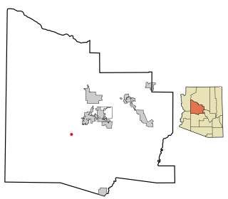
Chuichu is a census-designated place (CDP) in Pinal County, Arizona, United States. The population was 308 at the 2020 census. It is the northernmost traditional village on the Tohono O'odham Nation reservation.

<span class="mw-page-title-main">Santan, Arizona</span> CDP in Pinal County, Arizona, United States

Santan is an unincorporated community, and former census-designated place (CDP), in Pinal County, Arizona, United States. The settlement was named "Santa Ana" by its Akimel O'odham inhabitants in 1857, and pronounced "Santana".

<span class="mw-page-title-main">Sonoita, Arizona</span> CDP in Santa Cruz County, Arizona

Sonoita is a census-designated place (CDP) in Santa Cruz County, Arizona, United States. The population was 803 at the 2020 census.

<span class="mw-page-title-main">Cordes Lakes, Arizona</span> CDP in Yavapai County, Arizona

Cordes Lakes is a census-designated place (CDP) in Yavapai County, Arizona, United States. The population was 2,058 at the 2000 census. The Agua Fria National Monument lies to the east and south of the community and Arcosanti is to the north.

<span class="mw-page-title-main">Spring Valley, Arizona</span> CDP in Yavapai County, Arizona

Spring Valley is a census-designated place (CDP) in Yavapai County, Arizona, United States. The population was 1,019 at the 2000 census.

<span class="mw-page-title-main">Wilhoit, Arizona</span> Census-designated place in Yavapai County, Arizona, United States

Wilhoit is a census-designated place (CDP) in Yavapai County, Arizona, United States. The population was 664 at the 2000 census.

<span class="mw-page-title-main">Roseland, California</span> Place in California, United States

Roseland is a neighborhood in Santa Rosa, California. As of the 2010 census, the population was 6,325. Roseland was an unincorporated enclave within the City of Santa Rosa until the area was annexed by Santa Rosa on November 1, 2017.

<span class="mw-page-title-main">Bagdad, Florida</span> CDP in Florida, United States

Bagdad is a census-designated place (CDP) in Santa Rosa County, Florida, United States. The population was 1,490 at the 2000 census. It is part of the Pensacola–Ferry Pass–Brent Metropolitan Statistical Area.

<span class="mw-page-title-main">Sequoyah, Oklahoma</span> CDP in Oklahoma, United States

Sequoyah is a census-designated place (CDP) in Rogers County, Oklahoma, United States. The population was 671 at the 2000 census.

<span class="mw-page-title-main">Grand Acres, Texas</span> Census-designated place in Texas, United States

Grand Acres is a census-designated place (CDP) in Cameron County, Texas, United States. The population was 49 at the 2010 census. It is part of the Brownsville–Harlingen Metropolitan Statistical Area.

<span class="mw-page-title-main">Lake Cavanaugh, Washington</span> CDP in Washington, United States

Lake Cavanaugh is a census-designated place (CDP) in Skagit County, Washington, United States. The population was 167 at the 2010 census. It is included in the Mount Vernon–Anacortes, Washington Metropolitan Statistical Area.

<span class="mw-page-title-main">Duxbury (CDP), Massachusetts</span> Census-designated place in Massachusetts, United States

Duxbury is a census-designated place (CDP) in the town of Duxbury in Plymouth County, Massachusetts, United States. The population was 1,802 at the 2010 census.

Gu Oidak is a census-designated place (CDP) located within the Tohono O'odham Nation Division in Pima County, Arizona, United States. The population was 198 at the 2020 census. The name "Gu Oidak" is the O'odham term for "big field" and located on the Tohono O'odham Nation reservation.

Nolic is a census-designated place (CDP) located on the Tohono O'odham Indian Reservation in Pima County, Arizona, United States. The population was 37 at the 2010 census.

References

  1. "2020 U.S. Gazetteer Files". United States Census Bureau. Retrieved October 29, 2021.
  2. "Santa Rosa AZ ZIP Code". zipdatamaps.com. 2023. Retrieved February 17, 2023.
  3. "Santa Rosa, AZ Profile: Facts & Data". Arizona.hometownlocator.com. 2021. Retrieved August 22, 2021.
  4. "US Gazetteer files: 2010, 2000, and 1990". United States Census Bureau. February 12, 2011. Retrieved April 23, 2011.
  5. "Census of Population and Housing". Census.gov. Retrieved June 4, 2016.
  6. "U.S. Census website". United States Census Bureau . Retrieved January 31, 2008.