Ajo is an unincorporated community in Pima County, Arizona, United States. It is the closest community to Organ Pipe Cactus National Monument. The population was 3,039 at the 2020 census. Ajo is located on State Route 85 just 43 miles (69 km) from the Mexican border.
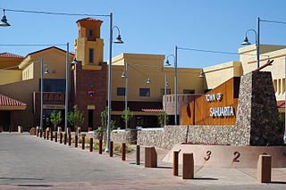
Sahuarita is a town in Pima County, Arizona, United States. Sahuarita is located south of the Tohono O'odham Nation and abuts the north end of Green Valley, 15 miles (24 km) south of Tucson. The 2022 population estimate was 35,638.

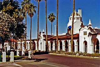
The San Xavier Indian Reservation is an Indian reservation of the Tohono O’odham Nation located near Tucson, Arizona, in the Sonoran Desert. The San Xavier Reservation lies in the southwestern part of the Tucson metropolitan area and consists of 111.543 sq mi (288.90 km2) of land area, about 2.5 percent of the Tohono O’odham Nation. It had a 2000 census resident population of 2,053 persons, or 19 percent of the Tohono O’odham population.

Swansea is a ghost town in La Paz County in the U.S. state of Arizona. It was settled circa 1909 in what was then the Arizona Territory. It served as a mining town as well as a location for processing and smelting the copper ore taken from the nearby mines.

Arivaca is an unincorporated community in Pima County, Arizona, United States. It is located 11 miles (18 km) north of the Mexican border and 35 miles (56 km) northwest of the port of entry at Nogales. The European-American history of the area dates back at least to 1695, although the community was not founded until 1878. Arivaca has the ZIP code 85601. The 85601 ZIP Code Tabulation Area had a population of 909 at the 2000 census.

Ruby is a ghost town in Santa Cruz County, Arizona, United States. It was founded as a mining town in Bear Valley, originally named Montana Camp, so named because the miners were mining at the foot of Montana Peak.

Tiger is a former populated place in Pinal County in the U.S. state of Arizona. The town was settled as Schultzcirca 1881 in what was then the Arizona Territory, then later reestablished as Tiger after World War I.
Silver mining in Arizona was a powerful stimulus for exploration and prospecting in early Arizona. Cumulative silver production through 1981 totaled 490 million troy ounces. However, only about 10% of Arizona's silver production came from silver mining. More than 80% of the state's silver was a byproduct of copper mining; other silver came as a byproduct of lead, zinc, and gold mining.

Sasco is a ghost town located in Pinal County, Arizona, west of Red Rock. Sasco, which is an acronym for the Southern Arizona Smelter Company, was a company town with a large smelter that served several mines. Once an impressive and little-known ghost town, today Sasco is a common sporting destination with shotgun shells, airsoft bb's, paintball splatter, and litter in the area.

The New Cornelia mine is a currently inactive open-pit copper mine in Pima County, Arizona, United States. It was the only productive mine in the Ajo mining district, and is located just outside the town of Ajo, which was built as a company town to serve the New Cornelia mines. The roughly circular pit is one and a half miles across at its widest point, and 1,100 feet deep at the center. Although not generally regarded as a 'dam', the New Cornelia Mine Tailings is often cited as the largest dam structure in the United States with a volume of 7.4 billion cubic feet.
The Detroit Copper Mining Company was an American copper mining and smelting operation based in Morenci, Arizona. Incorporated in July 1872, it existed as an independent company until 1897, when a controlling interest in the company was purchased by the predecessor of the Phelps Dodge Corporation. It continued to exist as a subsidiary of Phelps Dodge & Co until 1917, when all Phelps Dodge operations in the area were consolidated into the new Phelps Dodge Corporation, Morenci Branch.

Helvetia is a ghost town in Pima County, Arizona, United States that was settled in 1891 and abandoned in the early 1920s. Helvetia is an ancient name for Switzerland. Today, only the Ray Mine and cemetery are visitable, as the rest of the town has been fenced off due to active mining operations.

Harshaw is a ghost town in Santa Cruz County in the southeastern part of the U.S. state of Arizona. The town was settled in the 1870s, in what was then Arizona Territory. Founded as a mining community, Harshaw is named after the cattleman-turned-prospector David Tecumseh Harshaw, who first successfully located silver in the area. At the town's peak near the end of the 19th century, Harshaw's mines were among Arizona's highest producers of ore, with the largest mine, the Hermosa, yielding approximately $365,455 in bullion over a four-month period in 1880.
Bonanza City is a ghost town, located 13 miles (21 km) southwest of Santa Fe in Santa Fe County, New Mexico, United States. The town was founded in 1880 as a mining town, following the discovery of gold and silver in the nearby Cerrillos Hills. It was abandoned sometime in the early 1900s. Later in the 20th century, The Bonanza Creek Movie Ranch, which contains a movie set depicting a late 19th century mining town, was built near the ruins of Bonanza City.
Rosemont Copper is a proposed large open pit copper mine project by the Canadian mining corporation Hudbay Minerals. The project site is located within the Santa Rita Mountains and Coronado National Forest, in Pima County of southern Arizona. It has undergone a permitting review process under the direction of the United States Forest Service and the U.S. Army Corps of Engineers and has been delayed by legal judgements and suspension of its operating permit by the US Army Corps of Engineers.

The Mineral Park mine is a large open pit copper mine located in the Cerbat Mountains 14 miles northwest of Kingman, Arizona, in the southwestern United States. A 2013 report said that Mineral Park has an estimated reserves of 389 million tonnes of ore grading 0.14% copper and 31 million oz of silver.

Twin Buttes is a populated place on the east flank of the Sierrita Mountains approximately twenty miles south of Tucson, in Pima County, Arizona, United States. Named after a prominent hill located next to the town, Twin Buttes was founded as a small mining town circa 1903 and abandoned around 1930. Much of the actual town site is now buried underneath mine tailings, and all that remains is the Twin Buttes Cemetery.

Silver Bell is a ghost town in the Silver Bell Mountains in Pima County, Arizona, United States. The name "Silver Bell" refers to a more recent ghost town, which was established in 1954 and abandoned in 1984. The original town, established in 1904, was named "Silverbell" and abandoned in the early 1930s. Both towns were utilized and later abandoned due to the mining of copper in the area.


