
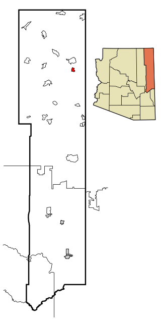
Mohave County is in the northwestern corner of the U.S. state of Arizona. As of the 2020 census, its population was 213,267. The county seat is Kingman, and the largest city is Lake Havasu City. It is the fifth largest county in the United States.

Nazlini is a census-designated place (CDP) in Apache County, Arizona, United States. The population was 489 at the 2010 census. Nearby are Nazlini Creek and Nazlini Canyon. Nazlini Canyon is the site of many Native American ruins and campsites that were abandoned when erosion made them unusable.

Steamboat is a census-designated place (CDP) in Apache County, Arizona, United States, that includes Steamboat Canyon and Steamboat Trading Post. The population was 284 at the 2010 census.
Tsaile is a census-designated place (CDP) in Apache County, Arizona, United States, on the Navajo Nation. The population was 1,205 at the 2010 census.

Cameron is a census-designated place (CDP) in Coconino County, Arizona, United States, on the Navajo Nation. The population was 885 at the 2010 census. Most of the town's economy is tourist food and craft stalls, restaurants, and other services for north–south traffic from Flagstaff and Page. There is a ranger station supplying information and hiking permits for the Navajo Nation as well as a small selection of books for sale. There is also a large craft store run by the Nation itself; most vendors in the area operate from small private stalls. It is named after Ralph H. Cameron, Arizona's first senator.

Page is a city in Coconino County, Arizona, United States, near the Glen Canyon Dam and Lake Powell. As of the 2010 census, the population of the city was 7,247.

Tusayan is a town, but was a census-designated place during the 2010 census. It is located in Coconino County, Arizona, United States. It was incorporated in 2010. A resort town near the south entrance to Grand Canyon National Park, Tusayan is served by Grand Canyon National Park Airport. The population was 558 at the 2010 census.
Canyon Day is a census-designated place (CDP) in Gila County, Arizona, United States, on the Fort Apache Indian Reservation. The population was 1,209 at the 2010 census.

Willow Valley is an unincorporated community and census-designated place (CDP) in Mohave County, Arizona, United States. The population was 1,059 as of the 2020 census.

Cibecue is a census-designated place (CDP) in Navajo County, Arizona, United States, on the Fort Apache Indian Reservation. The population was 1,713 in the 2010 United States Census.

Shonto is a census-designated place (CDP) in Navajo County, Arizona, United States, in the Navajo Nation. The population was 591 at the 2010 census.

Catalina Foothills is an unincorporated community and census-designated place (CDP) located north of Tucson in Pima County, Arizona, United States. Situated in the southern foothills of the Santa Catalina Mountains, Catalina Foothills had a population of 50,796 at the 2010 census. Catalina Foothills is one of the most affluent communities in Arizona and in the U.S., with the 6th highest per capita income in Arizona, and the 14th highest per capita income in the U.S. of communities with a population of at least 50,000. The Catalina Foothills community includes some of Arizona's most expensive homes and land, and has the highest median property value. It also includes resorts, golf courses, and spas.

Black Canyon City is an unincorporated community and census-designated place (CDP) in Yavapai County, Arizona, United States. The population was 2,837 at the 2010 census, up from 2,697 in 2000.

Gold Canyon is a census-designated place (CDP) and unincorporated community in Pinal County, Arizona, United States. The community is sometimes incorrectly called Gold Camp.

Valle is a census-designated place in Coconino County, Arizona, United States. As of the 2010 US Census the population of Valle was 832. It lies at an altitude of 5,994 feet (1,827 m), at the junction of U.S. Route 180 and State Route 64. Its attractions include the Valle Airport (40G), the Planes of Fame Air Museum, and Birds of Prey, formally Bedrock City (Arizona), amusement park. Drivers often stop at the town on their way to the Grand Canyon from either Williams or Flagstaff, as it is approximately at the halfway point.

Scenic is an unincorporated community and census-designated place (CDP) in Mohave County in extreme northwestern Arizona, United States. As of the 2020 census, its population was 1,321, down from 1,643 in 2010.
Del Muerto is a census-designated place (CDP) in Apache County, Arizona, United States. The population was 329 at the 2010 census.

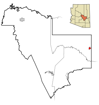
Deer Creek is a census-designated place in Gila County in the U.S. state of Arizona. Deer Creek is located almost directly between the community of Tonto Basin and the town of Payson near Arizona State Route 87. The population as of the 2010 U.S. Census was 216.
Icehouse Canyon is a census-designated place (CDP) in Gila County, Arizona, United States. The population was 677 at the 2010 census.
Clacks Canyon is a census-designated place (CDP) in Mohave County, Arizona, United States. The population was 167 at the 2020 census.


