Lava Beds National Monument is located in northeastern California, in Siskiyou and Modoc counties. The monument lies on the northeastern flank of Medicine Lake Volcano and has the largest total area covered by a volcano in the Cascade Range.

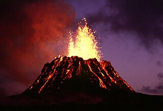
Kīlauea is an active shield volcano in the Hawaiian Islands. Historically, it is the most active of the five volcanoes that together form the Big Island of Hawaiʻi. Located along the southeastern shore of the island, the volcano is between 210,000 and 280,000 years old and emerged above sea level about 100,000 years ago. Its most recent eruption began on September 29, 2021.

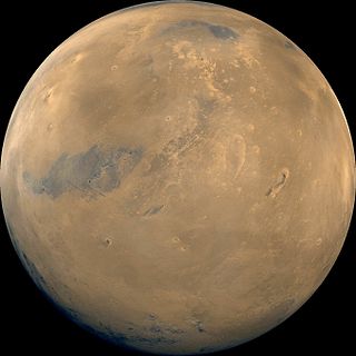
Ascraeus Mons is a large shield volcano located in the Tharsis region of the planet Mars. It is the northernmost and tallest of three shield volcanoes collectively known as the Tharsis Montes.

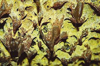
In volcanology, a lava dome is a circular mound-shaped protrusion resulting from the slow extrusion of viscous lava from a volcano. Dome-building eruptions are common, particularly in convergent plate boundary settings. Around 6% of eruptions on Earth are lava dome forming. The geochemistry of lava domes can vary from basalt to rhyolite although the majority are of intermediate composition The characteristic dome shape is attributed to high viscosity that prevents the lava from flowing very far. This high viscosity can be obtained in two ways: by high levels of silica in the magma, or by degassing of fluid magma. Since viscous basaltic and andesitic domes weather fast and easily break apart by further input of fluid lava, most of the preserved domes have high silica content and consist of rhyolite or dacite.
Puʻu ʻŌʻō is a volcanic cone on the eastern rift zone of Kīlauea volcano in the Hawaiian Islands. The eruption that created Puʻu ʻŌʻō began on January 3, 1983, and continued nearly continuously until April 30, 2018, making it the longest-lived rift-zone eruption of the last two centuries.

Puna is one of the 9 districts of Hawaii County on the Island of Hawaiʻi. It is located on the windward side of the island and shares borders with South Hilo district in the north and Kaʻū district in the west. With a size of just under 320,000 acres (1,300 km2) or 500 sq. miles. Puna is slightly smaller than the island of Kauaʻi.
The Decade Volcanoes are 16 volcanoes identified by the International Association of Volcanology and Chemistry of the Earth's Interior (IAVCEI) as being worthy of particular study in light of their history of large, destructive eruptions and proximity to densely populated areas. The Decade Volcanoes project encourages studies and public-awareness activities at these volcanoes, with the aim of achieving a better understanding of the volcanoes and the dangers they present, and thus being able to reduce the severity of natural disasters.
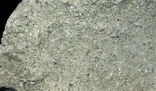
Rhyodacite is a volcanic rock intermediate in composition between dacite and rhyolite. It is the extrusive equivalent of those plutonic rocks that are intermediate in composition between monzogranite and granodiorite. Rhyodacites form from rapid cooling of lava relatively rich in silica and low in alkali metal oxides.

La Garita Caldera is a large supervolcanic caldera in the San Juan volcanic field in the San Juan Mountains near the town of Creede in southwestern Colorado, United States. It is west of La Garita, Colorado. The eruption that created the La Garita Caldera is among the largest known volcanic eruptions in Earth's history, as well as being one of the most powerful known supervolcanic events.
Cerberus is a large "dark spot" located on Mars and named after the mythical dog Cerberus. The arcuate (curved) markings in the upper right are in the Amazonis plains and may be sand drifts. The volcano Elysium Mons, a yellow area north of Cerberus, has several channels radiating from its flanks. The three bright spots, upper left, are volcanoes partially veiled by thin clouds.

Kapoho, Hawaii, is a now-uninhabited unincorporated area in Puna district, Hawaii County, Hawaii, located near the eastern tip of the island of Hawaii, in the easternmost subaerial end of the graben overlying Kīlauea's east rift zone. Originally destroyed by an eruption of Kīlauea in 1960, it was rebuilt as a community of private homes and vacation rentals. In the eruption that began in May 2018, the town was largely destroyed by lava by early June, and the bay filled in as the lava flow extended out into the ocean.

Level Mountain is a large volcanic complex in the Northern Interior of British Columbia, Canada. It is located 50 kilometres north-northwest of Telegraph Creek and 60 kilometres west of Dease Lake on the Nahlin Plateau. With a maximum elevation of 2,164 metres , it is the second-highest of four large complexes in an extensive north–south trending volcanic region. Much of the mountain is gently-sloping; when measured from its base, Level Mountain is about 1,100 metres tall, slightly taller than its neighbour to the northwest, Heart Peaks. The lower, broader half of Level Mountain consists of a shield-like structure while its upper half has a more steep, jagged profile. Its broad summit is dominated by the Level Mountain Range, a small mountain range with prominent peaks cut by deep valleys. These valleys serve as a radial drainage for several small streams that flow from the mountain. Meszah Peak is the only named peak in the Level Mountain Range.

S P Crater is a cinder cone volcano in the San Francisco volcanic field, 25 miles (40 km) north of Flagstaff, Arizona. It is surrounded by several other cinder cones which are older and more eroded. It is a striking feature on the local landscape, with a well-defined lava flow that extends for 4.3 miles (7 km) to the north.

The Athabasca Valles are a late Amazonian-period outflow channel system in the central Elysium Planitia region of Mars, located to the south of the Elysium Rise. They are part of a network of outflow channels in this region that are understood to emanate from large fissures in the Martian surface rather than the chaos terrains that source the circum-Chryse outflow channels. The Athabasca Valles in particular emanate from one of the Cerberus Fossae fissures and flow downstream to the southwest, constrained to the south by a wrinkle ridge for over 100 km, before debouching into the Cerberus Palus volcanic plain. The Athabasca Valles are widely understood to be the youngest outflow channel system on the planet.
Maitland Volcano is a heavily eroded shield volcano in the Northern Interior of British Columbia, Canada. It is 83 km (52 mi) southeast of the small community of Telegraph Creek in what is now the Klappan Range of the northern Skeena Mountains. This multi-vent volcano covered a remarkably large area and was topped by a younger volcanic edifice. Little remains of Maitland Volcano today, limited only to eroded lava flows and distinctive upstanding landforms created when magma hardened within the vents of the volcano.

Lava is magma once it has been expelled from the interior of a terrestrial planet or a moon onto its surface. Lava may be erupted at a volcano or through a fracture in the crust, on land or undersea, usually at temperatures from 800 to 1,200 °C. The volcanic rock resulting from subsequent cooling is also often called lava.

Lava Flow Hazard Zones are areas designated by the United States Geological Survey for the Island of Hawaiʻi in the United States. First prepared in 1974 by Donal Mullineaux and Donald Peterson of the USGS and revised in 1992, the maps outline the qualitative hazard posed by lava flows based on the past history of lava flow activity on each of the 5 volcanoes that form the Island of Hawaiʻi. Zone 1 represents the areas that are most hazardous and Zone 9 the least hazardous.

Lada Terra is a major landmass near the south pole of Venus which is centered at 60°S and 20°E and has a diameter of 8,615 kilometres (5,353 mi) or about the size of Abkhazia. It is defined by the International Astronomical Union as one of the three "major landmasses," or terrae, of Venus. The term "landmass" is not analogous to the landmass on Earth, as there are no apparent oceans on Venus. The term here applies to a substantial portion of land that lies above the average planetary radius, and corresponds to highlands. The broad region of Lada Terra contains massive coronae, rift zones, and volcanic plains as well as many other features that scientists use to attempt to piece together the history of this complex planet. The distinctive cross-cutting relationships found in the bedding of Lada Terra have been important in realizing relative ages of the extensional belts and coronae, as well as the complex tesserae features present planet-wide. In 1990 the Venus Radar Mapper revealed the largest outflow channel system on the planet located in the northern region of Lada Terra. Although Lada Terra is generally considered a highland of Venus, the topography is much lower-lying than its northern counterparts Ishtar Terra and Aphrodite Terra. Lada Terra is named after Lada, the Slavic goddess of love.

The 2018 lower Puna eruption was a volcanic event on the island of Hawaiʻi, on Kīlauea volcano's East Rift Zone that began on May 3, 2018. It is related to the larger eruption of Kīlauea that began on January 3, 1983, though some volcanologists and USGS scientists have discussed whether to classify it as a new eruption. Outbreaks of lava fountains up to 300 feet (90 m) high, lava flows, and volcanic gas in the Leilani Estates subdivision were preceded by earthquakes and ground deformation that created cracks in the roads.

The 1984 eruption of Mauna Loa was a Hawaiian eruption in the U.S. state of Hawaii that lasted from March 25 to April 15, 1984. It ended a 9-year period of quiescence at the volcano and continued for 22 days, during which time lava flows and lava fountains issued from the summit caldera and fissures along the northeast and southwest rift zones. Although the lava threatened Hilo, the flow stopped before reaching the outskirts of town.
