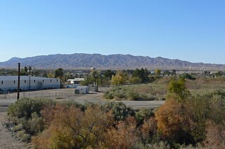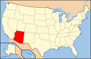
The Gila River is a 649-mile-long (1,044 km) tributary of the Colorado River flowing through New Mexico and Arizona in the United States. The river drains an arid watershed of nearly 60,000 square miles (160,000 km2) that lies mostly within the U.S., but also extends into northern Sonora, Mexico.

The Western Apache are a subgroup of the Apache Native American people, who live primarily in east central Arizona, in the United States and north of Mexico in the states of Sonora and Chihuahua. Most live within reservations. The Fort Apache Indian Reservation, San Carlos Apache Indian Reservation, Yavapai-Apache Nation, Tonto Apache, and the Fort McDowell Yavapai Nation are home to the majority of Western Apache and are the bases of their federally recognized tribes. In addition, there are numerous bands. The Western Apache bands call themselves Ndee (Indé). Because of dialectical differences, the Pinaleño/Pinal and Arivaipa/Aravaipa bands of the San Carlos Apache pronounce the word as Innee or Nnēē:.

The Sacramento Mountains are a mountain range in the Eastern Mojave Desert and within Mojave Trails National Monument, in San Bernardino County, California.

The following is an alphabetical list of articles related to the U.S. state of Arizona.

The Colorado River Indian Tribes is a federally recognized tribe consisting of the four distinct ethnic groups associated with the Colorado River Indian Reservation: the Mohave, Chemehuevi, Hopi, and Navajo. The tribe has about 4,277 enrolled members. A total population of 9,485 currently resides within the tribal reservation according to the 2012-2016 American Community Survey data.
Path 46, also called West of Colorado River, Arizona-California West-of-the-River Path (WOR), is a set of fourteen high voltage alternating-current transmission lines that are located in southeast California and Nevada up to the Colorado River.

The San Pedro River is a northward-flowing stream originating about 10 miles (16 km) south of the international border south of Sierra Vista, Arizona, in Cananea Municipality, Sonora, Mexico. The river starts at the confluence of other streams just east of Sauceda, Cananea. Within Arizona, the river flows 140 miles (230 km) north through Cochise County, Pima County, Graham County, and Pinal County to its confluence with the Gila River, at Winkelman, Arizona. It is the last major, undammed desert river in the American Southwest, and it is of major ecological importance as it hosts two-thirds of the avian diversity in the United States, including 100 species of breeding birds and almost 300 species of migrating birds.

The Muggins Mountains is a mountain range in southwest Arizona east of Yuma, Arizona, northeast of the Gila Mountains, and east of the Laguna Mountains. The Castle Dome Mountains lie to the northeast across the broad Castle Dome Plain. The Muggins Mountains Wilderness occupies the southwest portion of the range.

The 5th Regiment California Volunteer Infantry was an infantry regiment in the Union Army during the American Civil War. It spent its entire term of service in the western United States, attached to the Department of the Pacific and Department of New Mexico.
The Whitlock Valley is a small valley in southeast Graham County, Arizona, southwestern United States, lying between three mountain ranges. The valley lies on the south perimeter region of the White Mountains in eastern Arizona, and lies south of the west-flowing Gila River, and the region transitions south into Cochise County and three large valleys, with some scattered dry lakes. The valley is endorheic, with a small dry lake called Parks Lake, and merges southwest into the north of the San Simon Valley, where the San Simon River has its origins in the flatlands, and surrounding perimeter mountains. The valley was named after Captain James H. Whitlock who commanded during the Battle of Mount Gray in 1864 which was fought near the valley.

The Palo Verde Valley is located in the Lower Colorado River Valley, next to the eastern border of Southern California with Arizona, United States. It is located on the Colorado Desert within the Sonoran Desert south of the Parker Valley. Most of the valley is in Riverside County, with the southern remainder in Imperial County. La Paz County borders to the east on the Colorado River.
Camp Gaston, sometimes called Fort Gaston is a former U. S. Army camp, that was located 3 miles west of the old original course of the Colorado River south of modern Palo Verde, California in Imperial County, California, near Milpitas Wash Road. It was 80 miles (130 km) up river from Fort Yuma, and was active between 1859 and 1867.

The Blythe Intake is the place of the first irrigation canal to feed water to the Palo Verde Valley in 1877. It is located just north of Blythe, California in Riverside County, California. The Blythe Intake was designated a California Historic Landmark (No.948) on March 1, 1982. The site of the Blythe Intake is currently at the Palo Verde Dam.


