| Park Valley | |
|---|---|
 Park Valley | |
| Length | 15 mi (24 km) |
| Width | 12 mi (19 km) |
| Geography | |
| Country | United States |
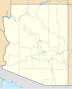
| State | Arizona |
| Region | Gila River Valley ((northwest)-Sonoran Desert) |
| District | Yuma County, Arizona |
| Population centers | Dateland AZ, Sentinel AZ and Hyder, AZ |
| Borders on | Hyder Valley-NE Palomas Mountains-NW San Cristobal Valley-SW Sentinel Plain-SE |
| Coordinates | 32°47′47″N113°32′28″W / 32.79639°N 113.54111°W Coordinates: 32°47′47″N113°32′28″W / 32.79639°N 113.54111°W |
The Park Valley of Arizona is a small, northwest by southeast trending valley centered on the Gila River in central-east Yuma County. The southeast border of the valley is the northern Sentinel Plain of Maricopa County which drains northwestwards toward the Gila River Valley.

Arizona is a state in the southwestern region of the United States. It is also part of the Western and the Mountain states. It is the sixth largest and the 14th most populous of the 50 states. Its capital and largest city is Phoenix. Arizona shares the Four Corners region with Utah, Colorado, and New Mexico; its other neighboring states are Nevada and California to the west and the Mexican states of Sonora and Baja California to the south and southwest.

The Gila River is a 649-mile (1,044 km) tributary of the Colorado River flowing through New Mexico and Arizona in the United States. The river drains an arid watershed of nearly 60,000 square miles (160,000 km2) that lies mainly within the U.S. but also extends into northern Sonora, Mexico. Indigenous peoples have lived along the river for at least 2,000 years, establishing complex agricultural societies before European exploration of the region began in the 16th century. However, European Americans did not permanently settle the Gila River watershed until the mid-19th century.

Yuma County is a county in the southwestern corner of the U.S. state of Arizona. As of the 2010 census, its population was 195,751. The county seat is Yuma.
Contents
Interstate 8 is on the south perimeter of the valley, with towns on I-8 of Dateland in the southwest, Aztec on the center-south, and further east, Sentinel on the southeast.

Dateland is both a CDP and a populated place in Yuma County, Arizona, United States. It is in an area well known for date palm dates.

Aztec is a census designated place situated in Yuma County, Arizona. As of July 2015 it had an estimated population of 52. It has an estimated elevation of 509 feet (155 m) above sea level. It is located along Interstate 8.

Sentinel is a populated place situated in Maricopa County, Arizona. It has an estimated elevation of 692 feet (211 m) above sea level.
Tenmile Wash, of the Tenmile Wash Watershed [1] has its outfall on the Gila River on the southwest of Park Valley. The coordinates for Dateland, Arizona, on the southwest border of Park Valley are 32°47′47″N113°32′28″W / 32.79639°N 113.54111°W [2]
Tenmile Wash is an ephemeral wash and watercourse about 85 miles (137 km) long in the northern Sonoran Desert of south-central Arizona. It forms the eastern drainage of a two drainage system of dry washes into the Gila River Valley; both flow northwesterly, and the western drainage is the San Cristobal Wash Drainage of approximately the same length.


