List of mountain ranges of Arizona

Last updated

Shaded relief map, Arizona. Arizona Relief NED.jpg
Shaded relief map, Arizona.
Arizona county index map Az county map-2.png
Arizona county index map

There are 210 named mountain ranges in Arizona.This list also includes mountain ranges that are mostly in New Mexico and Sonora, Mexico, that extend into Arizona.

Contents

Alphabetical list

The southeast of Arizona, with New Mexico, northwest Chihuahua and northeast Sonora contain insular sky island mountain ranges, (the Madrean Sky Islands), or smaller subranges in association. There are also numerous Sonoran Desert ranges, or Arizona transition zone ranges. Northern and northeast Arizona also has scattered ranges throughout.

Ajo Range, Organ Pipe Cactus National Monument Organ pipe cactus arches.jpg
Ajo Range, Organ Pipe Cactus National Monument
Artillery Mountains above Alamo Lake Alamo Lake and Artillery Peak.jpg
Artillery Mountains above Alamo Lake
Dragoon Mountains DragoonMountains.JPG
Dragoon Mountains
View of the Galiuro Mountains from San Manuel, Arizona Galiuro Mts near San Manuel.jpg
View of the Galiuro Mountains from San Manuel, Arizona
Harquahala Mountains in spring, 2009 Harquahala Mountains.jpg
Harquahala Mountains in spring, 2009
McDowell Mountains at sunset McDowell Mountains at sunset.jpg
McDowell Mountains at sunset
Low clouds on the Mohawk Mountains Low clouds on the Mohawk Mountains.jpg
Low clouds on the Mohawk Mountains
Navajo Mountain and Lake Powell, viewed from the north NavajoMtn.jpg
Navajo Mountain and Lake Powell, viewed from the north
Eagle Eye Arch in the New Water Mountains Eagle Eye Arch.jpg
Eagle Eye Arch in the New Water Mountains
Ocotillo below Lookout Mountain, Phoenix Mountains Ocotillo.jpg
Ocotillo below Lookout Mountain, Phoenix Mountains
A rock pillar (hoodoo) in the Santa Catalina Mountains Precarious pillar, Catalina hwy.jpg
A rock pillar (hoodoo) in the Santa Catalina Mountains
Mount Hopkins and the Smithsonian Observatory, Santa Rita Mountains Mount Hopkins Santa Rita Mountains AZ USA.10247.jpg
Mount Hopkins and the Smithsonian Observatory, Santa Rita Mountains
Misty morning in the Sierra Estrella Misty Morning.jpg
Misty morning in the Sierra Estrella
Western Superstition Mountains from Lost Dutchman State Park SUPERSTITIONS AZ15.jpg
Western Superstition Mountains from Lost Dutchman State Park
Wasson Peak in the Tucson Mountains Wasson.jpg
Wasson Peak in the Tucson Mountains
Virgin Mountains from Valley of Fire State Park Virgin Mountains from Valley of Fire 2.jpg
Virgin Mountains from Valley of Fire State Park
Meadow & cabin near Big Lake, White Mountains (Arizona) Meadow & cabin near Big Lake, AZ.jpg
Meadow & cabin near Big Lake, White Mountains (Arizona)
  1. Agua Caliente Mountains Yuma County and Maricopa County
  2. Agua Dulce Mountains Pima County
  3. Aguila Mountains Yuma County
  4. Ajo Range Pima County
  5. Alvarez Mountains Pima County
  6. Aquarius Mountains Mohave County
  7. Artesa Mountains Pima County
  8. Artillery Mountains Mohave County
  9. Atascosa Mountains Santa Cruz County
  10. Aubrey Hills Mohave County
  11. Baboquivari Mountains Pima County
  12. Batamote Mountains Pima County
  13. Bates Mountains Pima County
  14. Beaver Dam Mountains Mohave County
  15. Belmont Mountains Maricopa County
  16. Big Horn Mountains (Arizona) Maricopa County
  17. Big Lue Mountains Greenlee County
  18. Bill Williams Mountains Mohave County
  19. Black Hills (Greenlee County) Greenlee County
  20. Black Hills (Yavapai County) Yavapai County
  21. Black Mesa (Arizona) -- (E. Navajo County & W. Apache County)
  22. Black Mountains (Arizona) Mohave County
  23. Black Mountains (Yavapai County) Yavapai County-(southwest county)
  24. Blackjack Mountains (Arizona) Gila County
  25. Bradshaw Mountains Yavapai County
  26. Brownell Mountains Pima County
  27. Bryan Mountains Yuma County
  28. Buck Mountains Mohave County
  29. Buckhorn Mountains Yavapai County
  30. Buckskin Mountains (Arizona) La Paz County
  31. Buckskin Mountains (Arizona-Utah) Coconino County -- (S. Kane County, Utah)
  32. Butler MountainsYuma County
  33. Cabeza Prieta Mountains Yuma County
  34. Camelback Mountain Maricopa County
  35. Canelo Hills Santa Cruz County
  36. Carrizo Mountains Apache County
  37. Casa Grande Mountains Pinal County
  38. Castle Mountains Pima County
  39. Castle Dome Mountains Yuma County
  40. Cerbat Mountains Mohave County
  41. Cerro Colorado Mountains Pima County
  42. Chiricahua Mountains Cochise County
  43. Chocolate Mountains (Arizona) La Paz County
  44. Chuska Mountains Apache County
  45. Cimarron Mountains Pima County
  46. Connell Mountains Yavapai County
  47. Copper Mountains Yuma County
  48. Cottonwood Mountains Mohave County
  49. Coyote Mountains (Arizona) Pima County
  50. Crater Range Maricopa County
  51. Crooked Mountains Pima County
  52. Date Creek Mountains Yavapai County
  53. Diablo Mountains (Arizona) Pima County
  54. Dome Rock Mountains La Paz County
  55. Dos Cabezas Mountains Cochise County
  56. Dragoon Mountains Cochise County
  57. Dripping Spring Mountains Pinal County
  58. Eagletail Mountains Maricopa County
  59. Empire Mountains Pima County
  60. Gakolik Mountains Pima County
  61. Galiuro Mountains Graham County -- (SE. Pinal County)
  62. Gila Bend Mountains Maricopa County
  63. Gila Mountains (Graham County) Graham County
  64. Gila Mountains (Yuma County) Yuma County
  65. Goldfield Mountains Maricopa County
  66. Granite Mountains (Arizona) Pima Countysee also: Granite Mountain (Arizona)-(Yavapai County)
    a separate "Granite Mountain" is in s. La Paz County
  67. Granite Wash Mountains La Paz County
  68. Grayback Mountains Yavapai County
  69. Growler Mountains Pima County
  70. Guadalupe Mountains (Hidalgo County) Hidalgo County, NM - (Cochise County, AZ & Sonora, Mexico)
  71. Harcuvar Mountains NE. La Paz County -- (SW. Yavapai County)
  72. Harquahala Mountains E. La Paz County -- (W. Maricopa County)
  73. Hayes Mountains Gila County
  74. Hieroglyphic Mountains N. Maricopa County -- (some in S. Yavapai County)
  75. Hobble Mountains Coconino County
  76. Huachuca Mountains Cochise County
  77. Hualapai Mountains Mohave County
  78. John the Baptist Mountains Pima County
  79. Juniper Mountains Yavapai County
  80. Kofa Mountains N. Yuma County - (S. La Paz County)
  81. La Lesna Mountains Pima County
  82. Laguna Mountains (Arizona) Yuma County (see also: Laguna Mountains(Calif))
  83. Las Guijas Mountains Pima County
  84. Little Ajo Mountains Pima County
  85. Little Buckskin Mountains La Paz County
  86. Little Dragoon Mountains Cochise County
  87. Little Harquahala Mountains La Paz County
  88. Little Horn Mountains S. La Paz County -- (N. Yuma County)
  89. Little Rincon Mountains Cochise County
  90. Lukachukai Mountains Apache County
  91. Maricopa Mountains Maricopa County
  92. Mazatzal Mountains Southeast Yavapai County -- (and N. Maricopa County, W. Gila County)
  93. McAllister Range Yavapai County
  94. McCloud Mountains Yavapai County
  95. McCracken Mountains Mohave County
  96. McDowell Mountains Maricopa County
  97. Mescal Mountains Gila County
  98. Mesquite Mountains Pima County
  99. Middle Mountains S. La Paz County -- (N. Yuma County)
  100. Mineral Mountains, Arizona Pinal County
  101. Mingus Mountain, (= "Black Hills")Yavapai County
  102. Moccasin Mountains Mohave County -- (S. Kane County, Utah)
  103. Mohave Mountains Mohave County
  104. Mohawk Mountains Yuma County
  105. Mohon Mountains Yavapai County
  106. Moquith Mountains Mohave County
  107. Muggins Mountains Yuma County
  108. Mule Mountains Cochise County
  109. Music Mountains Mohave County
  110. Mustang Mountains Santa Cruz County
  111. Navajo Mountain, ArizonaCoconino County (mostly in Utah)
  112. Natanes Mountains Graham County
  113. New River Mountains Yavapai County & Maricopa County
  114. New Water Mountains S. La Paz County -- (connected to Kofa Mountains, N. Yuma County)
  115. North Comobabi Mountains Pima County
  116. Painted Rock Mountains Maricopa Count
  117. Pajarito Mountains Santa Cruz County
  118. Palo Verde Mountains Pinal County
  119. Palomas Mountains Yuma County
  120. Patagonia Mountains Santa Cruz County
  121. Peacock Mountains Mohave County
  122. Pedrogosa Mountains Cochise County
  123. Peloncillo Mountains (Cochise County) NE. Cochise County -- (SE. Graham County, S. Greenlee County)
    See also Peloncillo Mountains (Hidalgo County), New Mexico, also a Madrean Sky Island
  124. Perilla Mountains Cochise County
  125. Phoenix Mountains Maricopa County
  126. Picacho Mountains Pinal County
  127. Pinal Mountains Gila County
  128. Pinaleno Mountains Graham County
  129. Plomosa Mountains La Paz County
  130. Poachie Range SE. Mohave County -- (SW. Yavapai County, NE. La Paz County)
  131. Pozo Redondo Mountains Pima County
  132. Pozo Verde Mountains Pima County
  133. Puerto Blanco Mountains Pima County
  134. Quijotoa Mountains Pima County
  135. Quinlan Mountains Pima County
  136. Rawhide Mountains Mohave County
  137. Rincon Mountains Pima County
  138. Roskruge Mountains Pima County
  139. Sacaton Mountains Pinal County
  140. Salt River Mountains
  141. Salt River Mountains (Gila County) Gila County
  142. San Cayetano Mountains Santa Cruz County
  143. San Francisco Mountains Greenlee County
  144. San Francisco Mountains
  145. San Francisco Mountains (New Mexico) New Mexico & Greenlee County
  146. San Francisco Peaks Coconino County
  147. San Luis Mountains Pima County
  148. San Tan Mountains, Arizona
  149. Santan Mountains Pinal County
  150. Sand Tank Mountains Maricopa County
  151. Santa Catalina Mountains Pima County
  152. Santa Maria Mountains Yavapai County
  153. Santa Rita Mountains Santa Cruz County, Pima County
  154. Santa Rosa Mountains Pima County
  155. Santa Teresa Mountains Graham County
  156. Sauceda Mountains Pima County
  157. Sawmill Mountains Mohave County
  158. Sawtooth Mountains Pinal County
  159. Sevenmile Mountains, Arizona-Gila County
  160. Sheridan Mountains Pima County
  161. Sierra Ancha Gila County
  162. Sierra Arida Yuma County
  163. Sierra Blanca Mountains Pima County
  164. Sierra de la Lechuguilla Yuma County
  165. Sierra de la Nariz Pima County
  166. Sierra de Santa Rosa Pima County
  167. Sierra Estrella Maricopa County
  168. Sierra Madre Occidental Regional Western Mexico - (extension of individual ranges, along entire United States-Mexico border)
  169. Sky island/ Madrean sky islands
  170. Sierra Pinta Yuma County
  171. Sierra Prieta Yavapai County
  172. Sierrita Mountains Pima County
  173. Sikort Chuapo Mountains Pima County
  174. Silver Bell Mountains Pima County
  175. Silver Reef Mountains Pinal County
  176. Slate Mountains Pinal County
  177. Sonoyta Mountains Pima County
  178. South Comobabi Mountains Pima County
  179. South Mountains (Arizona) Maricopa County
  180. Suizo Mountains Pinal County
  181. Summit Mountains E. Greenlee County -- (W. Grant County, New Mexico)
  182. Superstition Mountains Pinal County
  183. Swisshelm Mountains Cochise County
  184. Table Top Mountains Pinal County
  185. Tank Mountains Yuma County
  186. Tat Momoli Mountains Pinal County
  187. Tinajas Altas Mountains Yuma County
  188. Tortilla Mountains Pinal County
  189. Tortolita Mountains Pima County, Pinal County
  190. Trigo Mountains La Paz County
  191. Tucson Mountains Pima County
  192. Tule Mountains Yuma County
  193. Tumacacori Mountains Santa Cruz County, Pima County
  194. Tunitcha Mountains Apache County
  195. Uinkaret Mountains Mohave County
  196. Usery Mountains Maricopa County
  197. Vekol Mountains Pinal County
  198. Virgin Mountains N. Mohave County -- (E. Clark County, Nevada)
  199. Vulture Mountains Maricopa County
  200. Waterman Mountains Pima County
  201. Weaver Mountains Yavapai County
  202. West Silver Bell Mountains Pima County
  203. Whetstone Mountains Cochise County
  204. White Mountains (Arizona) Apache County
  205. White Tank Mountains Maricopa County
  206. Whitlock Mountains Graham County
  207. Wickenburg Mountains Yavapai County
  208. Winchester Mountains N. Cochise County -- (they merge into S. Galiuro Mountains, Graham County)
  209. Yon Dot Mountains Coconino County

Associated regional landforms

Black Mesa west of Chilchinbito, Arizona. Black Mesa near Chilchinbito.jpg
Black Mesa west of Chilchinbito, Arizona.
Monument Valley Monument Valley.jpg
Monument Valley
Salt River Canyon SaltRivCan.jpg
Salt River Canyon
Sonoran Desert plants in the White Tank Mountain Regional Park Cylindropuntia bigelovii in White Tank Mountains Reg Park - Vegetation and Peaks - 60164.jpg
Sonoran Desert plants in the White Tank Mountain Regional Park

Apache County

Buffalo Pass, Lukachukai Mountains Buffalo Pass, Lukachukai.jpg
Buffalo Pass, Lukachukai Mountains

Cochise County

Hoodoos, Chiricahua National Monument Chiricahua nima4.JPG
Hoodoos, Chiricahua National Monument

Coconino County

San Francisco Peaks from the east San Francisco Peaks 01.jpg
San Francisco Peaks from the east

Gila County

Sierra Ancha mountains Sierra ancha1.jpg
Sierra Ancha mountains

Graham County

Pinaleno Mountains from the west Pinaleno Mountains from West.40929.JPG
Pinaleno Mountains from the west

Greenlee County

La Paz County

Harquahala Mountains, March 2005 Harquahala Mountains.jpg
Harquahala Mountains, March 2005

Maricopa County

Mazatzal Mountains viewed from the east, March 2010 Mazaztal Peaks.jpg
Mazatzal Mountains viewed from the east, March 2010

Mohave County

Beaver Dam Mountains, January 2007 Beaver Dam Mountains 1.jpg
Beaver Dam Mountains, January 2007
Boundary Cone and the Black Mountains (Arizona), viewed from about ~due-west (from Mohave Valley, in Lower Colorado River Valley) Boundary Cone from Mohave Valley 1.jpg
Boundary Cone and the Black Mountains (Arizona), viewed from about ~due-west (from Mohave Valley, in Lower Colorado River Valley)
Agathla Peak Agathla.jpg
Agathla Peak

Pima County

East face of Baboquivari Peak BoboquivariEastFace.jpg
East face of Baboquivari Peak
Kitt Peak, the highpoint of the Quinlan Mountains, and the Kitt Peak National Observatory KPNO.jpg
Kitt Peak, the highpoint of the Quinlan Mountains, and the Kitt Peak National Observatory

Pinal County

Mineral Mountains, Arizona Mineral mountains arizona.jpg
Mineral Mountains, Arizona

Santa Cruz County

Mustang Mountains Mustangmountains.jpg
Mustang Mountains

Yavapai County

Mingus Mountain, west of Jerome Mount Mingus Nima1.JPG
Mingus Mountain, west of Jerome

Yuma County

Kofa Mountains Kofa Mountains 002.jpg
Kofa Mountains

New Mexico

Mexico

Sonora

See also

Commons-logo.svg Media related to Mountain ranges of Arizona at Wikimedia Commons


Related Research Articles

The Indigenous peoples of Arizona are the Native American people of the state of Arizona. These include people that have lived in the region since time immemorial; tribes who entered the region centuries ago, such as the Southern Athabascan peoples; and the Pascua Yaqui who settled in Arizona in the early 20th century.

<span class="mw-page-title-main">United States District Court for the District of Arizona</span> U.S. federal district court in Arizona

The United States District Court for the District of Arizona is the U.S. district court that covers the state of Arizona. It is under the United States Court of Appeals for the Ninth Circuit.

<span class="mw-page-title-main">Sierra Estrella</span> Landform in Maricopa County, Arizona

The Sierra Estrella is a mountain range located southwest of Phoenix, Arizona. Much of the range falls within the Gila River Indian Reservation, but 14,400 acres (5,800 ha) of BLM land is protected as the Sierra Estrella Wilderness.

<span class="mw-page-title-main">National Register of Historic Places listings in Arizona</span>

This is a directory of properties and districts listed on the National Register of Historic Places in Arizona. There are about fourteen hundred listed sites in the state, and each of its fifteen counties has at least ten listings on the National Register. Forty-seven of the state's sites are further designated as National Historic Landmarks.

Area code 520 Area code in southern Arizona, United States

Area code 520 is a telephone area code in the North American Numbering Plan (NANP) for the U.S. state of Arizona. The numbering plan area comprises Tucson and most of the southeastern part of the state.

A board of supervisors is a governmental body that oversees the operation of county government in the U.S. states of Arizona, California, Iowa, Mississippi, Virginia, and Wisconsin, as well as 16 counties in New York. There are equivalent agencies in other states.

<span class="mw-page-title-main">Arizona Association of Counties</span> Member association for elected officials

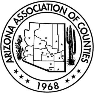
The Arizona Association of Counties (AACo) was established in 1968 as a member association for all elected officials of Arizona's 15 counties. AACo represents each Arizona county and its elected officials by serving as a liaison to the Arizona State Legislature, United States Congress, other governmental agencies, the media and the public. AACo also sponsors various educational programs and renders professional services for the benefit of its membership and county government.

<span class="mw-page-title-main">Yavapai</span> Native American tribe

The Yavapai are a Native American tribe in Arizona. Historically, the Yavapai – literally “people of the sun” – were divided into four geographical bands who identified as separate, independent peoples: the Ɖulv G’paaya, or Western Yavapai; the Yaavpe', or Northwestern Yavapai; the Gwev G’paaya, or Southeastern Yavapai; and the Wiipukpaa, or Northeastern Yavapai – Verde Valley Yavapai.

The Arizona Court of Appeals is the intermediate appellate court for the state of Arizona. It is divided into two divisions, with a total of twenty-two judges on the court: sixteen in Division 1, based in Phoenix, and six in Division 2, based in Tucson.

The Whitlock Valley is a small valley in southeast Graham County, Arizona, southwestern United States, lying between three mountain ranges. The valley lies on the south perimeter region of the White Mountains in eastern Arizona, and lies south of the west-flowing Gila River, and the region transitions south into Cochise County and three large valleys, with some scattered dry lakes. The valley is endorheic, with a small dry lake called Parks Lake, and merges southwest into the north of the San Simon Valley, where the San Simon River has its origins in the flatlands, and surrounding perimeter mountains. The valley was named after Captain James H. Whitlock who commanded during the Battle of Mount Gray in 1864 which was fought near the valley.

Arizona Department of Homeland Security State agency

The Arizona Department of Homeland Security (AZDOHS) is a state agency within the executive branch of the Arizona state government designed to develop, coordinate, and implement of a state policy to secure the state of Arizona from terrorist threat or attack. AZDOHS manages federal homeland security grants related to terrorism prevention and hazard management.

The 14th Arizona Territorial Legislative Assembly was a session of the Arizona Territorial Legislature which convened in Prescott, Arizona. The session ran from January 10, 1887, till March 10, 1887.

San Simon River is an ephemeral river, or stream running through the San Simon Valley in Graham and Cochise County, Arizona and Hidalgo County, New Mexico. Its mouth is at its confluence with the Gila River at Safford in Graham County. Its source is located at 31°51′21″N109°01′27″W.

<span class="mw-page-title-main">1st Arizona State Legislature</span> Session of the Arizona Legislature

The 1st Arizona State Legislature, consisting of the Arizona State Senate and the Arizona House of Representatives, was constituted from February 14, 1912 to December 31, 1914, during the first term of George Wylle Paul Hunt as Governor of Arizona, in Phoenix. The legislature was heavily skewed towards the Democrats, with their holding a 15–4 lead in the senate, and a 31–4 lead in the Arizona House of Representantatives The number of senators and representatives was set by the State Constitution, with 9 counties being granted one Senator, while the other 5 were granted two. Representation in the house was also by county, apportioned by population, with each county being guaranteed a minimum of 1 Representation.