
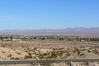
The Mohave Valley is a valley located mostly on the east shore of the south-flowing Colorado River in northwest Arizona. The valley extends into California's San Bernardino County; the northern side of the valley extends into extreme southeast Clark County, Nevada. The main part of the valley lies in southwest Mohave County, Arizona and is at the intersection of the southeast Mojave and northwest Sonoran deserts.
The Black Mountains of northwest Arizona are an extensive, mostly linear, north-south trending 75 miles (121 km) long mountain range. It forms the north-south border of southwest Mohave County as it borders the eastern shore of the south-flowing Colorado River from Hoover Dam.
The Granite Mountains of Arizona is a mountain range in the Sonoran Desert of southern Arizona. It is located in extreme western Pima County, Arizona, bordering southeast Yuma County.
The San Cristobal Wash is an ephemeral wash and watercourse of the San Cristobal Valley, flowing north into the Gila River Valley of the southwestern desert region of Arizona. Besides Death Valley, the Chihuahuan Desert area, and regions of Baja Peninsula North America, the southeast California deserts along the Lower Colorado River Valley, this drainage region is in the harshest desert regions of North America.

The Growler Mountains is a 23-mile, (37-km) long north-south trending mountain range of far western Pima County, Arizona that lies 12 miles (19 km) west of Ajo, Arizona. This desert region of southern Arizona lies in the north and central Sonoran Desert, and is one of the drier desert areas of North America.

Tyson Wash is one of the larger eastern-bank dry washes that enter the Colorado River in western Arizona. It drains the La Posa Plain south-to-north and is also coincident with the Plain,.

The Little Ajo Mountains is a mountain range in southern Arizona, in extreme western Pima County, Arizona. The city of Ajo sits on the northeast of this small mountain range. Both the mountain range and city take their name from the Spanish word for garlic.

Ajo Peak is a mountain peak in southern Arizona, in the north-and-east Sonoran Desert. Two peaks are nearby, Cardigan Peak at 2,922 feet (891 m) and North Ajo Peak 2,776 feet (846 m).
Tenmile Wash is an ephemeral wash and watercourse about 85 miles (137 km) long in the northern Sonoran Desert of south-central Arizona. It forms the eastern drainage of a two drainage system of dry washes into the Gila River Valley; both flow northwesterly, and the western drainage is the San Cristobal Wash Drainage of approximately the same length.
Lonesome Valley is a 23-mile (37 km) long valley located in central-north Yavapai County, Arizona; the valley is an extension southeastwards from Chino Valley (Arizona), the location of the Big Chino Wash, which becomes the Verde River at Paulden, Arizona; Paulden is located at the northwest terminus of Lonesome Valley. A small sub-valley is located on the northeast perimeter of Chino Valley, Arizona, located in the center-northwest of Lonesome Valley. The valley is named Little Chino Valley, and is the small valley link between Chino Valley, northwest, and Lonesome Valley, southeast.
The Harcuvar Mountains are a narrow mountain range in western-central Arizona, United States. The range lies just east of the north-south Colorado River, and south of the east-west, west-flowing Bill Williams River, from Alamo Lake.

The Buckskin Mountains is a mountain range in La Paz County, Arizona, United States. The range lies just east of the north–south Colorado River, and borders south of the east–west, west-flowing Bill Williams River.

Butler Valley is a valley of the Maria fold and thrust belt in western Arizona, USA. It lies east of the Colorado River, and is south of the west-flowing Bill Williams River.

The Piute Wash of extreme southeastern Nevada and northeast San Bernardino County California is the south-flowing drainage of the Piute Valley. The wash and valley are located northwest of Needles, California.
The Little Harquahala Mountains are a small, arid, low-elevation mountain range of western-central Arizona, in the southeast of La Paz County.
The Childs Valley is a valley in the Sonoran Desert of south-central Arizona northwest of Ajo. Upstream sections are located in far western Pima County; downstream it merges into the Gila River Valley in southwestern Maricopa County. Upstream, the valley lies northeast and parallel to the Growler Valley and Growler Mountains.

The Granite Wash Mountains are a short, arid, low elevation mountain range of western-central Arizona, in the southeast of La Paz County. The range borders a slightly larger range southeast, the Little Harquahala Mountains; both ranges form a section on the same water divide between two desert washes. The washes flow in opposite directions, one northwest to the Colorado River, the other southeast to the Gila River.
The Chemehuevi Wash is a large wash of northeast San Bernardino County in the southeast Mojave Desert. The wash enters the center-west bank of Lake Havasu on the California–Arizona border. Chemehuevi Wash drains the center of the Chemehuevi Valley and the regional landforms of washes, valleys and mountains is adjacent the northeast region of the Colorado Desert, the entire region south on the west side of the south-flowing Colorado River.
The Date Creek Mountains are a short, arid range in southwest Yavapai County, Arizona. Congress is on its southeast foothills, and Wickenburg lies 15 mi (24 km) southeast.

The Defiance Plateau, part of the geologic Defiance Uplift, is an approximately 75-mile (121 km) long, mostly north-trending plateau of Apache County, Arizona, with its east and southeast perimeter, as parts of San Juan and McKinley Counties, New Mexico.
