
Hualapai Valley is a valley in Mohave County, Arizona. [1]
Hualapai Valley is a valley in Mohave County, Arizona. [1]
Hualapai Valley is an endorheic basin and its watershed terminates in the dry lake or playa called Red Lake at an elevation of 2762 feet. [2] It is bounded on the east by the Grand Wash Cliffs and Peacock Mountains, on the south by the Hualapai Mountains, on the west by the Cerbat Mountains and the White Hills. It extends from its divide with Gold Basin 35°46′57″N114°07′53″W / 35.78250°N 114.13139°W at over 2680 feet, southward to Red Lake, and northward from Kingman and the Hualapai Mountains 35°10′21″N113°50′17″W / 35.17250°N 113.83806°W at 4439 feet, to Red Lake. [1]
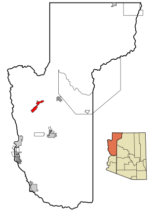
Walapai is a populated place on Arizona State Route 66 (former U.S. Route 66) in Mohave County, Arizona, United States. Walapai is located in the Hualapai Valley along a railroad line 14 miles (23 km) northeast of Kingman. Walapai has a post office with ZIP code 86412. [3]
From 1857 to 1858 Lieutenant Edward Fitzgerald Beale, built the first federal highway in the southwest, Beale's Wagon Road. Beale's road roughly followed the 35th Parallel railroad route laid out by Lieutenant Amiel Weeks Whipple west across New Mexico Territory through the Flagstaff area and then turned away northward through Peach Springs, Truxton Wash, and the Hualapai Valley, making its way through what became Kingman to a crossing on the Colorado River near the location of Fort Mohave. [4]
J. L. Smith, was known as Hualapai Smith for being first to explore the Hualapai Valley of Arizona before any other prospector in the early 1860s. [5]

Mohave County is a county in the northwestern corner of the U.S. state of Arizona. As of the 2020 census, its population was 213,267. The county seat is Kingman, and the largest city is Lake Havasu City. It is the fifth largest county in the United States.
Dolan Springs is an unincorporated community and census-designated place (CDP) in Mohave County, Arizona, United States. The population was 1,989 at the 2020 census, down from 2,033 at the 2010 census.

Golden Valley is an unincorporated area and census-designated place (CDP) in Mohave County, Arizona, United States. The population was 8,801 at the 2020 census.
Kingman is a city in and the county seat of Mohave County, Arizona, United States. It is named after Lewis Kingman, an engineer for the Atlantic and Pacific Railroad. It is located 105 miles (169 km) southeast of Las Vegas, Nevada, and 180 miles (290 km) northwest of Arizona's state capital, Phoenix. The population was 32,689 at the 2020 census.

The Hualapai is a federally recognized Native American tribe in Arizona with about 2300 enrolled members. Approximately 1353 enrolled members reside on the Hualapai Reservation, which spans over three counties in Northern Arizona.

The Hualapai Mountains are a mountain range located in Mohave County, east of Kingman, Arizona. Rising up to 8,417 feet at its highest peak, the higher elevations of the Hualapai Mountains support Madrean Sky Island habitats, and are host to a plethora of unique flora and fauna in a wide range of microclimates, high above the surrounding Mojave Desert.

The Mojave Road, also known as Old Government Road, is a historic route and present day dirt road across what is now the Mojave National Preserve in the Mojave Desert in the United States. This rough road stretched 147 miles (237 km) from Beale's Crossing, to Fork of the Road location along the north bank of the Mojave River where the old Mojave Road split off from the route of the Old Spanish Trail/Mormon Road.

Yucca is an unincorporated community and census-designated place (CDP) in Mohave County, Arizona, United States. As of the 2020 census it had a population of 96, down from 126 at the 2010 census.
The Sacramento Valley of northwestern Arizona is a north–south trending valley west and southwest of Kingman in Mohave County. The valley lies just east of the southern section of the Black Mountains. Interstate 40 in Arizona traverses the valley north–south.

The Cerbat Mountains is a mountain range in Mohave County in northwest Arizona immediately north of Kingman. The Cerbat Mountains and the White Hills (Arizona) adjacent north, are the dividing ranges between the Detrital Valley west, and the Hualapai Valley east.

Grand Canyon West is a census-designated place (CDP) in Mohave County, Arizona, United States, located on the Hualapai Reservation. The population was reported as 0 at the 2020 census. Grand Canyon West is home to the tribe's Grand Canyon business operations, including the Grand Canyon West Airport and the Grand Canyon Skywalk. Typically, they are open from 8:00 a.m. – 6:00 p.m., including all holidays.
The Rawhide Mountains are a mountain range of western Arizona, in the southwest of Mohave County. It is part of a block of mountain ranges on the north of an insular region called the Maria fold and thrust belt, containing mountain ranges, valleys, and plains. The Rawhide Mountains border the much smaller Artillery Mountains southeast, bordering on Alamo Lake State Park and the south-flowing Big Sandy River.
Dutch Flat of Arizona is a valley south of the Sacramento Valley and Interstate 40 in southern Mohave County.
Arizona State Prison – Kingman is a privately run minimum/medium-security prison designed to hold 3500 prisoners. It is located in unincorporated Mohave County, Arizona, in Golden Valley. When the idea of the prison was being sold to the residents of Golden Valley it was promised that it would be a prison only for Dui offenders. It was operated by the Management and Training Corporation under contract to the Arizona Department of Corrections until August 2015. MTC had been criticized for allowing the homicidal escape of three violent prisoners in 2010. The state began seeking an alternate provider after it found MTC failed to control riots on July 1, 2 and 4, at Kingman, in July 2015.
The Hualapai War, or Walapai War, was an armed conflict fought from 1865 to 1870 between the Hualapai native Americans and the United States in Arizona Territory. The Yavapai also participated on the side of the Hualapai and Mohave scouts were employed by the United States Army. Following the death of the prominent Yavapai leader Anasa in April 1865, the natives began raiding American settlements which provoked a response by the United States Army forces stationed in the area. By the spring of 1869 disease forced the majority of the Hualapais to surrender though some skirmishing continued for almost two more years.

Antares is an unincorporated community and census designated place (CDP) in Mohave County, Arizona, United States. As of the 2020 census, it had a population of 132. It exists along part of historic U.S. Route 66.
Beale's Crossing was a river crossing on the Colorado River, near the head of the Mohave Valley, between New Mexico Territory and California along the 35th Parallel route of Beale's Wagon Road. It was at what became the site of Fort Mohave in what is now Fort Mohave, Arizona, west of Beaver Lake, Nevada. It was named for Edward Fitzgerald Beale, who lead the expedition that built what came to be called Beale's Wagon Road from Albuquerque, New Mexico to Beale's Crossing in California, then by way of the Mohave Trail/Old Spanish Trail, and another old route west from the Mojave River to Fort Tejon, California.
Pine Lake is an unincorporated community and census-designated place (CDP) in Mohave County, Arizona, United States. The population was 142 at the 2020 census.
Pinion Pines is an unincorporated community and census-designated place (CDP) in Mohave County, Arizona, United States. The population was 158 at the 2020 census.