The Mohawk Valley along the Gila River proper contains the agricultural communities of Wellton, Noah, Roll, and Tacna. This river stretch of the valley is mostly east-west trending, and extends northeasterly upstream to the adjacent Hyder Valley; to the west the Gila River turns northwest through the Dome Valley which lies between the Gila Mountains and the Muggins Mountains Wilderness on the northeast.
The southern portion of the Mohawk Valley is an extensive plain extending south, and uphill towards Sonora, Mexico and the valley extends, on its eastern end, southwards, ending at the Tule Desert and the Sierra Pinta on the west; the eastern side of this southern stretch of the valley is bordered by the Mohawk and Bryan Mountains. Much of this part of the valley is in the Barry M. Goldwater Air Force Range.
California is a U.S. state on the western coast of North America. Covering an area of 163,696 sq mi (423,970 km2), California is among the most geographically diverse states. The Sierra Nevada, the fertile farmlands of the Central Valley, and the arid Mojave Desert of the south are some of the major geographic features of this U.S. state. It is home to some of the world's most exceptional trees: the tallest, most massive, and oldest. It is also home to both the highest and lowest points in the 48 contiguous states. The state is generally divided into Northern and Southern California, although the boundary between the two is not well defined. San Francisco is decidedly a Northern California city and Los Angeles likewise a Southern California one, but areas in between do not often share their confidence in geographic identity. The US Geological Survey defines the geographic center of the state at a point near North Fork, California.
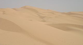
The Yuma Desert is a lower-elevation section of the Sonoran Desert in the southwestern United States and the northwest of Mexico. It lies in the Salton basin. The desert contains areas of sparse vegetation and has notable areas of sand dunes. With an average rainfall less than 8 inches (200 mm) each year, this is among the harshest deserts in North America. Human presence is sparse throughout, the largest city being Yuma, Arizona, on the Colorado River and the border of California.
The Tinajas Altas Mountains are an extremely arid northwest-southeast trending mountain range in southern Yuma County, Arizona, approximately 35 mi southeast of Yuma, Arizona. The southern end of the range extends approximately one mile into the northwestern Mexican state of Sonora on the northern perimeter of the Gran Desierto de Altar. The range is about 22 mi in length and about 4 mi wide at its widest point. The highpoint of the range is unnamed and is 2,766 feet above sea level and is located at 32°16'26"N, 114°02'48"W. Aside from the portion of the range in Mexico, the entirety of the range lies within the Barry M. Goldwater Air Force Range. They lie at the heart of the traditional homeland of the Hia C-eḍ O'odham people.
The Muggins Mountains is a mountain range in southwest Arizona east of Yuma, Arizona, northeast of the Gila Mountains, and east of the Laguna Mountains. The Castle Dome Mountains lie to the northeast across the broad Castle Dome Plain. The Muggins Mountains Wilderness occupies the southwest portion of the range.
The Bryan Mountains are a small mountain range in the northwestern Sonoran Desert of southwestern Arizona. The range is located in southeastern Yuma County, about 75 mi southeast of Yuma and about 35 mi west of Ajo. The range is approximately ten miles long and about three miles wide at its widest point. The highpoint of the range is 1,794 feet above sea level and is located at 32°18'27"N, 113°22'46"W. The range is located entirely within the Cabeza Prieta National Wildlife Refuge.
The San Cristobal Valley is a valley in the lower regions of the western Gila River Valley in southwestern Arizona in the western Sonoran Desert. The San Cristobal Wash drains northwest, but exists only in the southern half of the valley.
Mohawk is a populated place in Yuma County, Arizona, United States. It is part of the Yuma Metropolitan Statistical Area.
The Mohawk Mountains is a mountain range in the northwest Sonoran Desert of southwest Arizona. It abuts the western Gila River valley to the north, and is located in southern Yuma County. The Mohawk Valley lies adjacent and southwest of the range; the San Cristobal Valley is northeast.
The Sierra Pinta or Sierra Pintas are a narrow remote block faulted northwest-southeast trending mountain range, about 22 miles (35 km) long located in southwestern Arizona in the arid northwestern Sonoran Desert, just north of the Pinacate Reserve of northern Sonora, Mexico. The mountains derive their name from visitor descriptions of its multicolored hues when viewed at sunrise and sunset.
The San Cristobal Wash is an ephemeral wash and watercourse of the San Cristobal Valley, flowing north into the Gila River Valley of the southwestern desert region of Arizona. Besides Death Valley, the Chihuahuan Desert area, and regions of Baja Peninsula North America, the southeast California deserts along the Lower Colorado River Valley, this drainage region is in the harshest desert regions of North America.
Tenmile Wash is an ephemeral wash and watercourse about 85 miles (137 km) long in the northern Sonoran Desert of south-central Arizona. It forms the eastern drainage of a two drainage system of dry washes into the Gila River Valley; both flow northwesterly, and the western drainage is the San Cristobal Wash Drainage of approximately the same length.
The Altar Valley is a 45-mile (72 km) long north-south valley, trending slightly northeast from Sasabe, Arizona on the Mexico border to the Avra Valley west of the Tucson Mountains. It is delimited by Arizona State Route 86, from east-to-west on the north separating it from the Avra Valley which then trends northwesterly, merging into the plains and drainage of the Santa Cruz River.
The West Silver Bell Mountains are a small 10 mile (16 km) long mountain range of south-central Arizona, United States. The range lies in the north-central arid Sonoran Desert; the Madrean Sky Islands region of southeast Arizona, around Tucson is adjacent to the southeast.
The Black Hills of Greenlee County are a 20 mi (32 km) long mountain range of the extreme northeast Sonoran Desert bordering the south of the White Mountains of eastern Arizona's transition zone.
The Big Burro Mountains are a moderate length 35-mile (56 km) long, mountain range located in central Grant County, New Mexico. The range's northwest-southeast 'ridgeline' is located 15 mi southwest of Silver City.
The Arizona/New Mexico Mountains ecoregion is a Level III ecoregion designated by the United States Environmental Protection Agency (EPA) in the U.S. states of Arizona and New Mexico.
This page is based on this Wikipedia article Text is available under the CC BY-SA 4.0 license; additional terms may apply. Images, videos and audio are available under their respective licenses.


