
The Muggins Mountains is a mountain range in southwest Arizona east of Yuma, Arizona, northeast of the Gila Mountains, and east of the Laguna Mountains. The Castle Dome Mountains lie to the northeast across the broad Castle Dome Plain. The Muggins Mountains Wilderness occupies the southwest portion of the range.

The Muggins Mountain Wilderness is a 7,711-acre (31.21 km2) wilderness area in the U.S. state of Arizona. It is located approximately 38 miles (61 km) east of Yuma, Arizona in the Muggins Mountains and adjacent to the agricultural Dome Valley and Gila River. The wilderness area is made up of the highest peak in the southern section of Muggins Mountains, Klothos Temple at 1,666 feet (508 m). Muggins Peak is adjacent to the peak southeastwards, at 1,424 feet (434 m). Three deeply cut washes drain the southwest border of the wilderness, Twin Tanks Wash, Muggins Wash, and Morgan Wash. Muggins Wash is the access point to the wilderness, by way of County 7th Street.

The Mohawk Valley is a valley in the lower regions of the western Gila River Valley in southwestern Arizona in the western Sonoran Desert.
The Cabeza Prieta Mountains are a mountain range in the northwestern Sonoran Desert of southwest Arizona. It is located in southern Yuma County, Arizona.
The Bryan Mountains are a small mountain range in the northwestern Sonoran Desert of southwestern Arizona. The range is located in southeastern Yuma County, about 75 mi (121 km) southeast of Yuma and about 35 mi (56 km) west of Ajo. The range is approximately ten miles long and about three miles wide at its widest point. The highpoint of the range is 1,794 feet above sea level and is located at 32°18'27"N, 113°22'46"W. The range is located entirely within the Cabeza Prieta National Wildlife Refuge.
The San Cristobal Valley is a valley in the lower regions of the western Gila River Valley in southwestern Arizona in the western Sonoran Desert. The San Cristobal Wash drains northwest, but exists only in the southern half of the valley.
Mohawk is a populated place in Yuma County, Arizona, United States. It is part of the Yuma Metropolitan Statistical Area.
The Gila Mountains of Graham County are a mountain range in central-east Arizona. It borders the Gila River and Gila Valley on the valley's northeast in north-central Graham County; also the San Carlos Indian Reservation. The mountain range sits on the southern perimeter of the White Mountains and is located in the southeast area of Arizona's transition zone.
The Granite Mountains of Arizona is a mountain range in the Sonoran Desert of southern Arizona. It is located in extreme western Pima County, Arizona, bordering southeast Yuma County.

The Gila Mountains of Yuma County are a 26-mile (42 km) long mountain range in southwestern Arizona in the northwest Sonoran Desert.
The Sierra Pinta or Sierra Pintas are a narrow remote block faulted northwest-southeast trending mountain range, about 22 miles (35 km) long located in southwestern Arizona in the arid northwestern Sonoran Desert, just north of the Pinacate Reserve of northern Sonora, Mexico. The mountains derive their name from visitor descriptions of its multicolored hues when viewed at sunrise and sunset.
The San Cristobal Wash is an ephemeral wash and watercourse of the San Cristobal Valley, flowing north into the Gila River Valley of the southwestern desert region of Arizona. Besides Death Valley, the Chihuahuan Desert area, and regions of Baja Peninsula North America, the southeast California deserts along the Lower Colorado River Valley, this drainage region is in the harshest desert regions of North America.

The Growler Mountains is a 23-mile, (37-km) long north-south trending mountain range of far western Pima County, Arizona that lies 12 miles (19 km) west of Ajo, Arizona. This desert region of southern Arizona lies in the north and central Sonoran Desert, and is one of the drier desert areas of North America.

The Altar Valley is a 45-mile (72 km) long north–south valley, trending slightly northeast from Sasabe, Arizona on the Mexico border to the Avra Valley west of the Tucson Mountains. It is delimited by Arizona State Route 86, from east-to-west on the north separating it from the Avra Valley which then trends northwesterly, merging into the plains and drainage of the Santa Cruz River.
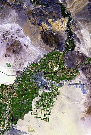
The Laguna Mountains are a small, approximately circular mountain range of extreme southwest Arizona northeast of Yuma and east of Winterhaven, California on the Colorado River. The Colorado forms the western perimeter of the mountains; Mittry Lake, on the Colorado is on its northwest.
The Little Harquahala Mountains are a small, arid, low-elevation mountain range of western-central Arizona, in southeastern La Paz County.

The Granite Wash Mountains are a short, arid, low elevation mountain range of western-central Arizona, in the southeast of La Paz County. The range borders a slightly larger range southeast, the Little Harquahala Mountains; both ranges form a section on the same water divide between two desert washes. The washes flow in opposite directions, one northwest to the Colorado River, the other southeast to the Gila River.
The West Silver Bell Mountains are a small 10 mile (16 km) long mountain range of south-central Arizona, United States. The range lies in the north-central arid Sonoran Desert; the Madrean Sky Islands region of southeast Arizona, around Tucson is adjacent to the southeast.

The Painted Rock Mountains are a short 15-mile (24 km) long mountain range of the north-central Sonoran Desert southwest of Phoenix, Arizona and in southwest Maricopa County. The Gila River flows through the central-north end of the range.


