
Apache Junction is a city in Maricopa and Pinal counties in the state of Arizona. According to the 2017 U.S. Census estimates, the population of the city was 40,358, most of whom lived in Pinal County.

Saguaro Lake is the fourth reservoir on the Salt River formed by the Stewart Mountain Dam in the U.S. state of Arizona. The lake is off State Route 87, about halfway between Phoenix and the ghost town of Sunflower. The dammed end of the lake is at 33.5656°N 111.5361°W, at an elevation of 1,506 feet (459 m).

The Phoenix Open is a professional golf tournament on the PGA Tour, held in late January/early February at the Tournament Players Club (TPC) of Scottsdale, Arizona.
North Central Arizona is a geographical region of Arizona. It is in the Transition Zone between the Basin and Range Province and the Colorado Plateau, and has some of the most rugged and scenic landscapes in Arizona.
The Cañada del Oro, is a primary watershed channel in the valley of Tucson, Arizona, USA. The word cañada has a tilde (ñ) and is pronounced [kaˈɲaða] in Spanish; in English it is pronounced kə-NYAH-də, not like the country of Canada.

The Sierra Ancha is a mountain range in Gila County, in central Arizona. It lies between Roosevelt Lake to the south, the Tonto Basin to the west, Cherry Creek to the east, and Pleasant Valley to the north. The range is one of several, including the Bradshaw Mountains, Mingus Mountain of the Black Hills, and the Mazatzal Mountains, which form a transitional zone between the lowland deserts of southern Arizona and the Colorado Plateau of northeastern Arizona. The highest point in the range is Aztec Peak, at an elevation of 2345 m (7694 ft).

The Arizona National Scenic Trail is a National Scenic Trail from Mexico to Utah that traverses the whole north–south length of the U.S. state of Arizona. The trail begins at the Coronado National Memorial near the US–Mexico border and moves north through parts of the Huachuca, Santa Rita, and Rincon Mountains. The trail continues through the Santa Catalina north of Tucson and the Mazatzal Mountains before ascending the Mogollon Rim north of Payson, eventually leading to the higher elevations of Northern Arizona and the San Francisco Peaks. The trail then continues across the Coconino Plateau and in and out of the Grand Canyon. The Arizona Trail terminates near the Arizona-Utah border in the Kaibab Plateau region. The 800-mile (1,300 km) long Arizona Trail was completed on December 16, 2011. The trail is designed as a primitive trail for hiking, equestrians, mountain biking, and even cross country skiing, showcasing the wide variety of mountain ranges and ecosystems of Arizona.
Thompson Peak refers to one of these mountain peaks:
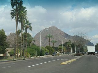
The Camelback East Village, also sometimes referred to as East Phoenix or the East Side, is one of the 15 villages that make up Phoenix, Arizona, United States. It is adjacent to the suburbs Paradise Valley and Scottsdale and sits between Piestewa Peak and Camelback Mountain. There are two main cores of the village. The first is the 24th Street and Camelback Road core and the other is the 44th Street and Van Buren Avenue core.

The Mazatzal Mountains are a mountain range in south central Arizona, about 30–45 miles northeast of Phoenix and the Phoenix metropolitan area. The origin of the name remains obscure but one possibility is that it is from the Aztec language meaning "place of the deer". The crest of the Mazatzals forms the county line between Maricopa County and Gila County. SR 87, the Beeline Highway, traverses the Mazatzals on its way to Payson. The highest peak is Mazatzal Peak at 7,903 feet (2,409 m). They also include the Four Peaks, with elevation 7,659 ft, 2,334 m; a prominent mountain and landmark of the eastern Phoenix area.
The Arizona State Fairgrounds is a permanent fairgrounds on McDowell Road, Encanto Village, within the city of Phoenix, Arizona, United States. It is currently used yearly to host the Arizona State Fair and the Maricopa County Fair, as well as for other events.

The Artillery Mountains are a mountain range in Mohave County in western Arizona. High point of the range is Artillery Peak, 2,917 feet above sea level. Artillery Peak is at coordinates N 34.36946 W 113.58160.

The Castle Dome Mountains are a mountain range in Yuma County, Arizona, within the Kofa National Wildlife Refuge. Castle Dome Peak, the high point of the range, is a prominent butte and distinctive landmark. The peak is 3,776 feet (1,151 m) high, and is located at 33°05′04″N114°08′36″W. Castle Dome was named by American soldiers at old Fort Yuma in the 1880s. Early Spanish explorers called the same peak Cabeza de Gigante, "Giant's Head."

The Sacaton Mountains are a range of granitic inselbergs in Pinal County, Arizona, located south of Phoenix near Casa Grande, Arizona.
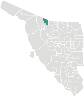
Sáric Municipality is a municipality in Sonora in north-western Mexico. Its northern boundary is the U.S. state of Arizona. The population of the municipality was 2,703 in 2010 living in an area of 1,676.23 square kilometers. The elevation is around 800 meters. At the municipal seat it is 780 meters.

The Tonto Basin, also known as Pleasant Valley, covers the main drainage of Tonto Creek and its tributaries in central Arizona, at the southwest of the Mogollon Rim, the higher elevation transition zone across central and eastern Arizona.
The Silver King Mine is an inactive silver mine located near Superior, Arizona in the United States. The richest silver mine in Arizona, it produced an estimated US$42 million worth of silver ore between 1875 and 1900.
The Goldfield Mountains of Arizona are located adjacent to the Superstition Mountains, between Usery Pass and Canyon Lake (Arizona). They are less known because of the Superstition Mountains, which are taller and more visible, and contain Canyon Lake (Arizona), which is a huge historic site. The southern part of the Goldfield Mountains used to be a big mining district in 1893. Even though the mining is done, the Goldfield Mountains are still a treasure themselves. These mountains are now big for hiking.
The Elsinore Trough is a graben rift valley in Riverside County, southern California. It is created by the Elsinore Fault Zone.

The Sierrita Mine is a large copper mine located in the Sierrita Mountains of Arizona, in the southwestern part of the United States. Sierrita was operated by Phelps Dodge until 2007 when it was acquired by Freeport-McMoRan. The mine represents one of the largest copper reserves in the United States and in the world. The deposit had estimated reserves of 907 million metric tons of ore grading 0.26% copper and 0.03% molybdenum along with additional 2.4 billion tons at 0.21% copper and 0.02% molybdenum.


