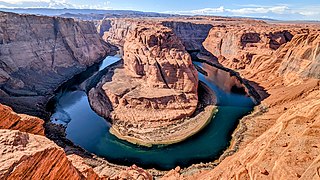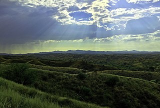
Flagstaff is the county seat of Coconino County, Arizona, in the southwestern United States. As of the 2020 United States census, the city's population was 76,831.

Coconino County is a county in the North-Central part of the U.S. state of Arizona. Its population was 145,101 at the 2020 census. The county seat is Flagstaff. The county takes its name from Cohonino, a name applied to the Havasupai people. It is the second-largest county by area in the contiguous United States, behind San Bernardino County, California. It has 18,661 sq mi (48,300 km2), or 16.4% of Arizona's total area, and is larger than the nine smallest states in the U.S.

Mohave County occupies the northwestern corner of the U.S. state of Arizona. As of the 2020 census, its population was 213,267. The county seat is Kingman, and the largest city is Lake Havasu City. It is the fifth largest county in the United States.

The Southwestern United States, also known as the American Southwest or simply the Southwest, is a geographic and cultural region of the United States that includes Arizona and New Mexico, along with adjacent portions of California, Colorado, Nevada, Oklahoma, Texas, and Utah. The largest cities by metropolitan area are Phoenix, Las Vegas, El Paso, Albuquerque, and Tucson. Before 1848, in the historical region of Santa Fe de Nuevo México as well as parts of Alta California and Coahuila y Tejas, settlement was almost non-existent outside of Nuevo México's Pueblos and Spanish or Mexican municipalities. Much of the area had been a part of New Spain and Mexico until the United States acquired the area through the Treaty of Guadalupe Hidalgo in 1848 and the smaller Gadsden Purchase in 1854.

The Colorado River is one of the principal rivers in the Southwestern United States and in northern Mexico. The 1,450-mile-long (2,330 km) river, the 5th longest in the United States, drains an expansive, arid watershed that encompasses parts of seven U.S. states and two Mexican states. The name Colorado derives from the Spanish language for "colored reddish" due to its heavy silt load. Starting in the central Rocky Mountains of Colorado, it flows generally southwest across the Colorado Plateau and through the Grand Canyon before reaching Lake Mead on the Arizona–Nevada border, where it turns south toward the international border. After entering Mexico, the Colorado approaches the mostly dry Colorado River Delta at the tip of the Gulf of California between Baja California and Sonora.

Humphreys Peak is the highest mountain and the second most prominent peak after Mount Graham in the U.S. state of Arizona. With an elevation of 12,633 feet (3,851 m), it is located within the Kachina Peaks Wilderness in the Coconino National Forest, about 11 miles (17.7 km) north of Flagstaff, Arizona. Humphreys Peak is the highest of a group of dormant volcanic peaks known as the San Francisco Peaks.

Camelback Mountain is a mountain in Phoenix, Arizona, United States. The English name is derived from its shape, which resembles the hump and head of a kneeling camel. The mountain, a prominent landmark of the Phoenix metropolitan area, is located in the Camelback Mountain Echo Canyon Recreation Area between the Arcadia neighborhood of Phoenix and the town of Paradise Valley. It is a popular recreation destination for hiking and rock climbing.

The Santa Catalina Mountains, commonly referred to as the Catalina Mountains or the Catalinas, are north and northeast of Tucson in Arizona, United States, on Tucson's north perimeter. The mountain range is the most prominent in the Tucson area, with the highest average elevation. The highest point in the Catalinas is Mount Lemmon at an elevation of 9,157 feet (2,791 m) above sea level and receives 18 inches (460 mm) of precipitation annually.

Mount Wrightson is a 9,456-foot (2,882 m) peak in the Santa Rita Mountains within the Coronado National Forest, in southern Arizona, United States.

Miller Peak, at 9,470 feet (2,886 m), is the second-highest mountain in Cochise County, Arizona. Located approximately 10 miles south of Sierra Vista, Arizona, it is the highest mountain in the Huachuca mountain range and a popular local hiking destination. The Miller Peak Wilderness encompasses 20,190 acres and is managed by the Coronado National Forest. This is also the most southerly peak and land area to rise above 9,000 feet in the continental United States. The area was affected by the 2011 Monument fire and most of the pine trees seen in older photographs were burned and destroyed. Scrub oak are beginning to replace the areas that were previously covered by pine.

Arizona is a landlocked state situated in the southwestern region of the United States of America. It has a vast and diverse geography famous for its deep canyons, high- and low-elevation deserts, numerous natural rock formations, and volcanic mountain ranges. Arizona shares land borders with Utah to the north, the Mexican state of Sonora to the south, New Mexico to the east, and Nevada to the northwest, as well as water borders with California and the Mexican state of Baja California to the southwest along the Colorado River. Arizona is also one of the Four Corners states and is diagonally adjacent to Colorado.

The Huachuca Mountains are part of the Sierra Vista Ranger District of the Coronado National Forest in Cochise County in southeastern Arizona, approximately 70 miles (110 km) south-southeast of Tucson and southwest of the city of Sierra Vista. Included in this area is the highest peak in the Huachucas, Miller Peak, and the region of the Huachucas known as Canelo Hills in eastern Santa Cruz County. The mountains range in elevation from 3,934 feet (1,199 m) at the base to 9,466 feet (2,885 m) at the top of Miller Peak. The second highest peak in this range is Carr Peak, elevation 9,200 feet (2,804 m). The Huachuca Mountain area is managed principally by the United States Forest Service (41%) and the U.S. Army (20%), with much of the rest being private land (32%). Sierra Vista is the main population center.

The Atascosa Mountains is a mountain range in western Santa Cruz County, Arizona, United States. It is sandwiched between the larger Tumacacori Mountains to the north, and a small east–west border range to the south, the Pajarito Mountains; the Pajaritos are on the U.S.–Mexico border and abut the Sierra La Esmeralda range in northern Sonora.

The Pajarito Mountains is a small mountain range of western Santa Cruz County, Arizona, United States, that extend south into Sonora, Mexico. The range is adjacent the Atascosa Mountains at its north, with both ranges in the center of a north-south sequence of ranges called the Tumacacori Highlands. The Highlands have the Tumacacori Mountains at the north, and south of the U.S.-Mexico border, the Sierra La Esmeralda range. The Tumacacori Highlands are part of a regional conservancy study of "travel corridors" for cats, called Cuatro Gatos, Four Cats, for mountain lions, ocelot, bobcat, and jaguar.

Carr Peak is the third-highest mountain in Cochise County, Arizona and is the second-highest mountain in the Huachuca Mountains. It rises about 10 miles (16 km) south of Sierra Vista, Arizona. The summit is in the Miller Peak Wilderness on the Coronado National Forest and about 4 miles (6 km) south of the Nature Conservancy's Ramsey Canyon Preserve. The area is well known among birders because of the variety of hummingbird species seen in the area as well as the dozens of southwestern specialties such as Apache pine, Chihuahua pine, ridge-nosed rattlesnake, lesser long-nosed bat and elegant trogon.
The Guadalupe Mountains of Hidalgo County are a 13 mi (21 km) long, sub-range in southwest Hidalgo County, New Mexico, United States, adjacent to the southeast border of Arizona's Cochise County. A small portion of the range is in Cochise County, namely the outlet of Guadalupe Canyon, famous for the Guadalupe Canyon Massacre. The southernmost end of the range is also in the border region of Sonora, just north of Federal Highway 2.

Thompson Peak is located in the McDowell Mountains, the summit being 20 miles (32 km) to the northeast of Phoenix, Arizona. Its height is 3,984 feet (1,214 m). Thompson Peak has amateur and Maricopa County government radio towers on the summit, accessible via a service road from Fountain Hills.

The Mountain states form one of the nine geographic divisions of the United States that are officially recognized by the United States Census Bureau. It is a subregion of the Western United States.
Steins Peak is a 5,864-foot-high (1,787 m) mountain in Hidalgo County, New Mexico. It lies south of the upper reach of Doubtful Canyon. It is located 0.3 miles (0.5 km) east of the Arizona, New Mexico State line and 8 miles (13 km) north northwest of Steins, New Mexico.

Mae West Peaks is a pair of summits in Cochise County, Arizona. The taller of the two was formerly known as Lime Peak and the elevation and coordinates in the infobox refer to this peak. They are in the Little Dragoon Mountains, northwest of Texas Canyon and 3.3 miles (5.3 km) west-southwest of the ghost town of Johnson, Arizona.


