
The Tucson Mountains are a minor mountain range west of Tucson, Arizona, United States. The Tucson Mountains, including Wasson Peak, are one of four notable mountain ranges surrounding the Tucson Basin. The Santa Catalina Mountains lie to the northeast, the Rincon Mountains are to the east of Tucson, and the Santa Rita Mountains lie to the south. Additionally, the Sierrita Mountains lie due south, the Roskruge Mountains lie to the west across Avra Valley, the Silver Bell Mountains lie to the northwest, and the Tortolita Mountains lie to the north across the Santa Cruz Valley.
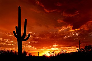
Saguaro National Park is a national park of the United States in southeastern Arizona. The 92,000-acre (37,000 ha) park consists of two separate areas—the Tucson Mountain District (TMD), about 10 miles (16 km) west of Tucson, and the Rincon Mountain District (RMD), about 10 miles (16 km) east of the city. Both districts preserve Sonoran Desert landscapes, fauna, and flora, including the giant saguaro cactus.
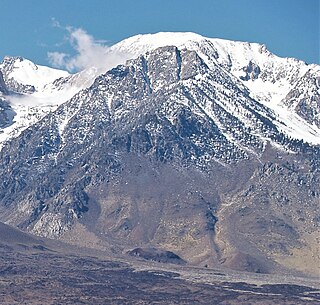
Goodale Mountain is a 12,772-foot-elevation (3,893-meter) mountain summit located one mile east of the crest of the Sierra Nevada mountain range, in Inyo County of northern California. It is situated less than two miles southeast of Taboose Pass in the John Muir Wilderness, on land managed by Inyo National Forest. It is also 16.5 miles (26.6 km) northwest of the community of Independence, and one mile northeast of Striped Mountain, the nearest higher neighbor. Topographic relief is significant as the east aspect rises 7,200 feet above Owens Valley in 3.5 miles. It ranks as the 218th highest peak in California.

Snowdon Peak is a 13,077-foot-elevation (3,986-meter) mountain summit located in San Juan County, Colorado, United States. It is situated seven miles south of the community of Silverton, in the Weminuche Wilderness, on land managed by San Juan National Forest. It is part of the San Juan Mountains range which is a subset of the Rocky Mountains of North America, and is set nine miles west of the Continental Divide. Topographic relief is significant as the east aspect rises 4,300 feet above the Animas River in approximately 1.5 mile. Neighbors include Mount Garfield three miles to the east-southeast, and Twilight Peak, which is the nearest higher peak, 3.7 miles to the south-southwest. This mountain can be seen from U.S. Route 550. The mountain is named after Snowdon, the highest mountain in Wales.

Mount Emma is a 13,581-foot-elevation (4,139-meter) mountain summit located in San Miguel County of Colorado, United States. It is situated three miles north of the community of Telluride, on the south side of Yankee Boy Basin, in the Uncompahgre National Forest. It is part of the Sneffels Range which is a subset of the San Juan Mountains, which in turn is part of the Rocky Mountains. Mount Emma is situated west of the Continental Divide, two miles south of Mount Sneffels, and 0.8 mile south of Gilpin Peak, the nearest higher neighbor. Emma ranks as the 197th-highest peak in Colorado, and the 10th-highest in the Sneffels Range. Topographic relief is significant as the south aspect rises 4,830 feet above Telluride in approximately three miles. An ascent of Mt. Emma is a difficult climb with 2,180 feet of elevation gain covering three miles from Yankee Boy Basin, or 4,836 feet of elevation gain from Telluride. This mountain's name was officially adopted by the U.S. Board on Geographic Names.
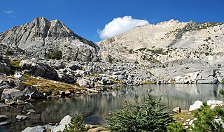
Graveyard Peak is an 11,539-foot-elevation (3,517 meter) mountain summit located in the Sierra Nevada mountain range in Fresno County of northern California, United States. It is situated in the John Muir Wilderness, on land managed by Sierra National Forest. Graveyard Peak ranks as the 535th-highest summit in California, and topographic relief is significant as the south aspect rises over 2,300 feet above Devils Bathtub in approximately one mile. It is two miles southeast of Silver Peak, five miles north of Lake Thomas A Edison, and approximately 13 miles (21 km) south of the community of Mammoth Lakes. The peak is set on Silver Divide, so precipitation runoff from the north side of this mountain drains into Fish Creek which is a tributary of the San Joaquin River, and from the south slope to Lake Thomas A Edison. The peak is most easily reached out of Lake Thomas Edison.
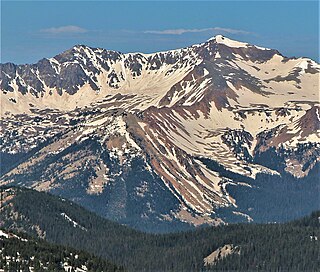
Mount Stratus is a 12,534-foot-elevation (3,820-meter) mountain summit in Grand County, Colorado, United States.

Carson Peak is a 13,662-foot-elevation (4,164-meter) summit in Hinsdale County, Colorado, United States.

Centennial Peak is a 13,062-foot-elevation (3,981-meter) mountain summit in Montezuma County, Colorado.

Diorite Peak is a 12,761-foot-elevation (3,890-meter) mountain summit on the common boundary shared by La Plata County and Montezuma County in Colorado.

Mount Sheridan is a 13,748-foot (4,190 m) mountain summit on the boundary shared by Lake County and Park County, in Colorado, United States.

Grayrock Peak is a 12,504-foot-elevation (3,811-meter) mountain summit located in San Juan County, Colorado, United States.
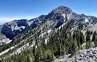
Lincoln Peak is an 11,597-foot elevation (3,535 m) mountain summit in White Pine County, Nevada, United States.

Wilson Mountain is a 7,122-foot-elevation (2,171-meter) summit in Coconino County, Arizona, United States.
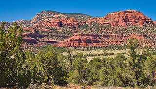
Bear Mountain is a 6,572-foot-elevation (2,003-meter) summit in Yavapai County, Arizona, United States.

Lost Wilson Mountain is a 6,762-foot-elevation (2,061-meter) summit in Yavapai County, Arizona, United States.

East Pocket Knob is a 7,196-foot-elevation (2,193-meter) summit in Coconino County, Arizona, United States.

Josephine Peak is a 5,561-foot-elevation (1,695 meter) mountain summit located in the San Gabriel Mountains, in Los Angeles County, California, United States.

Townsend Point is a 7,574-foot-elevation (2,309-meter) mountain summit in Brewster County, Texas, United States.

Hunter Peak is an 8,376-foot-elevation (2,553-meter) summit in Culberson County, Texas, United States.


