
Pinal County is located in the central part of the U.S. state of Arizona. According to U.S. Census Bureau estimates in 2019, the population of the county was 462,789, making it Arizona's third-most populous county. The county seat is Florence. The county was founded in 1875.

Apache Junction is a city in Maricopa and Pinal counties in the state of Arizona. According to the 2019 U.S. Census estimates, the population of the city was 42,571, most of whom lived in Pinal County. It is named for the junction of the Apache Trail and Old West Highway. The area where Apache Junction is located used to be known as Youngberg, AZ. Superstition Mountain, the westernmost peak of the Superstition Mountains, is nearby.
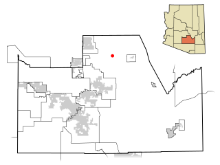
Queen Valley is a census-designated place (CDP) in north central Pinal County, Arizona, United States. The population was 820 at the 2000 census.

Sacaton is a census-designated place (CDP) in Pinal County, Arizona, United States. The population was 1,584 at the 2000 census. It is the capital of the Gila River Indian Community.

The Gila River Indian Community (GRIC) is an Indian reservation in the U.S. state of Arizona, lying adjacent to the south side of the city of Phoenix, within the Phoenix Metropolitan Area in Pinal and Maricopa counties. Gila River Indian Reservation was established in 1859, and the Gila River Indian Community formally established by Congress in 1939. The community is home for members of both the Akimel O’odham (Pima) and the Pee-Posh (Maricopa) tribes.

The South Mountains, known locally as simply South Mountain, is a mountain range in central Arizona in south Phoenix, Arizona. It is on public land managed by the city of Phoenix as South Mountain Park.
North Central Arizona is a geographical region of Arizona. It is in the Transition Zone between the Basin and Range Province and the Colorado Plateau, and has some of the most rugged and scenic landscapes in Arizona.

The Sierra Ancha is a mountain range in Gila County, in central Arizona. It lies between Roosevelt Lake to the south, the Tonto Basin to the west, Cherry Creek to the east, and Pleasant Valley to the north. The range is one of several, including the Bradshaw Mountains, Mingus Mountain of the Black Hills, and the Mazatzal Mountains, which form a transitional zone between the lowland deserts of southern Arizona and the Colorado Plateau of northeastern Arizona. The highest point in the range is Aztec Peak, at an elevation of 2345 m (7694 ft).
Thompson Peak refers to one of these mountain peaks:
The Camelback East Village, also sometimes referred to as East Phoenix or the East Side, is one of the 15 villages that make up Phoenix, Arizona, United States. It is adjacent to the suburbs Paradise Valley and Scottsdale and sits between Piestewa Peak and Camelback Mountain. There are two main cores of the village. The first is the 24th Street and Camelback Road core and the other is the 44th Street and Van Buren Street core.

The Mineral Mountains are a group of rugged, volcanic hills and mountains southwest of Superior and northeast of Florence in Pinal County, Arizona.

The Mazatzal Mountains are a mountain range in south central Arizona, about 30–45 miles northeast of Phoenix and the Phoenix metropolitan area. The origin of the name remains obscure but one possibility is that it is from the Nahuatl language meaning "place of the deer". The crest of the Mazatzals forms the county line between Maricopa County and Gila County. SR 87, the Beeline Highway, traverses the Mazatzals on its way to Payson. The highest peak is Mazatzal Peak at 7,903 feet (2,409 m). They also include the Four Peaks, with elevation 7,659 ft, 2,334 m; a prominent mountain and landmark of the eastern Phoenix area.

The Tonto Basin, also known as Pleasant Valley, covers the main drainage of Tonto Creek and its tributaries in central Arizona, at the southwest of the Mogollon Rim, the higher elevation transition zone across central and eastern Arizona. Although the word tonto means silly or foolish in Spanish, this place name is derived from the Apache word, Koun’nde, which means wild, rough people and refers to the indigenous Dilzhe’e Tonto Apache.
The Pajarito Mountains is a small mountain range of western Santa Cruz County, Arizona, United States, that extend south into Sonora, Mexico. The range is adjacent the Atascosa Mountains at its north, with both ranges in the center of a north-south sequence of ranges called the Tumacacori Highlands. The Highlands have the Tumacacori Mountains at the north, and south of the U.S.-Mexico border, the Sierra La Esmeralda range. The Tumacacori Highlands are part of a regional conservancy study of "travel corridors" for cats, called Cuatro Gatos, Four Cats, for mountain lions, ocelot, bobcat, and jaguar.

The Gila Bend Mountains are a 35-mile (56 km) long mountain range of the north-central Sonoran Desert southwest of Phoenix, Arizona and in southwest Maricopa County.
The Goldfield Mountains of Arizona are located adjacent to the Superstition Mountains, between Usery Pass and Canyon Lake (Arizona). They are less known because of the Superstition Mountains, which are taller and more visible, and contain Canyon Lake (Arizona), which is a huge historic site. The southern part of the Goldfield Mountains used to be a big mining district in 1893. Even though the mining is done, the Goldfield Mountains are still a treasure themselves. These mountains are now big for hiking.
Sweetwater, is a populated place located along the south side of the Gila River, between Sacaton and Casa Blanca, in what is now the Gila River Indian Community in Pinal County, Arizona, United States at an elevation of 1,211 feet.
San Simon River is an ephemeral river, or stream running through the San Simon Valley in Graham and Cochise County, Arizona and Hidalgo County, New Mexico. Its mouth is at its confluence with the Gila River at Safford in Graham County. Its source is located at 31°51′21″N109°01′27″W.
Tres Alamos Wash, an ephemeral stream tributary to the San Pedro River, in Cochise County, Arizona. It runs southwesterly to meet the San Pedro River, across the river from the former settlement of Tres Alamos, Arizona. Tres Alamos Wash passes east and northeastward between the Little Dragoon Mountains and Johnny Lyon Hills to where it arises in a valley east of those heights and west of Allen Flat and the Steele Hills. It has its source at 32°07′45″N110°02′59″W.

The Blackjack Mountains are a mountain range located in Gila County, Arizona. They have a maximum elevation of 6,942 ft (2,116 m) at Apache Peaks and a prominence of 2,580 ft (790 m). The peak has a topographic isolation of 17.88 miles, with the nearest higher peak lying to the south in the Pinal Mountains. The Blackjack mountains are located within the Tonto National Forest and are north of Globe, Arizona. The high point of the range, Apache Peaks, is ranked 36th in prominence for Arizona's most prominent peaks.
