
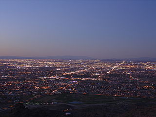
Buckeye is a city in Maricopa County, Arizona, United States. It is Arizona's largest city by area, and it is the westernmost suburb in the Phoenix Metropolitan Area. As of the 2020 census, the population was 91,502, up from 50,876 in 2010, and 6,537 in 2000. It was the fastest-growing city in the United States for 2017, 2018, and 2021.

Cave Creek is a town in Maricopa County, Arizona, United States. It is part of the Phoenix metropolitan area. As of the 2020 census, the population of the town was 4,892.

New River is an unincorporated community and census-designated place (CDP) in Maricopa County, Arizona, United States. The population was 17,290 as of the 2020 census, up from 14,952 at the 2010 census.

Paradise Valley is a town in Maricopa County, Arizona, United States, and a suburb of Phoenix. It is Arizona's wealthiest municipality. The town is known for its luxury golf courses, shopping, expensive real estate, and restaurant scene. According to the 2020 census, its population was 12,658. Despite its relatively small area and population compared to other municipalities in the Phoenix metropolitan area, Paradise Valley is home to eight full-service resorts, making it one of Arizona's premier tourist destinations.

Scottsdale is a city in the eastern part of Maricopa County, Arizona, United States, and is part of the Phoenix metropolitan area. Named Scottsdale in 1894 after its founder Winfield Scott, a retired U.S. Army chaplain, the city was incorporated in 1951 with a population of 2,000. At the 2020 census, the population was 241,361, which had grown from 217,385 in 2010. Its slogan is "The West's Most Western Town". Over the past two decades, it has been one of the fastest growing cities in the United States.

Youngtown is a town in Maricopa County, Arizona, United States. As of the 2020 census, the population of the town was 7,056, up from 6,156 in 2010. It is part of the Phoenix metropolitan area.

Valles Caldera is a 13.7-mile (22.0 km) wide volcanic caldera in the Jemez Mountains of northern New Mexico. Hot springs, streams, fumaroles, natural gas seeps and volcanic domes dot the caldera floor landscape. The highest point in the caldera is Redondo Peak, an 11,253-foot (3,430 m) resurgent lava dome located entirely within the caldera. Also within the caldera are several grass valleys, or valles, the largest of which is Valle Grande, the only one accessible by a paved road. In 1975, Valles Caldera was designated as a National Natural Landmark by the National Park Service with much of the caldera being within the Valles Caldera National Preserve, a unit of the National Park System.

South Mountain Park in Phoenix, Arizona is the largest municipal park in the United States, and one of the largest urban parks in North America and in the world. It has been designated as a Phoenix Point of Pride.

Camelback Mountain is a mountain in Phoenix, Arizona, United States. The English name is derived from its shape, which resembles the hump and head of a kneeling camel. The mountain, a prominent landmark of the Phoenix metropolitan area, is located in the Camelback Mountain Echo Canyon Recreation Area between the Arcadia neighborhood of Phoenix and the town of Paradise Valley. It is a popular recreation destination for hiking and rock climbing.

The American Battlefield Trust is a charitable organization whose primary focus is in the preservation of battlefields of the Revolutionary War, the War of 1812, and the American Civil War, through the acquisition of battlefield land. The American Battlefield Trust was formerly known as the Civil War Trust. On May 8, 2018, the organization announced the creation of the American Battlefield Trust as the umbrella organization for two divisions, the Civil War Trust and the Revolutionary War Trust, which was formerly known as "Campaign 1776."
South Phoenix is a region of Phoenix, Arizona. By one definition it encompasses an area south of the Salt River, north of Roeser Road, east of 24th Street, and west of 32nd Street.

JW Marriott Scottsdale Camelback Inn Resort and Spa is a historic resort and spa owned by Marriott International, Inc, located on the southern slope of Mummy Mountain in Paradise Valley, Arizona, United States. The Camelback Inn was established in 1936 by Jack Bell Stewart and John C. Lincoln. Its popularity among Hollywood celebrities and political leaders made it a significant contributor to the region's growth. In 2012, Camelback Inn was one of three North American hotels which had maintained a AAA 5-Diamond rating since the award's inception in 1975. In 2013, AAA reduced the hotel's status to four diamonds.

Alma is a ghost town and drowned town in Santa Clara County in California, United States. It lies beneath the waters of the Lexington Reservoir above Los Gatos. The location is latitude 37.18N and longitude 121.98W. It was 551 feet above sea level.
California Rangeland Trust is a conservation nonprofit organization founded in 1998. The Rangeland Trust claims to be the largest land trust in California, having conserved over 371,000 acres (1,500 km2) of rangeland on 90 ranches across 26 counties.

Martis Valley is a geographic area of 70 square miles (180 km2) in the United States, extending northward from the North Shore of Lake Tahoe, California, to the west of the California-Nevada border. It is located in Placer and Nevada Counties and is bisected by Martis Creek which flows north to the Truckee River.

The Sunnyslope community is an established neighborhood within the borders of the city of Phoenix, Arizona. The geographic boundaries are 19th Avenue to the west, Cactus Road to the north, 16th Street to the east, and Northern Avenue to the south. This area covers approximately nine square miles (23 km2) and is divided into nine census tracts. The Sunnyslope community is included in parts of three zip code areas: 85020, 85021 and 85029.

Joppenbergh Mountain is a nearly 500-foot (152 m) mountain in Rosendale Village, a hamlet in the town of Rosendale, in Ulster County, New York. The mountain is composed of a carbonate bedrock overlain by glacially deposited material. It was named after Rosendale's founder, Jacob Rutsen, and mined throughout the late 19th century for dolomite that was used in the manufacture of natural cement. Extensive mining caused a large cave-in on December 19, 1899, that destroyed equipment and collapsed shafts within Joppenbergh. Though it was feared that several workers had been killed, the collapse happened while all the miners were outside, eating lunch. Since the collapse, the mountain has experienced shaking and periodic rockfalls.

Deer Valley or Deer Valley Village is one of the 15 urban villages that make up Phoenix, Arizona, United States. As of 2010, the population was 165,656, 25% of whom were under 18 years of age. The origin of the name is unclear; it first appeared on a 1921 General Land Office map of the area describing the valley created by Skunk Creek.

Trout Brook Valley State Park Reserve is a 300-acre (120 ha) parcel owned by the state of Connecticut that is part of the larger Trout Brook Valley Preserve, located in Easton, Connecticut. The full conservation area covers 1,009 acres (408 ha) and comprises several contiguous parcels in the towns of Easton and Weston, bordering the southeast corner of the Saugatuck Reservoir. It is managed by the Aspetuck Land Trust. The state park portion of the preserve offers opportunities for hiking and hunting.
The Big Sur Land Trust is a private 501(c)(3) non-profit located in Monterey, California, that has played an instrumental role in preserving land in California's Big Sur and Central Coast regions. The trust was the first to conceive of and use the "conservation buyer" method in 1989 by partnering with government and developers to offer tax benefits as an inducement to sell land at below-market rates. Since 1978, with the support of donors, funders and partners, it has conserved over 40,000 acres through conservation easements, acquisition and transfer of land to state, county and city agencies. It has placed conservation easements on 7,000 acres and has retained ownership of over 4,000 acres.

