Related Research Articles

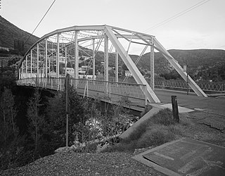
Black Canyon City is an unincorporated community and census-designated place (CDP) in Yavapai County, Arizona, United States. The population was 2,837 at the 2010 census, up from 2,697 in 2000.

The San Francisco River is a 159-mile-long (256 km) river in the southwest United States, the largest tributary of the Upper Gila River. It originates near Alpine, Arizona and flows into New Mexico before reentering Arizona and joining the Gila downstream from Clifton.

The Four Corners is a region of the Southwestern United States consisting of the southwestern corner of Colorado, southeastern corner of Utah, northeastern corner of Arizona, and northwestern corner of New Mexico. The Four Corners area is named after the quadripoint at the intersection of approximately 37° north latitude with 109° 03' west longitude, where the boundaries of the four states meet, and are marked by the Four Corners Monument. It is the only location in the United States where four states meet. Most of the Four Corners region belongs to semi-autonomous Native American nations, the largest of which is the Navajo Nation, followed by Hopi, Ute, and Zuni tribal reserves and nations. The Four Corners region is part of a larger region known as the Colorado Plateau and is mostly rural, rugged, and arid. In addition to the monument, commonly visited areas within Four Corners include Monument Valley, Mesa Verde National Park, Chaco Canyon, Canyons of the Ancients National Monument and Canyon de Chelly National Monument. The most populous city in the Four Corners region is Farmington, New Mexico, followed by Durango, Colorado.

Horseshoe Bend is a horseshoe-shaped incised meander of the Colorado River located near the town of Page, Arizona, United States. It is also referred to as the "east rim of the Grand Canyon."

The Chuska Mountains are an elongate range on the southwest Colorado Plateau and within the Navajo Nation whose highest elevations approach 10,000 feet. The range is about 80 by 15 km. It trends north-northwest and is crossed by the state line between Arizona and New Mexico. The highlands are a dissected plateau, with an average elevation of about 2,740 m (8,990 ft), and subdued topography. The highest point is Roof Butte at 2,994 m (9,823 ft), near the northern end of the range in Arizona. Other high points include the satellite Beautiful Mountain at 2,861 m (9,386 ft) and Lukachukai Mountains at 2,885 m (9,465 ft), both also near the northern end, and Matthews Peak at 2,911 m (9,551 ft). The San Juan Basin borders the Chuskas on the east, and typical elevations in nearby parts of that basin are near 1,800 m (5,900 ft). The eastern escarpment of the mountains is marked by slumps and landslides that extend out onto the western margin of the San Juan Basin. To the north, the Chuskas are separated from the Carrizo Mountains by Red Rock Valley, which is today commonly referred to as Red Valley.

Kanab Creek is one of the many tributaries of the Colorado River. It begins in Kane County, Utah, just south of the watershed to the Great Basin and flows 125 miles (201 km) south to the Colorado River.

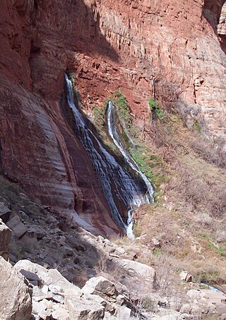
Vasey's Paradise, also stylized as Vaseys Paradise, is an oasis approximately 1.5 miles (2.4 km) below the Mile 30 Sand Bar on the Colorado River within Grand Canyon National Park, in Coconino County, Arizona, United States.

The Navajo Section is a physiographic section of the larger Colorado Plateaus Province, which in turn is part of the larger Intermontane Plateaus physiographic Division.

The Canelo Hills are a range of low mountains or hills in eastern Santa Cruz County, Arizona. The range consists of a series of northwest–southeast trending ridges extending from the Sonoita Creek valley southwest of Sonoita to the Parker Canyon Lake area in southwest Cochise County, Arizona. The Canelo Hills merge with the Huachuca Mountains to the southeast. The San Rafael Valley lies to the southwest of the range and the Patagonia Mountains lie to the west across the Harshaw Creek valley. The Canelo Hills Cienega Reserve and the ghost town of Canelo, Arizona, are located on the eastern side of the hills.
San Simon River is an ephemeral river, or stream running through the San Simon Valley in Graham and Cochise County, Arizona and Hidalgo County, New Mexico. Its mouth is at its confluence with the Gila River at Safford in Graham County. Its source is located at 31°51′21″N109°01′27″W.
Steins Creek, a stream or arroyo tributary to the San Simon River, that arises within an east–west running canyon, in Hidalgo County, New Mexico with its mouth in Cochise County, Arizona. This canyon provides the gap, called Stein's Pass, through which the railroad and Interstate 10 pass through the Peloncillo Mountains. Steins Creek has its source at 32°14′10″N108°59′43″W, and its mouth in the San Simon Valley, where its waters usually sink into the soil, short of any confluence with the San Simon River.
Boulder Canyon, originally Devils Gate Canyon, is a canyon on the Colorado River, above Hoover Dam, now flooded by Lake Mead. It lies between Clark County, Nevada and Mohave County, Arizona. It heads at western end of the Virgin River Basin of Lake Mead, at about 36°09′05″N114°32′51″W. Boulder Canyon divides the Black Mountains into the Black Mountains of Arizona, and the Black Mountains of Nevada. Its mouth is now under the eastern end of the Boulder Basin of Lake Mead, between Canyon Point in Nevada and Canyon Ridge in Arizona. Its original mouth is now underneath Lake Mead between Beacon Rock and Fortification Ridge on the southern shore in Arizona.

Laguña Creek also formerly also known as Tyende Creek, is a stream in the Navajo and Apache Counties of Arizona. Laguña Creek has its source at 36°41′15″N110°30′36″W, at the confluence of Long Canyon and Dowozhiebito Canyon at an elevation of 6325 feet / 1928 meters at the head of Tsegi Canyon. Its mouth is in the Chinle Valley at its confluence with Chinle Wash which together forms Chinle Creek, at an elevation of 4774 feet / 1455 meters. Chinle Creek is a tributary of San Juan River which is in turn a tributary of the Colorado River.

Chinle Creek is a tributary stream of the San Juan River in Apache County, Arizona and San Juan County, Utah. Its source is at 36°53′40″N109°44′37″W, the confluence of Laguña Creek and the Chinle Wash arroyo. Its name is derived from the Navajo word ch'inili meaning 'where the waters came out. Its sources is in Canyon de Chelly National Monument where Canyon de Chelly and Canyon del Muerto have their confluence at an elevation of 5,616 feet at 36°08′35″N109°29′17″W. It then trends northwest to its confluence with Laguña Creek where it forms Chinle Creek, 7 miles northeast of Dennehotso, Arizona at an elevation of 4,774 feet / 1,455 meters.

Muley Point is a remote cliff and scenic overlook in southern Utah near Mexican Hat in San Juan County, Utah. The view provides panoramic vistas of the desert landscape of southern Utah and northern Arizona. Monument Valley is visible in the distance while the San Juan River cuts into the canyon below.
Walker Creek is a stream in Apache County, Arizona. Its mouth is at an elevation of 4,688 feet at its confluence with Chinle Creek. Its source is located at 36°41′28″N109°15′04″W, the confluence of Alcove Canyon and Tah Chin Lini Canyon in the Carrizo Mountains, from which it flows west and northwest to Chinle Creek at 36°57′42″N109°41′35″W. Hogansaani Spring, a tributary, is located on the south side of Walker Creek, at an elevation of 5,102 feet (1,555 m), midway downstream Walker Creek to its confluence with Chinle Creek.
Coyote Wash is a tributary stream of Whiskey Creek in the watershed of the San Juan River and Colorado River. The confluence with Whiskey Creek lies within the Canyon de Chelly National Monument. It is entirely in Apache County, Arizona. Its mouth is located at an elevation of 7,080 feet (2,160 m) at its confluence with Whiskey Creek. Its source is at an elevation of 7,096 feet (2,163 m) at the confluence of Crystal Creek and Cattail Wash 36°04′52″N109°08′56″W.
Alcove Canyon is a valley in Apache County in the U.S. state of Arizona. The valley lies southwest of the Carrizo Mountains and extends to Walker Creek.
Bitsihuitsos Butte is a summit in the U.S. state of Arizona.
Butler Canyon is a valley in the U.S. state of Arizona.
References
- ↑ U.S. Geological Survey Geographic Names Information System: Bat Canyon
- ↑ Barnes, Will Croft (1960). Arizona place names. University of Arizona Press. p. 4.