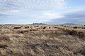
| Las Cienegas National Conservation Area | |
|---|---|
IUCN category V (protected landscape/seascape) | |
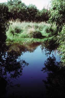 Cienega Creek | |
 Location of Las Cienegas in the United States. | |
| Location | Pima and Santa Cruz counties, Arizona, United States |
| Nearest city | Sierra Vista, Arizona |
| Coordinates | 31°46′48″N110°37′08″W / 31.78°N 110.619°W |
| Area | 45,000 acres (180 km2) |
| Established | 2000 |
| Governing body | Bureau of Land Management |
| Website | Las Cienegas National Conservation Area |
The Las Cienegas National Conservation Area is a National Conservation Area of Arizona, located in the transitional zone between the Sonoran Desert and the Chihuahuan Desert. [1]