New Hanover County is a county located in the U.S. state of North Carolina. As of the 2020 census, the population was 225,702. The county seat is Wilmington. Though the second-smallest county in North Carolina by land area, it is one of the most populous counties, as Wilmington is one of the largest communities in the state. The county was created in 1729 as New Hanover Precinct and gained county status in 1739. New Hanover County is included in the Wilmington, NC Metropolitan Statistical Area, which also includes neighboring Pender and Brunswick counties.

Bald Head Island, historically Smith Island, is a village located on the east side of the Cape Fear River in Brunswick County, North Carolina, United States. Compared to the nearby city of Wilmington to the north, the village of Bald Head Island is small and somewhat remote. It is accessible by ferry from the nearby town of Southport and by four-wheel drive vehicle along the beach strand from Fort Fisher to the north. Only government officials are allowed to drive the beach strand route. There are few cars on the island; instead, residents drive modified electric golf carts. Bald Head Island is nationally recognized for its sea turtle nesting activity.

Carolina Beach is a beach town in New Hanover County, North Carolina, United States, situated about 12 miles (19 km) south of Wilmington International Airport in southeastern coastal North Carolina. As of the 2020 census, the city population was 6,564. It is part of the Wilmington metropolitan area. The community of Wilmington Beach was annexed by the town in 2000.

Cape Hatteras is a cape located at a pronounced bend in Hatteras Island, one of the barrier islands of North Carolina.

Fort Fisher State Recreation Area is a 287-acre (1.16 km2) North Carolina state park in New Hanover County, North Carolina in the United States. Located near Kure Beach, North Carolina, it includes Fort Fisher, site of a major naval engagement during the American Civil War. The recreation area also served as a home for the Fort Fisher Hermit, Robert Harrill. Harrill lived in a bunker and shared his beliefs about "common sense" with thousands of visitors every year while surviving on what he could gather from the surrounding salt marsh and oyster beds.

Fort Fisher was a Confederate fort during the American Civil War. It protected the vital trading routes of the port at Wilmington, North Carolina, from 1861 until its capture by the Union in 1865. The fort was located on one of Cape Fear River's two outlets to the Atlantic Ocean on what was then known as Federal Point or Confederate Point and today is known as Pleasure Island. The strength of Fort Fisher led to its being called the Southern Gibraltar and the "Malakoff Tower of the South". The battle of Fort Fisher was the most decisive battle of the Civil War fought in North Carolina.

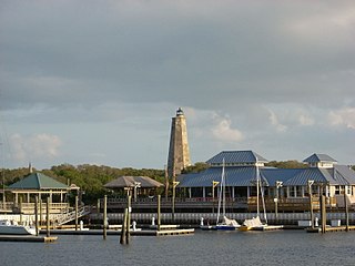
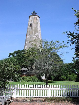
Bald Head Lighthouse, known as Old Baldy, is the oldest lighthouse still standing in North Carolina. It is the second of three lighthouses that have been built on Bald Head Island since the 18th century to help guide ships past the dangerous shoals at the mouth of the Cape Fear river.

Hillsboro Inlet Lighthouse is a lighthouse located on the north side of Hillsboro Inlet, midway between Fort Lauderdale and Boca Raton, in Hillsboro Beach, Florida. The light marks the northern limit of the Florida Reef, an underwater coral formation on the lower east coast of the state.

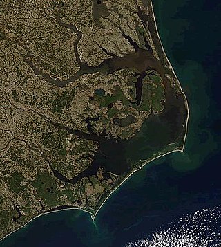
The Outer Banks are a 200 mi (320 km) string of barrier islands and spits off the coast of North Carolina and southeastern Virginia, on the east coast of the United States. They line most of the North Carolina coastline, separating Currituck Sound, Albemarle Sound, and Pamlico Sound from the Atlantic Ocean. A major tourist destination, the Outer Banks are known for their wide expanse of open beachfront and the Cape Hatteras National Seashore. The seashore and surrounding ecosystem are important biodiversity zones, including beach grasses and shrubland that help maintain the form of the land.

The Amelia Island Light is the oldest existing lighthouse in the state of Florida in the United States. It is located near the northern end of Amelia Island in the northeastern part of the state. Its light marks St. Marys Entrance, the inlet leading to St. Marys River, the Cumberland Sound and the harbor of Fernandina Beach, Florida along the Amelia River. The white light flashes every ten seconds which turns red from 344° to 360° when covering the shoal water in the vicinity of Nassau Sound.

Stratford Point Light is a historic lighthouse in the Lordship neighborhood of Stratford, Connecticut, United States, at the mouth of the Housatonic River. The second tower was one of the first prefabricated cylindrical lighthouses in the country and remains active.

Ilhéu de Sal Rei is an uninhabited islet near the coast of Boa Vista Island, Cape Verde. It is located 1 km southwest of the island capital Sal Rei. Its area is 89 ha (0.34 sq mi) and its highest point is 27 m (88.6 ft).

Pleasure Island is a coastal barrier island in Southeastern North Carolina, United States, just south of the City of Wilmington. Pleasure Island is located within Federal Point Township, in New Hanover County. The coastal resort towns of Carolina Beach and Kure Beach, as well as the annexed communities of Wilmington Beach and Hanby Beach are located on the island. The southern end of Pleasure Island was separated from Bald Head Island by Corncake Inlet until the inlet was shoaled and closed in 1998 by Hurricane Bonnie; thus Pleasure Island and Bald Head Island are no longer separate islands.
Bodie Island is a long, narrow barrier peninsula that forms the northernmost portion of the Outer Banks. The land that is most commonly referred to as Bodie Island was at one time a true island, but in 1811 Roanoke Inlet, which had separated it from the Currituck Banks in the north, closed. As a result, the Currituck Banks and Bodie Island are now one contiguous peninsula, joined at the Nags Head area, where the inlet once flowed. Today, either name can be used to refer to the peninsula as a whole, but both portions colloquially retain their historical names.
The Bloody Point Range Lights, which is known as the Bloody Point Lighthouse, were range lights on the southern end of Daufuskie Island in Beaufort County, South Carolina. The Bloody Point Range Lights were built in 1883. Due to erosion, the front light was moved to the location of the former rear light and became the rear light. The lights were maintained as an official aid to navigation until 1922. The original Front Range Light house is currently a private home.

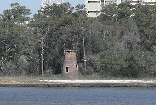
The Price Creek Lighthouse, also known as the Price's Creek Lighthouse, is a structure located near Southport, North Carolina. It was one of two range lights at Price Creek in a series of lights to guide ships from Cape Fear to Wilmington, North Carolina.

The Core Banks are barrier islands in North Carolina, part of the Cape Lookout National Seashore. Named after the Coree tribe, they extend from Ocracoke Inlet to Cape Lookout, and consist of two low-relief narrow islands, North Core Banks and South Core Banks, and, since September 2011, two smaller islands. New Drum Inlet, Old Drum Inlet and Ophelia Inlet now separate the islands. The Core Banks are now uninhabited. However, Portsmouth, at the north end of the North Core Banks, was once a substantial port, and Cape Lookout Village, about one and half miles south of the Cape Lookout Lighthouse, contains the historic Lookout Life-Saving Station, a U.S. Coast Guard Station, and several island homes.
CSS Arctic was a Confederate ironclad floating battery converted from USS Arctic at Wilmington, North Carolina in 1862. Confederate forces seized USS Arctic at the beginning of the war and converted into a receiving ship. Arctic was a 328-ton screw steamer built in Philadelphia in 1851 at the navy yard by Theodore Birely. The two-decked, three-masted steamer measured 121 feet (37 m) in length, 24 feet (7.3 m) in beam, 12 feet (3.7 m) in depth, and 125 tons.

Brazos Santiago Pass is a natural coastal landform located in the Lower Laguna Madre and Lower Rio Grande Valley on the furthest southern beach terrain of the Texas Gulf Coast. The seacoast passage is interpolated by barrier islands encompassing the southern Brazos Island and the northern South Padre Island.


