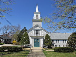
Pocasset, Massachusetts

Last updated

Pocasset, Massachusetts
First Baptist Church, Pocasset MA.jpg
First Baptist Church
Barnstable County Massachusetts incorporated and unincorporated areas Pocasset highlighted.svg
Location in Barnstable County and the state of Massachusetts.
Coordinates: 41°41′27″N70°37′0″W / 41.69083°N 70.61667°W / 41.69083; -70.61667
Country United States
State Massachusetts
County Barnstable
Town Bourne
Area
[1]
  Total9.80 sq mi (25.38 km2)
  Land3.70 sq mi (9.58 km2)
  Water6.10 sq mi (15.81 km2)
Elevation
33 ft (10 m)
Population
 (2020)
  Total2,843
  Density769.00/sq mi (296.90/km2)
Time zone UTC-5 (Eastern (EST))
  Summer (DST) UTC-4 (EDT)
ZIP code
02559
Area code 508
FIPS code 25-54450
GNIS feature ID0616446

The village of Pocasset is a census-designated place (CDP) in the town of Bourne in Barnstable County, Massachusetts, United States, located on Buzzards Bay. The population was 2,851 at the 2010 census. [2]

Contents

Geography

Pocasset is located in the southwestern part of the town of Bourne. It is bordered to the north by the villages of Bourne and Monument Beach, to the east by Route 28; to the south by the village of Cataumet and Red Brook Pond and Red Brook Harbor; and to the west by the northern end of Buzzards Bay.

According to the United States Census Bureau, the CDP has a total area of 9.8 square miles (25.3 km2), of which 3.7 square miles (9.5 km2) is land, and 6.1 square miles (15.8 km2) (62.42%) is water. [2]

Name

The name derives from the Pocasset Wampanoag and evolved over time: "Returning from this excursion in the direction of Wareham, and retracing our steps through the entire length of Monument westward and southward, we come to the ancient 2d Precinct of Sandwich, called by the early Indians Pouglikeeste — at a later period Pokesit and now called Pocasset." [3]

Demographics

Historical population
CensusPop.Note
2020 2,843
U.S. Decennial Census [4]

As of the census [5] of 2000, there were 2,671 people, 1,277 households, and 753 families residing in the CDP. The population density was 275.0/km2 (712.8/mi2). There were 2,038 housing units at an average density of 209.8/km2 (543.9/mi2). The racial makeup of the CDP was 96.26% White, 1.27% African American, 0.52% Native American, 0.26% Asian, 0.52% from other races, and 1.16% from two or more races. Hispanic or Latino of any race were 0.37% of the population.

There were 1,277 households, out of which 17.0% had children under the age of 18 living with them, 49.4% were married couples living together, 6.5% had a female householder with no husband present, and 41.0% were non-families. 35.2% of all households were made up of individuals, and 18.4% had someone living alone who was 65 years of age or older. The average household size was 2.09 and the average family size was 2.70.

In the CDP, the population was spread out, with 16.1% under the age of 18, 4.9% from 18 to 24, 20.5% from 25 to 44, 30.4% from 45 to 64, and 28.0% who were 65 years of age or older. The median age was 50 years. For every 100 females, there were 92.0 males. For every 100 females age 18 and over, there were 89.2 males.

The median income for a household in the CDP was $97,523, and the median income for a family was $162,596. Males had a median income of $103,889 versus $71,971 for females. The per capita income for the CDP was $106,866. About 0.7% of families and 1.8% of the population were below the poverty line, including 0.9% of those under age 18 and 0.2% of those age 65 or over.

Drinking water

In May 2016, three homes in a Pocasset neighborhood received bottled water, because of elevated perfluorinated organic compounds in drinking water, linked to firefighting foam used after military fuel truck crashes at Otis Rotary, which connects to nearby Otis Air National Guard Base. [6]

Landmarks

Wing's Neck Light is a Cape Cod-style lighthouse built in 1849, with a white, wooden hexagonal tower and lantern room on top of a stone house where the keeper lived. [7]

Related Research Articles

<span class="mw-page-title-main">Barnstable County, Massachusetts</span> County in Massachusetts, United States

Barnstable County is a county located in the U.S. state of Massachusetts. At the 2020 census, the population was 228,996. Its county seat is Barnstable. The county consists of Cape Cod and associated islands.

<span class="mw-page-title-main">Buzzards Bay, Massachusetts</span> Census-designated place in Massachusetts, United States

Buzzards Bay is a census-designated place (CDP) in the town of Bourne in Barnstable County, Massachusetts. The population was 3,859 at the 2010 census. It is the most populous of the five CDPs in Bourne.

<span class="mw-page-title-main">Dennis Port, Massachusetts</span> Census-designated place in Massachusetts, United States

Dennis Port is a census-designated place (CDP) in the town of Dennis in Barnstable County, Cape Cod, Massachusetts. At the 2010 census, its population was 3,162.

<span class="mw-page-title-main">East Falmouth, Massachusetts</span> Census-designated place in Massachusetts, United States

East Falmouth is a census-designated place (CDP) in the town of Falmouth in Barnstable County, Massachusetts, United States. It is located at the base of Massachusetts' "fishhook" peninsula. The population was 6,038 at the 2010 census, making East Falmouth the most populous of the six CDPs in Falmouth.

<span class="mw-page-title-main">East Sandwich, Massachusetts</span> Census-designated place in Massachusetts, United States

East Sandwich is a village and census-designated place (CDP) within the town of Sandwich in Barnstable County, Massachusetts, United States. The population was 3,940 at the 2010 census.

<span class="mw-page-title-main">Monomoscoy Island, Massachusetts</span> Census-designated place in Massachusetts, United States

Monomoscoy Island is a census-designated place (CDP) in the town of Mashpee in Barnstable County, Massachusetts, United States. At the 2010 census, the CDP had a total population of 147.

<span class="mw-page-title-main">Monument Beach, Massachusetts</span> Census-designated place in Massachusetts, United States

Monument Beach is a census-designated place (CDP) in the town of Bourne in Barnstable County, Massachusetts, United States. The population was 2,790 at the 2010 census.

<span class="mw-page-title-main">North Falmouth, Massachusetts</span> Census-designated place in Massachusetts, United States

North Falmouth is a census-designated place (CDP) in the town of Falmouth in Barnstable County, Massachusetts, United States. The population was 3,084 at the 2010 census.

<span class="mw-page-title-main">Popponesset Island, Massachusetts</span> Census-designated place in Massachusetts, United States

Popponesset Island is an island and census-designated place (CDP) in the town of Mashpee in Barnstable County, Massachusetts, United States. The population was 220 at the 2010 census.

<span class="mw-page-title-main">Sagamore, Massachusetts</span> Census-designated place in Massachusetts, United States

Sagamore is a census-designated place (CDP) in the town of Bourne in Barnstable County, Massachusetts, United States. The population was 3,623 at the 2010 census. "Sagamore" was one of the words used by northeastern Native Americans to designate an elected chief or leader.

<span class="mw-page-title-main">Teaticket, Massachusetts</span> Census-designated place in Massachusetts, United States

Teaticket is a census-designated place (CDP) in the town of Falmouth, Massachusetts. The population was 1,692 at the 2010 census.

<span class="mw-page-title-main">West Falmouth, Massachusetts</span> Census-designated place in Massachusetts, United States

West Falmouth is a census-designated place (CDP) in the town of Falmouth in Barnstable County, Massachusetts, United States. The population was 1,738 at the 2010 census.

<span class="mw-page-title-main">Woods Hole, Massachusetts</span> Census-designated place in Massachusetts, United States

Woods Hole is a census-designated place in the town of Falmouth in Barnstable County, Massachusetts, United States. It lies at the extreme southwest corner of Cape Cod, near Martha's Vineyard and the Elizabeth Islands. The population was 781 at the 2010 census. The eminnet Hungarian born biochemist and Nobel prize laureate, Albert Imre Szent-Györgyi de Nagyrápolt died here in 1986.

<span class="mw-page-title-main">Yarmouth Port, Massachusetts</span> Census-designated place in Massachusetts, United States

Yarmouth Port is a census-designated place (CDP) in the town of Yarmouth in Barnstable County, Massachusetts, United States. The population was 5,320 at the 2010 census.

<span class="mw-page-title-main">Bourne (CDP), Massachusetts</span> Census-designated place in Massachusetts, United States

The village of Bourne is a census-designated place (CDP) in the town of Bourne in Barnstable County, Massachusetts, United States. The population was 1,418 at the 2010 census, out of 19,754 in the town of Bourne as a whole.

<span class="mw-page-title-main">Bourne, Massachusetts</span> Town in Massachusetts, United States

Bourne is a town in Barnstable County, Massachusetts, United States. The population was 20,452 at the 2020 census.

<span class="mw-page-title-main">Falmouth (CDP), Massachusetts</span> Census-designated place in Massachusetts, United States

Falmouth is a census-designated place (CDP) consisting of the primary settlement in the town of Falmouth in Barnstable County, Massachusetts, United States. The population of the CDP was 3,799 at the 2010 census, out of 31,532 in the town as a whole. It was named after Falmouth, Cornwall, England.

<span class="mw-page-title-main">Falmouth, Massachusetts</span> Town in Massachusetts, United States

Falmouth is a town in Barnstable County, Massachusetts, United States. The population was 32,517 at the 2020 census, making Falmouth the second-largest municipality on Cape Cod after Barnstable. The terminal for the Steamship Authority ferries to Martha's Vineyard is located in the village of Woods Hole in Falmouth. Woods Hole also contains several scientific organizations such as the Woods Hole Oceanographic Institution (WHOI), the Marine Biological Laboratory (MBL), the Woodwell Climate Research Center, NOAA's Woods Hole Science Aquarium, and the scientific institutions' various museums.

<span class="mw-page-title-main">Orleans (CDP), Massachusetts</span> Census-designated place in Massachusetts, United States

Orleans is a census-designated place (CDP) in the town of Orleans in Barnstable County, Massachusetts, United States. The population was 1,621 at the 2010 census.

<span class="mw-page-title-main">Sandwich (CDP), Massachusetts</span> Census-designated place in Massachusetts, United States

Sandwich is a village and census-designated place (CDP) in the town of Sandwich in Barnstable County, Massachusetts, United States. The population was 2,962 at the 2010 census, out of a total 20,675 people in the town of Sandwich.

References

  1. "2020 U.S. Gazetteer Files". United States Census Bureau. Retrieved May 21, 2022.
  2. 1 2 "Geographic Identifiers: 2010 Demographic Profile Data (G001): Pocasset CDP, Massachusetts". U.S. Census Bureau, American Factfinder. Archived from the original on February 12, 2020. Retrieved December 11, 2013.
  3. Freeman, Frederick (1862). History of Cape Cod: the Annals of the Thirteen Towns of Barnstable County, vol. II. Boston, MA: Geo. C Rand & Avery. p. 134. Retrieved August 6, 2021.
  4. "Census of Population and Housing". Census.gov. Retrieved June 4, 2016.
  5. "U.S. Census website". United States Census Bureau . Retrieved January 31, 2008.
  6. George Brennan (May 20, 2016). "Air Force reacts to contaminated Falmouth water wells". Cape Cod Times. Falmouth, MA. Local Media Group, Inc. Retrieved May 25, 2016.
  7. "Wing's Neck Light History". www.lighthouse.cc. Archived from the original on December 7, 2000.