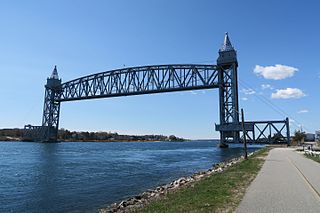
Buzzards Bay is a census-designated place (CDP) in the town of Bourne in Barnstable County, Massachusetts, United States. The population was 3,859 at the 2010 census. It is the most populous of the five CDPs in Bourne.

East Sandwich is a village and census-designated place (CDP) within the town of Sandwich in Barnstable County, Massachusetts. The population was 3,940 at the 2010 census.

Monomoscoy Island is a census-designated place (CDP) in the town of Mashpee in Barnstable County, Massachusetts, United States. At the 2010 census, the CDP had a total population of 147.

The village of Pocasset is a census-designated place (CDP) in the town of Bourne in Barnstable County, Massachusetts, United States, located on Buzzards Bay. The population was 2,851 at the 2010 census.

Popponesset Island is an island and census-designated place (CDP) in the town of Mashpee in Barnstable County, Massachusetts, United States. The population was 220 at the 2010 census.

South Dennis is a census-designated place (CDP) in the town of Dennis in Barnstable County, Massachusetts, United States. The population was 3,643 at the 2010 census, the largest of the five CDPs in Dennis.
Teaticket is a census-designated place (CDP) in the town of Falmouth, Massachusetts. The population was 1,692 at the 2010 census.

West Falmouth is a census-designated place (CDP) in the town of Falmouth in Barnstable County, Massachusetts, United States. The population was 1,738 at the 2010 census.

West Yarmouth is a census-designated place (CDP) in the town of Yarmouth in Barnstable County, Massachusetts, United States. The population was 6,012 at the 2010 census.

Yarmouth Port is a census-designated place (CDP) in the town of Yarmouth in Barnstable County, Massachusetts, United States. The population was 5,320 at the 2010 census.

Smith Mills is a census-designated place (CDP) in the town of Dartmouth in Bristol County, Massachusetts, United States. The population was 4,760 at the 2010 census.

Marion Center is a census-designated place (CDP) in the town of Marion in Plymouth County, Massachusetts, United States. The population was 1,111 at the 2010 census.

Middleborough Center is a census-designated place (CDP) in the town of Middleborough in Plymouth County, Massachusetts, United States. The population was 7,319 at the 2010 census.

North Lakeville is a census-designated place (CDP) in the town of Lakeville in Plymouth County, Massachusetts, United States. The population was 2,630 at the 2010 census.

North Plymouth is a census-designated place (CDP) in the town of Plymouth in Plymouth County, Massachusetts, United States. The population was 3,600 at the 2010 census. It is best known as the location of Cordage Park, a small village where the Plymouth Cordage Company was once headquartered. The village is now home to Cordage Commerce Center, a large retail development that consists of offices and stores.

Onset is a census-designated place (CDP) in the town of Wareham, Massachusetts, United States. The population was 1,573 at the 2010 census.

Wareham Center is a census-designated place (CDP) in the town of Wareham in Plymouth County, Massachusetts, United States. The population was 2,896 at the 2010 census.

West Wareham is a census-designated place (CDP) in the town of Wareham in Plymouth County, Massachusetts, United States. The population was 2,064 at the 2010 census.

Weweantic is a census-designated place (CDP) in the town of Wareham in Plymouth County, Massachusetts, United States. The population was 2,105 at the 2010 census.

White Island Shores is a census-designated place (CDP) in the town of Wareham in Plymouth County, Massachusetts, United States, along the shores of White Island Pond. The population was 2,106 at the 2010 census.


