Hatchville, Massachusetts | |
|---|---|
Village | |
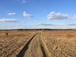 Pheasant Area Frances A. Crane Wildlife Management Area | |
 Hatchville | |
| Coordinates: 41°37′45″N70°33′48″W / 41.62917°N 70.56333°W | |
| Country | United States |
| State | Massachusetts |
| County | Barnstable |
| Town | Falmouth |
| Elevation | 28 m (92 ft) |
| Population (2010) | |
• Total | 9,264 |
| Time zone | UTC-5 (Eastern (EST)) |
| • Summer (DST) | UTC-4 (EDT) |
| ZIP codes | 02536 |
| Area codes | 508, 774 |
Hatchville is a neighborhood within the town of Falmouth, Massachusetts, on Cape Cod, United States. The mailing address for the area is East Falmouth, to the south of Hatchville.
