Dennis, Massachusetts | |
|---|---|
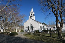 Dennis Union Church | |
 Location in Barnstable County and the state of Massachusetts. | |
| Coordinates: 41°44′7″N70°11′57″W / 41.73528°N 70.19917°W | |
| Country | United States |
| State | Massachusetts |
| County | Barnstable |
| Town | Dennis |
| Area | |
• Total | 5.13 sq mi (13.28 km2) |
| • Land | 4.91 sq mi (12.72 km2) |
| • Water | 0.21 sq mi (0.56 km2) |
| Elevation | 16 ft (5 m) |
| Population (2020) | |
• Total | 2,399 |
| • Density | 488.50/sq mi (188.61/km2) |
| Time zone | UTC-5 (Eastern (EST)) |
| • Summer (DST) | UTC-4 (EDT) |
| ZIP code | 02638 |
| Area code | 508 |
| FIPS code | 25-16740 |
| GNIS feature ID | 0615824 |
Dennis is a village and census-designated place (CDP) in the town of Dennis in Barnstable County, Massachusetts, United States. The population was 2,407 at the 2010 census. [2] The CDP includes the populated places known as North Dennis [3] and New Boston. [4]
Contents
The Dennis post office, one of five post offices in the town of Dennis, is assigned zip code 02638. [5]
